 |
      |
| Home > Alaska > Bald Mountain Trail |
Bald Mountain Trail
Tuesday, February 27, 2024
| Other Names | Anchorage Recreation Management Area, Bald Mountain Ridge, B 29 Trail, B-29 Trail, Talkeetna Mountain Range |
| Last Known Status | Open |
This trail is about 22 miles long and starts out as a rough dirt road in a wooded forest for the first few miles but becomes more of a technical trail as you go up in elevation. The trail eventually climbs above the tree line and leads toward Bald Mountain Ridge.
The trail can get very muddy and has wide mud holes that can last well into the late summer months. A side trail leads to a memorial plaque and wreckage of a B-29 plane that happened in 1956.
REGULATIONS
| Permit Required | ||
| Dates Open | Year-Round | |
| Other ATV Stickers Accepted | Unknown | |
| Spark Arrestor | Yes | A spark arresting exhaust silencer or end cap is required for all vehicles. |
| Noise Limit | ||
| Whip Flags | ||
| Maximum Vehicle Width | No Restriction | |
 Motorcycles & Dirt Bikes Motorcycles & Dirt Bikes | Permitted | |
 Four Wheelers Four Wheelers | Permitted | |
 UTV & SXS UTV & SXS | Permitted | |
 4x4 & Jeeps (registered) 4x4 & Jeeps (registered) | Permitted | |
| Dune Buggy & Sand Rail 4x4 (unregistered) | Permitted | |
| 2 Stroke Engines | No Restriction | |
 Camping Camping | ||
 Campfires Campfires | ||
| Night Riding | Unknown | |
| Trail Blazing | Prohibited | vehicles must stay on trail |
| Rule Enforcement |
Advertisement
TERRAIN
| Miles Of Trail | 22 | |
| Climate Type | Forest | |
| Elevation | 700 to 3400 ft. | |
| Trail Maintenance | Unknown | |
| Loose Dirt |  Some Some | |
| Hard Pack |  Little Little | |
| Sand |  None None | |
| Mud |  Mostly Mostly | |
| Dust | None | |
| Rocks | Some | |
| Trees |  All All | |
| Steep Hills |  Many Many | |
| Water Crossings | Many | |
| Small Jumps | None | |
| Large Jumps | None | |
| Berms | None | |
| Sand/Gravel Pits | None | |
| Single Track | None | |
| Roads | Some | |
| Shade | Many | |
| Hazards |  Few Few | (hazards assumed marked but use caution) |
 Novice Novice | Some | |
 Amateur Amateur | Mostly | |
 Expert Expert | Little |
TYPE OF AREA
| Area | Motorized Trails |
| Land | State Recreation |
GPS POINTS


KEY SERVICES
 Gasoline Gasoline | 1-5 Miles (S) | Valley County Stores (907) 376-7151 |
| Diesel | 1-5 Miles (S) | Valley County Stores (907) 376-7151 |
 Water Water | 1-5 Miles (SW) | Alaskan Trails RV & Camper Park (907) 376-5504 |
 RV Hookup RV Hookup | 1-5 Miles (SW) | Alaskan Trails RV & Camper Park (907) 376-5504 |
 RV Disposal RV Disposal | 1-5 Miles (SW) | Alaskan Trails RV & Camper Park (907) 376-5504 |
| Campground | 1-5 Miles (SW) | Alaskan Trails RV & Camper Park (907) 376-5504 |
 Conv Store Conv Store | 1-5 Miles (S) | Valley County Stores (907) 376-7151 |
FEES & PASSES
| Parking | (None) |
| Entry | (None) |
| Riding | (None) |
| Camping | (None) |
RATINGS
| Our Rating |  |
| Recommended Stay | Full Day |
| Comments | (Scroll Down For Rider Reviews & Comments) |
DRIVING DIRECTIONS
| Nearest City | Wasilla, AK | ||
| Address | Solitude Street, Wasilla, AK 99629 | ||
| From: Wasilla, AK
1) Take SR-3 to the intersection for Church Road 2) Turn north onto Church Road, continue 4.1 miles 3) Turn left (west) onto Schrock Road, continue .9 miles 4) Turn right (east) onto Sitze Road, continue .25 miles 5) Parking is on the side of the road at the intersection of Sitze Road and Solitude Street (look for a white trailer on the left). |

OFFICIAL CONTACTS
| Contact Info | Alaska DNR - Mat- Su Copper Basin Area Office HC 32 Box 6706 Wasilla, AK 99654 (907) 745-3975 (907) 745-0938 dnr.alaska.gov |
Bald Mountain Trail Photo
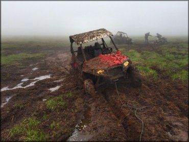
Photo Submitted 6/21/2015 (Thanks!)
Bald Mountain Trail Photo
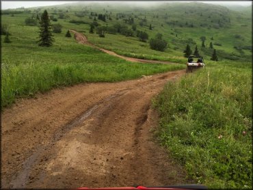
Photo Submitted 6/21/2015 (Thanks!)
Bald Mountain Trail Photo
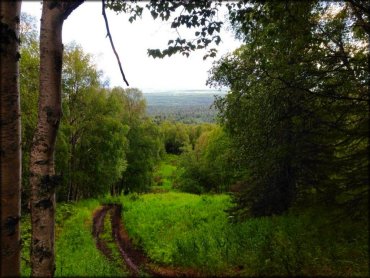
Photo Submitted 8/7/2014 (Thanks!)
Bald Mountain Trail Photo
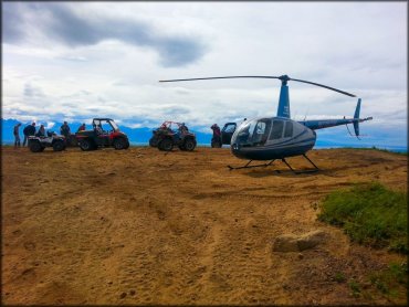
Photo Submitted 7/3/2015 (Thanks!)
RIDER COMMENTS & REVIEWS