 |
      |
| Home > Arizona > Red Springs |
Red Springs
Sunday, March 10, 2024
| Other Names | Diablo Mountain, Coronado National Forest, Saucito Mountain, Diablito Spring, Sardina Peak, Nogales Ranger District, Tumacacori Mountains |
| Last Known Status | Open |
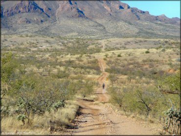
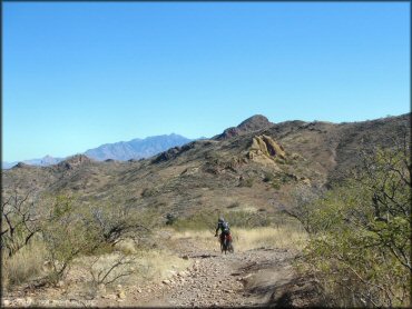
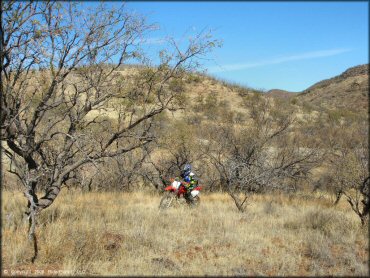
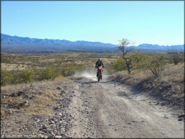
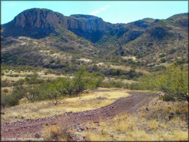
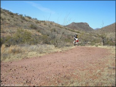
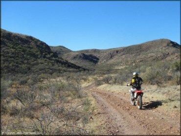
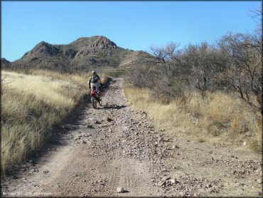
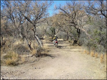
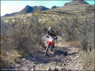
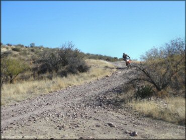
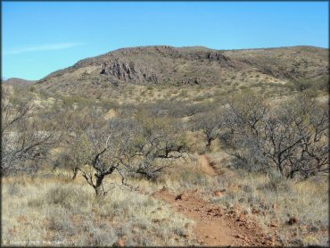
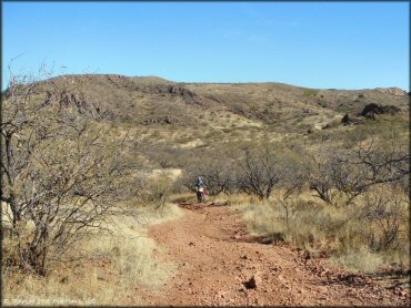
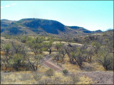
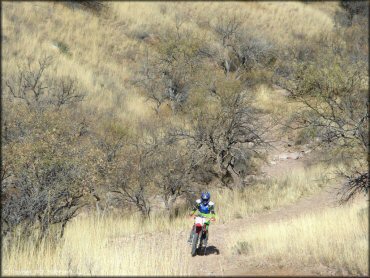
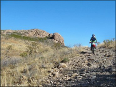
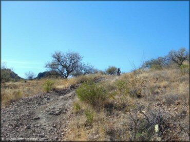
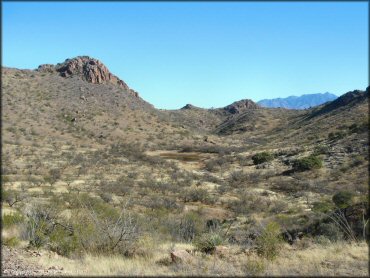
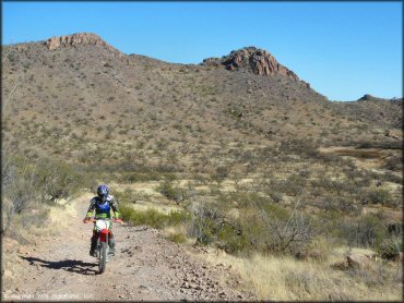
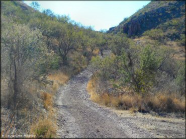
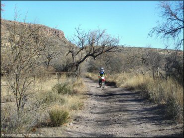
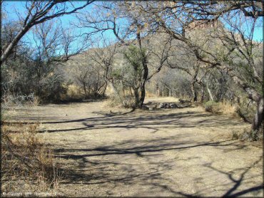
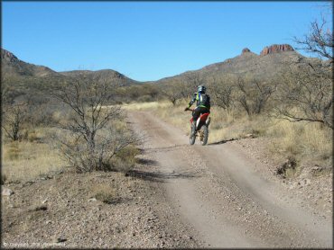
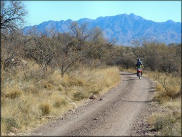
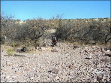
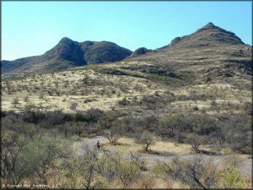
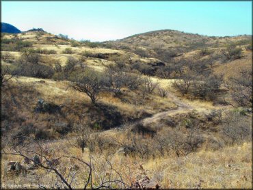
This area was primarily a hunting area with some 4x4 trails and dirt roads but thanks to the hard work of the Trail Riders of Southern Arizona (TRS), USFS and Arizona State Parks, a designated area with about 25 miles of motorized single track trails were recently added. The single track trails are geared for experienced riders and are not beginner friendly.
Large dual sport motorcycles (KLR650, KTM 690, etc) are not recommended since the terrain is narrow, rugged and technical. ATVs, UTVs and larger vehicles are permitted on the forest service roads but are not allowed on the single track trails. The main roads are chunky, and loaded with small sharp rocks - perhaps enough to take the fun out of it for some motorcyclists.
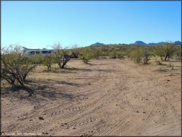
The main staging area near I-19 is small and simple with minimal room and no services but the trailhead near the single track offers an informational kiosk, shade ramada, picnic table and space for about 10 vehicles.
Overnight parking is not permitted at the staging area but dispersed camping is allowed at allowed alongside some designated routes (see Coronado National Forest map for details).
REGULATIONS
| Permit Required | Yes | AZGFD sticker required |
| Dates Open | Year-Round | |
| Other ATV Stickers Accepted | No | All non-residents must purchase an Arizona OHV decal. |
| Spark Arrestor | Yes | A spark arresting exhaust silencer or end cap is required for all vehicles. |
| Noise Limit | Yes (96 dB) | |
| Whip Flags | Not Required | |
| Maximum Vehicle Width | No Restriction | |
 Motorcycles & Dirt Bikes Motorcycles & Dirt Bikes | Permitted | |
 ATVs ATVs | Some Areas | permitted on designated forest service roads only |
 UTV & SXS UTV & SXS | Some Areas | permitted on designated forest service roads only |
 SUVs & Jeeps (registered) SUVs & Jeeps (registered) | Some Areas | permitted on designated forest service roads only |
| Dune Buggy & Sand Rail 4x4 (unregistered) | Some Areas | permitted on designated forest service roads only |
| 2 Stroke Engines | No Restriction | |
| MX Helmet Required | Youth Only | required for persons under 18 by state law (RiderPlanet strongly recommends helmets for all riders.) |
 Camping Camping | Some Areas | See FS MVUM map for dispersed camping locations |
 Campfires Campfires | Some Areas | (permitted in developed campsites only) |
| Night Riding | No | riding permitted dawn to dusk |
| Trail Blazing | Prohibited | stay on the trail |
| Rule Enforcement | Few/Periodic | |
| Comment | See FS MVUM map for dispersed camping locations - camping not permitted at staging areas. All users are required to clean their equipment prior to using the trail system to avoid spreading invasive plants. | |
TERRAIN
| Approx Size | 38,400 acres (60 sq mi) | |
| Miles Of Trail | 65 | |
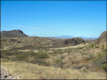
| Climate Type | Desert | |
| Elevation | 3100 to 4000 ft. | |
| Trail Maintenance | Marked, Not Rated, Lightly Maintained | |
| Loose Dirt |  None None | |
| Hard Pack |  Mostly Mostly | |
| Sand |  Little Little | |
| Mud | None | |
| Dust | Little | |
| Rocks | Mostly | |
| Trees |  Few Few | |
| Steep Hills | Few | |
| Water Crossings |  Some Some | usually dry but seasonal water crossings |
| Small Jumps | Few | |
| Large Jumps | None | |
| Berms | None | |
| Sand/Gravel Pits | Some | |
| Single Track | Some | about 25 miles of single track added |
| Roads |  All All | |
| Intersections | Few | |
| Rider Traffic | None | hunters use area |
| Shade | Few | |
| Ranges/Gunfire | Some | |
| Hazards | None | |
 Novice Novice | Some | |
 Amateur Amateur | Mostly | |
 Expert Expert | None | |
| Comment | Trails numbered 480 thru 485 are open to motorcycles, mountain bikes, equestrian and foot traffic only. Trail 486 is open to ATVs, UTVs and Jeeps. | |
TYPE OF AREA
| Area | Motorized Trails |
| Land | National Forest |
GPS POINTS


KEY SERVICES
 Gasoline Gasoline | 5-20 Miles (N) | Shell/Green Valley (520) 571-7600 |
| Diesel | 5-20 Miles (N) | Shell/Green Valley (520) 571-7600 |
 Water Water | 5-20 Miles (N) | Shell/Green Valley (520) 571-7600 |
 RV Hookup RV Hookup | 5-20 Miles (N) | Green Valley RV Resort (520) 625-3900 |
 RV Disposal RV Disposal | 5-20 Miles (N) | Green Valley RV Resort (520) 625-3900 |
| Campground | 30+ Miles (SE) | Patagonia Lake State Park (520) 287-6965 |
 Conv Store Conv Store | 5-20 Miles (N) | Shell/Green Valley (520) 571-7600 |
FEES & PASSES
| Parking | (None) |
| Entry | (None) |
| Riding | (None) |
| Camping | (None) |
RATINGS
| Pros | free, decent desert scenery |
| Cons | lots of sharp rocks, very chunky |
| Our Rating |  Fair Fair |
| Recommended Stay | Full Day Fall/Winter |
| Comments | (Scroll Down For Rider Reviews & Comments) |
DRIVING DIRECTIONS
| Nearest City | Tubac, AZ | ||
| Address | Frontage Road, Tubac, AZ 85646 | ||
| From: Tucson, AZ
1) Take I-19 South to Exit 40, about 40 miles 2) Turn right (west) off the exit ramp, continue to the intersection 3) Turn right (north) at stop sign onto the frontange road, continue .3 miles 4) Look for Hunter Access Point sign (Road 684) with a cattleguard on the left, turn here 5) Stage past forest service sign. For Single Track: 6) Continue west about 4 miles |


OFFICIAL CONTACTS
| Contact Info | Coronado National Forest - Nogales Ranger District 303 Old Tucson Road Nogales, AZ 85621 (520) 281-2296 mailroom_r3_coronado@fs.fed.us www.fs.usda.gov |
| Contact Info | Coronado National Forest - Supervisor's Office 300 W. Congress Street Tucson, AZ 85701 (520) 388-8300 |
| Contact Info | Trail Riders of Southern Arizona newmembers@trsaz.org trsaz.org |
Red Springs Trail Photo
Red Springs Trail Photo
Red Springs Trail Photo
Red Springs Trail Photo
Red Springs Trail Photo
Red Springs Trail Photo
Red Springs Trail Photo
Red Springs Trail Photo
Red Springs Trail Photo
Red Springs Trail Photo
Red Springs Trail Photo
Red Springs Trail Photo
Red Springs Trail Photo
Red Springs Trail Photo
Red Springs Trail Photo
Red Springs Trail Photo
Red Springs Trail Photo
Red Springs Trail Photo
Red Springs Trail Photo
Red Springs Trail Photo
Red Springs Trail Photo
Red Springs Trail Photo
Red Springs Trail Photo
Red Springs Trail Photo
Red Springs Trail Photo
Red Springs Trail Photo
Red Springs Trail Photo
Red Springs Trail Photo
Red Springs Trail Photo
Red Springs Trail Photo
Red Springs Trail Photo
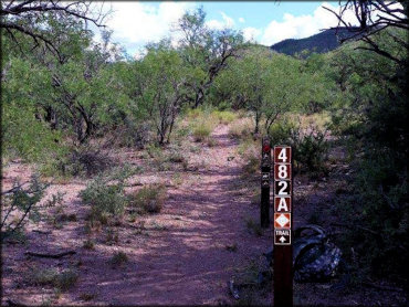
The Red Springs single track trail is marked and rated for difficulty. Photo Submitted 9/18/2019 (Thanks!)
RIDER COMMENTS & REVIEWS