 |
      |
| Home > Arizona > Redington Pass |
Redington Pass
Saturday, December 23, 2023
| Other Names | Redington Road, Tanque Verde Rd, Tanque Verde Falls, Chivo Falls, Coronado National Forest, Agua Caliente Hill, Agua Caliente Canyon, Italian Trap, Canyon De La Pina, Jaquine Canyon, Alisoo Canyon, Santa Caliente Mountains, Rincon Mountains, Chimney Rock, Redington Pass, Santa Catalina Ranger District |
| Last Known Status | Open |
This secluded area has several miles of very nice motorcycle and ATV trails and some surrounding fun jeep trails that offer beautiful panoramic desert views. The trails are somewhat rocky, but still a lot of fun on a motorcycle. (The trail system itself is maintained by the Tucson Rough Riders, so be sure to say thanks for the great work.)
The main access road is maintained but is long and steep which may make driving up with large RVs or trailers difficult. The main staging area has three loading ramps and offers ample turnaround space for large vehicles.
After a day of riding check out the two hiking trails that lead to Tanque Verde creek. The lower trailhead will lead to the bottom and if you hike upstream for about 25 minutes you will come across a 75’ waterfall. (The upper trailhead provides access to a nude beach area.)
The Arizona Game and Fish Department occasionally sets up a checkpoint on the main access road to enforce hunting regulations but they also check for OHV stickers. It is only legal to ride on the main access road if you make your bike street legal, and you'll still need an OHV sticker.
REGULATIONS
| Permit Required | Yes | AZGFD sticker required |
| Dates Open | Year-Round | |
| Other ATV Stickers Accepted | No | All non-residents must purchase an Arizona OHV decal. |
| Spark Arrestor | Yes | A spark arresting exhaust silencer or end cap is required for all vehicles. |
| Noise Limit | Yes (96 dB) | |
| Whip Flags | Not Required | |
| Maximum Vehicle Width | No Restriction | |
 Motorcycles & Dirt Bikes Motorcycles & Dirt Bikes | Permitted | |
 ATVs ATVs | Permitted | |
 UTV & SXS UTV & SXS | Permitted | |
 SUVs & Jeeps (registered) SUVs & Jeeps (registered) | Some Areas | permitted on designated trails |
| Dune Buggy & Sand Rail 4x4 (unregistered) | Some Areas | permitted on designated trails |
| 2 Stroke Engines | No Restriction | |
| MX Helmet Required | Youth Only | required for persons under 18 by state law (RiderPlanet strongly recommends helmets for all riders.) |
 Camping Camping | No Restriction | (camp anywhere) |
 Campfires Campfires | Some Areas | (permitted in developed campsites only) campfire permit required |
| Night Riding | Yes | |
| Trail Blazing | Prohibited | stay on trails |
| Alcohol | Prohibited | |
| Rule Enforcement | Few/Periodic | Jeep/SUV Patrol Occasionally a road block checkpoint is set up to check for OHV stickers and hunting tags. |
TERRAIN
| Approx Size | 19,200 acres (30 sq mi) | |
| Miles Of Trail | 10 | |
| Climate Type | Desert | |
| Elevation | 3700 to 4500 ft. | |
| Trail Maintenance | Marked, Not Rated, Lightly Maintained | |
| Loose Dirt |  Some Some | |
| Hard Pack | Some | mostly hardpacked sand |
| Sand | Some | |
| Mud |  Little Little | puddles |
| Dust |  None None | |
| Rocks |  Mostly Mostly | |
| Trees |  Few Few | |
| Steep Hills | None | |
| Water Crossings |  Many Many | |
| Small Jumps | Many | |
| Large Jumps | None | |
| Berms | Some | |
| Sand/Gravel Pits | None | |
| Single Track | None | double-track trails |
| Roads | Mostly | |
| Intersections | Few | |
| Rider Traffic | Few | |
| Shade | Few | |
| Ranges/Gunfire | Many | |
| Hazards | Few | (hazards not marked) shooting/hunting |
 Novice Novice | Little | |
 Amateur Amateur | Mostly | |
 Expert Expert | None | |
| Comment | mostly jeep trails with couple of motorcycle/ATV designated trails | |
TYPE OF AREA
| Area | Motorized Trails |
| Land | National Forest |
GPS POINTS


KEY SERVICES
 Gasoline Gasoline | 5-20 Miles (SW) | Circle K/Tucson (520) 749-4658 |
| Diesel | 5-20 Miles (SW) | Circle K/Tucson (520) 749-4658 |
 Water Water | 5-20 Miles (SW) | Circle K/Tucson (520) 749-4658 |
 RV Hookup RV Hookup | 5-20 Miles (S) | Cactus Country RV Resort (800) 777-8799 |
 RV Disposal RV Disposal | 5-20 Miles (S) | Cactus Country RV Resort (800) 777-8799 |
| Campground | 5-20 Miles (NW) | Molino Basin Campground |
 Conv Store Conv Store | 5-20 Miles (SW) | Unicomp Fortran Market (520) 298-7212 |
FEES & PASSES
| Parking | (None) |
| Entry | (None) |
| Riding | (None) |
| Camping | (None) |
| Comment | Surrounding campsites have different fees. |
RATINGS
| Pros | secluded, free, decent staging area, some very nice motorcycle/ATV trails |
| Cons | long access road, difficult to access for RVs, street legal bikes only on access road |
| Our Rating |  Very Good Very Good |
| Recommended Stay | 1-2 Days Fall/Spring |
| Comments | (Scroll Down For Rider Reviews & Comments) |
DRIVING DIRECTIONS
| Nearest City | Tucson, AZ | ||
| Address | Redington Road, Tucson, AZ 85748 | ||
| From: Tucson, AZ
1) Take Grant Road east to Tanque Verde Road intersection 2) Turn left on Tanque Verde Road and continue east 18.1 miles. (Tanque Verde Road will turn to Redington Road which will turn into a steep dirt road). Staging area is on the left. |


OFFICIAL CONTACTS
| Contact Info | Coronado National Forest - Santa Catalina Ranger District 5700 N. Sabino Canyon Road Tucson, AZ 85750 (520) 749-8700 mailroom_r3_coronado@fs.fed.us www.fs.usda.gov |
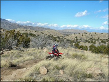
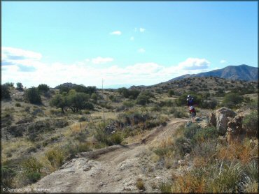
Redington Pass Trail Photo
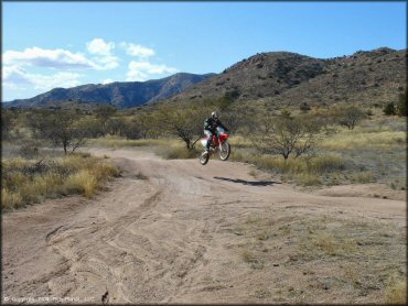
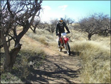
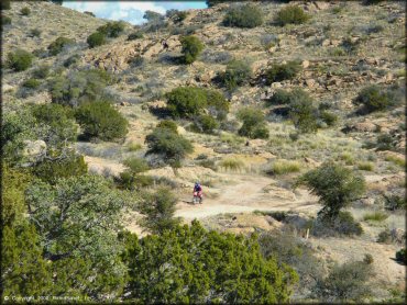
There is one main loop for motorcycles, but there are also many wider trails throughout the area.
Redington Pass Trail Photo
This hiking path leads to the falls, where there are some large rocks for sunbathing and swimming.
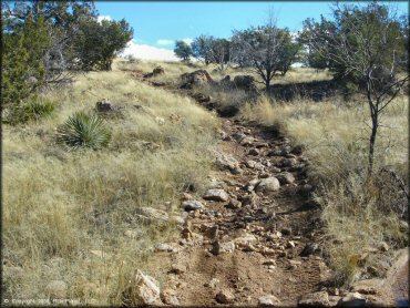
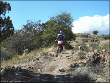
Redington Pass Trail Photo
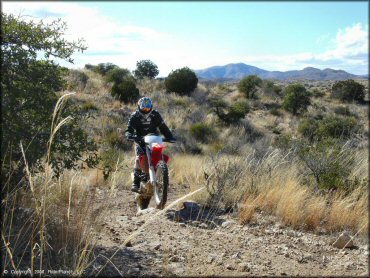
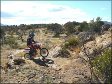
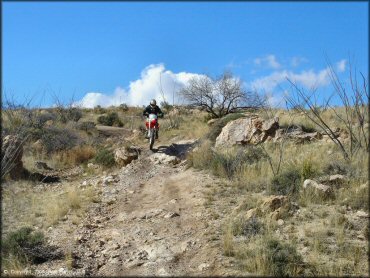
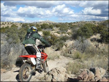
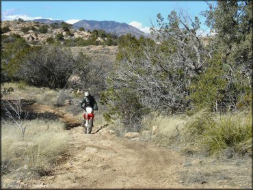
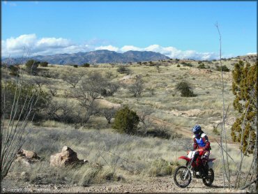
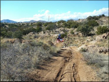
Parts of the motorcycle trail are rocky but nothing too bad.
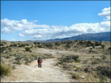
Redington Pass Trail Photo
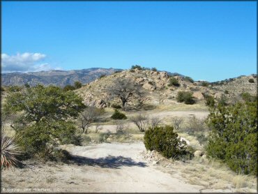
There are countless wide sandy 4x4 trails and some and a few small play pits near the staging area.
Redington Pass Trail Photo
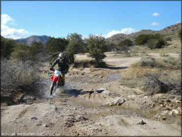
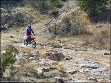
There are a handful of water crossings, most of which are shallow.
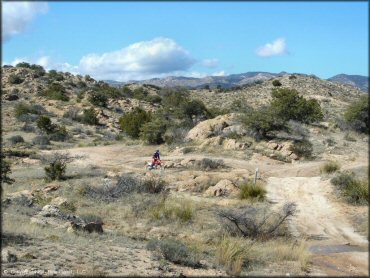
Redington Pass Trail Photo
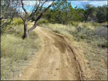
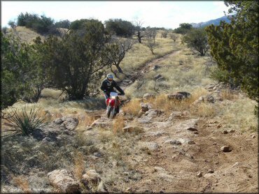
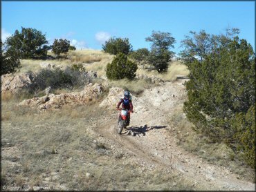
Not all of the trails are rocky.
Redington Pass Trail Photo
Redington Pass Trail Photo
Redington Pass Trail Photo
Redington Pass Trail Photo
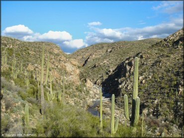
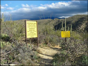
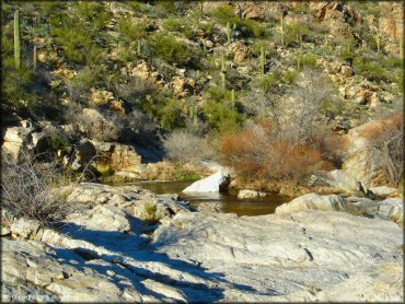
The waterfalls are in this canyon, which can be reached by the hiking trail.
Redington Pass Trail Photo
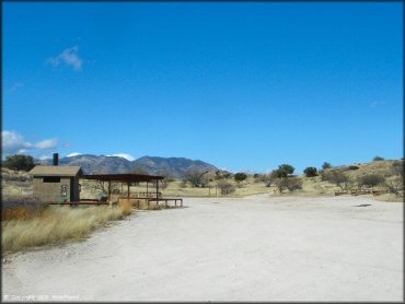
The main staging area is clearly marked and has restrooms and loading ramps.
Redington Pass Trail Photo
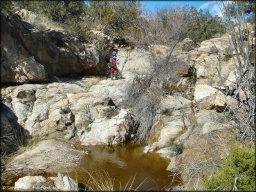
One of the many cool diversions along the trail.
Redington Pass Trail Photo
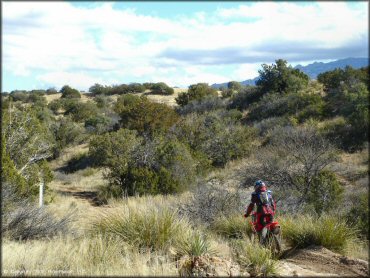
Redington Pass Trail Photo
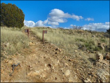
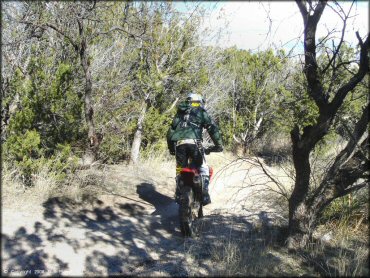
There are some trails for motorcycles and ATVs only. Keep your eyes open or you may blow right past them.
Redington Pass Trail Photo
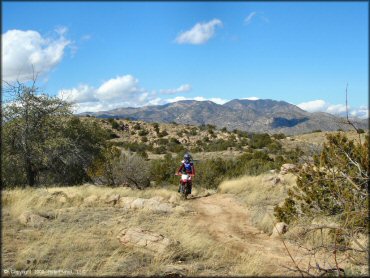
Redington Pass Trail Photo
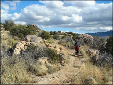
This could probably be considered a typical example of the motorcycle and ATV only trails.
Redington Pass Trail Photo
Redington Pass Trail Photo
Redington Pass Trail Photo
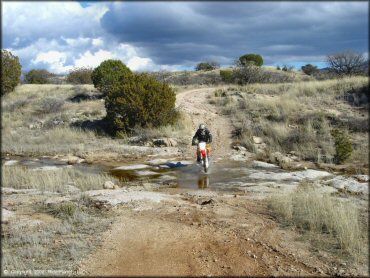
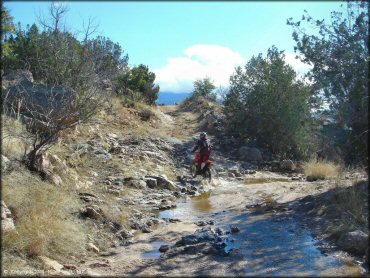
This water crossing was on the 4x4 trail.
Redington Pass Trail Photo
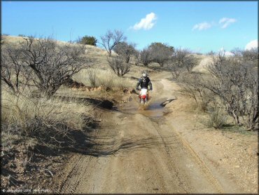
Mud puddles are pretty common here during the winter. Nothing too bad, but sometimes a little deeper than they look.
Redington Pass Trail Photo
Redington Pass Trail Photo
Redington Pass Trail Photo
There is one pretty fun section where the trail follows the stream for awhile.
Redington Pass Trail Photo
Redington Pass Trail Photo
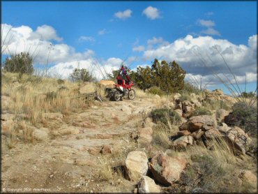
Some sections of the motorcycle trail have loose rocks like this to keep you alert.
Redington Pass Trail Photo
Redington Pass Trail Photo
Redington Pass Trail Photo
Redington Pass Trail Photo
Redington Pass Trail Photo
Redington Pass Trail Photo
Redington Pass Trail Photo
Redington Pass Trail Photo
Redington Pass Trail Photo
Redington Pass Trail Photo
Redington Pass Trail Photo
RIDER COMMENTS & REVIEWS