 |
      |
| Home > Arizona > Boulders OHV |
Boulders OHV Area
Saturday, December 23, 2023
| Other Names | Lake Pleasant, Mile Marker 11.5, Boulders Staging Area, Hieroglyphic Mountains Area, Shirttail Mountains, Shirt Tail Mountains, Picacho Wash Road |
| Last Known Status | Open |
This area has many miles of designated off-road trails with sand washes that wind past old windmills and corrals in the rolling desert hills.
There are plenty of easy to moderate trails, as well as some advanced level single track routes, with some trails stretching all the way into neighboring regions. While most of the land is BLM, there are some adjoining areas that may require a State Trust permit to ride.
The main staging area is large, flat, and meticulously maintained. There is a separate beginners area that is sometimes used for ATV training courses. The staging area can be busy on weekends, but due to the large number of good camping spots you can usually still find a comfortable place.
Much of the vegetation surrounding the staging area is protected so do your best not to trample it and always save your riding for the trail. The Boy Scouts and local riding clubs often do the trail and staging area clean up, so this will continue to be one of the best riding choices near Phoenix, as long as people take care of it.
REGULATIONS
| Permit Required | Yes | AZGFD sticker required AZ State Trust Land Recreation Permit |
| Dates Open | Year-Round | |
| Other ATV Stickers Accepted | No | All non-residents must purchase an Arizona OHV decal. |
| Spark Arrestor | Yes | A spark arresting exhaust silencer or end cap is required for all vehicles. |
| Noise Limit | Yes (96 dB) | |
| Whip Flags | Not Required | |
| Maximum Vehicle Width | No Restriction | |
 Motorcycles & Dirt Bikes Motorcycles & Dirt Bikes | Permitted | |
 ATVs ATVs | Permitted | |
 UTV & SXS UTV & SXS | Permitted | |
 SUVs & Jeeps (registered) SUVs & Jeeps (registered) | Permitted | Not Recommended |
| Dune Buggy & Sand Rail 4x4 (unregistered) | Permitted | |
| 2 Stroke Engines | No Restriction | |
| MX Helmet Required | Youth Only | required for persons under 18 by state law (RiderPlanet strongly recommends helmets for all riders.) |
 Camping Camping | No Restriction | (camp anywhere) |
 Campfires Campfires | No Restriction | |
| Night Riding | Yes | |
| Trail Blazing | Prohibited | stay on trails |
| Rule Enforcement | Some | Dedicated Rangers/Officers Jeep/SUV Patrol |
TERRAIN
| Approx Size | 38,400 acres (60 sq mi) | |
| Miles Of Trail | 200 | |
| Climate Type | Desert | |
| Elevation | 1700 to 3500 ft. | |
| Trail Maintenance | Marked, Not Rated, Lightly Maintained | |
| Loose Dirt |  Little Little | |
| Hard Pack |  Some Some | |
| Sand | Some | gravel sand washes |
| Mud |  None None | |
| Dust | Little | |
| Rocks | Little | |
| Trees |  Few Few | |
| Steep Hills | Few | |
| Water Crossings | Few | seasonal |
| Small Jumps | Some | |
| Large Jumps | None | |
| Berms |  Many Many | |
| Sand/Gravel Pits | None | |
| Single Track | Few | |
| Roads | Some | |
| Intersections | Few | |
| Rider Traffic | Many | |
| Shade | Few | |
| Ranges/Gunfire | None | |
| Hazards | Few | (hazards not marked) scattered debris, trails have some blind corners on sand washes |
 Novice Novice |  Mostly Mostly | |
 Amateur Amateur | Some | |
 Expert Expert | Some |
TYPE OF AREA
| Area | Motorized Trails |
| Land | BLM, State Trust Land |
GPS POINTS


KEY SERVICES
 Gasoline Gasoline | 5-20 Miles (E) | Chevron (623) 780-3221 |
| Diesel | 5-20 Miles (E) | Chevron (623) 780-3221 |
 Water Water | 5-20 Miles (E) | Chevron (623) 780-3221 |
 RV Hookup RV Hookup | 5-20 Miles (NE) | Lake Pleasant Regional Park (928) 501-1710 |
 RV Disposal RV Disposal | 5-20 Miles (NE) | Lake Pleasant Regional Park (928) 501-1710 |
| Campground | 5-20 Miles (NE) | Lake Pleasant Regional Park (928) 501-1710 |
 Conv Store Conv Store | 5-20 Miles (E) | Albertsons (623) 582-4985 |
FEES & PASSES
| Parking | (None) |
| Entry | (None) |
| Riding | (None) |
| Camping | (None) |
| Comment | Visitors should obtain a state trust permit prior to arrival. |
RATINGS
| Pros | large staging area, nice trails, nice scenery |
| Cons | no services, blind corners in sand washes |
| Our Rating |  Very Good Very Good |
| Recommended Stay | 1-2 Days Winter/Spring |
| Comments | (Scroll Down For Rider Reviews & Comments) |
DRIVING DIRECTIONS
| Nearest City | Peoria, AZ | ||
| From: Phoenix, AZ
1) Take I-17 North to Exit 223A (Carefree Hwy Exit) 2) Turn left (west) off the exit ramp, continue 18.7 miles to mile marker 11.5 3) Turn right (north) onto gravel road, continue .8 miles toward staging area. *Note: The main entrance road is not marked from the highway. If coming from the west begin to slow down at mile marker 12, then look for a gravel road on the left (a kiosk will be visible from the highway), enter here. |


OFFICIAL CONTACTS
| Contact Info | BLM - Phoenix Field Office 21605 N. 7th Ave. Phoenix, AZ 85027 (602) 867-5400 blm_az_pdoweb@blm.gov www.blm.gov |
| Contact Info | Arizona State Land Department 1616 West Adams Street Phoenix, AZ 85007 (602) 364-2753 land.az.gov |
| Contact Info | Arizona State Parks (602) 542-6942 (602) 542-2146 mrogers@azstateparks.gov meberhart@azstateparks.gov azstateparks.com |
| Comment | Arizona State Parks OHV Sticker Info |
Boulders OHV Trail Photo
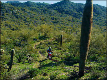
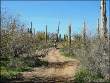
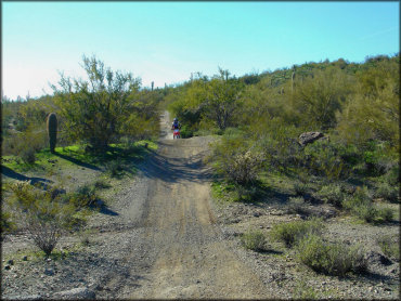
This is a large area with all types of terrain, including some single track. The scenery and surrounding cacti vegetation is spectacular, especially during the spring months.
Boulders OHV Trail Photo
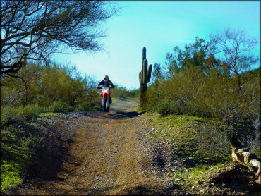
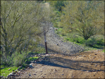
All of the motorized trails are marked to show what off-road vehicles are permitted. This trail is open to dirt bikes, ATVs and Jeeps.
Boulders OHV Trail Photo
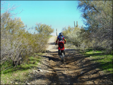
A good portion of the ATV trails are wide and hard packed with some loose gravel. This is a good place to bring beginners, families or a group ride.
Boulders OHV Trail Photo
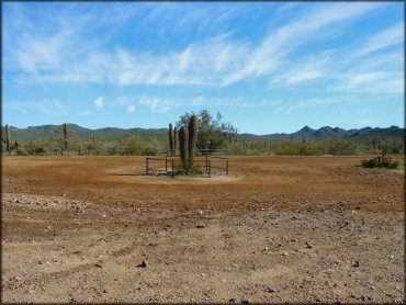
There is a flat novice / pee-wee learning area at the staging area which is fenced off for safety. This area is limited to small riders and ATVs 40 inches or less in width.
Boulders OHV Trail Photo
With mild fall and winter temperatures and hundreds of miles of motorized trails, Boulders OHV is a good choice to plan your next off-road vacation.
Boulders OHV Trail Photo
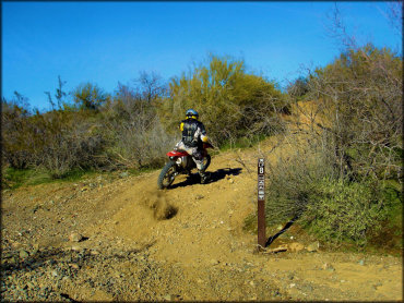
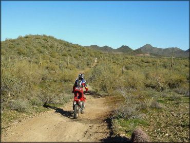
There are some designated single track trails just for dirt bikes. These trails are rocky and hard packed, which is typical of Arizona terrain.
Boulders OHV Trail Photo
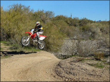
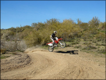
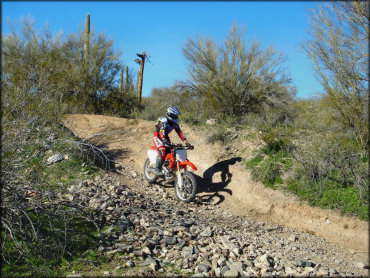
Some of the ATV trails have small hills where you can get a little air.
Boulders OHV Trail Photo
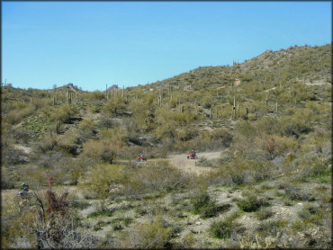
Another view of the type of terrain you will encounter at Boulders OHV Area.
Boulders OHV Trail Photo
The ATV trails are still fun even on a dirt bike.
Boulders OHV Trail Photo

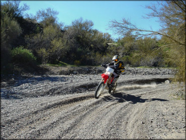
You can even rail a small berm in the sand washes.
Boulders OHV Trail Photo
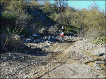
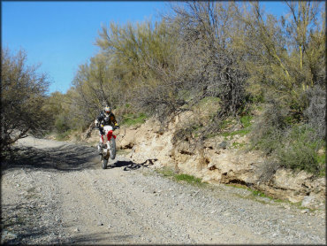
Some of the sand washes have a few rocky sections but they can easily be avoided.
Boulders OHV Trail Photo
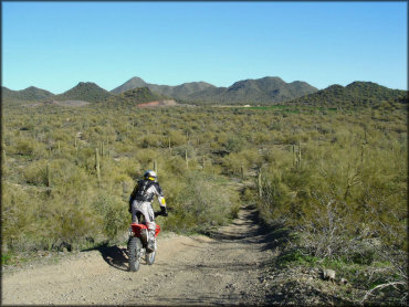
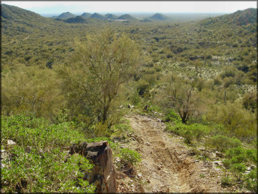
This area has panoramic views of the Hieroglyphic Mountains.
Boulders OHV Trail Photo
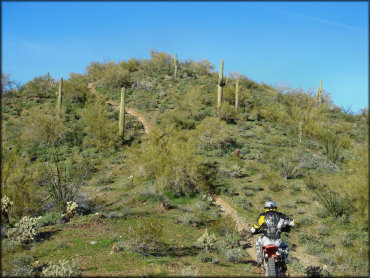
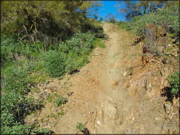
This section of single track motorcycle trail is rugged and steep but still a lot of fun.
Boulders OHV Trail Photo
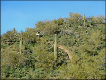
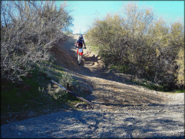
Coming down on this single track motorcycle trail is a lot easier than going up.
Boulders OHV Trail Photo
The trails are maintained by local ATV clubs and the Boy Scouts.
Boulders OHV Trail Photo
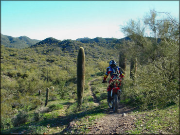
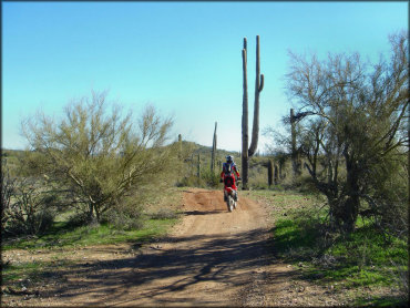
The saguaro cactus is plentiful here. This is also the Arizona state flower.
Boulders OHV Trail Photo
Due to the width and light moderation changes, these trails are mostly geared for ATVs and UTVs but are still worth exploring on a dirt bike.
Boulders OHV Trail Photo
The sand and gravel washes are a lot of fun.
Boulders OHV Trail Photo
The view at the top of this single track motorcycle trail is amazing.
Boulders OHV Trail Photo
The single track is rough and rugged with steep climbs. Get a good run and choose your lines wisely.
Boulders OHV Trail Photo
The ATV trails have some light to moderate elevation changes but nothing to scary.
Boulders OHV Trail Photo
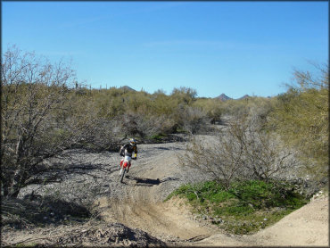
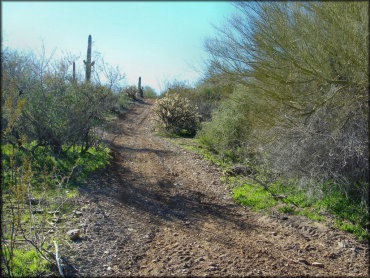
Most of the trails are fast, smooth and easy.
Boulders OHV Trail Photo
Another view of the trail markers. Most trails are open to all off-road vehicle types but some are only open to ATVs and dirt bikes.
Boulders OHV Trail Photo
This is another view of one of the ATV trails.
Boulders OHV Trail Photo
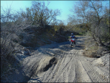
You will encounter the occasional section of loose chunk rock but most of the motorized trails are hard packed with loose gravel.
Boulders OHV Trail Photo
This trail system is unique thanks to the beautiful Sonoran desert landscape.
Boulders OHV Trail Photo
The cholla cactus can also be found in the area.
Boulders OHV Trail Photo
You can really lean in on the turns in the gravel washes.
Boulders OHV Trail Photo
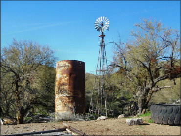
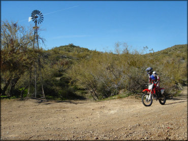
Another view of an old windmill and water tank, possibly remnants of an old homestead.
Boulders OHV Trail Photo
There are some old windmills and corrals to be found.
Boulders OHV Trail Photo
Off-road riders of all skill levels will enjoy this place.
Boulders OHV Trail Photo
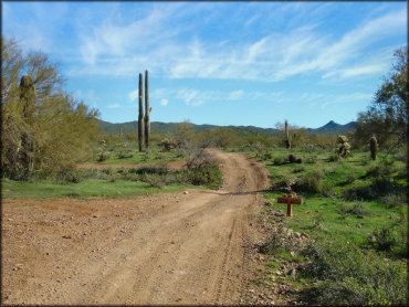
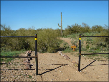
You will find occasional wooden signs reminding you to stay on the trail. Heed this warning.
RIDER COMMENTS & REVIEWS