 |
      |
| Home > Arizona > Black Hills Box Canyon |
Black Hills Box Canyon
Saturday, December 23, 2023
| Other Names | Box Canyon, Rincon Road, The Box, Wickenburg Mountains, Constellation Road, Black Hills, Hassayampa River, Rincon Rd., Wickenburg Box Canyon, Fools Canyon, King Solomon Gulch, Blue Tank Wash |
| Last Known Status | Open |
If you are looking for an alternative to the Florence Box Canyon you can check out this place near Wickenburg. It is more "untamed" than Florence and it will test you on every type of terrain from desert single track to deep water crossings and steep rocky climbs.
Some of the trails cross the Hasayampa River at different points. The river flows most of the year and is usually very shallow and narrow but during some seasons it can get particularly wide and deep making it difficult to cross (see photos). It has a bottom of soft sand that will quickly capture you if you don’t keep some momentum.
There are also several side trails that lead to some mines and small canyons but they are easy to miss so keep your eyes open. There are some spectacular looking rock canyons to explore and although most of these trails dead end after a short distance, some of the routes have short but truly expert-only rock climbs.
REGULATIONS
| Permit Required | Yes | AZGFD sticker required AZ State Trust Land Recreation Permit |
| Dates Open | Year-Round | |
| Spark Arrestor | Yes | A spark arresting exhaust silencer or end cap is required for all vehicles. |
| Noise Limit | Yes (96 dB) | |
| Whip Flags | Not Required | |
| Maximum Vehicle Width | No Restriction | |
 Motorcycles & Dirt Bikes Motorcycles & Dirt Bikes | Permitted | |
 ATVs ATVs | Permitted | |
 UTV & SXS UTV & SXS | Permitted | |
 SUVs & Jeeps (registered) SUVs & Jeeps (registered) | Permitted | |
| Dune Buggy & Sand Rail 4x4 (unregistered) | Permitted | |
| 2 Stroke Engines | No Restriction | |
| MX Helmet Required | Youth Only | required for persons under 18 by state law (RiderPlanet strongly recommends helmets for all riders.) |
 Camping Camping | No Restriction | (camp anywhere) |
 Campfires Campfires | Some Areas | (permitted in developed campsites only) |
| Night Riding | Yes | Not Recommended |
| Trail Blazing | Some Areas | |
| Rule Enforcement | Few/Periodic |
TERRAIN
| Approx Size | 1,000 acres (2 sq mi) | |
| Miles Of Trail | 10 | |
| Climate Type | Desert | |
| Elevation | 2100 to 2400 ft. | |
| Trail Maintenance | Not Marked, Not Rated, Not Maintained | |
| Loose Dirt |  Little Little | |
| Hard Pack |  Some Some | |
| Sand |  Mostly Mostly | |
| Mud | Little | |
| Dust | Little | |
| Rocks | Some | |
| Trees |  Few Few | |
| Steep Hills | Some | side trails |
| Water Crossings |  Many Many | |
| Small Jumps | Few | |
| Large Jumps |  None None | |
| Berms | Some | |
| Sand/Gravel Pits | None | |
| Single Track | None | |
| Roads | Mostly | |
| Intersections | Some | |
| Rider Traffic | Few | |
| Shade | Few | |
| Ranges/Gunfire | Few | |
| Hazards | Few | (hazards not marked) flash floods |
 Novice Novice | Mostly | |
 Amateur Amateur | Some | |
 Expert Expert | Little |
TYPE OF AREA
| Area | Motorized Trails |
| Land | AZ State Trust Land |


KEY SERVICES
 Gasoline Gasoline | 1-5 Miles (S) | Chevron |
| Diesel | 1-5 Miles (S) | Chevron |
 Water Water | 1-5 Miles (S) | Chevron |
 RV Hookup RV Hookup | 5-20 Miles (SE) | Desert Cypress RV Park (928) 684-2153 |
 RV Disposal RV Disposal | 5-20 Miles (SE) | Wickenburg Community Center (928) 668-0565 |
| Campground | 5-20 Miles (SE) | Constellation Park Campground (928) 684-5451 **no tents** |
 Conv Store Conv Store | 1-5 Miles (S) | Chevron |
FEES & PASSES
| Parking | (None) |
| Entry | (None) |
| Riding | (None) |
| Camping | Yes Tent: $8.00 RV: $8.00 Addtl. Vehicle: $0.00 Constellation Park Campground Fee |
RATINGS
| Pros | free, many water crossing |
| Cons | trails are not marked, no real motorcycle trails |
| Our Rating |  Good Good |
| Recommended Stay | 1-2 Days Summer/Fall |
| Comments | (Scroll Down For Rider Reviews & Comments) |
DRIVING DIRECTIONS
| Nearest City | Wickenburg, AZ | ||
| Address | Scenic Loop Road, Wickenburg, AZ 85390 | ||
| From: Wickenburg, AZ
For the Northern Staging Area: 1) Take Hwy 60 to Hwy 89/93 junction 2) Turn north onto Hwy 89/93, continue 3.5 miles 3) Turn right (north) onto Scenic Loop Road, continue about 4 miles. For the Eastern Staging Area: 1) Take Hwy 60 East past Hwy 89/93 junction .4 miles 2) Turn left on El Recreo Drive, continue .9 miles (El Recreo Drive will turn into Constellation Road) 3) Constellation Park Campground will be on the left, turn and stage here. |


OFFICIAL CONTACTS
| Contact Info | Arizona State Trust Land 1616 West Adams Street Phoenix, AZ 85007 (602) 542-4631 land.az.gov |
| Contact Info | Constellation Park 1201 Constellation Road Wickenburg, AZ 85390 (928) 684-5451 hworkman@wickenburgaz.org dolson@wickenburgaz.org www.wickenburgaz.org |
Black Hills Box Canyon Trail Photo
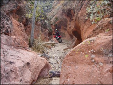
There are a number of shallow canyons like this, but most are dead ends.
Black Hills Box Canyon Trail Photo
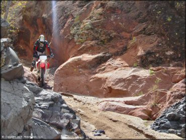
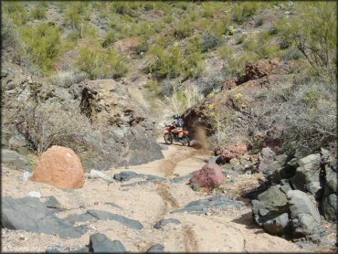
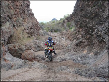
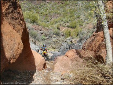
There are short challenging rock climbs, with deep sand on the approach, making it difficult to get any speed.
Black Hills Box Canyon Trail Photo
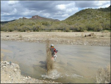
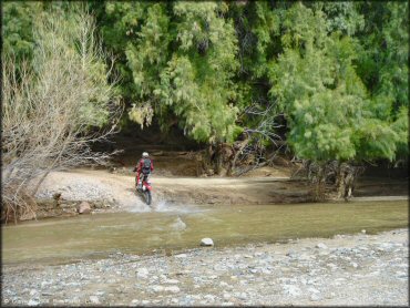
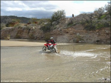
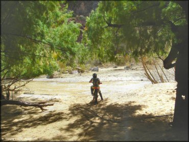
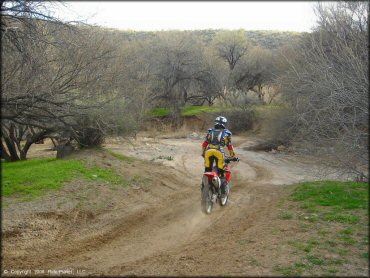
You'll have to cross the river multiple times (seasonal). The bottom is smooth, but very soft. It's easy to get stuck.
Black Hills Box Canyon Trail Photo
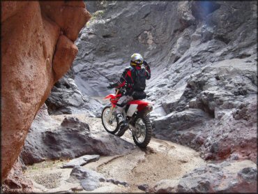
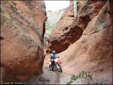
Talk about a tight fit!
Black Hills Box Canyon Trail Photo
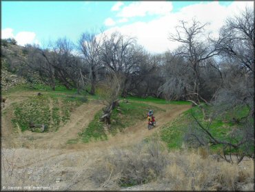
The most surprising thing about this area is the wide variety of terrain you will find.
Black Hills Box Canyon Trail Photo
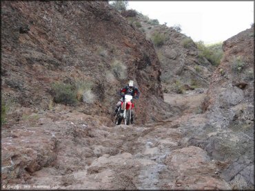
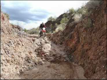
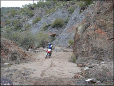
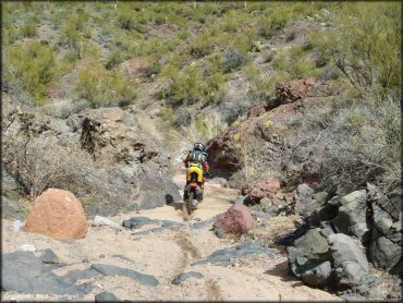
Sand and rocks is what you will find here.
Black Hills Box Canyon Trail Photo
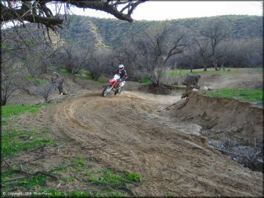
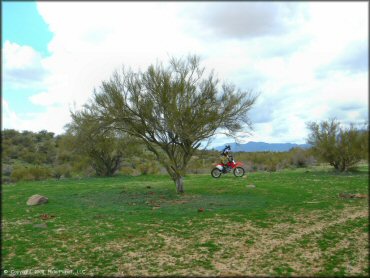
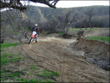
This sand play pit is just one of many fun areas to check out.
Black Hills Box Canyon Trail Photo
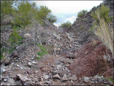
This canyon was a dead end, but still worth seeing.
Black Hills Box Canyon Trail Photo
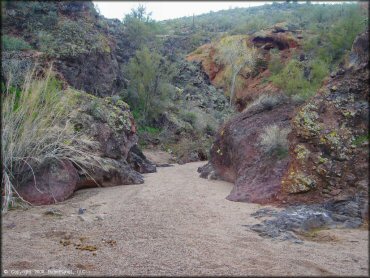
The canyons have beautiful earthy colors. The occasional scrub brush and saguaro cactus call this place home.
Black Hills Box Canyon Trail Photo
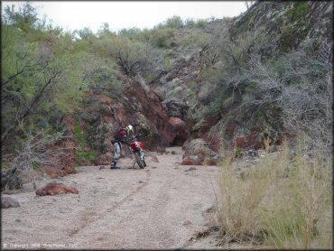
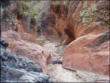
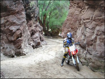
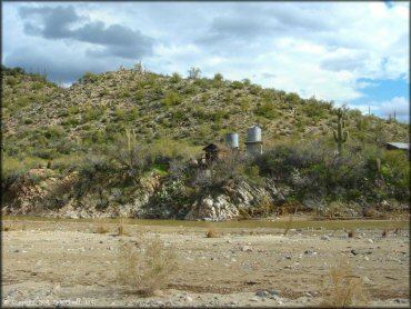
This is the entrance to "The Box", which is a tall shallow canyon with a spooky looking primitive campsite.
Black Hills Box Canyon Trail Photo
Black Hills Box Canyon Trail Photo
Black Hills Box Canyon Trail Photo
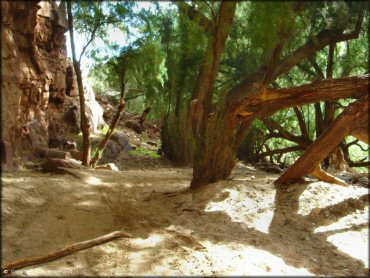
Entrance to "The Box". Its more of a cave than a trail. You can't go very far.
Black Hills Box Canyon Trail Photo
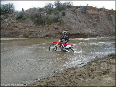
A Honda CRF250x is hard to beat in tight woods single track but I had to pin it to get through the water here. One bobble and it lost all momentum.
Black Hills Box Canyon Trail Photo
Black Hills Box Canyon Trail Photo
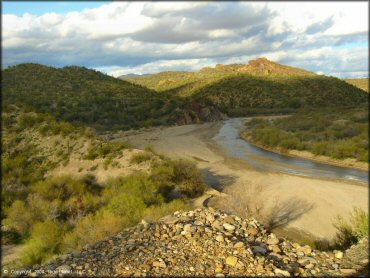
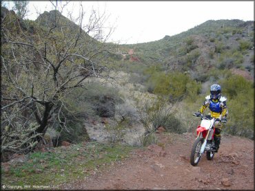
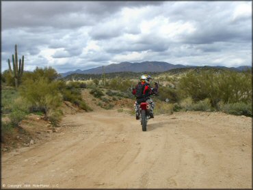
This is a view from the hillside near the southern staging area.
Black Hills Box Canyon Trail Photo
Black Hills Box Canyon Trail Photo
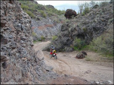
Like we said... very "untamed". This is a brutal climb, much steep than the photo indicates.
Black Hills Box Canyon Trail Photo
The highlights of this place was the unique, colorful and very cool terrain.
Black Hills Box Canyon Trail Photo
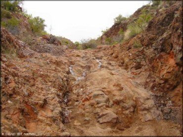
What made spots like this difficult was the soft sand at the base.
Black Hills Box Canyon Trail Photo
Black Hills Box Canyon Trail Photo
Black Hills Box Canyon Trail Photo
Black Hills Box Canyon Trail Photo
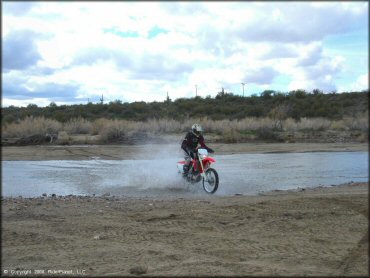
Most of the river crossings were fairly shallow.
Black Hills Box Canyon Trail Photo
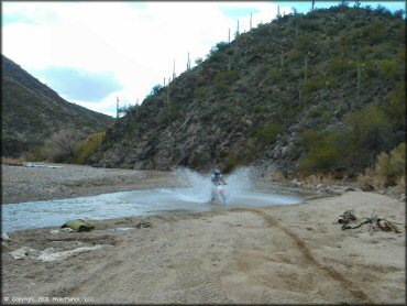
River crossings are fun!
Black Hills Box Canyon Trail Photo
The play are overlooks the Hassayampa River.
Black Hills Box Canyon Trail Photo
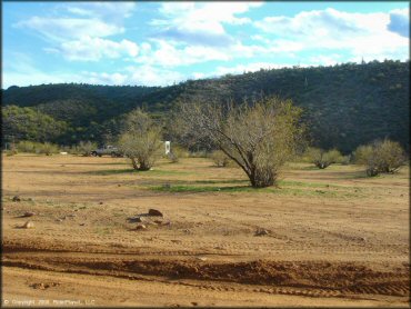
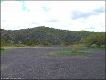
This is the northern staging area off Scenic Loop Road. There is plenty of space for all types of RVs and campers.
Black Hills Box Canyon Trail Photo
Black Hills Box Canyon Trail Photo
Black Hills Box Canyon Trail Photo
Black Hills Box Canyon Trail Photo
Black Hills Box Canyon Trail Photo
Black Hills Box Canyon Trail Photo
Black Hills Box Canyon Trail Photo
Rocks and sand.
Black Hills Box Canyon Trail Photo
Since most of the terrain is sand, you have to be on the gas!
Black Hills Box Canyon Trail Photo
This was the turnaround point of "The Box". As you can see, its mostly a shallow and narrow canyon but is a popular place to camp.
Black Hills Box Canyon Trail Photo
The Hassayampa River flows by the entrance of "The Box". Very unique.
Black Hills Box Canyon Trail Photo
Black Hills Box Canyon Trail Photo
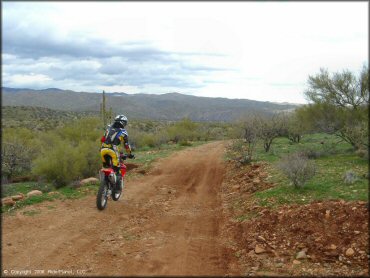
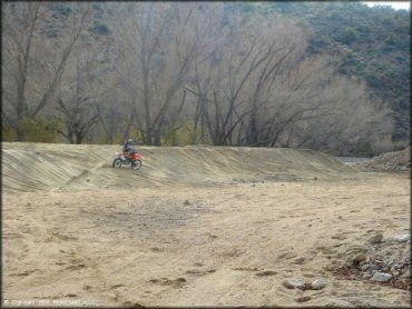
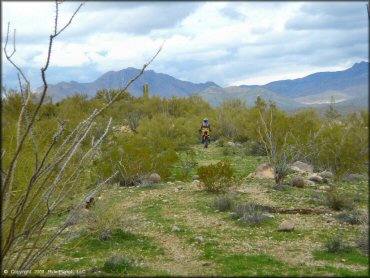
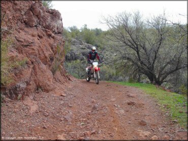
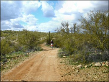
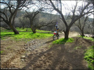
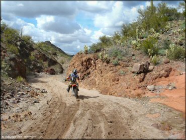
The trails eventually break out into smoother and flatter roads.
Black Hills Box Canyon Trail Photo
Black Hills Box Canyon Trail Photo
Another shot of the play area.
Black Hills Box Canyon Trail Photo
Black Hills Box Canyon Trail Photo
This is the southern staging area off Rincon Road.
Black Hills Box Canyon Trail Photo
This play area is located just east past "The Box".
RIDER COMMENTS & REVIEWS