 |
      |
| Home > Arkansas > Brock Creek |
Brock Creek Trails
Thursday, January 4, 2024
| Other Names | Ozark National Forest, Big Piney Ranger District, Bell Road, Charleston Road, Stoebuck Mountain, Moccasin Hollow, Kincannon Mountain, Campbell Hollow, John Mountain, Drivers Creek, Tackett Mountain, Zing Trailhead, Mountain Man Trailhead, Austin Trailhead |
| Last Known Status | Open |
This part of the Ozark National Forest offers 42 miles of ATV and dirt bike trails that wind through a mixed hickory, oak and pine tree forest. The trail system consists of two main loops and some smaller side trails that all interconnect. The terrain is mostly hard packed dirt with some loose chunk rock and a few shallow water crossings.
The trails are marked with yellow and orange blazes and routes wind through numerous scenic views, creek crossings, small waterfalls and beautiful deep woods scenery. The trail system has three staging areas and one campground with direct trail access. The Mountain Man staging area offers direct access to single track trails while the Zing staging area offers access to the ATV trails.
The Brock Creek Campground is located at the southern part of the trail system and features six sites, each with a picnic table, fire ring and lantern holder. There is a vault toilet available but no water so bring your own.
REGULATIONS
| Permit Required | No | |
| Dates Open | Year-Round | |
| Other ATV Stickers Accepted | Unknown | |
| Spark Arrestor | Yes | A spark arresting exhaust silencer or end cap is required for all vehicles. |
| Noise Limit | Yes (96 dB) | |
| Whip Flags | Not Required | |
| Maximum Vehicle Width | Yes (50 inches) | has entrance gate and narrow terrain |
 Motorcycles & Dirt Bikes Motorcycles & Dirt Bikes | Permitted | |
 ATVs ATVs | Permitted | (maximum width 50 inches) |
 UTV & SXS UTV & SXS | Permitted | (maximum width 50 inches) |
 SUVs & Jeeps (registered) SUVs & Jeeps (registered) | Prohibited | |
| Dune Buggy & Sand Rail 4x4 (unregistered) | Prohibited | |
| 2 Stroke Engines | No Restriction | |
| MX Helmet Required | No | (RiderPlanet strongly recommends helmets for all riders.) |
 Camping Camping | Some Areas | (camp in developed sites only) |
 Campfires Campfires | Some Areas | (permitted in developed campsites only) |
| Night Riding | Unknown | |
| Trail Blazing | Prohibited | stay on designated trails |
| Alcohol | Prohibited | |
| Rule Enforcement | ||
| Comment | Arkansas residents are required to register all 3 and 4-wheeled OHVs with the AR Department of Revenue. Decal is not a forest pass, it fulfills state requirements only. Arkansas residents can call their county revenue department for more information. | |
TERRAIN
| Miles Of Trail | 42 | |
| Climate Type | Forest | |
| Elevation | 700 to 1500 ft. | |
| Trail Maintenance | Marked, Not Rated, Lightly Maintained | trails are marked with yellow and orange diamonds |
| Loose Dirt |  Some Some | |
| Hard Pack |  Mostly Mostly | |
| Sand |  None None | |
| Mud |  Little Little | |
| Dust | Little | |
| Rocks | Some | |
| Trees |  All All | |
| Steep Hills | Some | |
| Water Crossings | Some | |
| Small Jumps | None | |
| Large Jumps | None | |
| Berms |  Few Few | |
| Sand/Gravel Pits | None | |
| Single Track | Some | |
| Roads | None | |
| Intersections | Some | |
| Rider Traffic | Few | |
| Shade |  Many Many | |
| Hazards | Few | (hazards assumed marked but use caution) |
 Novice Novice | Some | |
 Amateur Amateur | Mostly | |
 Expert Expert | Some |
TYPE OF AREA
| Area | Motorized Trails |
| Land | National Forest |
GPS POINTS


KEY SERVICES
 Gasoline Gasoline | 1-5 Miles (SW) | Phillips 66 (479) 284-2700 |
| Diesel | 1-5 Miles (SW) | Phillips 66 (479) 284-2700 |
 Water Water | 5-20 Miles (NW) | Macks Pines (479) 331-3261 |
 RV Hookup RV Hookup | 5-20 Miles (NW) | Macks Pines (479) 331-3261 |
 RV Disposal RV Disposal | 5-20 Miles (NW) | Macks Pines (479) 331-3261 |
| Campground | On Site | Brock Creek Campground (479) 284-3150 |
 Conv Store Conv Store | 1-5 Miles (SW) | Phillips 66 (479) 284-2700 |
FEES & PASSES
| Parking | (None) |
| Entry | (None) |
| Riding | (None) |
| Camping | (None) |
| Comment | No day use fee at campground but a donation tube available to help maintain parking, trails and vault toilets. |
RATINGS
| Our Rating |  Good Good |
| Recommended Stay | Full Day |
| Comments | (Scroll Down For Rider Reviews & Comments) |
DRIVING DIRECTIONS
| Nearest City | Jerusalem, AR | ||
| Address | Bell Road, Jerusalem, AR 72080 | ||
| From: Russellville, AR
1) Take SR-124 East about 20 miles toward the town of Jerusalem 2) Turn left (north) onto Conway County Road 32, continue 6 miles 3) Turn right (north-east) onto Bell Road, continue about 1 mile toward Brock Creek Campground. |


OFFICIAL CONTACTS
| Contact Info | Ozark National Forest - Big Piney Ranger District 12000 SR27 Hector, AR 72843 (479) 284-3150 mailroom_r8_ozark@fs.fed.us www.fs.usda.gov |
Brock Creek Trail Photo
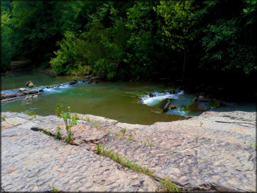
Photo Submitted 6/12/2016 (Thanks!)
Brock Creek Trail Photo
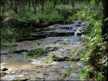
Photo Submitted 9/15/2016 (Thanks!)
Brock Creek Trail Photo

Photo Submitted 6/12/2016 (Thanks!)
Brock Creek Trail Photo
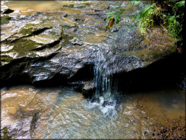
Photo Submitted 9/15/2016 (Thanks!)
RIDER COMMENTS & REVIEWS