 |
      |
| Home > California > Stonyford |
Stonyford
Sunday, March 31, 2024
| Other Names | Davis Flat, Wolf Creek, Fouts Springs, Fout Springs, Fouts Campground, Little Stony, Cedar Canyon, Mendocino National Forest, Mine Camp, Grindstone Ranger District, Letts Lake, Mill Creek Campground, Potato Hill |
| Last Known Status | Open |
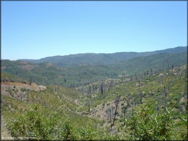
You might call this the northern offroad showcase of the Mendocino National Forest. With swimming holes, water crossings, and paved access to multiple campgrounds and staging areas, this area is huge and will not disappoint. (A Chatter Box or something like a Rino GPS is recommended.)
The area offers some single track, and many mountain trails of moderate to advanced difficulty. All trails are marked and rated. Most of the steeper trails are plenty wide if you need to bail out. Shade is minimal on the trail, but better in the campground.
Nearby East Park Reservoir is closed to OHV riding, but offers lakeshore camping, boating and water skiing. Elevation ranges from about 1700 to almost 6000 feet.
REGULATIONS
| Permit Required | Yes | CA OHMVR stickers required (Red Sticker Permitted Year-Round) |
| Dates Open | Year-Round | CA OHMVR red sticker vehicles permitted year round |
| Other ATV Stickers Accepted | Yes | Residents of any state not listed must purchase a Nonresident OHV Use Permit. (AR, AZ, CA, CO, CT, DE, IA, ID, IN, LA, MA, MD, ME, MI, MN, MO, MT, ND, NH, NJ, NM, NV, NY, OH, OK, OR, PA, RI, TX, UT, VT, WA, WI, WY) |
| Spark Arrestor | Yes | A spark arresting exhaust silencer or end cap is required for all vehicles. |
| Noise Limit | Yes (96 dB) | CA OHMVR noise limits apply (1985/older limit 101 dB, 1986/newer limit 96 dB) |
| Whip Flags | Not Required | |
| Maximum Vehicle Width | Yes (50 inches) | has entrance gate or posts wider vehicles are permitted on forest service roads |
 Motorcycles & Dirt Bikes Motorcycles & Dirt Bikes | Permitted | CA OHMVR stickers required |
 ATVs ATVs | Permitted | CA OHMVR stickers required (maximum width 50 inches) |
 UTV & SXS UTV & SXS | Permitted | CA OHMVR stickers required (maximum width 50 inches) |
 SUVs & Jeeps (registered) SUVs & Jeeps (registered) | Some Areas | permitted on forest service roads |
| Dune Buggy & Sand Rail 4x4 (unregistered) | Some Areas | CA OHMVR stickers required (maximum width 50 inches) permitted on forest service roads |
| 2 Stroke Engines | Certain Times | CA OHMVR restrictions apply |
| MX Helmet Required | Yes | helmets required by state law |
 Camping Camping | Some Areas | (camp in developed sites only) |
 Campfires Campfires | Some Areas | (permitted in developed campsites only) |
| Night Riding | Unknown | Not Recommended |
| Trail Blazing | Prohibited | stay on trail |
| Alcohol | No Restriction | |
| Rule Enforcement | Some | Dedicated Rangers/Officers Jeep/SUV Patrol |
| Comment | Motorcycles that are registered for the street may also use the trails. The plate must be properly displayed at all times, including off-highway. | |
TERRAIN
| Approx Size | 90,240 acres (141 sq mi) | |
| Miles Of Trail | 200 | |
| Climate Type | Forest | |
| Elevation | 1700 to 6000 ft. | |
| Trail Maintenance | Marked, Rated, Heavily Maintained | |
| Loose Dirt |  Some Some | |
| Hard Pack |  Mostly Mostly | |
| Sand |  None None | |
| Mud |  Little Little | trails close when there is more than 2 inches of rain |
| Dust | Mostly | |
| Rocks | Some | |
| Trees | Some | |
| Steep Hills |  Many Many | |
| Water Crossings | Some | |
| Small Jumps | Many | |
| Large Jumps |  Few Few | |
| Berms | Some | |
| Sand/Gravel Pits | None | |
| Single Track | Some | |
| Roads | Few | |
| Intersections | Few | |
| Rider Traffic | Few | |
| Shade | Few | |
| Ranges/Gunfire | None | |
| Hazards | Few | (hazards not marked) Beware of cliffs. some cliffs go adjacent to steep cliffs |
 Novice Novice | Little | |
 Amateur Amateur | Some | |
 Expert Expert | Mostly | |
| Comment | Most of the trails are geared for advanced riders - most trails are marked as blue but really are black diamonds. Amateurs will have a better time at Penny Pines or Hollister Hills. | |
TYPE OF AREA
| Area | Motorized Trails |
| Land | National Forest |
GPS POINTS


KEY SERVICES
 Gasoline Gasoline | 5-20 Miles (E) | Stonyford General Store (530) 963-3235 |
| Diesel | 30+ Miles (SE) | Chevron (530) 934-5802 |
 Water Water | On Site | potable water Davis Flats/Fouts Springs Staging Area |
 RV Hookup RV Hookup | 30+ Miles (SW) | Holiday Harbor RV Park (707) 274-1136 |
 RV Disposal RV Disposal | On Site | Fout Springs Campground |
| Campground | On Site | |
 Conv Store Conv Store | 5-20 Miles (E) | Stonyford General Store (530) 963-3235 |
FEES & PASSES
| Parking | (None) |
| Entry | (None) |
| Riding | (None) |
| Camping | Yes Tent: $10.00 RV: $10.00 Addtl. Vehicle: $0.00 Mill Valley Campground Fee |
| Comment | Davis Flats, Fouts Springs, Mill Creek, North Fork and South Fork Campgrounds - $5/night. Self-pay stations at each camping/staging area. |
RATINGS
| Pros | swimming holes, water crossings, nice area to camp at Davis Flat, many staging areas with picnic tables, creek flows through area |
| Cons | dry, dusty, not enough shade, hard to find on a map |
| Our Rating |  Very Good Very Good |
| Recommended Stay | 1-2 Days Spring or Fall |
| Comments | (Scroll Down For Rider Reviews & Comments) |
DRIVING DIRECTIONS
| Nearest City | Stonyford, CA | ||
| Address | Fouts Springs Road, Stonyford, CA 95979 | ||
| From: Sacramento, CA
1) Take I-5 North to Exit 586 2) Turn left (west) off the exit ramp onto Maxwell Coulsa Road, continue 9.6 miles 3) Turn right (north) onto Sites Ladoga Road, continue 21.6 miles 4) Turn left at the intersection onto Market Street, continue .3 miles 5) Turn left (west) onto Fouts Springs Road, continue about 4 miles toward Wolf Creek Staging Area or 9 miles toward Davis Flat / Fouts Springs Campground. |


OFFICIAL CONTACTS
| Contact Info | Mendocino National Forest - Stonyford Work Center 5171 Stonyford - Elk Creek Road Stonyford, CA 95979 (530) 963-3128 mailroom_r5_mendocino@fs.fed.us www.fs.usda.gov |
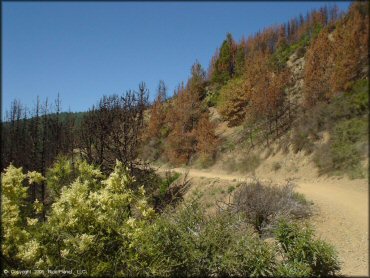
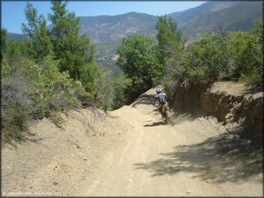
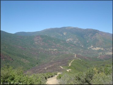
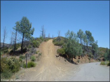
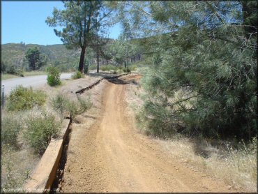
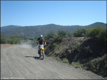
Stonyford Trail Photo
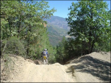
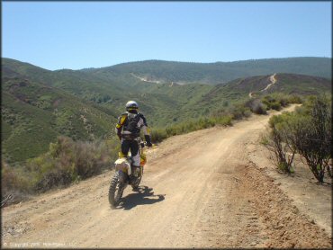
Some of the trails are fairly steep, but manageable.
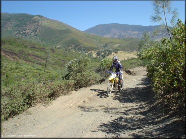
Stonyford Trail Photo
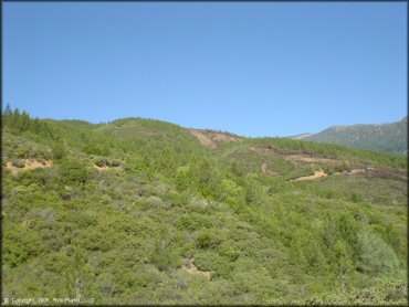
Stonyford Trail Photo
Stonyford Trail Photo
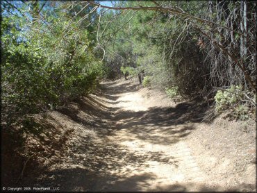
Some of the trails go through some cool brush tunnels.
Stonyford Trail Photo
Stonyford Trail Photo
Stonyford Trail Photo
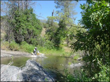
Plenty of creek crossings are scattered throughout Stonyford.
Stonyford Trail Photo
Stonyford Trail Photo
Intersections where the trail crosses paved roads are marked with stop signs.
Stonyford Trail Photo
Stonyford Trail Photo
Stonyford Trail Photo
Stonyford Trail Photo
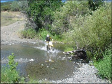
Plenty of creek crossings are scattered throughout Stonyford.
Stonyford Trail Photo
Stonyford Trail Photo
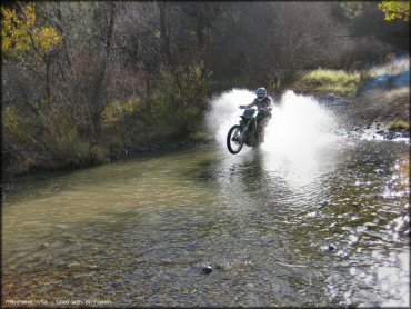
The trail system has numerous stream crossings like this.
RIDER COMMENTS & REVIEWS