 |
      |
| Home > California > South Cow Mountain |
South Cow Mountain
Friday, February 9, 2024
| Other Names | Ukiah, Talmage, Mill Creek Road, Clear Lake, Mend Lake Road, Lake Mendocino, Buckhorn Campground, Oakwood Springs, Red Mountain Camp, Westside Staging Area, Scotts Creek Staging Area, Morrison Creek, Miners Ridge, Eightmile Valley, Willow Creek, Panther Creek, Benmore Creek, Blue Oak Ranch |
| Last Known Status | Open |
This trail system is recommended mainly for experienced riders. The trails range from deep rutted single track with tight switchbacks and mud holes, to extremely sharp rocky sections near the peaks that will tear up your tires a bit.
The access road is narrow and winding, and is not recommended for RVs or long trailers. All trails are looped, and there is a nice swimming hole downstream from where trail 6 meets 24. Maps are available at each of the staging areas, which have loading docks and restrooms.
This area is most crowded in the fall, and the ruts and mud holes get very deep in some places. The surrounding area has 25,000 acres for hiking and mountain biking.
Please note that this area is subject to temporary wet weather closures and may close on short notice, so check the hotline before heading out.
REGULATIONS
| Permit Required | Yes | CA OHMVR stickers required |
| Dates Open | Year-Round | CA OHMVR red sticker vehicles permitted year round |
| Other ATV Stickers Accepted | Yes | Residents of any state not listed must purchase a Nonresident OHV Use Permit. (AR, AZ, CA, CO, CT, DE, IA, ID, IN, LA, MA, MD, ME, MI, MN, MO, MT, ND, NH, NJ, NM, NV, NY, OH, OK, OR, PA, RI, TX, UT, VT, WA, WI, WY) |
| Spark Arrestor | Yes | A spark arresting exhaust silencer or end cap is required for all vehicles. |
| Noise Limit | Yes (96 dB) | CA OHMVR noise limits apply (1985/older limit 101 dB, 1986/newer limit 96 dB) |
| Whip Flags | Not Required | |
| Maximum Vehicle Width | No Restriction | |
 Motorcycles & Dirt Bikes Motorcycles & Dirt Bikes | Permitted | CA OHMVR stickers required |
 ATVs ATVs | Permitted | CA OHMVR stickers required some trails too narrow for ATVs |
 UTV & SXS UTV & SXS | Some Areas | CA OHMVR stickers required permitted on designated 4x4 trails |
 SUVs & Jeeps (registered) SUVs & Jeeps (registered) | Some Areas | permitted on designated 4x4 trails |
| Dune Buggy & Sand Rail 4x4 (unregistered) | Some Areas | CA OHMVR stickers required permitted on designated 4x4 trails |
| 2 Stroke Engines | No Restriction | CA OHMVR restrictions apply |
| MX Helmet Required | Yes | helmets required by state law |
 Camping Camping | Some Areas | (camp in developed sites only) Red Mountain Camp |
 Campfires Campfires | Some Areas | (permitted in developed campsites only) |
| Night Riding | No | quiet hours at dusk |
| Trail Blazing | Prohibited | no trailblazing |
| Alcohol | No Restriction | |
| Rule Enforcement | Few/Periodic | Jeep/SUV Patrol |
TERRAIN
| Approx Size | 23,000 acres (36 sq mi) | |
| Miles Of Trail | 94 | |
| Climate Type | Forest | |
| Elevation | 800 to 4000 ft. | |
| Trail Maintenance | Not Marked, Not Rated, Not Maintained | |
| Loose Dirt |  Some Some | |
| Hard Pack | Some | |
| Sand |  None None | |
| Mud | Some | |
| Dust |  Little Little | |
| Rocks | Some | upper elevation trails are very rocky |
| Trees |  Many Many | |
| Steep Hills | Many | |
| Water Crossings |  Few Few | |
| Small Jumps | Some | |
| Large Jumps | Few | |
| Berms | Some | |
| Sand/Gravel Pits | None | |
| Single Track | Many | beware steep climbs with sharp cut-backs |
| Roads | Some | |
| Intersections | Some | |
| Rider Traffic | Some | busy in late spring and fall, slow in summer |
| Shade | Many | |
| Ranges/Gunfire | Some | |
| Hazards | Some | (hazards not marked) very deep ruts (waist high), huge mud holes |
 Novice Novice | Some | |
 Amateur Amateur |  Mostly Mostly | |
 Expert Expert | Some | |
| Comment | Target practice at N.Cow Mountain, S.Cow Mountain open to hunters all year. | |
TYPE OF AREA
| Area | Motorized Trails |
| Land | BLM |

| Features | Public |
| Max Engine Size | No Maximum |
| Min Engine Size | No Minimum |
| Comment | Practice Track |
GPS POINTS


KEY SERVICES
 Gasoline Gasoline | 5-20 Miles (NW) | AMPM (707) 462-1969 |
| Diesel | 5-20 Miles (NW) | AMPM (707) 462-1969 |
 Water Water | 30+ Miles (NW) | potable water Redwood Empire Fairgrounds Overnight RV Park (707) 462-3884 |
 RV Hookup RV Hookup | 30+ Miles (NW) | Redwood Empire Fairgrounds Overnight RV Park (707) 462-3884 |
 RV Disposal RV Disposal | 30+ Miles (NW) | Redwood Empire Fairgrounds Overnight RV Park (707) 462-3884 |
| Campground | On Site | Red Mountain Campground |
 Conv Store Conv Store | 5-20 Miles (NW) | AMPM (707) 462-1969 |
FEES & PASSES
| Parking | (None) |
| Entry | (None) |
| Riding | (None) |
| Camping | (None) |
RATINGS
| Pros | lot of single track, nice staging areas, swimming hole where trail 6 meets 24, maps at staging area, loading docks, looped trails |
| Cons | deep ruts, some very rocky sections, rugged access road, only 10 camp sites, tough to get an RV in. two way trails - very tight |
| Our Rating |  Very Good Very Good |
| Recommended Stay | 1-2 Days late spring when creeks flow |
| Comments | (Scroll Down For Rider Reviews & Comments) |
DRIVING DIRECTIONS
| Nearest City | Ukiah, CA | ||
| Address | Mill Creek Road, Ukiah, CA 95482 | ||
| From: San Francisco, CA
1) 101 N to Exit 548A 2) Turn right (east) off the exit ramp onto Talmage Road, continue 1.5 miles 3) Turn right (south) onto Old River Road, continue .4 miles 4) Turn left (east) onto Mill Creek Road, continue 5.7 miles (follow the signs to South Cow Mountain Recreation Area). Note: Access road is steep, rugged and narrow with tight switchbacks. RVs and trailers not recommended. |


OFFICIAL CONTACTS
| Contact Info | BLM - Ukiah Field Office 2550 North State Street Ukiah, CA 95482 (707) 468-4000 blm_ca_web_uk@blm.gov www.blm.gov |
| Comment | Extension 1 |
South Cow Mountain Trail Photo
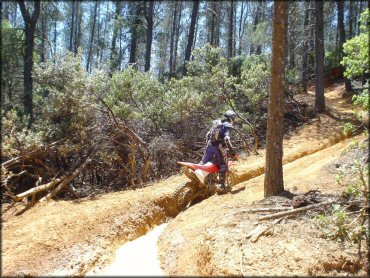
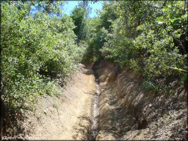
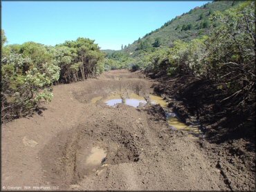
Keep an eye out for deep ruts. This trail had ruts so deep that they actually caught the footpegs and stopped this CRF150.
South Cow Mountain Trail Photo
South Cow Mountain Trail Photo
Here is another look at some of the ruts we encountered in the woods. They were a nuisance for the mini bike.
South Cow Mountain Trail Photo
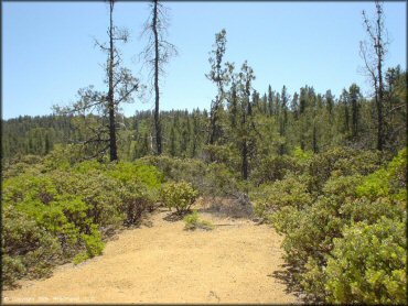
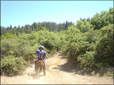
And here's some dry single track (almost) to round out the mix of terrain. This place really does have a little of everything.
South Cow Mountain Trail Photo
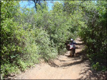
The brush tunnels and the tight woods trails were the most fun.
South Cow Mountain Trail Photo
South Cow Mountain Trail Photo
South Cow Mountain Trail Photo
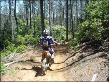
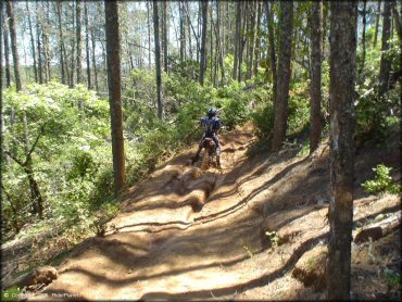
So just like that the trails can switch back to narrow woods. Smooth and twisty.
South Cow Mountain Trail Photo
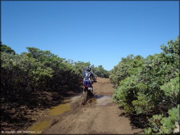
There were plenty of deeper mud puddles that were fun to go through as well.
South Cow Mountain Trail Photo
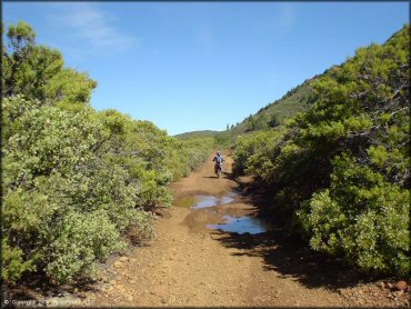
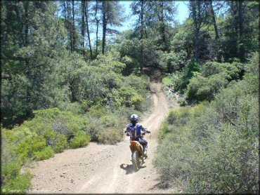
This part of the trail was pretty fun with just the occasional mud puddle.
South Cow Mountain Trail Photo
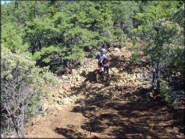
Up near the top of the mountain the trails get pretty rocky. These small rocks are loose and sharp but most of the trails are not like this.
South Cow Mountain Trail Photo
Another look at one of the upper trails surrounded by shrubs. The dirt was great, really soft, and you would think the trail would dry out quicker than it does.
South Cow Mountain Trail Photo
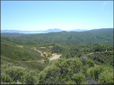
This is a typical view from a hilltop where you can see the pond and some of the other trails along one of the two main routes.
South Cow Mountain Trail Photo
Here is another example of how some of the trails get pretty rocky toward the top of the ridge. This trails was just piles of loose sharp rocks so keep your tire pressure up.
South Cow Mountain Trail Photo
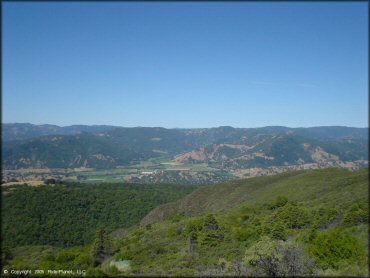
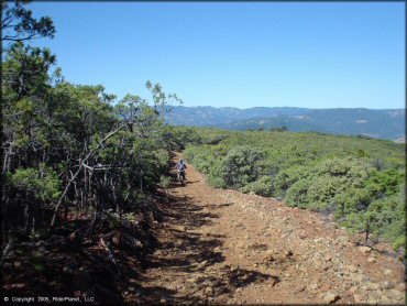
One of the many scenic views to be had from the ridge tops. Looking back toward the valley.
South Cow Mountain Trail Photo
Photo Submitted 4/24/2015 (Thanks!)
South Cow Mountain Trail Photo
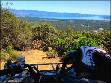
Photo Submitted 4/24/2015 (Thanks!)
South Cow Mountain Trail Photo
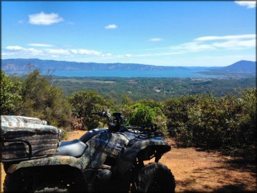
Photo Submitted 4/24/2015 (Thanks!)
RIDER COMMENTS & REVIEWS