 |
      |
| Home > California > Frank Raines |
Frank Raines OHV Park
Saturday, December 23, 2023
| Other Names | Frank Raines - Deer Creek OHV Park, Del Puerto Creek, Del Puerto Canyon, Stanislaus County |
| Last Known Status | Open |
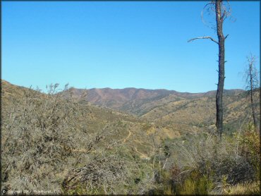
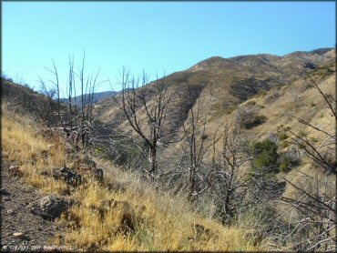
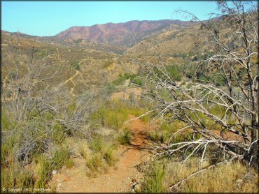
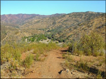
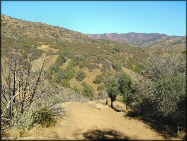
Open to all OHVs, this off road park has a variety of terrain that includes some rugged hill climbs, washouts, rocky creek beds and rutted 4x4 trails. In general the trails are pretty dry and crusty most times, and the surrounding vegetation is sparse with just the occasional shrub or patch of grass.
Note that the trails have a seasonal closure which usually runs between mid June through the end of October for fire season. Exact dates vary so call first before heading out.
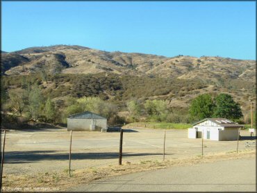
Camping is permitted at Deer Creek Campground which offers nice shady sites with full RV hookups, restroom and shower facilities plus direct trail access. RV sites can be reserved online, but tent sites are first come, first serve.
REGULATIONS
| Permit Required | Yes | CA OHMVR stickers required |
| Dates Open | October - June | CA OHMVR red sticker vehicles permitted from 10/1 to 4/30 |
| Other ATV Stickers Accepted | Yes | Residents of any state not listed must purchase a Nonresident OHV Use Permit. (AR, AZ, CA, CO, CT, DE, IA, ID, IN, LA, MA, MD, ME, MI, MN, MO, MT, ND, NH, NJ, NM, NV, NY, OH, OK, OR, PA, RI, TX, UT, VT, WA, WI, WY) |
| Spark Arrestor | Yes | A spark arresting exhaust silencer or end cap is required for all vehicles. |
| Noise Limit | Yes (96 dB) | CA OHMVR noise limits apply (1985/older limit 101 dB, 1986/newer limit 96 dB) |
| Whip Flags | Not Required (96 inches) | recommended by park for all 4-Wheel OHVs, but not required |
| Maximum Vehicle Width | No Restriction | |
 Motorcycles & Dirt Bikes Motorcycles & Dirt Bikes | Permitted | CA OHMVR stickers required |
 ATVs ATVs | Permitted | CA OHMVR stickers required |
 UTV & SXS UTV & SXS | Permitted | CA OHMVR stickers required |
 SUVs & Jeeps (registered) SUVs & Jeeps (registered) | Permitted | |
| Dune Buggy & Sand Rail 4x4 (unregistered) | Permitted | CA OHMVR stickers required |
| 2 Stroke Engines | Certain Times | CA OHMVR restrictions apply |
| MX Helmet Required | Yes | helmets required by state law |
 Camping Camping | Some Areas | (camp in developed sites only) |
 Campfires Campfires | Some Areas | (permitted in developed campsites only) |
| Night Riding | No | riding permitted from dawn to dusk |
| Trail Blazing | Prohibited | riders must stay on trail |
| Alcohol | No Restriction | |
| Rule Enforcement | Few/Periodic |
TERRAIN
| Approx Size | 860 acres (1 sq mi) | |
| Miles Of Trail | 10 | |
| Climate Type | High Desert/forest | |
| Elevation | 1150 to 2500 ft. | |
| Trail Maintenance | Not Marked, Not Rated, Lightly Maintained | |
| Loose Dirt |  Little Little | |
| Hard Pack |  Mostly Mostly | |
| Sand |  None None | |
| Mud | Little | |
| Dust | Mostly | |
| Rocks | Mostly | |
| Trees |  Many Many | |
| Steep Hills |  All All | |
| Water Crossings |  Few Few | |
| Small Jumps | None | |
| Large Jumps | None | |
| Berms | None | |
| Sand/Gravel Pits | None | |
| Single Track |  Some Some | |
| Roads | Some | |
| Intersections | Some | |
| Rider Traffic | Some | |
| Shade | Many | |
| Ranges/Gunfire | None | |
| Hazards | Some | (hazards not marked) steep rutted chutes, large rocks & steep ravines |
 Novice Novice | Little | |
 Amateur Amateur | Some | |
 Expert Expert | Mostly |
TYPE OF AREA
| Area | Motorized Trails |
| Land | County Land |


KEY SERVICES
 Gasoline Gasoline | 5-20 Miles (E) | 76 (209) 892-5444 |
| Diesel | 5-20 Miles (E) | 76 (209) 892-5444 |
 Water Water | On Site | |
 RV Hookup RV Hookup | On Site | Deer Creek Campground (209) 525-6750 |
 RV Disposal RV Disposal | On Site | Deer Creek Campground (209) 525-6750 |
| Campground | On Site | Deer Creek Campground (209) 525-6750 |
 Conv Store Conv Store | 5-20 Miles (E) | Save-Mart (209) 892-5000 |
FEES & PASSES
| Parking | (None) |
| Entry | Yes ($5.00 per vehicle) day use fee |
| Riding | (None) |
| Camping | Yes Tent: $20.00 RV: $30.00 Addtl. Vehicle: $10.00 Only two vehicles permitted per campsite and must be registered to the same owner. Three day holiday weekend - add $5/night/vehicle. |
| Comment | Annual Pass - $100 (good toward all OHVs carried within transportation vehicle; does not include camping fees); Dogs - $3/dog per day |
RATINGS
| Pros | onsite campground has RV hookups/disposal & plenty of shade & grassy sections |
| Cons | most terrain immediately gets challenging for younger riders, some VERY steep & rutted parts |
| Our Rating |  Good Good |
| Recommended Stay | 1-2 Days Winter/Spring |
| Comments | (Scroll Down For Rider Reviews & Comments) |
DRIVING DIRECTIONS
| Nearest City | Patterson, CA | ||
| Address | Del Puerto Canyon Road, Livermore, CA 94550 | ||
| From: Patterson, CA
1) Take I-5 South to Exit 434 2) Turn right (west) off the exit ramp, continue .2 miles 3) Turn right (north) onto Del Puerto Canyon Road, continue about 16 miles 4) Deer Creek Campground will be on the right (north). Stage here. |


OFFICIAL CONTACTS
| Contact Info | Stanislaus County Department of Parks And Recreation 3800 Cornucopia Way, Ste C Modesto, CA 95358 (209) 525-6750 stancountyparks@parksrec.org www.stancountyparks.com |
| Contact Info | Stanislaus County Sheriff's Department 320 E Street Waterford, CA 95382 (209) 874-2349 |
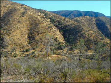
Frank Raines Trail Photo
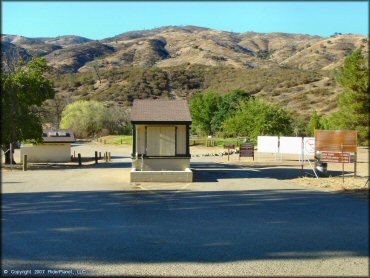
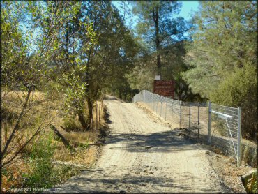
The main entrance is gated and visitors should expect possible sticker and sound level inspections.
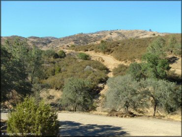
Frank Raines Trail Photo
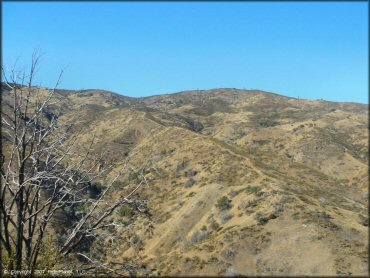
Frank Raines Trail Photo
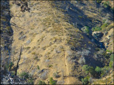
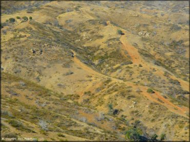
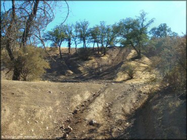
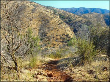
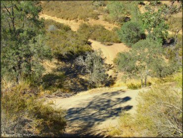
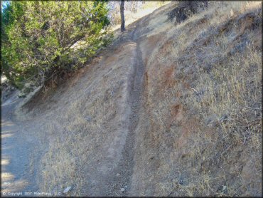
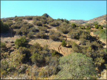
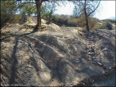
There is some steep single track to be found. Some is off limits.
Frank Raines Trail Photo
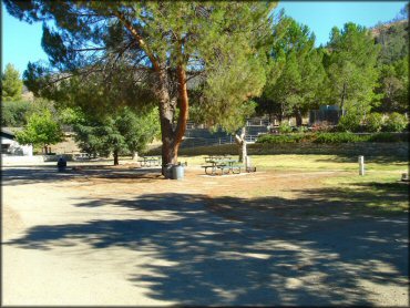
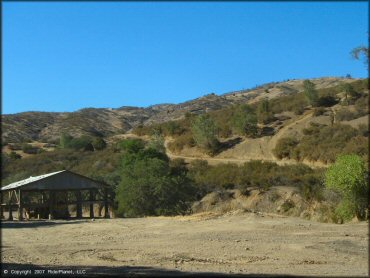
The main staging area is large with full amenities that include full hookups, picnic tables and BBQ rings.
Frank Raines Trail Photo
Frank Raines Trail Photo
Frank Raines Trail Photo
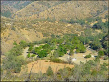
This is a top town view of the staging area, which includes both day-use and camping sites.
Frank Raines Trail Photo
Frank Raines Trail Photo
Frank Raines Trail Photo
Frank Raines Trail Photo
Frank Raines Trail Photo
Frank Raines Trail Photo
Frank Raines Trail Photo
Frank Raines Trail Photo
Frank Raines Trail Photo
Frank Raines Trail Photo
Frank Raines Trail Photo
Frank Raines Trail Photo
Frank Raines Trail Photo
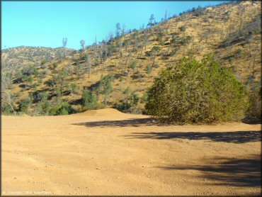
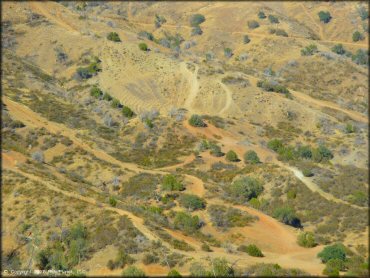
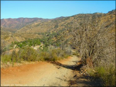
This is one of a few places along the main road where the trail breaks out into a large dirt lot.
Frank Raines Trail Photo
Frank Raines Trail Photo
Frank Raines Trail Photo
Frank Raines Trail Photo
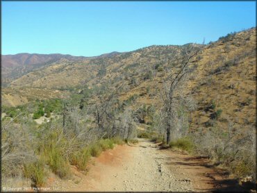
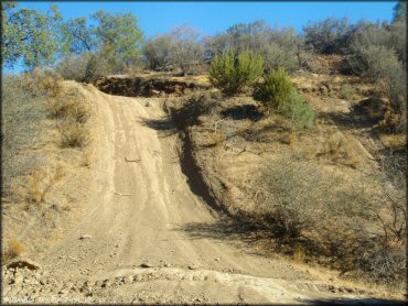
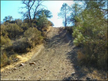
This is the main road which provide access to the trails. It's the only way in and is locked when the park is closed.
Frank Raines Trail Photo
Frank Raines Trail Photo
Frank Raines Trail Photo
Frank Raines Trail Photo
One drawback is that there is not much here for pee-wees. To the left of the painted circle is considered the 'pee-wee' area.
RIDER COMMENTS & REVIEWS