 |
      |
| Home > California > Jackson Meadows |
Jackson Meadows
Monday, January 01, 2024
| Other Names | Henness Pass Rd, Middle Yuba River, Meadow Lake Rd, Webber Lake, Bowman Lake, Little Truckee Summit Staging Area, Pacific Crest National Scenic Trail, French Lake, Henness Pass Road, Tahoe National Forest, Truckee Ranger District, Fordyce Trail |
| Last Known Status | Closed For Season |
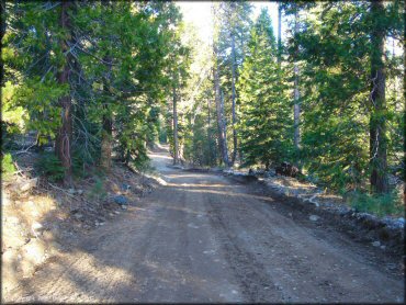
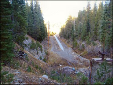
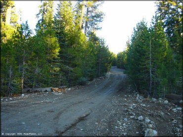
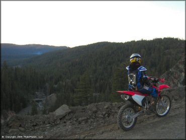
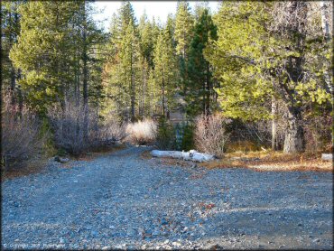
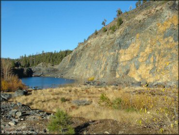
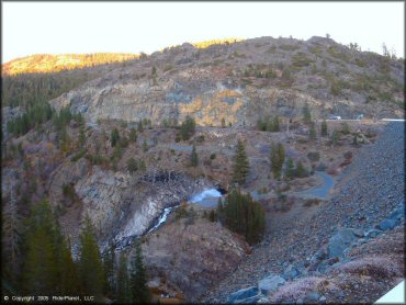
This part of the Tahoe National Forest mainly consists of dirt roads but still offers plenty of recreational opportunities to choose from, such as numerous lakes and campsites to please any outdoor enthusiast.
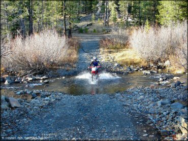
Challenging motorcycle trails are scarce but some of the roads do occasionally go over small creek crossings, and the views are top notch. If you stay on the main road you can eventually reach the famous Fordyce Jeep Trail (experts only) which is rocky and challenging for ATVs, but not recommended for motorcycles.
REGULATIONS
| Permit Required | Yes | CA OHMVR stickers required |
| Dates Open | April 24 - December 31 | CA OHMVR red sticker vehicles permitted year round |
| Other ATV Stickers Accepted | Yes | Residents of any state not listed must purchase a Nonresident OHV Use Permit. (AR, AZ, CA, CO, CT, DE, IA, ID, IN, LA, MA, MD, ME, MI, MN, MO, MT, ND, NH, NJ, NM, NV, NY, OH, OK, OR, PA, RI, TX, UT, VT, WA, WI, WY) |
| Spark Arrestor | Yes | A spark arresting exhaust silencer or end cap is required for all vehicles. |
| Noise Limit | Yes (96 dB) | CA OHMVR noise limits apply (1985/older limit 101 dB, 1986/newer limit 96 dB) |
| Whip Flags | Not Required | |
| Maximum Vehicle Width | No Restriction | |
 Motorcycles & Dirt Bikes Motorcycles & Dirt Bikes | Permitted | CA OHMVR stickers required |
 ATVs ATVs | Permitted | CA OHMVR stickers required |
 UTV & SXS UTV & SXS | Permitted | CA OHMVR stickers required |
 SUVs & Jeeps (registered) SUVs & Jeeps (registered) | Permitted | |
| Dune Buggy & Sand Rail 4x4 (unregistered) | Permitted | CA OHMVR stickers required |
| 2 Stroke Engines | Certain Times | CA OHMVR restrictions apply |
| MX Helmet Required | Yes | helmets required by state law |
 Camping Camping | Some Areas | (camp in developed sites only) |
 Campfires Campfires | Some Areas | (permitted in developed campsites only) |
| Night Riding | Unknown | |
| Trail Blazing | Prohibited | stay on trails |
| Alcohol | No Restriction | |
| Rule Enforcement | Few/Periodic |
TERRAIN
| Approx Size | 92,800 acres (145 sq mi) | |
| Miles Of Trail | 100 | |
| Climate Type | Forest | |
| Elevation | 5700 to 7200 ft. | |
| Trail Maintenance | Not Marked, Not Rated, Lightly Maintained | |
| Loose Dirt |  Little Little | |
| Hard Pack |  Mostly Mostly | |
| Sand |  None None | |
| Mud |  Some Some | |
| Dust | Little | |
| Rocks | Little | |
| Trees |  All All | |
| Steep Hills | None | |
| Water Crossings | Some | |
| Small Jumps | None | |
| Large Jumps | None | |
| Berms | None | |
| Sand/Gravel Pits | None | |
| Single Track | None | |
| Roads | All | |
| Intersections | Some | |
| Rider Traffic | None | |
| Shade | All | |
| Ranges/Gunfire |  Few Few | |
| Hazards | None | |
 Novice Novice | Mostly | |
 Amateur Amateur | Little | |
 Expert Expert | None |
TYPE OF AREA
| Area | Motorized Trails |
| Land | National Forest |


KEY SERVICES
 Gasoline Gasoline | 5-20 Miles (NE) | Sierraville Superstore (530) 994-3820 |
| Diesel | 5-20 Miles (NE) | Sierraville Superstore (530) 994-3820 |
 Water Water | 5-20 Miles (NE) | Sierraville |
 RV Hookup RV Hookup | 20-30 Miles (SE) | Coachland RV Park (530) 587-3071 |
 RV Disposal RV Disposal | 5-20 Miles (SE) | Coachland RV Park (530) 587-3071 |
| Campground | 1-5 Miles (E) | Tahoe National Forest Pass Creek Campground (530) 993-1410 |
 Conv Store Conv Store | 5-20 Miles (NE) | Sierraville Superstore (530) 994-3820 |
FEES & PASSES
| Parking | (None) |
| Entry | (None) |
| Riding | (None) |
| Camping | Yes Tent: $24.00 RV: $24.00 Addtl. Vehicle: $5.00 East Meadow, Fir Top and Findley campground fees. Add $2/day for reservations during holiday weekends. |
RATINGS
| Pros | plenty of campgrounds/campsites to choose from, some are very close to the reservoir, great scenic views, boat ramp is close by, some creek crossings, plenty nearby lakes. |
| Cons | no motorcycle single track trails, all are dirt roads |
| Our Rating |  Good Good |
| Recommended Stay | Full Day Summer/Fall |
| Comments | (Scroll Down For Rider Reviews & Comments) |
DRIVING DIRECTIONS
| Nearest City | Truckee, CA | ||
| From: Reno, NV
1) I-80 West to Exit 188 2) Turn right (north) off the exit ramp onto Hwy 89, continue .2 miles 3) Proceed through roundabout to continue on Hwy 89, continue .3 miles 4) Proceed through second roundabout to stay on Hwy 89, continue 15 miles 5) Turn left (west) on Jackson Meadows Road (you will see a sign for Little Truckee Summit OHV Staging Area) 6) Follow Jackson Meadows Road to Jackson Meadows Reservoir Dam, approx. 15 miles 7) Stage on the right hand side before the dam. |


OFFICIAL CONTACTS
| Contact Info | Tahoe National Forest - Truckee Ranger District 10811 Stockrest Springs Road Truckee, CA 96161 (530) 536-0417 (530) 587-3558 mailroom_r5_tahoe@fs.fed.us www.fs.usda.gov |
Jackson Meadows Trail Photo
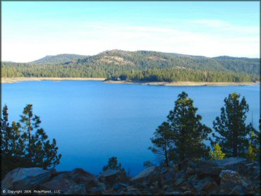
Jackson Meadows Reservoir
Jackson Meadows Trail Photo
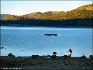
During the low tide months you can ride past the boat ramp.
Jackson Meadows Trail Photo
Jackson Meadows Trail Photo
Jackson Meadows Trail Photo
Jackson Meadows Trail Photo
Jackson Meadows Trail Photo
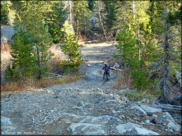
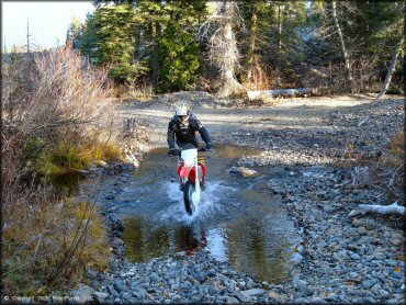
Looks can be deceiving as some of the creek crossings are fairly deep.
Jackson Meadows Trail Photo

Jackson Meadows Trail Photo
Jackson Meadows Trail Photo
Jackson Meadows Trail Photo
Jackson Meadows Trail Photo
Jackson Meadows Trail Photo
Jackson Meadows Trail Photo
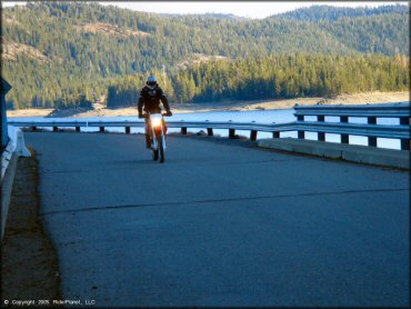
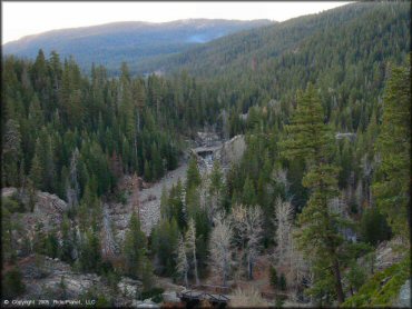
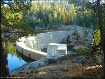
To access most of the trails go across the Jackson Meadows Reservoir Dam.
Jackson Meadows Trail Photo
Jackson Meadows Trail Photo
Jackson Meadows Trail Photo
Jackson Meadows Trail Photo
RIDER COMMENTS & REVIEWS