 |
      |
| Home > California > Indian Springs |
Indian Springs
Friday, April 5, 2024
| Other Names | Soda Springs, Grouse Lake Area, Eagle Lakes Road, Tahoe National Forest, South Yuba River, Caryle Road, Grouse Ridge Trail, Lake Spaulding, Brady Mountain, Fordyce Lake, Four Dice, Signal Peak, Nevada City Ranger District, Pierce OHV Trail, Fordyce Trail, Indian Springs Campground |
| Last Known Status | Open |
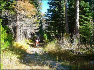
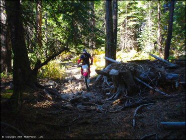
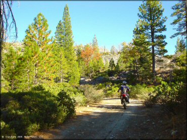
This area is actually more of a 4x4 trail, but it will test your rock climbing skills if you decide to tackle it on your motorcycle. There are plenty of private, primitive campsites right on the river if you bear left at each opportunity. The camping and scenery is also beautiful in the upper elevations (bear right at all opportunities), but the higher you go, the rockier it gets, so expect to be challenged.
The main staging area is open for day use only but dispersed camping is permitted throughout the forest. Indian Springs Campground is about .5 miles away from the staging area but non-steet legal machines must be hauled to and from the campground since there is no direct trail access.
Please note that the OHV trails in this area are closed to motorized use from January 1 through March 31 except the Fordyce Jeep Trail, which is open if there is 15” of snow on the ground. For current trail conditions contact the Tahoe National Forest.
REGULATIONS
| Permit Required | Yes | CA OHMVR stickers required |
| Dates Open | April 1 - December 31 | CA OHMVR red sticker vehicles permitted year round |
| Other ATV Stickers Accepted | Yes | Residents of any state not listed must purchase a Nonresident OHV Use Permit. (AR, AZ, CA, CO, CT, DE, IA, ID, IN, LA, MA, MD, ME, MI, MN, MO, MT, ND, NH, NJ, NM, NV, NY, OH, OK, OR, PA, RI, TX, UT, VT, WA, WI, WY) |
| Spark Arrestor | Yes | A spark arresting exhaust silencer or end cap is required for all vehicles. |
| Noise Limit | Yes (96 dB) | CA OHMVR noise limits apply (1985/older limit 101 dB, 1986/newer limit 96 dB) |
| Whip Flags | Not Required | |
| Maximum Vehicle Width | No Restriction | |
 Motorcycles & Dirt Bikes Motorcycles & Dirt Bikes | Permitted | CA OHMVR stickers required |
 ATVs ATVs | Permitted | CA OHMVR stickers required |
 UTV & SXS UTV & SXS | Permitted | CA OHMVR stickers required |
 SUVs & Jeeps (registered) SUVs & Jeeps (registered) | Permitted | |
| Dune Buggy & Sand Rail 4x4 (unregistered) | Permitted | CA OHMVR stickers required |
| 2 Stroke Engines | Certain Times | CA OHMVR restrictions apply |
| MX Helmet Required | Yes | helmets required by state law |
 Camping Camping | Some Areas | (camp in developed sites only) |
 Campfires Campfires | Some Areas | (permitted in developed campsites only) |
| Night Riding | Yes | Not Recommended |
| Trail Blazing | Prohibited | stay on trails |
| Alcohol | No Restriction | |
| Rule Enforcement | None |
TERRAIN
| Approx Size | 5,120 acres (8 sq mi) | |
| Miles Of Trail | 15 | |
| Climate Type | Forest | |
| Elevation | 5400 to 7750 ft. | |
| Trail Maintenance | Not Marked, Not Rated, Lightly Maintained | |
| Loose Dirt |  Some Some | |
| Hard Pack |  Mostly Mostly | |
| Sand |  Little Little | |
| Mud | Little | |
| Dust | Some | |
| Rocks | Mostly | |
| Trees |  All All | |
| Steep Hills | Some | |
| Water Crossings |  Few Few | |
| Small Jumps |  None None | |
| Large Jumps | None | |
| Berms | Few | |
| Sand/Gravel Pits | None | |
| Single Track | None | |
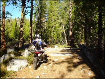
| Roads | Mostly | |
| Intersections | Some | |
| Rider Traffic | Few | |
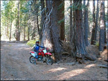
| Shade | All | |
| Ranges/Gunfire | Few | |
| Hazards | Few | (hazards not marked) upper elevations have very rocky hill climbs |
 Novice Novice | Mostly | |
 Amateur Amateur | Some | |
 Expert Expert | Little | |
| Comment | Upper elevations are very rocky, recommended for experts only. | |
TYPE OF AREA
| Area | Motorized Trails |
| Land | National Forest |


KEY SERVICES
 Gasoline Gasoline | 5-20 Miles (E) | 76 (530) 426-9041 |
| Diesel | 5-20 Miles (E) | 76 (530) 426-9041 |
 Water Water | 5-20 Miles (E) | Soda Springs |
 RV Hookup RV Hookup | 1-5 Miles (S) | Thousand Trails-Snowflower Preserve (530) 389-8241 |
 RV Disposal RV Disposal | 1-5 Miles (S) | Thousand Trails-Snowflower Preserve (530) 389-8241 |
| Campground | 1-5 Miles (S) | Thousand Trails-Snowflower Preserve (530) 389-8241 |
 Conv Store Conv Store | 5-20 Miles (W) | Harmony Ridge Market (530) 265-5761 |
FEES & PASSES
| Parking | (None) |
| Entry | (None) |
| Riding | (None) |
| Camping | Yes Tent: $24.00 RV: $24.00 Addtl. Vehicle: $5.00 Indian Springs Campground Fee |
RATINGS
| Pros | nice secluded campgrounds, mostly easy trails, very scenic, a lot of roads |
| Cons | no motorcycle or single trails, upper elevation trails are very rocky and challenging |
| Our Rating |  Very Good Very Good |
| Recommended Stay | 1-2 Days Summer/Fall |
| Comments | (Scroll Down For Rider Reviews & Comments) |
DRIVING DIRECTIONS
| Nearest City | Soda Springs, CA | ||
| Address | Eagle Lakes Road, Nevada City, CA 95959 | ||
| From: Reno, NV
1) Take I-80 West to Exit 164/Eagle Lakes Road 2) Turn right (north) off the exit ramp onto Eagle Lakes Road,continue about 3/4 mile 3) Veer right at the fork, staging area is straight ahead. |


OFFICIAL CONTACTS
| Contact Info | Tahoe National Forest - Forest Headquarters 631 Coyote Street Nevada City, CA 95959 (530) 265-4531 mailroom_r5_tahoe@fs.fed.us www.fs.usda.gov |
| Contact Info | Tahoe National Forest - Yuba River Ranger District 15924 Highway 49 Camptonville, CA 95922 (530) 288-3231 www.fs.usda.gov |
| Contact Info | Sacramento Jeepers Inc. P.O. Box 160521 Sacramento, CA 95816 www.sacramentojeepers.org |
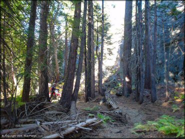
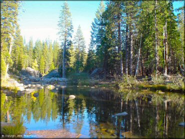
Indian Springs Trail Photo
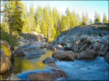
The beautiful South Yuba River offers plenty of primitive campsites to choose from.
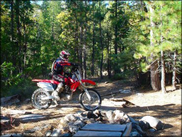
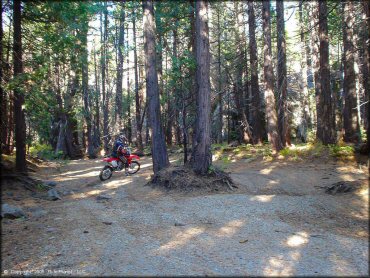
Indian Springs Trail Photo
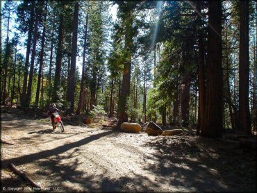
Indian Springs Trail Photo
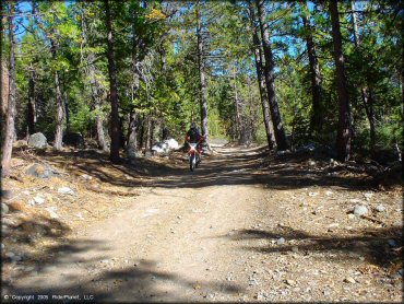
Indian Springs Trail Photo
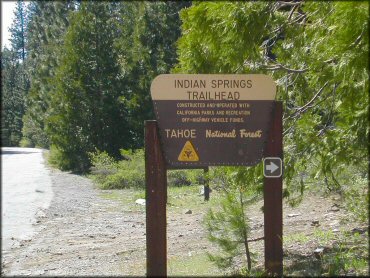
This is the signage for the Indian Springs Trailhead.
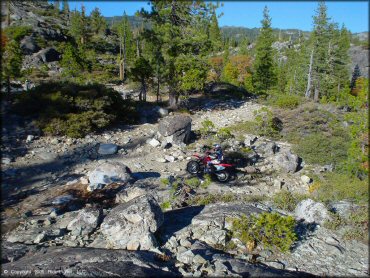
Indian Springs Trail Photo
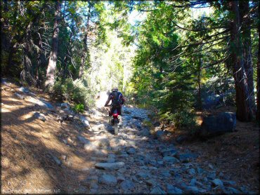
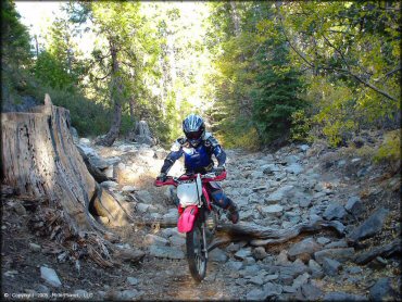
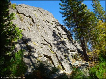
The rocky 4x4 jeep trails will truly test your rock crawling skills.
Indian Springs Trail Photo
Indian Springs Trail Photo
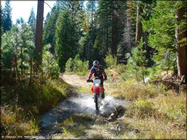
One of the few creek crossings.
Indian Springs Trail Photo
Indian Springs Trail Photo
Indian Springs Trail Photo
Indian Springs Trail Photo
Indian Springs Trail Photo
Indian Springs Trail Photo
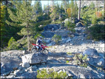
The rocky 4x4 jeep trails will truly test your rock crawling skills.
Indian Springs Trail Photo
Indian Springs Trail Photo

Indian Springs Trail Photo
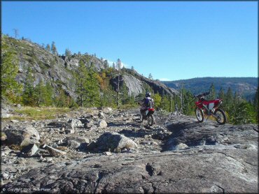
The upper elevation trails are difficult, but are worth the scenic views.
Indian Springs Trail Photo
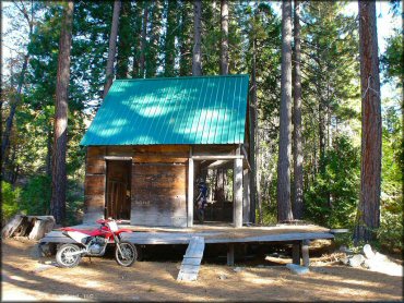
An old abandoned house makes for a nice resting point.
Indian Springs Trail Photo
Indian Springs Trail Photo
Indian Springs Trail Photo
Indian Springs Trail Photo
Indian Springs Trail Photo
RIDER COMMENTS & REVIEWS