 |
      |
| Home > California > Rattlesnake Ridge |
Rattlesnake Ridge Area
Saturday, December 23, 2023
| Other Names | Smith River National Recreation Area, Little Rattlesnake Mountain, Boulder Ridge, Pigeon Roost, Rattlesnake Lake, Soldier Well, Mud Spring, Goose Creek, South Fork Smith River, Childs Hill, Six Rivers National Forest, Pigeon Roost Spring |
| Last Known Status | Open |
This area offers some great scenery but mainly consists of old mining roads from the 1940's. The sharp rocky routes lead past a small pond and over the ridge, with some spurs leading to old nickel / chromium mines.
There are no real motorcycle trails, and due to the rugged terrain, this place is best explored on an ATV or in a Jeep. Some portions are overgrown from lack of use and there is no designated staging area.
One positive aspect is the abundance of attractive swimming and fishing spots on the Smith River which you'll pass as you approach the area.
REGULATIONS
| Permit Required | Yes | CA OHMVR stickers required |
| Dates Open | Year-Round | CA OHMVR red sticker vehicles permitted year round |
| Other ATV Stickers Accepted | Yes | Residents of any state not listed must purchase a Nonresident OHV Use Permit. (AR, AZ, CA, CO, CT, DE, IA, ID, IN, LA, MA, MD, ME, MI, MN, MO, MT, ND, NH, NJ, NM, NV, NY, OH, OK, OR, PA, RI, TX, UT, VT, WA, WI, WY) |
| Spark Arrestor | Yes | A spark arresting exhaust silencer or end cap is required for all vehicles. |
| Noise Limit | Yes (96 dB) | CA OHMVR noise limits apply (1985/older limit 101 dB, 1986/newer limit 96 dB) |
| Whip Flags | Not Required | |
| Maximum Vehicle Width | No Restriction | |
 Motorcycles & Dirt Bikes Motorcycles & Dirt Bikes | Permitted | CA OHMVR stickers required |
 ATVs ATVs | Permitted | CA OHMVR stickers required |
 UTV & SXS UTV & SXS | Permitted | CA OHMVR stickers required |
 SUVs & Jeeps (registered) SUVs & Jeeps (registered) | Permitted | |
| Dune Buggy & Sand Rail 4x4 (unregistered) | Permitted | CA OHMVR stickers required |
| 2 Stroke Engines | No Restriction | CA OHMVR restrictions apply |
| MX Helmet Required | Yes | helmets required by state law |
 Camping Camping | No Restriction | (camp anywhere) |
 Campfires Campfires | Some Areas | |
| Night Riding | Unknown | Not Recommended |
| Trail Blazing | Prohibited | keep on the trail |
| Alcohol | No Restriction | |
| Rule Enforcement | None |
TERRAIN
| Approx Size | 16,000 acres (25 sq mi) | |
| Miles Of Trail | 15 | |
| Climate Type | Forest | |
| Elevation | 550 to 3500 ft. | |
| Trail Maintenance | Marked, Not Rated, Not Maintained | |
| Loose Dirt |  Little Little | |
| Hard Pack |  Mostly Mostly | |
| Sand |  None None | |
| Mud | None | |
| Dust | Little | |
| Rocks | Mostly | |
| Trees |  All All | |
| Steep Hills |  Few Few | |
| Water Crossings | Few | |
| Small Jumps | Few | |
| Large Jumps | None | |
| Berms | None | |
| Sand/Gravel Pits | None | |
| Single Track | None | |
| Roads | Mostly | |
| Intersections | Few | |
| Rider Traffic | Few | |
| Shade | All | |
| Ranges/Gunfire | None | |
| Hazards | Few | (hazards not marked) Beware of open mine shafts. |
 Novice Novice | Little | |
 Amateur Amateur | Mostly | |
 Expert Expert |  Some Some |
TYPE OF AREA
| Area | Motorized Trails |
| Land | National Forest, Nat Recreation |


KEY SERVICES
 Gasoline Gasoline | 5-20 Miles (NW) | Hiouchi/Chevron |
| Diesel | 5-20 Miles (NW) | Hiouchi/Chevron |
 Water Water | 5-20 Miles (NW) | Hiouchi Hamlet Market (707) 458-3114 |
 RV Hookup RV Hookup | 5-20 Miles (NW) | Hiouchi Hamlet RV Resort (707) 458-3321 |
 RV Disposal RV Disposal | 5-20 Miles (NW) | Hiouchi Hamlet RV Resort (707) 458-3321 |
| Campground | 5-20 Miles (S) | Big Flat Campground (707) 457-3131 |
 Conv Store Conv Store | 5-20 Miles (NW) | Hiouchi Hamlet Market (707) 458-3114 |
FEES & PASSES
| Parking | (None) |
| Entry | (None) |
| Riding | (None) |
| Camping | (None) |
RATINGS
| Pros | free, beautiful forest scenery |
| Cons | no real motorcycle trails, area consists of old and unused rocky jeep trails |
| Our Rating |  Fair Fair |
| Recommended Stay | Full Day |
| Comments | (Scroll Down For Rider Reviews & Comments) |
DRIVING DIRECTIONS
| Nearest City | Crescent City, CA | ||
| From: Crescent City, CA
1) Take US-101 North about 2 miles 2) Take exit for US-199 east (Redwood Hwy) about 7 miles 3) Turn right onto South Fork Road, continue .4 miles 4) After crossing bridge veer left CR-427, continue 7.5 miles 5) *Turn right onto FS-16N23 (rough road), continue about 200 yards. Stage anywhere. Alternate Route (less rocky): 6) Continue past FS-16N23 2.15 miles 7) Veer right onto FS-15N02 (you will see a brown FS sign on the right, turn here), continue 1.1 miles 8) Stage here. *Note: The alternate route is a gravel road and is a much smoother route. Road FS-16N23 is very rocky. |


OFFICIAL CONTACTS
| Contact Info | Six Rivers National Forest - Smith River NRA Highway 199 P.O. Box 228 Gasquet, CA 95543 (707) 457-3131 mailroom_r5_six_rivers@usda.gov www.fs.usda.gov |
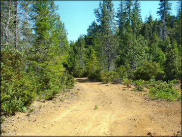
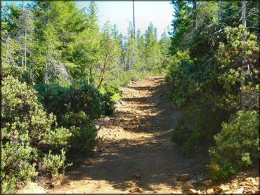
Rattlesnake Ridge Trail Photo
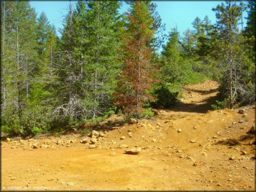
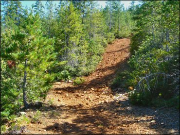
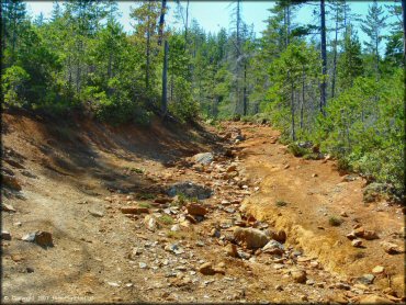
Most of the trails either look like this, or they are overgrown.
Rattlesnake Ridge Trail Photo
If you stay on the main road you'll eventually reach some primitive camping spots but nothing very large.
Rattlesnake Ridge Trail Photo
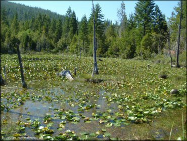
"Rattlesnake Lake" is a shallow pond surrounded by a few primitive camping spots. There is a chance to turn around here.
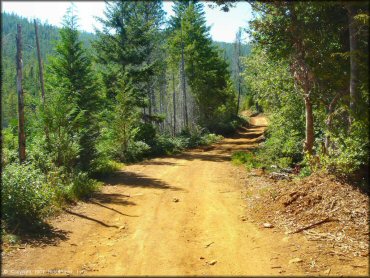
Rattlesnake Ridge Trail Photo
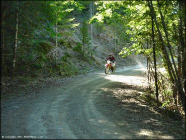
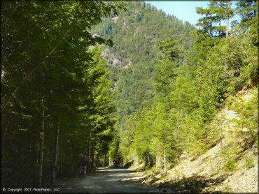
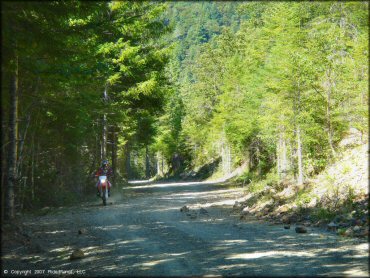
If you use the second entrance, the main road stays fairly smooth for the first mile or two, but the turns get tighter.
Rattlesnake Ridge Trail Photo
Rattlesnake Ridge Trail Photo
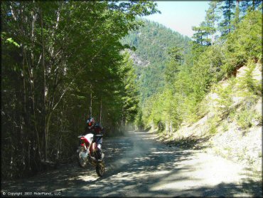
Rattlesnake Ridge Trail Photo
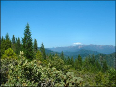
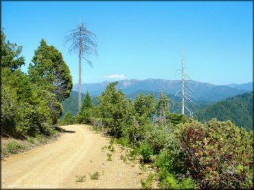
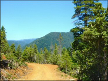
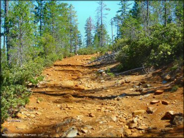
Outstanding views like this can be found along the main road.
Rattlesnake Ridge Trail Photo
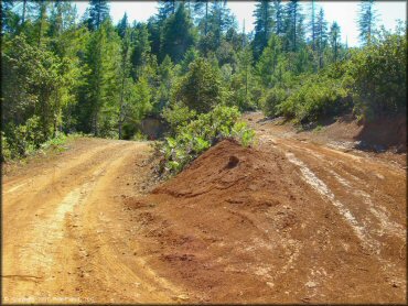
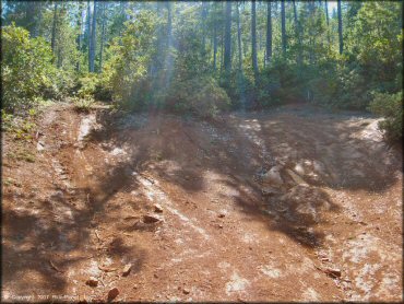
You'll find side trails like this, but they never seem to pan out into anything worthwhile, mostly just looping directly back.
Rattlesnake Ridge Trail Photo
Rattlesnake Ridge Trail Photo
Rattlesnake Ridge Trail Photo
Rattlesnake Ridge Trail Photo
Rattlesnake Ridge Trail Photo
Rattlesnake Ridge Trail Photo
Rattlesnake Ridge Trail Photo
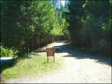
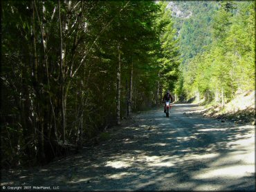
This is the second entrance point, which is smoother.
Rattlesnake Ridge Trail Photo
Rattlesnake Ridge Trail Photo
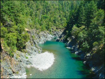
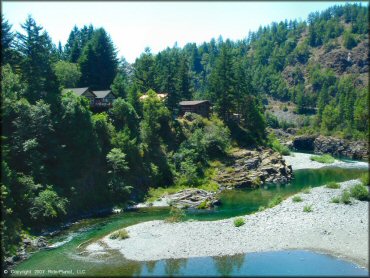
You'll cross a bridge on the way to the area. There are great spots on the river before and after the bridge.
Rattlesnake Ridge Trail Photo
As is typical, the further up you go in elevation, the more rocky the trail.
Rattlesnake Ridge Trail Photo
Rattlesnake Ridge Trail Photo
Rattlesnake Ridge Trail Photo
Rattlesnake Ridge Trail Photo

RIDER COMMENTS & REVIEWS