 |
      |
| Home > Connecticut > Thomaston Dam |
Thomaston Dam
Saturday, December 23, 2023
| Other Names | Naugatuck River Valley |
| Last Known Status | Closed For Season |
This scenic area offers a great single track loop (for motorcycles only) with about 12 miles of trail covering 800 acres of public land. There are some technical sections with ruts and some short rocky climbs with tight cutbacks, but overall nothing too bad.
The area is generally open for trail riding during the summer months and weekends are often busy. There have been a couple years (2011-2012) that had delayed openings and early closures due to storm damage and downed trees, leaving a very short riding season.
During the winter, the trails are reserved for snowmobiling and cross-country skiing. Although some parts of the trail are fairly wide, ATVs and quads are not permitted. There is no camping on site but the day use area has picnic tables, restrooms, and water. The nearby model aircraft flying field also has tables and BBQ grills.
This area may close on short notice during and after inclement weather, so call first before heading out.
REGULATIONS
| Permit Required | Yes | CT All Terrain Registration required (DMV) |
| Dates Open | Late May through October 14 (weather and reservoir flood management operations permitting) | |
| Other ATV Stickers Accepted | Yes | (FL, NY, PA, VT) |
| Spark Arrestor | Yes | A spark arresting exhaust silencer or end cap is required for all vehicles. CT All Terrain Registration requires spark arrestor |
| Noise Limit | Yes | CT All Terrain Registration requires 'reasonable' volume |
| Whip Flags | Not Required | |
| Maximum Vehicle Width | ||
 Motorcycles & Dirt Bikes Motorcycles & Dirt Bikes | Permitted | CT All Terrain Registration required (DMV) |
 ATVs ATVs | Prohibited | |
 UTV & SXS UTV & SXS | Prohibited | |
 SUVs & Jeeps (registered) SUVs & Jeeps (registered) | Prohibited | |
| Dune Buggy & Sand Rail 4x4 (unregistered) | Prohibited | |
| 2 Stroke Engines | No Restriction | |
| MX Helmet Required | Yes | |
 Camping Camping | Prohibited | |
 Campfires Campfires | Prohibited | |
| Night Riding | No | riding hours 8am to one hour before sunset or 7pm |
| Trail Blazing | Prohibited | stay on the trail |
| Alcohol | No Restriction | |
| Rule Enforcement | Few/Periodic | On-Site Office/Station |
| Comment | Out of state registrations from NY, VT, FL and PA are honored. | |
TERRAIN
| Approx Size | 800 acres (1 sq mi) | |
| Miles Of Trail | 12 | |
| Climate Type | Forest | |
| Elevation | 400 to 700 ft. | |
| Trail Maintenance | Marked, Not Rated, Lightly Maintained | |
| Loose Dirt |  Some Some | |
| Hard Pack | Some | |
| Sand |  Little Little | |
| Mud | Some | |
| Dust | Some | |
| Rocks | Some | |
| Trees |  Many Many | |
| Steep Hills |  None None | |
| Water Crossings |  Few Few | |
| Small Jumps | Few | |
| Large Jumps | None | |
| Berms | Some | |
| Sand/Gravel Pits | None | |
| Single Track | Many | |
| Roads | Few | |
| Intersections | Some | |
| Rider Traffic | Many | |
| Shade | Some | |
| Ranges/Gunfire | None | |
| Hazards | Few | (hazards not marked) |
 Novice Novice | Little | |
 Amateur Amateur |  Mostly Mostly | |
 Expert Expert | Little | |
| Comment | Mostly one-way single track motorcycle trails and a couple play areas (ATVs/Quads prohibited throughout). | |
TYPE OF AREA
| Area | Motorized Trails |
| Land | Army Corps of Engineers |

| Features | Public |
| Max Engine Size | No Maximum |
| Min Engine Size | No Minimum |
| Comment | Small MX track with berms and whoops and two or three small (5ft) jumps |


KEY SERVICES
 Gasoline Gasoline | 5-20 Miles (S) | Sunoco (860) 283-0239 |
| Diesel | 5-20 Miles (S) | Sunoco (860) 283-0239 |
 Water Water | On Site | Day Use Area |
 RV Hookup RV Hookup | 1-5 Miles (SE) | Branch Brook Campground (860) 283-8144 |
 RV Disposal RV Disposal | 1-5 Miles (SE) | Branch Brook Campground (860) 283-8144 |
| Campground | 1-5 Miles (SE) | Branch Brook Campground (860) 283-8144 |
 Conv Store Conv Store | 5-20 Miles (SE) | Waterbury |
FEES & PASSES
| Parking | (None) |
| Entry | (None) |
| Riding | (None) |
| Camping | (None) |
RATINGS
| Pros | motorcycles only, one-way single track throughout, great views, some short sections of good technical stuff |
| Cons | dam sometimes closed, no ATVs or quads, no camping |
| Our Rating |  Very Good Very Good |
| Recommended Stay | Full Day |
| Comments | (Scroll Down For Rider Reviews & Comments) |
DRIVING DIRECTIONS
| Nearest City | Thomaston, CT | ||
| Address | 331 Hill Road, Thomaston, CT 06787 | ||
| From: Waterbury, CT
1) Take Route 8 North to Exit 39 2) Turn left (west) off the ramp onto East Main Street 3) At the traffic light, turn right (north) onto North Main Street 4) Continue about 1 mile then turn right (northeast) on Route 222 (Hill Road) 5) Entrance is about 0.5 mile on the left (look for signs) 6) Cross the dam to the main staging area. |


OFFICIAL CONTACTS
| Contact Info | Army Corps of Engineers 331 Hill Road Thomaston, CT 06787 (860) 283-5540 steven.d.patchkofsky@usace.army.mil www.nae.usace.army.mil |
| Contact Info | Pathfinders Motorcycle Club 147 Freeman Road Oxford, CT 06478 www.pathfindersmc.org |
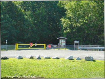
Thomaston Dam Trail Photo
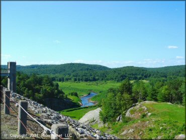
A scenic view coming across the dam at the entrance... There is a general information kiosk here, but more detailed info can be found at the trailhead.
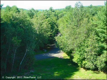
Thomaston Dam Trail Photo
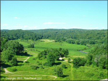
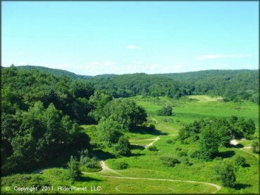
A look down from the road to the staging area off to the northeast side. You can see some of the trail system here.
Thomaston Dam Trail Photo
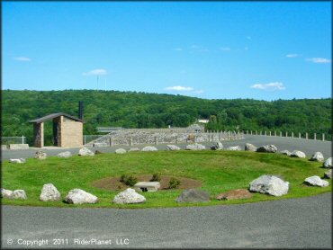
After crossing the dam you will find the main staging area is a paved loop with limited parking. It is well maintained and has a clean restroom.
Thomaston Dam Trail Photo
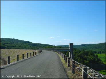
Another shot of the road across the dam, entering the area...
Thomaston Dam Trail Photo
This is the trailhead or entrance point at the staging area. The kiosk here has all of the information about motorcycles and motorized use of the trails.
Thomaston Dam Trail Photo
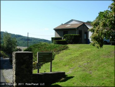
The park management office is located at the main entrance off Hill Rd.
Thomaston Dam Trail Photo
Taken from the staging area, you can just see a portion of the main access road or trailhead road through the trees. The trails begin short after this point.
Thomaston Dam Trail Photo
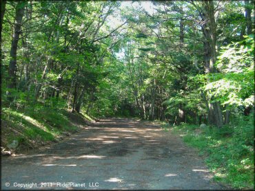
An access road...
Thomaston Dam Trail Photo
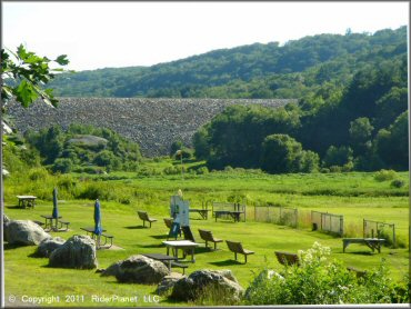
This is the model aircraft flying field. You can access it from the northern entrance off Hill Rd.
Thomaston Dam Trail Photo
The single track is in the trees to the left.
Thomaston Dam Trail Photo
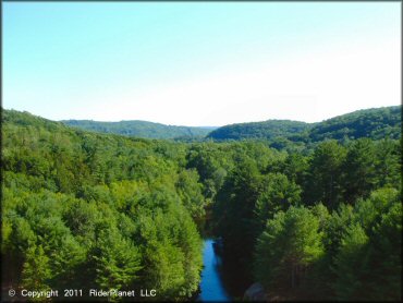
More scenery from the dam when the water is low.
Thomaston Dam Trail Photo
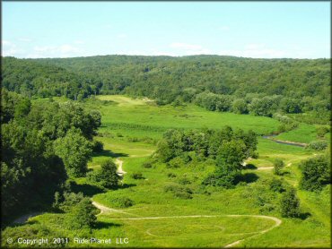
This is a view to the southwest from the road that crosses the dam.
RIDER COMMENTS & REVIEWS