 |
      |
| Home > Idaho > Owyhee Front |
Owyhee Front
Sunday, February 25, 2024
| Other Names | Hemingway Butte, Rabbit Creek, Fossil Creek, Wilson Peak, Squaw Butte, Reynolds Creek Rd, Windy Point |
| Last Known Status | Open |
Owyhee Front consists of tight canyons, sand washes and hundreds of miles of trails. A 200 acre open play area is located adjacent to the Hemingway Butte Trailhead which has hill climbs and makeshift motocross tracks.
There are over nine trailheads to choose from which feature flat, gravel parking, loading ramps and vault toilets, but no shade or water. There is no fee charged to camp or ride but dirt bikes and ATVs must have a current Idaho OHV sticker, which can be purchased online or at nearby Dan's Ferry Services.
Summers can be very hot and dusty, so bring plenty of water. Nearby Lowell Lake offers boating and swimming opportunities.
REGULATIONS
| Permit Required | Yes | Idaho OHV Registration Sticker |
| Dates Open | Year-Round | |
| Other ATV Stickers Accepted | No | A non-resident registration sticker must be purchased. (As of January 2020, Idaho no longer honors stickers from other states.) |
| Spark Arrestor | Yes | A spark arresting exhaust silencer or end cap is required for all vehicles. |
| Noise Limit | Yes (96 dB) | |
| Whip Flags | Not Required | |
| Maximum Vehicle Width | No Restriction | |
 Motorcycles & Dirt Bikes Motorcycles & Dirt Bikes | Permitted | |
 ATVs ATVs | Permitted | |
 UTV & SXS UTV & SXS | Permitted | |
 4x4 & Jeeps (registered) 4x4 & Jeeps (registered) | Permitted | |
| Dune Buggy & Sand Rail 4x4 (unregistered) | Permitted | |
| 2 Stroke Engines | No Restriction | |
| MX Helmet Required | Youth Only | required for persons under 18 by state law (RiderPlanet strongly recommends helmets for all riders.) |
 Camping Camping | ||
 Campfires Campfires | ||
| Night Riding | Unknown | |
| Trail Blazing | Some Areas | permitted at play area near Hemingway Butte Trailhead |
| Alcohol | No Restriction | |
| Rule Enforcement | Few/Periodic |
TERRAIN
| Approx Size | 400,000 acres (625 sq mi) | |
| Climate Type | Desert | |
| Elevation | 2500 to 6000 ft. | |
| Trail Maintenance | Marked, Not Rated, Lightly Maintained | |
| Loose Dirt |  Some Some | |
| Hard Pack | Some | |
| Sand | Some | |
| Mud |  Little Little | |
| Dust | Some | |
| Rocks | Some | |
| Trees |  None None | |
| Steep Hills | Some | |
| Small Jumps | Some | |
| Large Jumps |  Few Few | |
| Sand/Gravel Pits | None | |
| Single Track |  Many Many | |
| Roads | Few | |
| Intersections | Some | |
| Rider Traffic | Some | |
| Ranges/Gunfire | Few | |
| Hazards | Few | (hazards assumed marked but use caution) |
 Novice Novice | Some | |
 Amateur Amateur |  Mostly Mostly | |
 Expert Expert | Little |
TYPE OF AREA
| Area | Motorized Trails |
| Land | BLM |
GPS POINTS


KEY SERVICES
 Gasoline Gasoline | 5-20 Miles (NE) | Dan's Ferry Services (208) 495-2507 |
| Diesel | 5-20 Miles (NE) | Dan's Ferry Services (208) 495-2507 |
 Water Water | 1-5 Miles (N) | Melba |
 RV Hookup RV Hookup | 5-20 Miles (N) | Garrity RV Park (877) 442-9090 |
 RV Disposal RV Disposal | 5-20 Miles (N) | Garrity RV Park (877) 442-9090 |
| Campground | 30+ Miles (E) | KOA - Mountain Home (208) 587-5111 |
 Conv Store Conv Store | 5-20 Miles (NE) | Dan's Ferry Services (208) 495-2507 |
FEES & PASSES
| Parking | (None) |
| Entry | (None) |
| Riding | (None) |
| Camping | (None) |
RATINGS
| Our Rating |  Good Good |
| Recommended Stay | Full Day |
| Comments | (Scroll Down For Rider Reviews & Comments) |
DRIVING DIRECTIONS
| Nearest City | Melba, ID | ||
| Address | Upper Reynolds Creek Road, Melba, ID 83641 | ||
| From: Melba, ID
1) Take Hwy 45 South toward Hwy 78 junction 2) After crossing the Snake River veer left 3) Proceed about 0.7 miles 4) Turn right (west) on Upper Reynolds Creek Road 5) Continue about 2 miles, staging area will be on your left. |

OFFICIAL CONTACTS
| Contact Info | BLM - Owyhee Field Office 20 First Ave West Marsing, ID 83639 (208) 896-5912 blm_id_stateoffice@blm.gov www.blm.gov |
| Contact Info | Idaho Parks And Recreation 5657 E Warm Springs Ave Boise, ID 83716 (208) 334-4197 reghelpline@idpr.idaho.gov idahostateparks.reserveamerica.com |
| Comment | Idaho OHV Sticker Info |
Owyhee Front Trail Photo
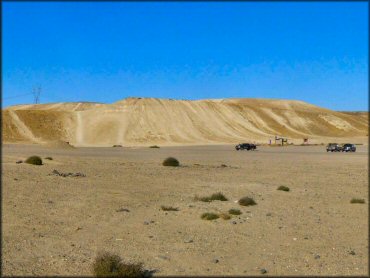
Photo Submitted 6/17/2012 (Thanks!)
Owyhee Front Trail Photo
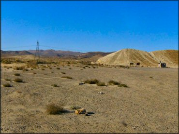
Photo Submitted 6/17/2012 (Thanks!)
Owyhee Front Trail Photo
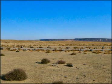
Photo Submitted 6/17/2012 (Thanks!)
Owyhee Front Trail Photo
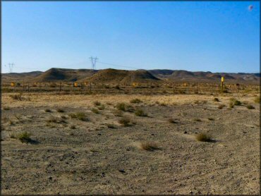
Photo Submitted 6/17/2012 (Thanks!)
Owyhee Front Trail Photo
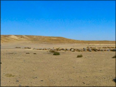
Photo Submitted 6/17/2012 (Thanks!)
RIDER COMMENTS & REVIEWS