 |
      |
| Home > Idaho > South Hills |
South Hills
Saturday, December 23, 2023
| Other Names | Third Fork Heart Attack Loop, Wahlstrom Hollow Trail #238, Third Fork Rock Creek, Magpie Basin, Sawtooth National Forest, Dry Flat Spring, Cow Spring, Elk Butte, Cotton Spring, Bear Gulch, Pike Mountain, Telephone Canyon, Harrington Peak, Martindale Fork, Rock Creek Trail System, Diamondfield Jack Campground, Porcupine Springs Campground, Pettit Campground, Minidoka Ranger District, Cassia Mountains |
| Last Known Status | Closed For Season |
If you are coming to southern Idaho to ride, this spot should not be overlooked. With over 50+ miles of designated ATV trails, twisty mountain single track, secluded swimming holes, cool camping spots and scenery ranging from high desert rolling hills to rugged, forested mountain and canyon views, there is something for everyone.
Most of the trails are marked and form both short and long loops. Camping ranges from primitive tent sites to designated campgrounds. Bear Gulch, Porcupine Springs, Bostetter and Father and Sons campgrounds cater to the ATV/side by side crowd while motorcycle riders will find direct access to single track at Harrington Fork (day use only), Third Fork and Fifth Fork trailheads.
Most campgrounds are free but are on a first come basis. Porcupine Springs, Lower and Upper Penstemon Campgrounds charge a small fee but can also be reserved.
Off road vehicles must display a current Idaho OHV Sticker. Note that this trail system is also very popular with mountain bikes and equestrian riders, so use caution.
ATV and UTV riders can access South Hills if staying in Jackpot by using the BLM access roads that are found on the outskirts of town and head in a northeast direction.
REGULATIONS
| Permit Required | Yes | Idaho OHV Registration Sticker |
| Dates Open | May 16 - November 30 | |
| Other ATV Stickers Accepted | No | A non-resident registration sticker must be purchased. (As of January 2020, Idaho no longer honors stickers from other states.) |
| Spark Arrestor | Yes | A spark arresting exhaust silencer or end cap is required for all vehicles. |
| Noise Limit | Yes | |
| Whip Flags | Not Required | |
| Maximum Vehicle Width | Yes (50 inches) | has entrance gate or posts |
 Motorcycles & Dirt Bikes Motorcycles & Dirt Bikes | Permitted | |
 ATVs ATVs | Permitted | (maximum width 50 inches) |
 UTV & SXS UTV & SXS | Permitted | (maximum width 50 inches) |
 4x4 & Jeeps (registered) 4x4 & Jeeps (registered) | Some Areas | permitted on designated forest service roads |
| Dune Buggy & Sand Rail 4x4 (unregistered) | Permitted | (maximum width 50 inches) |
| 2 Stroke Engines | No Restriction | |
| MX Helmet Required | Youth Only | required for persons under 18 by state law (RiderPlanet strongly recommends helmets for all riders.) |
 Camping Camping | Some Areas | (camp in developed sites only) |
 Campfires Campfires | Some Areas | (permitted in developed campsites only) |
| Night Riding | Unknown | |
| Trail Blazing | Prohibited | stay on the trail |
| Alcohol | No Restriction | |
| Rule Enforcement | Few/Periodic | |
| Comment | Most trails open around mid May through end of November but some open in June through September - see Forest Service MVUM for details. | |
TERRAIN
| Approx Size | 12,800 acres (20 sq mi) | |
| Miles Of Trail | 50 | |
| Climate Type | Forest | |
| Elevation | 5200 to 7400 ft. | |
| Trail Maintenance | Marked, Not Rated, Lightly Maintained | |
| Loose Dirt |  Mostly Mostly | |
| Hard Pack |  Some Some | |
| Sand |  Little Little | |
| Mud | Little | |
| Dust | Little | |
| Rocks | Little | |
| Trees |  Many Many | |
| Steep Hills | Some | |
| Water Crossings |  Few Few | |
| Small Jumps | Few | |
| Large Jumps |  None None | |
| Berms | Many | |
| Sand/Gravel Pits | None | |
| Single Track | Many | |
| Roads | Some | |
| Intersections | Many | |
| Rider Traffic | Some | |
| Shade | Many | |
| Ranges/Gunfire | Few | |
| Hazards | Few | (hazards not marked) |
 Novice Novice | Mostly | |
 Amateur Amateur | Some | |
 Expert Expert | Little |
TYPE OF AREA
| Area | Motorized Trails |
| Land | National Forest |
GPS POINTS


KEY SERVICES
 Gasoline Gasoline | 20-30 Miles (N) | Hansen |
| Diesel | 20-30 Miles (N) | Hansen |
 Water Water | 1-5 Miles (N) | Steer Basin Campground |
 RV Hookup RV Hookup | 5-20 Miles (NW) | Nat-Soo-Pah Hot Springs (208) 655-4337 |
 RV Disposal RV Disposal | 5-20 Miles (NW) | Nat-Soo-Pah Hot Springs (208) 655-4337 |
| Campground | 1-5 Miles (N) | Steer Basin Campground |
 Conv Store Conv Store | 20-30 Miles (N) | Hansen Market (208) 423-5547 |
FEES & PASSES
| Parking | (None) |
| Entry | (None) |
| Riding | (None) |
| Camping | (None) |
| Comment | Bear Gulch, Bostetter and Father and Sons Campgrounds are free. Porcupine Springs is $14/night, Lower and Upper Penstemon Campgrounds are $8/night. |
RATINGS
| Pros | free, miles of designated trails, cool single track, lots of free camping, nice swimming holes |
| Cons | poor cell reception |
| Our Rating |  Excellent Excellent |
| Recommended Stay | 1 Week |
| Comments | (Scroll Down For Rider Reviews & Comments) |
DRIVING DIRECTIONS
| Nearest City | Hansen, ID | ||
| Address | Rock Creek Road, Hansen, ID 83334 | ||
| From: Twin Falls, ID
For Harrington Fork Picnic Area (single track only): 1) Take Hwy 30 East toward Hansen 2) Turn right (south) onto Rock Creek Road, continue about 17 miles 3) Trailhead will be on your left (east). For Third Fork Trailhead (single track only): 1) Continue south past Harrington Fork Picnic Area about 4 miles 2) Trailhead will be on your left (south). For Porcupine Springs Campground: 1) Continue south on Rock Creek Road past Third Fork Trailhead about 21 miles 2) Campground entrance is on the right. From Jackpot, NV: For Bear Gulch Campground 1) Take Hwy 93 North about 19 miles 2) Turn right (east) onto Shoshone Basin Road, continue 4.8 miles 3) Turn right (south) onto Magic Hot Springs Road, continue about 2.5 miles 4) Veer left to stay on Shoshone Basin Road, continue about 4 miles 5) Turn left (north) onto Magic Mountain Road, continue about 3 miles 6) Bear Gulch Campground entrance is on the left (north). |

OFFICIAL CONTACTS
| Contact Info | Sawtooth National Forest - Minidoka Ranger District 3650 South Overland Avenue Burley, ID 83318-3242 (208) 678-0430 mailroom_r4_sawtooth@fs.fed.us www.fs.usda.gov |
| Contact Info | Idaho Parks And Recreation 5657 E. Warm Springs Ave Boise, ID 83716 (208) 334-4197 reghelpline@idpr.idaho.gov idahostateparks.reserveamerica.com |
| Comment | Idaho OHV Sticker Info |
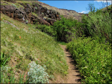
South Hills Trail Photo
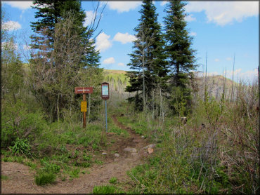
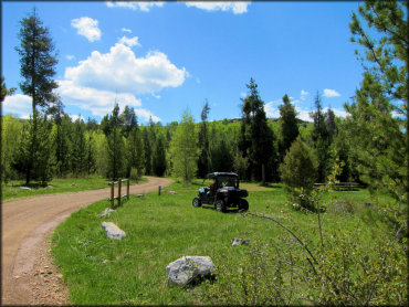
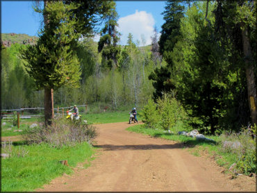
This large trail system has a wide variety of trails for all riders and skill levels. This single track trail can be accessed from the Harrington Fork Staging Area off Rock Creek Road.
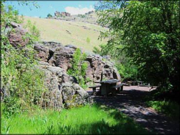
South Hills Trail Photo
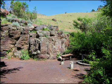
This is one of the unique picnic areas at Harrington Fork. There is no fee charged to park or use the picnic sites but this particular area is open for day use only.
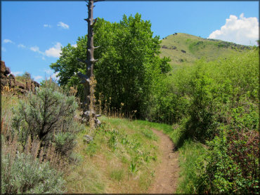
South Hills Trail Photo
The South Hills is a must visit for dirt bike riders and ATVs too. Some wider trails like this ensure that a good time is guaranteed for all.
South Hills Trail Photo
Bear Gulch Campground offers direct offroad access to the surrounding trail system and is a good staging area for ATVs and UTVs. The campground offers eight sites that are big rig friendly.
South Hills Trail Photo

The single track trail from Harrington Fork day use area is nicely maintained and intended for motorcycles only.
South Hills Trail Photo
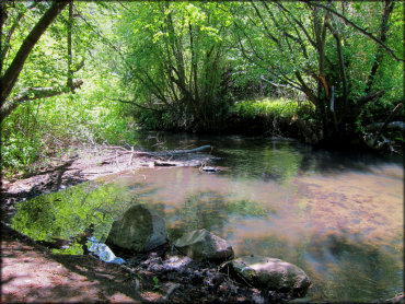
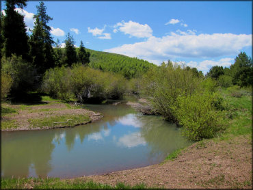
About a mile north of Harrington Fork Staging Area on the west side of Rock Creek Road are some secluded campsites along the shallow creek. There is no direct trail access but you can camp and relax here. It is a short haul to multiple trailheads.
South Hills Trail Photo
The Harrington Fork trail for motorcycles is very scenic as it cuts through the surrounding hills.
South Hills Trail Photo
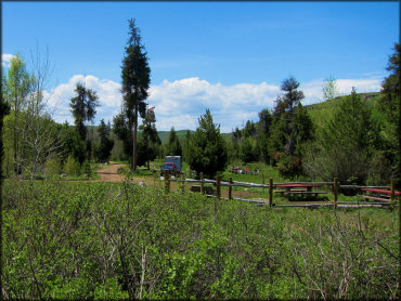
At Harrington Fork there is a paved parking area and a restroom. From there you can access the single track motorcycle trail or choose from one of several very unique picnic sites. There is no camping here, day use only.
South Hills Trail Photo
It's not all knarly goat trails. There is also plenty of terrain for just cruising.
South Hills Trail Photo
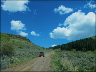
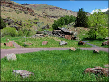
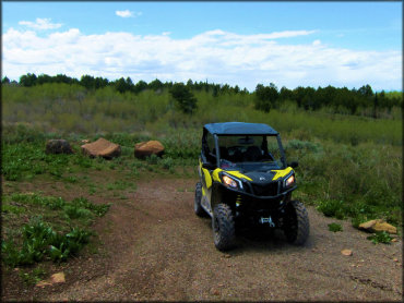
The wider UTVs are permitted on the massive loops of designated Forest Service roads.
South Hills Trail Photo
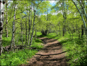
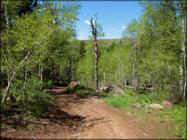
The single track on Harrington Fork trail quickly breaks out of the aspen forest and into some high desert scenery. You can put the earbuds in and find your flow on this route.
South Hills Trail Photo
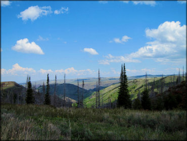
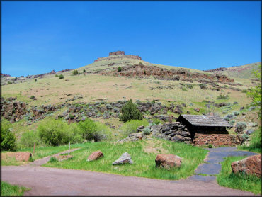
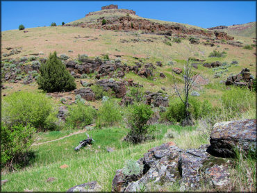
One of panoramic views from the peak at South Hills. This photo really doesn't do it justice.
South Hills Trail Photo
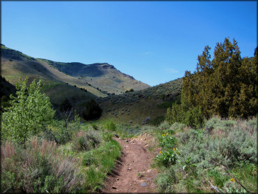
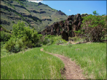
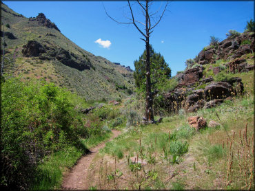
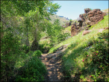
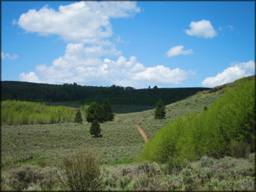
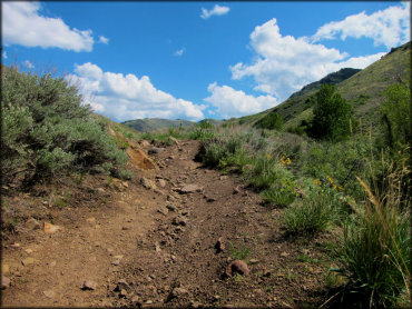
This particular trail can be accessed from the Third Fork Staging Area which is a basic unpaved lot. The initial trail may be a little rocky at the start but it's a good one and you can always connect to other trails so just enjoy the fantastic views.
South Hills Trail Photo
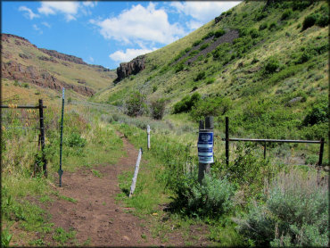
Be sure to pay attention to any signage and close any cattle gates.
South Hills Trail Photo
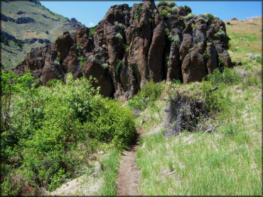
A rock formation near the start of Harrington Fork trail.
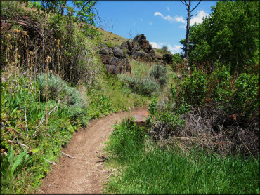
South Hills Trail Photo
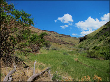
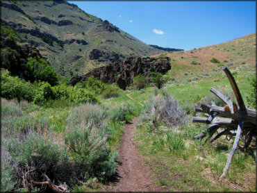
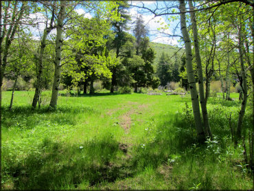
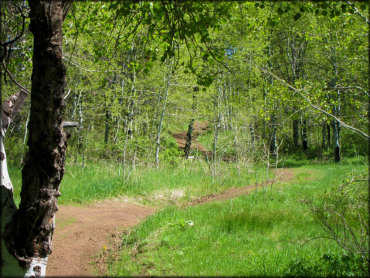
Some single track through the grassy meadows.
South Hills Trail Photo
South Hills Trail Photo
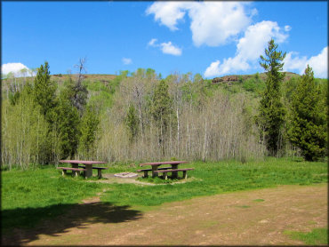
One of many picnic sites at Harrington Fork. Each has it's own unique setup, and some sites even border the shallow creek. There is no fee but unfortunately this area is only open during daylight hours.
South Hills Trail Photo
South Hills Trail Photo
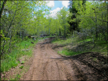
Much of the Harrington Fork trail is smooth with some nice berms and good twisty flow.
South Hills Trail Photo
South Hills Trail Photo
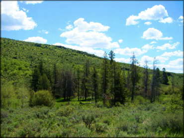
The Thompson Creek Trail is one of the few designated hiking trails in the area. But it is something the whole family can enjoy.
South Hills Trail Photo
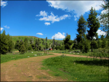
The Harington Fork Staging Area is a paved loop with some pleasant picnic areas and a rustic looking restroom. This is a favorite for dirt bikes to park and access some single track, then haul a short way back to the campsites on the creek.
South Hills Trail Photo
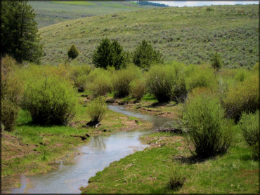
This grassy meadow is located off Magic Mountain Road before Bear Gulch Campground. This area on both sides of the road is open for non-motorized use only but there are places like this where you can hike to a pleasant shallow creek.
South Hills Trail Photo
The Shoshone Creek hugs the southern part of the trail system.
South Hills Trail Photo
The Bear Gulch Campground has a wide loop that makes it easy to pick a campsite. The campground is very scenic and all sites come with a picnic table and BBQ ring.
South Hills Trail Photo
This is the main entrance view of Bear Gulch Campground, which offers eight campsites that can accommodate large trailers. Each campsite comes with a picnic table, BBQ grill and some beautiful views of the South Hills.
South Hills Trail Photo
One of the campsites at Bear Gulch Campground.
South Hills Trail Photo
This trail head north from the Bear Gulch Campground is popular for ATVs and UTVs 50 inches or less. As you continue, the trail remains wide but gets more twisty, making it worthwile on a dirt bike too.
South Hills Trail Photo
Some single track that goes past the restroom at Harrington Fork . The trail remains narrow and twisty throughout with some good elevation changes.
South Hills Trail Photo
The Bear Gulch Trail is surrounded by mostly aspen and pine trees with various bushes. The further you continue the more twisty and narrow it gets, but is open and passable for 50 inch wide vehicles.
South Hills Trail Photo
Another piece of the Bear Gulch Trail.
South Hills Trail Photo
A view of Bear Gulch Campground from the trail. Each site is roomy and has grassy parking and some fantastic views of the surrounding hills.
South Hills Trail Photo
Crossing Shoshone Creek on one of the main roads.
South Hills Trail Photo
One of the side trails located on the western side of the South Hills.
South Hills Trail Photo
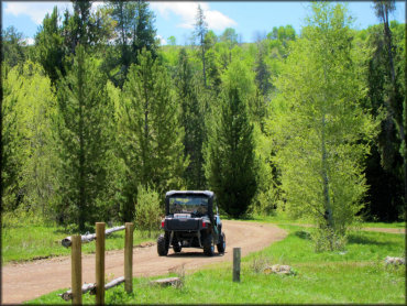
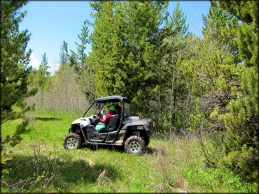
ATVs and UTVs will have a blast exploring this large trail system in southern Idaho.
South Hills Trail Photo
Another view of the Third Fork motorcycle trail. Expect to encounter some loose chunk rock the further you venture out.
South Hills Trail Photo
The Bear Gulch Trail is narrow and twisty with some gradual elevation changes. The best time to visit is spring and fall.
South Hills Trail Photo
As you head west off Hwy 93 toward the South Hils, the vegetation starts out as typical high desert but gradually gets greener.
South Hills Trail Photo
Much of the trail system is limited to machines that are 50 inches wide or less. But wider machines can still explore the vast area by staying on the many designated Forest Service roads.
South Hills Trail Photo
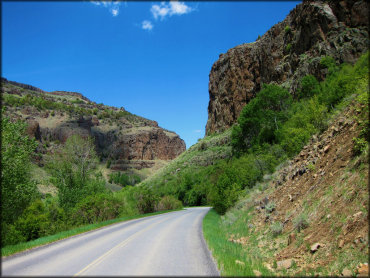
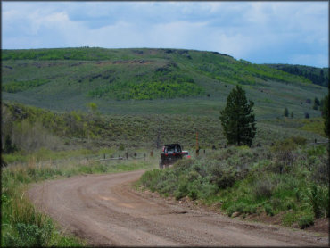
Rock Creek Road is the paved highway that runs north and south from Twin Falls. You can use this road to access the eastern trails and staging areas like Harrington Fork.
RIDER COMMENTS & REVIEWS