 |
      |
| Home > Idaho > Devil's Corral |
Devil's Corral
Saturday, December 23, 2023
| Other Names | Perrine Bridge, Shoshone Falls Road, Snake River Canyon, Three Springs, Devils Corral, North Rim Canyon Park, Snake River Rim Recreation Area |
| Last Known Status | Open |
Overlooking the rugged Snake River, this area offers several hundred acres of wide 4x4 dirt roads, a few makeshift motocross tracks and a couple play areas. Some of the trails get really close to the edge of the canyon, and while this provides some fantastic views, just use caution (it's a long drop down!).
The area is open year-round but camping is not permitted. Vegetation is limited to the occasional scrub brush, so bring shade during the summer months. Overall this is a good spot to get a quick ride in, but if you're looking for more challenging terrain with plenty of camping check out nearby South Hills.
The only portion that is closed to offroad use is the Devils Corral Canyon, which is located on the eastern section of the area, and is only accessible via hiking since it has been recently blocked off by the BLM to motorized use to help preserve ancient Indian artifacts.
REGULATIONS
| Permit Required | Yes | Idaho OHV Registration Sticker |
| Dates Open | Year-Round | |
| Other ATV Stickers Accepted | No | A non-resident registration sticker must be purchased. (As of January 2020, Idaho no longer honors stickers from other states.) |
| Spark Arrestor | Yes | A spark arresting exhaust silencer or end cap is required for all vehicles. |
| Noise Limit | Yes | |
| Whip Flags | Not Required | |
| Maximum Vehicle Width | No Restriction | |
 Motorcycles & Dirt Bikes Motorcycles & Dirt Bikes | Permitted | |
 ATVs ATVs | Permitted | |
 UTV & SXS UTV & SXS | Permitted | |
 4x4 & Jeeps (registered) 4x4 & Jeeps (registered) | Permitted | |
| Dune Buggy & Sand Rail 4x4 (unregistered) | Permitted | |
| 2 Stroke Engines | No Restriction | |
| MX Helmet Required | Youth Only | required for persons under 18 by state law (RiderPlanet strongly recommends helmets for all riders.) |
 Camping Camping | Prohibited | area is closed to overnight use - open from 5am to 10pm only |
 Campfires Campfires | Prohibited | |
| Night Riding | No | |
| Trail Blazing | Permitted | |
| Rule Enforcement | Few/Periodic |
TERRAIN
| Approx Size | 206 acres | |
| Miles Of Trail | 20 | |
| Climate Type | Desert | |
| Elevation | 3640 to 3690 ft. | |
| Trail Maintenance | Not Marked, Not Rated, Not Maintained | |
| Loose Dirt |  Little Little | |
| Hard Pack |  Mostly Mostly | |
| Sand |  Some Some | |
| Mud | Little | |
| Dust | Some | |
| Rocks | Some | |
| Trees |  None None | |
| Steep Hills | None | |
| Water Crossings | None | |
| Small Jumps |  Few Few | |
| Large Jumps | None | |
| Berms | Some | |
| Sand/Gravel Pits | None | |
| Single Track | Some | |
| Roads | None | |
| Intersections | Some | |
| Rider Traffic | Some | |
| Shade | None | |
| Ranges/Gunfire | None | |
| Hazards | Some | (hazards not marked) Beware of cliffs. |
 Novice Novice | Mostly | |
 Amateur Amateur | Some | |
 Expert Expert | None |
TYPE OF AREA
| Area | Motorized Trails |
| Land | BLM, County Land, Jerome County |


KEY SERVICES
 Gasoline Gasoline | 1-5 Miles (SW) | Chevron (208) 735-8000 |
| Diesel | 1-5 Miles (SW) | Chevron (208) 735-8000 |
 Water Water | 1-5 Miles (N) | Twin Falls Jerome KOA (208) 324-4169 or (800) 562-4169 |
 RV Hookup RV Hookup | 1-5 Miles (N) | Twin Falls Jerome KOA (208) 324-4169 or (800) 562-4169 |
 RV Disposal RV Disposal | 1-5 Miles (N) | Twin Falls Jerome KOA (208) 324-4169 or (800) 562-4169 |
| Campground | 1-5 Miles (N) | Twin Falls Jerome KOA (208) 324-4169 or (800) 562-4169 |
 Conv Store Conv Store | 1-5 Miles (SW) | Chevron (208) 735-8000 |
FEES & PASSES
| Parking | (None) |
| Entry | (None) |
| Riding | (None) |
| Camping | (None) |
RATINGS
| Pros | free, open area, nice views of the river, canyon and waterfalls |
| Cons | no trees, no amenities, no camping |
| Our Rating |  Good Good |
| Recommended Stay | Half Day |
| Comments | (Scroll Down For Rider Reviews & Comments) |
DRIVING DIRECTIONS
| Nearest City | Jerome, ID | ||
| Address | Shoshone Falls Road, Jerome, ID 83338 | ||
| From: Twin Falls, ID
1) Take US-93 North about 5 miles 2) After crossing the Perrine Bridge, turn right (east) on Shoshone Falls Road, continue about 100 yards 3) Parking is on the right (south). |

OFFICIAL CONTACTS
| Contact Info | BLM - Twin Falls District 2536 Kimberly Road Twin Falls, ID 83301 (208) 735-2060 mcourtney@blm.gov www.blm.gov |
| Contact Info | Idaho Parks And Recreation 5657 E. Warm Springs Ave Boise, ID 83716 (208) 334-4197 reghelpline@idpr.idaho.gov idahostateparks.reserveamerica.com |
| Comment | Idaho OHV Sticker Info |
Devil's Corral Trail Photo
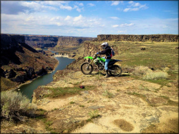
There is no shortage of fantastic views of the Snake River surrounded by steep and rugged canyons. Photo Submitted 4/30/2015 (Thanks!)
Devil's Corral Trail Photo
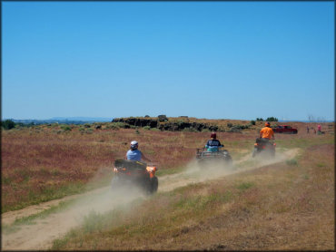
This area is popular with the ATV and UTV crowd. The trails are mostly wide and hard packed, which makes it a good choice for locals looking for an easy day ride.
Devil's Corral Trail Photo
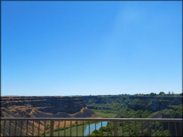
There is a pedestrian path that crosses the Perrine Bridge where you can get some excellent views of the Snake River and waterfalls.
Devil's Corral Trail Photo
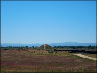
From a distance you can see the tall hill where Evel Knievel made his infamous attempt in 1974 to jump the Snake River. Shoshone Falls Park is located across the canyon which has a paved bicycle trail that will take you to the hill.
Devil's Corral Trail Photo
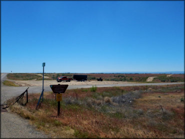
This is the main entrance just north of the Perrine Bridge off Hwy 93. The main staging area is to the right but there is additional parking further up this road.
Devil's Corral Trail Photo
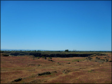
The trails are open year-round during daylight hours. Overnight parking is not permitted but RV campgrounds are close by.
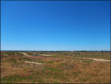
Devil's Corral Trail Photo
The trails are mostly flat with the occasional small hill, which makes this a good spot for ATVs and UTVs. There isn't much much single track or challenging terrain to be found here.
Devil's Corral Trail Photo
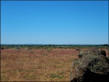
There are no trees, so remember to bring an umbrella or an E-Z Up tent, especially during the summer months.
Devil's Corral Trail Photo
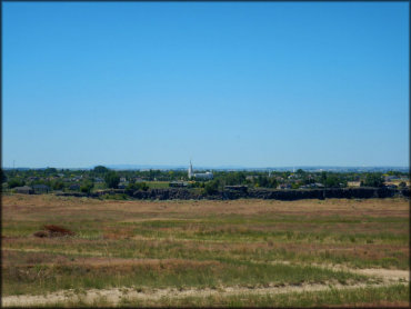
From this point you can see the various buildings across the canyon.
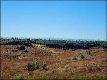
Devil's Corral Trail Photo
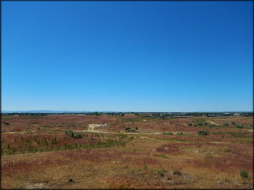
This is a good example of what you will find here, mostly flat terrain with scattered scrub brush and desert grass.
Devil's Corral Trail Photo
During the summer months expect dry and dusty conditions. The best time to visit is during spring and fall.
Devil's Corral Trail Photo
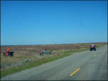
Photo Submitted 6/10/2018 (Thanks!)
RIDER COMMENTS & REVIEWS