 |
      |
| Home > Massachusetts > Freetown-Fall River |
Freetown-Fall River State Forest
Sunday, February 25, 2024
| Other Names | Assonet Ledge, Free Town Fall River |
| Last Known Status | Closed For Season |
This state forest boasts 25 miles of single track motorcycle-only trails that range from moderate to very difficult with some nice forest scenery.
The area is divided into two parts, a western section and an eastern section. The trails on the western side can be accessed directly from the corner of the staging area and are mostly smooth and very fun single track with banked turns, ups and downs, very few rocks and some bridge crossings. The eastern trails are across the road (Bell Rock Road) from the staging area and these trails are rockier and more challenging.
There are many parking entrances but there is only one designated motorcycle staging area. The parking area near the ranger station offers some picnic areas, restrooms, and a wading pool but bring some spray because the mosquitoes can get pretty thick in the evening hours. During the winter months snowmobiles are permitted on the trails.
This place is worth the drive, so be sure to say thanks to the Pilgrim Sands Trail Riders for maintaining these awesome trails. And although the forest is rumored to be haunted, especially The Ledge, we were having too much fun to notice any paranormal activity! Any true motorcycle trail rider will enjoy this ride.
REGULATIONS
| Permit Required | Yes | Massachusetts Registration Sticker |
| Dates Open | May through last Sunday in November (usually reopens after annual Wampanoag celebration held first week in May) | |
| Other ATV Stickers Accepted | No | Motorcycles must be registered in Massachusetts, no reciprocity with other states. |
| Spark Arrestor | Yes | A spark arresting exhaust silencer or end cap is required for all vehicles. |
| Noise Limit | Yes (96 dB) | |
| Whip Flags | Not Required | |
| Maximum Vehicle Width | ||
 Motorcycles & Dirt Bikes Motorcycles & Dirt Bikes | Permitted | |
 ATVs ATVs | Prohibited | |
 UTV & SXS UTV & SXS | Prohibited | |
 SUVs & Jeeps (registered) SUVs & Jeeps (registered) | Prohibited | |
| Dune Buggy & Sand Rail 4x4 (unregistered) | Prohibited | |
| 2 Stroke Engines | No Restriction | |
| MX Helmet Required | Yes | required by state law |
 Camping Camping | Prohibited | |
 Campfires Campfires | Prohibited | |
| Night Riding | No | riding hours dawn to dusk |
| Trail Blazing | Prohibited | stay on designated trails |
| Alcohol | Prohibited | |
| Rule Enforcement | Many | Dedicated Rangers/Officers |
TERRAIN
| Approx Size | 5,441 acres (9 sq mi) | |
| Miles Of Trail | 25 | |
| Climate Type | Forest | |
| Elevation | 50 to 220 ft. | |
| Trail Maintenance | Marked, Not Rated, Lightly Maintained | |
| Loose Dirt |  Some Some | |
| Hard Pack |  Mostly Mostly | |
| Sand | Some | |
| Mud | Some | |
| Dust |  Little Little | |
| Rocks | Some | eastern trails have the most rocks |
| Trees |  All All | |
| Steep Hills | Some | |
| Water Crossings |  Few Few | |
| Small Jumps |  None None | |
| Large Jumps | None | |
| Berms | Few | |
| Sand/Gravel Pits | Few | |
| Single Track | All | |
| Roads | None | |
| Intersections | Some | |
| Rider Traffic |  Many Many | |
| Shade | Many | |
| Ranges/Gunfire | Some | area open during hunting season |
| Hazards | Few | (hazards not marked) |
 Novice Novice | Some | |
 Amateur Amateur | Mostly | |
 Expert Expert | Some | |
| Comment | The eastern side trails have the most rocky and challenging sections. | |
TYPE OF AREA
| Area | Motorized Trails, Gravel Pit |
| Land | State Forest |
GPS POINTS


KEY SERVICES
 Gasoline Gasoline | 5-20 Miles (SW) | 7-Eleven (508) 672-7310 |
| Diesel | 5-20 Miles (SW) | Fall River |
 Water Water | 5-20 Miles (SW) | Cumberland Farms (508) 676-1339 |
 RV Hookup RV Hookup | 5-20 Miles (NE) | Boston / Cape Cod KOA (508) 947-6435 |
 RV Disposal RV Disposal | 5-20 Miles (NE) | Boston / Cape Cod KOA (508) 947-6435 |
| Campground | 1-5 Miles (N) | Forge Pond Campground Inc (508) 644-5701 |
 Conv Store Conv Store | 5-20 Miles (SW) | Xtra Mart |
FEES & PASSES
| Parking | (None) |
| Entry | (None) |
| Riding | (None) |
| Camping | (None) |
RATINGS
| Pros | nice single track |
| Cons | small area |
| Our Rating |  Very Good Very Good |
| Recommended Stay | Full Day |
| Comments | (Scroll Down For Rider Reviews & Comments) |
DRIVING DIRECTIONS
| Nearest City | Fall River, MA | ||
| Address | Bell Rock Road, Fall River, MA 02720 | ||
| From: Fall River, MA
1) Take SR-24 North to Exit 9 2) Turn left off the exit ramp, continue .6 miles 3) Turn left Copicut Road, continue 1.3 miles 4) Turn right at intersection, continue about .7 miles. 5) Staging area will be on the right. |


OFFICIAL CONTACTS
| Contact Info | Freetown - Fall River State Forest Slab Bridge Road Assonet, MA 02702 (508) 644-5522 www.mass.gov |
| Contact Info | Massachusetts Environmental Police 251 Causeway Street, Suite 101 Boston, MA 02114 (617) 626-1610 www.mass.gov |
| Comment | ATV/motorcycle registration info |
| Contact Info | Pilgrim Sands Trail Riders 45 Liberty Street Hanson, MA 02341 (781) 294-8355 pstrinfo@gmail.com www.pstr.club |
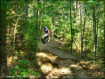
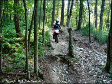
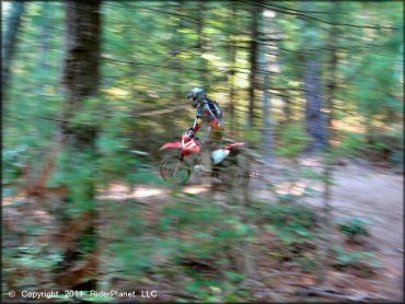
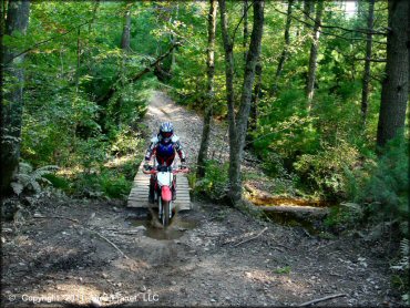
Freetown-Fall River Trail Photo
Freetown-Fall River Trail Photo
This trail pops out next to the play area.
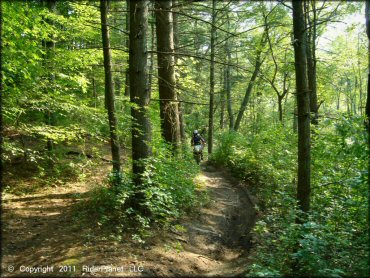
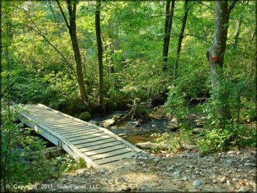
Freetown-Fall River Trail Photo
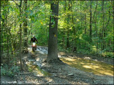
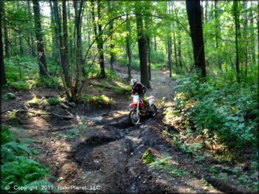
There are a couple mud puddles but there are bypasses.
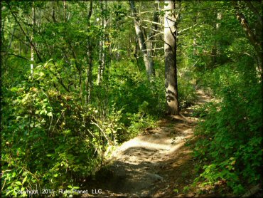
Freetown-Fall River Trail Photo
Freetown-Fall River Trail Photo
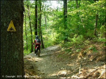
Motorcycle trails are marked with yellow triangles.
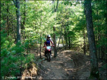
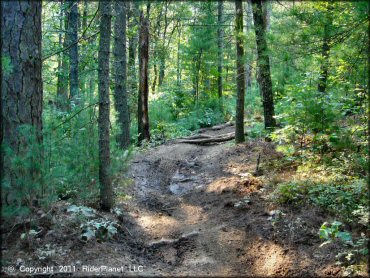
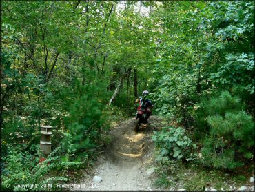
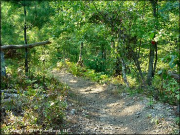
Freetown-Fall River Trail Photo
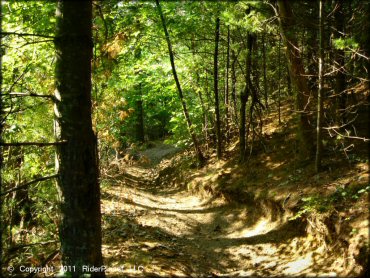
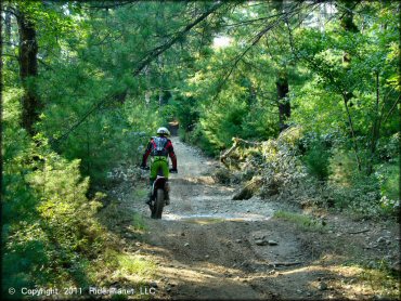
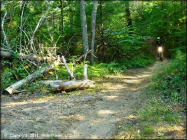
Most of the trails look like this.
Freetown-Fall River Trail Photo
Freetown-Fall River Trail Photo
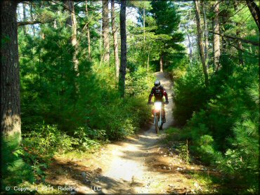
Smooth and fast sums up this area.
Freetown-Fall River Trail Photo
Freetown-Fall River Trail Photo
Freetown-Fall River Trail Photo
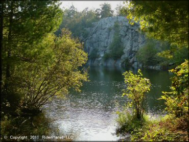
A pond with a rock formation called "The Ledge".
Freetown-Fall River Trail Photo
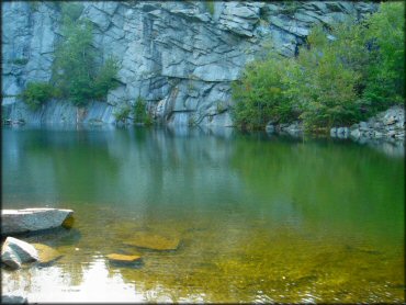
A swimming hole at "The Ledge" (see trail map.)
Freetown-Fall River Trail Photo
Freetown-Fall River Trail Photo
Freetown-Fall River Trail Photo
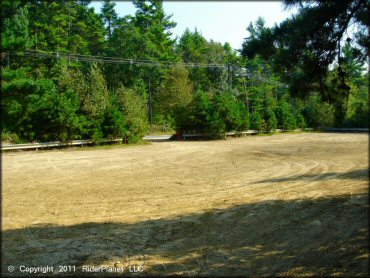
A view of the main staging area. Level parking, no amenities.
Freetown-Fall River Trail Photo
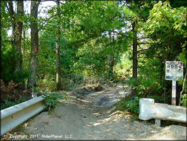
This is the trailhead.
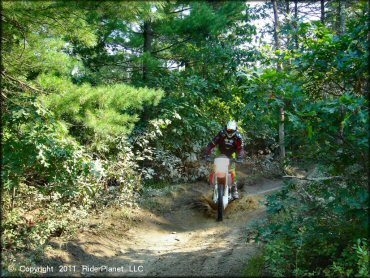
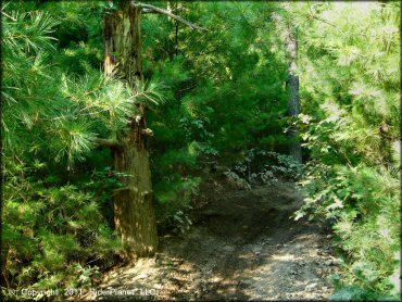
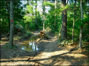
Freetown-Fall River Trail Photo
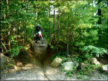
Nothing too challenging here.
Freetown-Fall River Trail Photo
Freetown-Fall River Trail Photo
Freetown-Fall River Trail Photo
Freetown-Fall River Trail Photo
Freetown-Fall River Trail Photo
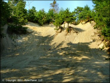
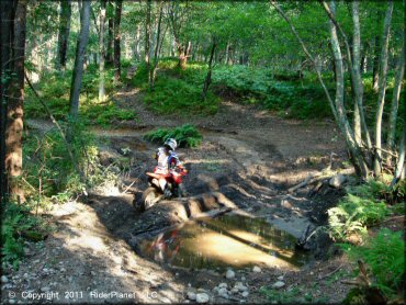
Play area.
Freetown-Fall River Trail Photo
Freetown-Fall River Trail Photo
Freetown-Fall River Trail Photo
Freetown-Fall River Trail Photo
Freetown-Fall River Trail Photo
Freetown-Fall River Trail Photo
RIDER COMMENTS & REVIEWS