 |
      |
| Home > Massachusetts > Wrentham Trails |
Wrentham Trails
Sunday, February 25, 2024
| Other Names | Wrentham State Forest, Wampum Rock, Rabbit Hill Pond, Pinnacle Hill, Bear Swamp Trail, Hollow Rock Trail |
| Last Known Status | Closed For Season |
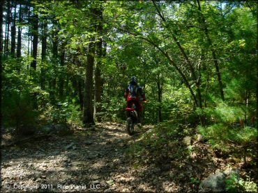
This deep forest has about 8 miles of rocky single track trails and while there is nothing too challenging, these trails will keep you mostly in first or second gear. The staging area has direct trail access to the western section but you will need to cross the pavement (Taunton Street) to access the eastern side.
Old stone walls can be found on the eastern side, a reminder of the areas farming history. This area is patrolled heavily by both local police and state forest rangers, so current registration is a must.
There is a lot of single track here, much more than you would expect, and it is easy to get disoriented. One trick is to remember that Route 495 (East/West) and Taunton Street (North/South) make a cross right through the center of the area so you should at least be able to tell what quadrant you are in. Treat any other paved roads that you come across as boundaries and you'll be in good shape. Beware of hunters during hunting season (no hunting on Sundays).
REGULATIONS
| Permit Required | Yes | Massachusetts Registration Sticker |
| Dates Open | May 1 through last Sunday in November | |
| Other ATV Stickers Accepted | No | Motorcycles must be registered in Massachusetts, no reciprocity with other states. |
| Spark Arrestor | Yes | A spark arresting exhaust silencer or end cap is required for all vehicles. |
| Noise Limit | Yes (96 dB) | |
| Whip Flags | Not Required | |
| Maximum Vehicle Width | ||
 Motorcycles & Dirt Bikes Motorcycles & Dirt Bikes | Permitted | |
 ATVs ATVs | Prohibited | |
 UTV & SXS UTV & SXS | Prohibited | |
 SUVs & Jeeps (registered) SUVs & Jeeps (registered) | Prohibited | |
| Dune Buggy & Sand Rail 4x4 (unregistered) | Prohibited | |
| 2 Stroke Engines | No Restriction | |
| MX Helmet Required | Yes | required by state law |
 Camping Camping | Prohibited | |
 Campfires Campfires | ||
| Night Riding | No | riding hours dawn to dusk |
| Trail Blazing | Prohibited | stay on trail |
| Alcohol | Prohibited | |
| Rule Enforcement | Many | Dedicated Rangers/Officers |
TERRAIN
| Approx Size | 1,064 acres (2 sq mi) | |
| Miles Of Trail | 8 | |
| Climate Type | Forest | |
| Elevation | 290 to 380 ft. | |
| Trail Maintenance | Marked, Not Rated, Lightly Maintained | |
| Loose Dirt |  Little Little | |
| Hard Pack |  Some Some | |
| Sand |  None None | |
| Mud | Some | |
| Dust | Little | |
| Rocks |  Mostly Mostly | |
| Trees |  All All | |
| Steep Hills |  Few Few | |
| Water Crossings | Some | |
| Small Jumps | None | |
| Large Jumps | None | |
| Berms | None | |
| Sand/Gravel Pits | None | |
| Single Track |  Many Many | |
| Roads | Few | |
| Intersections | Some | |
| Rider Traffic | Few | |
| Shade | All | |
| Ranges/Gunfire | Some | area open during hunting season |
| Hazards | Few | (hazards not marked) |
 Novice Novice | Little | |
 Amateur Amateur | Mostly | |
 Expert Expert | Some |
TYPE OF AREA
| Area | Motorized Trails |
| Land | State Forest |
GPS POINTS


KEY SERVICES
 Gasoline Gasoline | 1-5 Miles (NW) | Shell (866) 903-6321 |
| Diesel | 1-5 Miles (W) | Mobil (508) 384-5390 |
 Water Water | 1-5 Miles (E) | Normandy Farms Family Camping Resort (866) 673-2767 |
 RV Hookup RV Hookup | 1-5 Miles (E) | Normandy Farms Family Camping Resort (866) 673-2767 |
 RV Disposal RV Disposal | 1-5 Miles (E) | Normandy Farms Family Camping Resort (866) 673-2767 |
| Campground | 20-30 Miles (SE) | Massasoit State Park (508) 822-7405 |
 Conv Store Conv Store | 1-5 Miles (W) | Mobil (508) 384-5390 |
FEES & PASSES
| Parking | (None) |
| Entry | (None) |
| Riding | (None) |
| Camping | (None) |
RATINGS
| Pros | nice scenery, mostly single track trails |
| Cons | very rocky, no camping |
| Our Rating |  Very Good Very Good |
| Recommended Stay | Full Day |
| Comments | (Scroll Down For Rider Reviews & Comments) |
DRIVING DIRECTIONS
| Nearest City | Wrentham, MA | ||
| Address | Taunton Street, Wrentham, MA 02093 | ||
| From: Plainville, MA
1) Take SR-1 North about 3 miles 2) Turn left on Taunton Street, continue about 1 mile 3) Staging area is on the left. |


OFFICIAL CONTACTS
| Contact Info | Wrentham State Forest Mill Street Foxborough, MA 02035 (508) 543-9084 f.g.hills@state.ma.us www.mass.gov |
| Contact Info | Massachusetts Environmental Police 251 Causeway Street, Suite 101 Boston, MA 02114 (617) 626-1610 www.mass.gov |
| Comment | Motorcycle Registration Info |
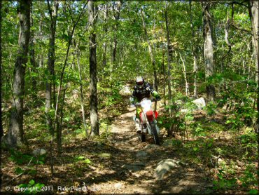
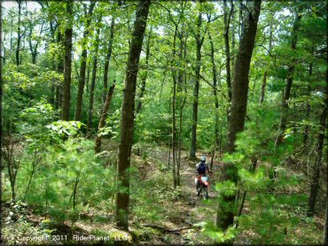
Wrentham Trails Photo
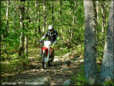
Most of the trail loop consist of large chunky rock but there is nothing too challenging.
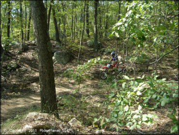
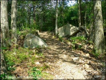
Wrentham Trails Photo
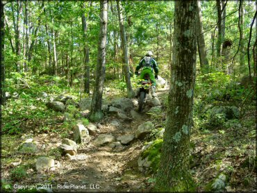
Some sections are very rocky.
Wrentham Trails Photo
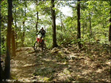
Wrentham Trails Photo
After a heavy rainfall expect to encounter a few mud puddles.
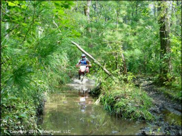
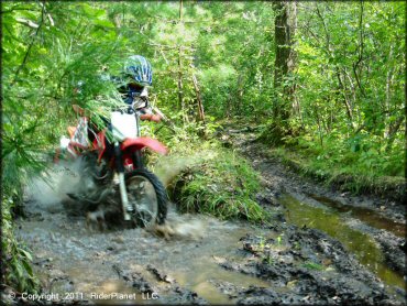
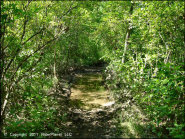
Wrentham Trails Photo
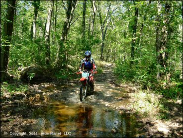
Expect to encounter some water crossings after a rainfall.
Wrentham Trails Photo
Wrentham Trails Photo
Wrentham Trails Photo
Wrentham Trails Photo
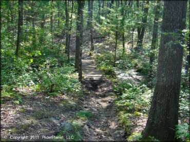
One of the bridge crossings.
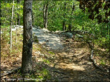
Wrentham Trails Photo
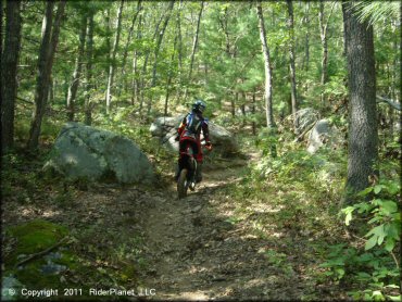
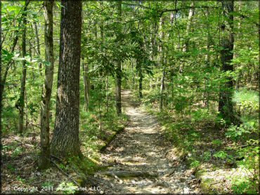
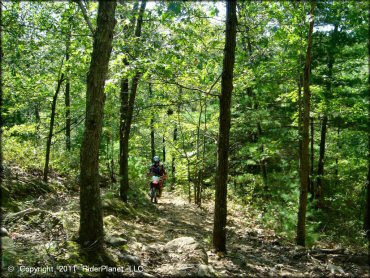
Some sections are smooth and pleasant.
Wrentham Trails Photo
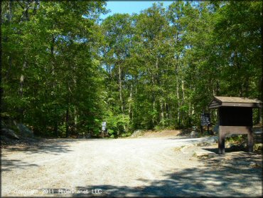
The main staging area is small but offers level parking and plenty of shade.
Wrentham Trails Photo
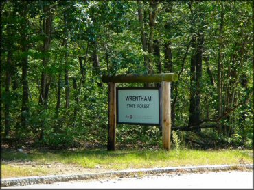
This sign is the access point for the eastern trails.
Wrentham Trails Photo
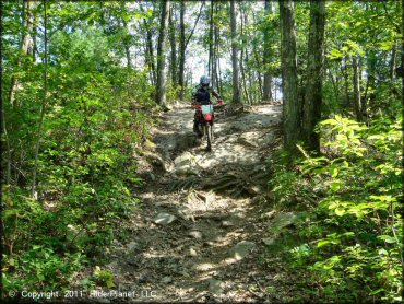
Wrentham Trails Photo
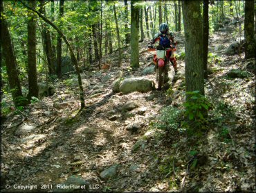
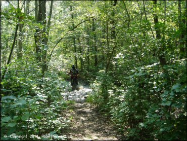
Some sections are a little chunky.
Wrentham Trails Photo
Wrentham Trails Photo
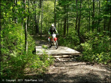
The bridge crossings are nice and wide.
Wrentham Trails Photo
Wrentham Trails Photo
Wrentham Trails Photo
Wrentham Trails Photo
Wrentham Trails Photo
Wrentham Trails Photo
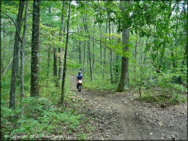
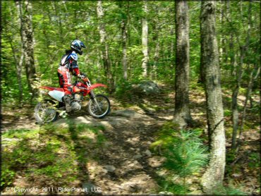
Wrentham Trails Photo
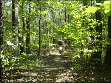
On the gas!
Wrentham Trails Photo
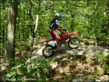
There are a few downhill sections but they are short and fairly easy.
Wrentham Trails Photo
More mud puddles!
Wrentham Trails Photo
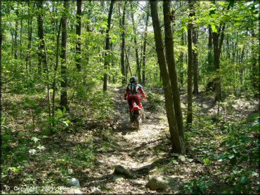
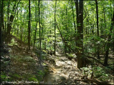
Most of the trail is fairly flat with some chunky rock.
Wrentham Trails Photo
Another shot of the trail.
Wrentham Trails Photo
A shallow water crossing.
Wrentham Trails Photo
Preparing to go down a small hill.
RIDER COMMENTS & REVIEWS