 |
      |
| Home > Nevada > Logandale Trails |
Logandale Trails
Thursday, February 8, 2024
| Other Names | Overton Trails, Valley Of Fire, North Muddy Mountains, Moapa Valley OHV Park |
| Last Known Status | Open |
Is it the hottest place on earth? Actually no, that's nearby Death Valley, but you get the point! This trail system sits on the scenic eastern boundary of the Valley of Fire about 45 miles northeast of Las Vegas. The riding area consists of one main easy loop and a handful of sandy side trails that wind through a chain of rock formations.
A massive amount of effort went into acquiring and managing these trails and you can read all about it at the main trailhead. If you pay attention you'll see some tarantulas, and maybe some desert big horn sheep or other desert wildlife, but perhaps most interesting thing to see are the petroglyphs. These primitive drawings can be found on the rock formations at few locations.
Overall, this is a fun place to camp, and a decent place to ride for beginners and tourists, with nothing too challenging on the main loop. (If you are going to play around in some of the brushy areas with deep sand and blind corners we recommend a whip flag.)
If you are adventurous you can ride the ridgetop trails or ride from your campsite all the way into the town of Overton for supplies. Large ATV tour groups run through this area daily. ATV Tours Info...
REGULATIONS
| Permit Required | Yes | NVOHV sticker required |
| Dates Open | Year-Round | |
| Other ATV Stickers Accepted | Yes | Nevada registration is not required if the vehicle is already registered in another state and will be located in Nevada for no more than 15 days. |
| Spark Arrestor | Yes | A spark arresting exhaust silencer or end cap is required for all vehicles. |
| Noise Limit | Yes (96 dB) | |
| Whip Flags | Not Required | Whip Flags Recommended For Safety (tall brush areas) |
| Maximum Vehicle Width | No Restriction | |
 Motorcycles & Dirt Bikes Motorcycles & Dirt Bikes | Permitted | |
 ATVs ATVs | Permitted | |
 UTV & SXS UTV & SXS | Permitted | |
 SUVs & Jeeps (registered) SUVs & Jeeps (registered) | Permitted | popular jeep rock hopping routes |
| Dune Buggy & Sand Rail 4x4 (unregistered) | Permitted | |
| 2 Stroke Engines | No Restriction | |
| MX Helmet Required | Yes | |
 Camping Camping | No Restriction | (camp anywhere) |
 Campfires Campfires | No Restriction | |
| Night Riding | Unknown | |
| Trail Blazing | Prohibited | stay on trails |
| Alcohol | No Restriction | |
| Rule Enforcement | Few/Periodic | Jeep/SUV Patrol |
TERRAIN
| Approx Size | 45,000 acres (70 sq mi) | |
| Miles Of Trail | 200 | |
| Climate Type | Desert | |
| Elevation | 1100 to 2000 ft. | |
| Trail Maintenance | Not Marked, Not Rated, Not Maintained | |
| Loose Dirt |  Little Little | |
| Hard Pack |  Some Some | |
| Sand |  Mostly Mostly | |
| Mud |  None None | |
| Dust | Some | |
| Rocks | Some | |
| Trees |  Few Few | |
| Steep Hills | Few | |
| Water Crossings | None | |
| Small Jumps | Few | |
| Large Jumps | Few | |
| Berms | Some | |
| Sand/Gravel Pits |  Many Many | many sand pits/washes/play areas |
| Single Track | Few | |
| Roads | Few | |
| Intersections | Few | |
| Rider Traffic | Some | |
| Shade | Few | |
| Ranges/Gunfire | None | |
| Hazards | Few | (hazards not marked) |
 Novice Novice | Mostly | |
 Amateur Amateur | Some | |
 Expert Expert | Little | |
| Comment | mostly sandy trails & gravel roads/trails with a few dirtmounds, play areas, and some cool rock face sections (100%rock) | |
TYPE OF AREA
| Area | Motorized Trails, mix of sandy trails, small dunes & washes, gravel roads & trails |
| Land | BLM |
GPS POINTS


KEY SERVICES
 Gasoline Gasoline | 1-5 Miles (E) | Wallys Gas & Food/Chevron (702) 398-3400 |
| Diesel | 1-5 Miles (E) | Wallys Gas & Food/Chevron (702) 398-3400 |
 Water Water | 30+ Miles (SW) | Valley of Fire State Park Campground (702) 397-2088 |
 RV Hookup RV Hookup | 30+ Miles (SW) | Valley of Fire State Park Campground (702) 397-2088 |
 RV Disposal RV Disposal | 30+ Miles (SW) | Valley of Fire State Park Campground (702) 397-2088 |
| Campground | On Site | primitive sites scattered throughout |
 Conv Store Conv Store | 1-5 Miles (E) | Wallys Gas & Food/Chevron (702) 398-3400 |
FEES & PASSES
| Parking | (None) |
| Entry | (None) |
| Riding | (None) |
| Camping | (None) |
| Comment | free/BLM |
RATINGS
| Pros | excellent scenery, petrglyphs, cool play areas, cool rock fornmations, big sandy berms, fun place to camp |
| Cons | not enough trails, not enough singletrack, not enough challenging terrain, big tarantulas |
| Our Rating |  Very Good Very Good |
| Recommended Stay | 1-2 Days good for a weekend visit - not enough trails |
| Comments | (Scroll Down For Rider Reviews & Comments) |
DRIVING DIRECTIONS
| Nearest City | Logandale, NV | ||
| Address | Pioneer Road, Logandale, NV 89021 | ||
| From: Las Vegas, NV
1) Take I-15 North to Exit 93 2) Turn right (south) off the exit ramp onto NV-169/Moapa Valley Blvd, continue 5.7 miles 3) Turn right (west) onto Liston Ave (look for Chinese restaurant on right) 4) Turn right at the stop sign 5) Stay to the right until dirt road forces you across the tracks (to Pioneer Road) 6) Stay on this road as it winds up the canyon (2WD ok) 7) First staging area is about 1.5 miles in (trailhead) and has bathrooms, additional staging and camping ahead. |


OFFICIAL CONTACTS
| Contact Info | BLM - Southern Nevada District Office 4701 North Torrey Pines Drive Las Vegas, NV 89130 (702) 515-5000 blm_nv_sndo_web_mail@blm.gov www.blm.gov |
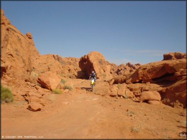
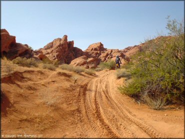
Logandale Trails Photo
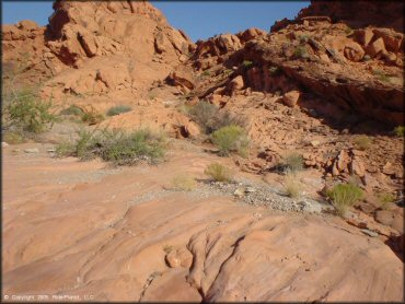
The trails wind through these interesting rock formations with sparse desert vegetation. There are numerous inviting camping spots (designated) surrounded by the red rock walls and green shrubs.
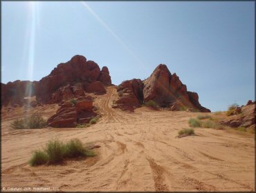
Logandale Trails Photo
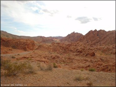
You really can't beat the scenery if you are out for an easy ride and camp. It is the perfect place to take a first time rider and get them hooked!
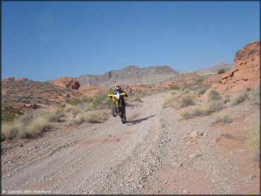
Logandale Trails Photo
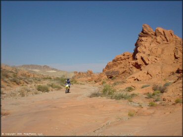
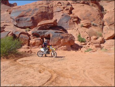
There are a couple of cool points where the trail itself is solid rock, but nothing too difficult or steep on the main loop. The main loop is commonly used for tours.
Logandale Trails Photo
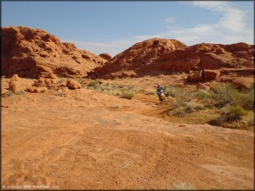
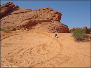
This is the cut through trail that shortens the main outer loop. It has some good sandy turns and great views.
Logandale Trails Photo
A solid rock step down on the cut through trail makes for a fun challenge for beginners to conquer. As long as you stick to the main trail there is nothing dangerous or scary.
Logandale Trails Photo
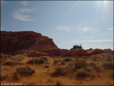
This jeep was doing some rock climbing on one of the play areas.
Logandale Trails Photo
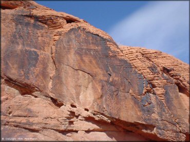
Here is a view of some of the more prevalant petroglyphs. The GPS location of these are labeled on our map.
Logandale Trails Photo
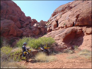
Taking a short break to check out the petroglyphs. Unfortunately no kickstands on the RM two-strokes.
Logandale Trails Photo
The side trails have some pretty deep sand. Winding sand trails like this are a lot of fun but you will wish there was more of it.
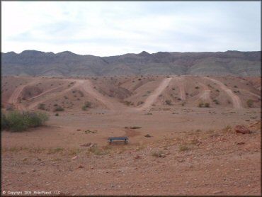
Logandale Trails Photo
This is one of the larger main open sand areas.
Logandale Trails Photo
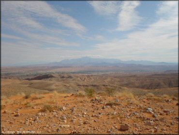
This is a view from the access road on the way in.
Logandale Trails Photo
The outer loop is basically just a gravel road in parts and can get a little boring.
Logandale Trails Photo
Great views from the main loop. If you know the way, you can ride all the way into Overton.
Logandale Trails Photo
Hanging out at the petroglyphs.
Logandale Trails Photo
Another shot from the main sand play area.
RIDER COMMENTS & REVIEWS