 |
      |
| Home > Nevada > Genoa Peak |
Genoa Peak
Saturday, December 23, 2023
| Other Names | Kingsbury Grade, Hwy 207, Genoa Peak Road, Burke Creek, Genoa Canyon, Spooner Summit, Tahoe Rim Trail, Castle Rock, Lake Tahoe Basin Management Unit, Kingsbury Stinger Trail |
| Last Known Status | Closed For Season |
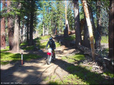
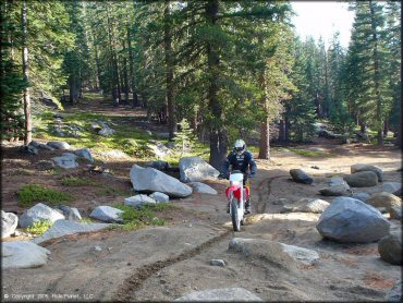
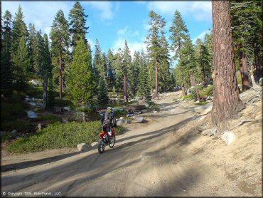
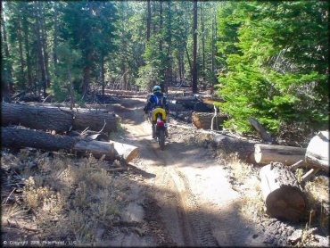
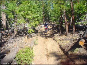
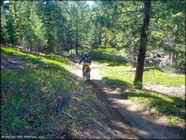
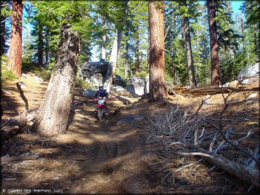
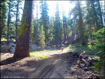
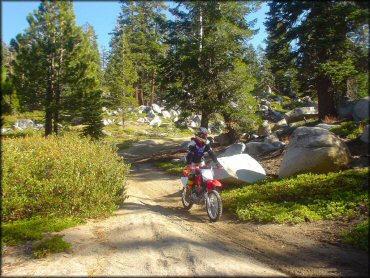
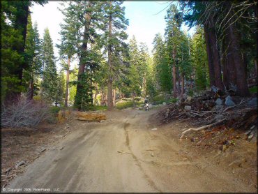
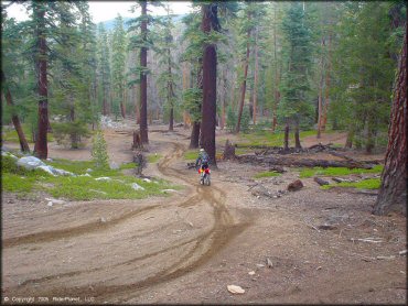
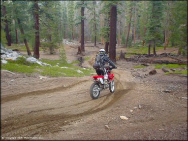
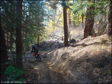
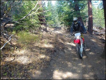
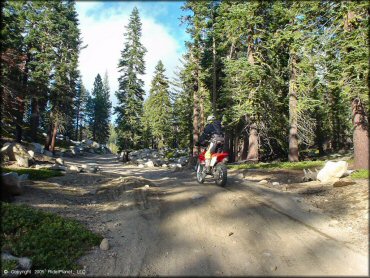
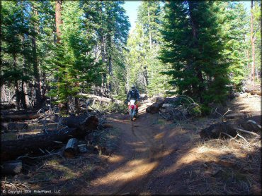
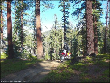
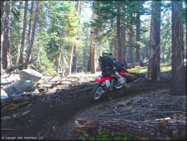
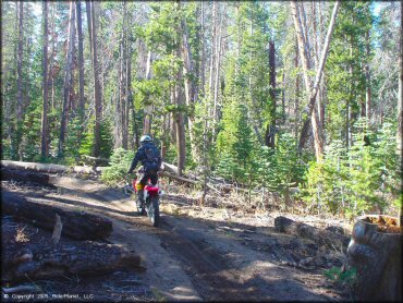
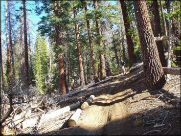
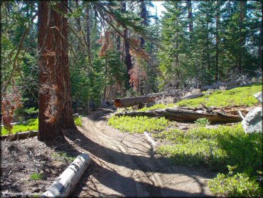
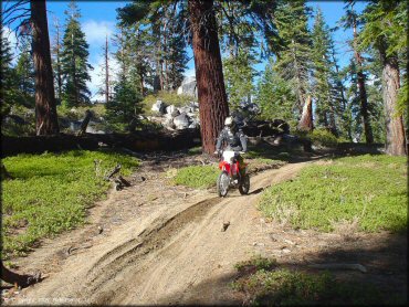
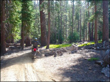
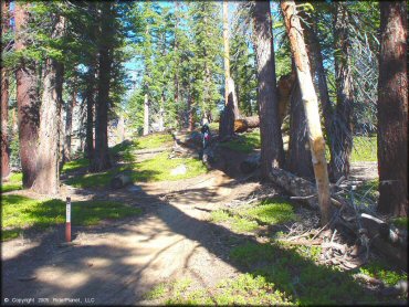
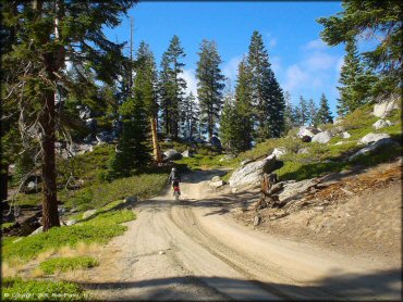
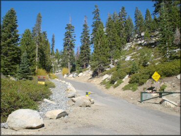
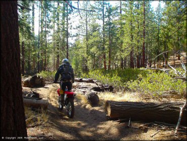
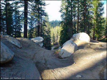
Great scenic views of Lake Tahoe, smooth trails, soft soil, and some killer single track is what you'll find here. The only drawback is the single track trails are just not long enough, and they sometimes dead end into the backyards of the Lake Tahoe residents. This is a popular mountain bike area, but rest assured these trails are OHV friendly, with some even specifically marked for motorcycles.
This area has about ten miles of upper elevation roads with multiple side trails and some primitive camp areas plus a couple nice play areas. If you keep heading north along the main route the trails will eventually tie into South Camp Peak.
Overall this is a very fun place to ride; you'll just wish there was more of it.
REGULATIONS
| Permit Required | Yes | NVOHV sticker required |
| Dates Open | June - November 15 | |
| Other ATV Stickers Accepted | Yes | Nevada registration is not required if the vehicle is already registered in another state and will be located in Nevada for no more than 15 days. |
| Spark Arrestor | Yes | A spark arresting exhaust silencer or end cap is required for all vehicles. |
| Noise Limit | Yes (96 dB) | |
| Whip Flags | Not Required | |
| Maximum Vehicle Width | Yes (50 inches) | has entrance gate or posts |
 Motorcycles & Dirt Bikes Motorcycles & Dirt Bikes | Permitted | |
 ATVs ATVs | Permitted | (maximum width 50 inches) |
 UTV & SXS UTV & SXS | Permitted | (maximum width 50 inches) |
 SUVs & Jeeps (registered) SUVs & Jeeps (registered) | Some Areas | Not Recommended permitted on Trail 14N35 and 14N35A |
| Dune Buggy & Sand Rail 4x4 (unregistered) | Some Areas | (maximum width 50 inches) permitted on Trail 14N35 and 14N35A |
| 2 Stroke Engines | No Restriction | |
 Camping Camping | Some Areas | (camp in developed sites only) |
 Campfires Campfires | Some Areas | (permitted in developed campsites only) |
| Night Riding | Yes | Not Recommended |
| Trail Blazing | Prohibited | stay on trails |
| Alcohol | No Restriction | |
| Rule Enforcement | None |
TERRAIN
| Approx Size | 8,960 acres (14 sq mi) | |
| Miles Of Trail | 10 | |
| Climate Type | Forest | |
| Elevation | 7000 to 9150 ft. | |
| Trail Maintenance | Marked, Rated, Not Maintained | |
| Loose Dirt |  Little Little | |
| Hard Pack |  Some Some | |
| Sand |  None None | |
| Mud | Little | |
| Dust | Some | |
| Rocks | Little | |
| Trees |  All All | |
| Steep Hills |  Few Few | |
| Water Crossings | None | |
| Small Jumps | Few | |
| Large Jumps | None | |
| Berms |  Many Many | |
| Sand/Gravel Pits | None | |
| Single Track | Many | |
| Roads | Few | |
| Intersections | Few | |
| Rider Traffic | Few | |
| Shade | All | |
| Ranges/Gunfire | Few | |
| Hazards | Few | (hazards not marked) Beware of cliffs. |
 Novice Novice | Some | |
 Amateur Amateur |  Mostly Mostly | |
 Expert Expert | Little |
TYPE OF AREA
| Area | Motorized Trails |
| Land | National Forest |
GPS POINTS


KEY SERVICES
 Gasoline Gasoline | 5-20 Miles (SW) | Exxon (775) 588-3305 |
| Diesel | 5-20 Miles (SW) | Exxon (775) 588-3305 |
 Water Water | 5-20 Miles (SW) | Kingsbury |
 RV Hookup RV Hookup | 5-20 Miles (NW) | Zephyr Cove RV Park & Campground (775) 589-4907 |
 RV Disposal RV Disposal | 5-20 Miles (NW) | Zephyr Cove RV Park & Campground (775) 589-4907 |
| Campground | 5-20 Miles (SW) | Nevada Beach Campground (775) 588-5562 or (530) 543-2600 |
 Conv Store Conv Store | 5-20 Miles (SW) | Exxon (775) 588-3305 |
FEES & PASSES
| Parking | (None) |
| Entry | (None) |
| Riding | (None) |
| Camping | (None) |
RATINGS
| Pros | some nice single track side trails, trails are not very rocky, side trails are bermed, soft soil, great scenery (views of Lake Tahoe) |
| Cons | best trails (side trails) are not very long, side trails dead-end at private property, primarily a mountain bike area |
| Our Rating |  Excellent Excellent |
| Recommended Stay | Full Day Spring, Fall |
| Comments | (Scroll Down For Rider Reviews & Comments) |
DRIVING DIRECTIONS
| Nearest City | Carson City, NV | ||
| Address | Genoa Peak Road, Zephyr Cove, NV 89448 | ||
| From: Carson City, NV
1) Take 395 S. about 13 miles 2) Turn onto Hwy 88 S., continue 2 miles 3) Turn right (west) on SR 207, continue 11.5 miles 4) Turn right (north) on N. Benjamin Drive, continue 1.5 miles (N. Benjamin Drive turns into Andria Drive) 5) Staging area will be on your left. |


OFFICIAL CONTACTS
| Contact Info | Lake Tahoe Basin Management Unit 35 College Drive South Lake Tahoe, CA 96150-4500 (530) 543-2600 sm.fs.paltbmu@usda.gov www.fs.usda.gov |
Genoa Peak Trail Photo
Genoa Peak Trail Photo
Genoa Peak Trail Photo
Genoa Peak Trail Photo
Genoa Peak Trail Photo
Genoa Peak Trail Photo
Genoa Peak Trail Photo
Genoa Peak Trail Photo
Genoa Peak Trail Photo
Genoa Peak Trail Photo
Genoa Peak Trail Photo
Genoa Peak Trail Photo
Genoa Peak Trail Photo
Genoa Peak Trail Photo
Genoa Peak Trail Photo
Genoa Peak Trail Photo
Genoa Peak Trail Photo

Genoa Peak Trail Photo
Genoa Peak Trail Photo
Genoa Peak Trail Photo
Genoa Peak Trail Photo
Genoa Peak Trail Photo
Genoa Peak Trail Photo
Genoa Peak Trail Photo
Genoa Peak Trail Photo
Genoa Peak Trail Photo
Genoa Peak Trail Photo
Genoa Peak Trail Photo
Genoa Peak Trail Photo
RIDER COMMENTS & REVIEWS