 |
      |
| Home > Ohio > Lake Moco |
Lake Moco, LLC Riding Club
Saturday, December 23, 2023
| Other Names | Muskingum River |
| Last Known Status | Open (open during select weekends) |
This riding club offers about 25 miles of trails that wind through 450 acres of woods, streams and grassy meadows. The property has a wide variety of terrain that ranges from mud bogs, shallow pond and stream crossings to rugged and steep hill climbs.
Riding is permitted during select days throughout the year. During scheduled ride days the trails are open from 10am to sunset. The property is also available for private rental.
REGULATIONS
| Permit Required | No | |
| Dates Open | open during select weekends | |
| Spark Arrestor | No | A spark arresting exhaust silencer or end cap is not required but is always recommended. |
| Noise Limit | No | |
| Whip Flags | Not Required | |
| Maximum Vehicle Width | ||
 Motorcycles & Dirt Bikes Motorcycles & Dirt Bikes | Permitted | |
 ATVs ATVs | Permitted | |
 UTV & SXS UTV & SXS | Permitted | |
 SUVs & Jeeps (registered) SUVs & Jeeps (registered) | Prohibited | |
| Dune Buggy & Sand Rail 4x4 (unregistered) | Prohibited | |
| 2 Stroke Engines | No Restriction | |
| MX Helmet Required | Yes | |
 Camping Camping | No Restriction | (camp anywhere) |
 Campfires Campfires | ||
| Night Riding | No | riding permitted from 10am to dusk |
| Trail Blazing | Prohibited | stay on the trail stay on marked trails |
| Alcohol | Prohibited | |
| Rule Enforcement | ||
| Comment | Riders under 18 must be signed for and accompanied by an adult. | |
Advertisement
TERRAIN
| Approx Size | 450 acres (1 sq mi) | |
| Miles Of Trail | 25 | |
| Climate Type | Forest | |
| Elevation | 950 to 1000 ft. | |
| Trail Maintenance | Marked, Not Rated, Heavily Maintained | |
| Loose Dirt |  Little Little | |
| Hard Pack |  Mostly Mostly | |
| Sand |  None None | |
| Mud |  Some Some | |
| Dust | Little | |
| Rocks | Little | |
| Trees |  Many Many | |
| Steep Hills | Some | |
| Water Crossings | Some | |
| Small Jumps |  Few Few | |
| Large Jumps | None | |
| Berms | Few | |
| Sand/Gravel Pits | None | |
| Single Track | Few | |
| Roads | None | |
| Shade | Many | |
| Hazards | Few | (hazards assumed marked but use caution) |
 Novice Novice | Some | |
 Amateur Amateur | Mostly | |
 Expert Expert | Little |
TYPE OF AREA
| Area | Motorized Trails |
| Land | Privately Owned / Commercial |
GPS POINTS


KEY SERVICES
 Gasoline Gasoline | 5-20 Miles (SE) | Sunoco Gas Station (740) 962-4229 |
| Diesel | 5-20 Miles (SE) | Sunoco Gas Station (740) 962-4229 |
 Water Water | 5-20 Miles (W) | RiverView Kampground (740) 624-4175 |
 RV Hookup RV Hookup | 5-20 Miles (W) | RiverView Kampground (740) 624-4175 |
 RV Disposal RV Disposal | 5-20 Miles (W) | RiverView Kampground (740) 624-4175 |
| Campground | On Site | primitive camping |
 Conv Store Conv Store | 5-20 Miles (SE) | Sunoco Gas Station (740) 962-4229 |
FEES & PASSES
| Parking | (None) |
| Entry | (None) |
| Riding | Yes ($20.00 per rider) kids 12 and under are free |
| Camping | (None) |
| Comment | private rental rates - $400/20 riders, each additional rider - $20 |
RATINGS
| Our Rating |  Good Good |
| Recommended Stay | Full Day |
| Comments | (Scroll Down For Rider Reviews & Comments) |
DRIVING DIRECTIONS
| Nearest City | Mcconnelsville, OH | ||
| Address | 9176 N Pisgah Ridge Road NW, McConnelsville, OH 43756 | ||
| From: Zanesville, OH
1) Take Hwy 60 south about 13 miles 2) Turn left (east) onto OH-376, continue 2 blocks 3) Turn right (south) onto Graysport Hill Road, continue 4 miles 4) Continue straight onto N Pisgah Ridge Road, continue about 1.5 miles toward park entrance. |


OFFICIAL CONTACTS
| Contact Info | Lake Moco, LLC Riding Club 9176 N Pisgah Ridge RD NW Mcconnelsville, OH 43756 (740) 331-9750 bfinley89@hotmail.com |
Lake Moco Trail Photo
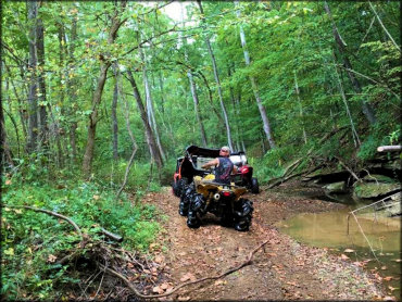
Photo Submitted 1/9/2017 (Thanks!)
Lake Moco Trail Photo
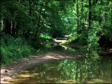
Photo Submitted 1/9/2017 (Thanks!)
Lake Moco Trail Photo
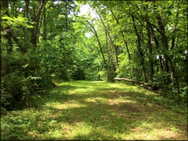
Photo Submitted 1/9/2017 (Thanks!)
Lake Moco Trail Photo
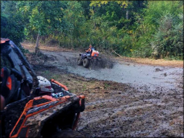
Photo Submitted 1/9/2017 (Thanks!)
Lake Moco Trail Photo
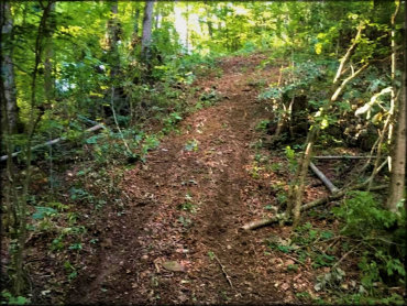
Photo Submitted 1/9/2017 (Thanks!)
Lake Moco Trail Photo
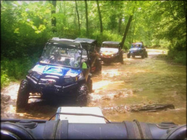
Photo Submitted 1/9/2017 (Thanks!)
Lake Moco Trail Photo
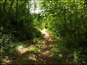
Photo Submitted 1/9/2017 (Thanks!)
RIDER COMMENTS & REVIEWS