 |
      |
| Home > Utah > Mineral Fork Trail |
Mineral Fork Trail
Saturday, December 23, 2023
| Other Names | Big Cottonwood Canyon, Uinta-wasatch-cache National Forest, Salt Lake Ranger District, Cardiff Fork, Lake Blanche Fork, Big Cottonwood Creek, Wasatch Mine |
| Last Known Status | Closed For Season |
This rugged trail is about six miles long and mainly consists of rocky, loose sharp chunk rock with steep climbs and narrow switchbacks. The first part of the trail starts out as a ATV trail but eventually turns narrow single track.
Parking is limited and large trailers are not recommended. There is a gate that blocks the trail at the staging area but just ride around the right side of the gate (the left side leads to a hiking trail).
This trail is usually open for riding around mid May through late October but some parts can be snow covered well into late summer.
REGULATIONS
| Permit Required | Yes | UT OHV Sticker |
| Dates Open | May - October | |
| Other ATV Stickers Accepted | No | Non-residents must purchase a non-resident OHV permit. |
| Spark Arrestor | Yes | A spark arresting exhaust silencer or end cap is required for all vehicles. |
| Noise Limit | ||
| Whip Flags | Not Required | |
| Maximum Vehicle Width | Yes (50 inches) | has entrance gate or posts |
 Motorcycles & Dirt Bikes Motorcycles & Dirt Bikes | Permitted | |
 ATVs ATVs | Permitted | (maximum width 50 inches) |
 UTV & SXS UTV & SXS | Prohibited | |
 SUVs & Jeeps (registered) SUVs & Jeeps (registered) | Prohibited | |
| Dune Buggy & Sand Rail 4x4 (unregistered) | Prohibited | |
| 2 Stroke Engines | No Restriction | |
 Camping Camping | Prohibited | |
 Campfires Campfires | ||
| Night Riding | Unknown | Not Recommended |
| Trail Blazing | Prohibited | no trailblazing |
| Rule Enforcement |
TERRAIN
| Miles Of Trail | 6 | |
| Climate Type | Forest | |
| Elevation | 6700 to 9200 ft. | |
| Trail Maintenance | Marked, Not Rated, Lightly Maintained | |
| Loose Dirt |  Little Little | |
| Hard Pack |  Some Some | |
| Sand |  None None | |
| Mud | Little | |
| Dust | Little | |
| Rocks |  Mostly Mostly | |
| Trees |  All All | |
| Steep Hills |  Many Many | |
| Water Crossings |  Few Few | |
| Small Jumps | None | |
| Large Jumps | None | |
| Berms | Few | |
| Sand/Gravel Pits | None | |
| Single Track | All | |
| Roads | None | |
| Intersections | Few | |
| Rider Traffic | Few | |
| Shade | Many | |
| Hazards | Few | (hazards assumed marked but use caution) |
 Novice Novice | Little | |
 Amateur Amateur | Some | |
 Expert Expert | Mostly |
TYPE OF AREA
| Area | Motorized Trails |
| Land | National Forest |
GPS POINTS


KEY SERVICES
 Gasoline Gasoline | 1-5 Miles (W) | 7-11 (801) 942-6668 |
| Diesel | 1-5 Miles (W) | 7-11 (801) 942-6668 |
 Water Water | 1-5 Miles (E) | Spruces Campground (801) 733-2660 |
 RV Hookup RV Hookup | 20-30 Miles (E) | Jordanelle State Park Campground (435) 649-9540 |
 RV Disposal RV Disposal | 20-30 Miles (E) | Jordanelle State Park Campground (435) 649-9540 |
| Campground | 1-5 Miles (E) | Spruces Campground (801) 733-2660 |
 Conv Store Conv Store | 1-5 Miles (W) | 7-11 (801) 942-6668 |
FEES & PASSES
| Parking | (None) |
| Entry | (None) |
| Riding | (None) |
| Camping | (None) |
RATINGS
| Our Rating |  Good Good |
| Recommended Stay | Full Day |
| Comments | (Scroll Down For Rider Reviews & Comments) |
DRIVING DIRECTIONS
| Nearest City | Salt Lake City, UT | ||
| From: Salt Lake City, UT
1) Take SR-190/Big Cottonwood Canyon East about 6 miles 2) Staging area is on the right (south). |

OFFICIAL CONTACTS
| Contact Info | Uinta Wasatch Cache National Forest - Salt Lake Ranger District 6944 South 3000 East Salt Lake City, UT 84121 (801) 733-2660 mailroom_r4_uinta@fs.fed.us www.fs.usda.gov |
| Contact Info | Utah State Parks OHV Education Office 1594 W North Temple, Suite 116 Salt Lake City, UT 84116 (800) 648-7433 ohveducation@utah.gov stateparks.utah.gov |
Mineral Fork Trail Photo
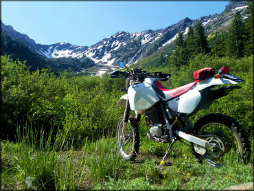
Photo Submitted 6/9/2018 (Thanks!)
Mineral Fork Trail Photo
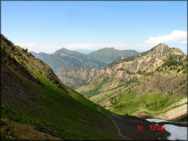
Photo Submitted 6/11/2015 (Thanks!)
Mineral Fork Trail Photo
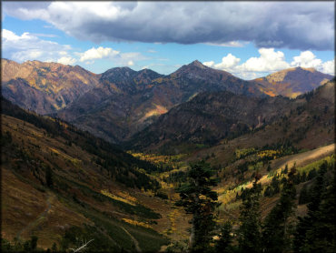
Photo Submitted 10/2/2016 (Thanks!)
Mineral Fork Trail Photo
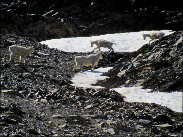
Photo Submitted 6/9/2018 (Thanks!)
Mineral Fork Trail Photo
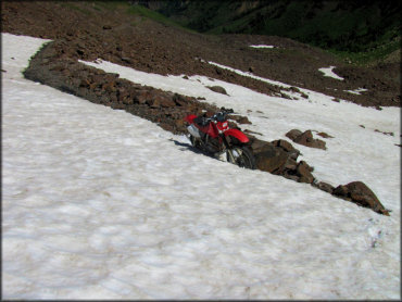
Photo Submitted 6/9/2018 (Thanks!)
Mineral Fork Trail Photo
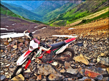
Photo Submitted 6/29/2015 (Thanks!)
RIDER COMMENTS & REVIEWS