 |
      |
| Home > Utah > Paiute ATV |
Paiute ATV Trail System
Saturday, December 23, 2023
| Other Names | Piaute ATV Trail System, Pauite Trails, Webers Piute Trails Inn, Piute ATV Trail, Otter Creek State Park, Otter Creek Reservoir Recreation Area, Fishlake National Forest, Tushar Mountains, Pahvant Range, Sevier Plateau, Castle Rock Campground, Clear Creek Canyon |
| Last Known Status | Open |
The Paiute ATV Trail System consists of over 250 marked and well maintained trails with access to over 2,000 interconnecting ATV trails. Staging opportunities are numerous and range from secluded primitive campgrounds to full RV parks; many with direct access to the Paiute trail.
Most of the towns that surround the trail system allow ATV use on the streets to access the trailheads. The trails cross three different mountain ranges and go through everything from desert type terrain to deep forest vegetation. July through the middle of October are the preferred times to explore the Paiute as the weather is slightly cooler and the tree leaves are changing to fall colors.
REGULATIONS
| Permit Required | Yes | UT OHV sticker required |
| Dates Open | Year-Round | |
| Other ATV Stickers Accepted | No | Non-residents must purchase a non-resident OHV permit. |
| Spark Arrestor | Yes | A spark arresting exhaust silencer or end cap is required for all vehicles. |
| Noise Limit | Yes | |
| Whip Flags | Not Required | |
| Maximum Vehicle Width | ||
 Motorcycles & Dirt Bikes Motorcycles & Dirt Bikes | Permitted | |
 ATVs ATVs | Permitted | |
 UTV & SXS UTV & SXS | Permitted | |
 SUVs & Jeeps (registered) SUVs & Jeeps (registered) | Some Areas | |
| Dune Buggy & Sand Rail 4x4 (unregistered) | Permitted | |
| 2 Stroke Engines | No Restriction | |
| MX Helmet Required | Youth Only | required for persons under 18 by state law (RiderPlanet strongly recommends helmets for all riders.) |
 Camping Camping | Some Areas | (camp in developed sites only) |
 Campfires Campfires | Some Areas | (permitted in developed campsites only) |
| Night Riding | Unknown | |
| Trail Blazing | Prohibited | riders must stay on trail |
| Alcohol | No Restriction | |
| Rule Enforcement | Few/Periodic | |
| Comment | No specific decibel limit but excessive mechanical noise is prohibited. | |
TERRAIN
| Approx Size | 960,000 acres (1,500 sq mi) | |
| Miles Of Trail | 250 | |
| Climate Type | Forest | |
| Elevation | 5000 to 11000 ft. | |
| Trail Maintenance | Marked, Not Rated, Heavily Maintained | |
| Loose Dirt |  Some Some | |
| Hard Pack |  Mostly Mostly | |
| Sand |  Little Little | |
| Mud | Little | |
| Dust | Some | |
| Rocks | Some | |
| Trees |  All All | |
| Steep Hills | Some | |
| Water Crossings | Some | |
| Sand/Gravel Pits |  None None | |
| Single Track |  Few Few | |
| Roads | Mostly | |
| Intersections |  Many Many | |
| Rider Traffic | Many | |
| Shade | Many | |
| Ranges/Gunfire | Few | |
| Hazards | Few | (hazards assumed marked but use caution) |
 Novice Novice | Some | |
 Amateur Amateur | Mostly | |
 Expert Expert | Little |
TYPE OF AREA
| Area | Motorized Trails |
| Land | BLM, National Forest |
GPS POINTS


KEY SERVICES
 Gasoline Gasoline | 1-5 Miles (W) | Maverik Country Stores (435) 743-7511 |
| Diesel | 1-5 Miles (W) | |
 Water Water | 1-5 Miles (W) | |
 RV Hookup RV Hookup | 1-5 Miles (W) | Fillmore KOA (435) 743-4420 |
 RV Disposal RV Disposal | 1-5 Miles (W) | Fillmore KOA (435) 743-4420 |
| Campground | On Site | various campgrounds |
 Conv Store Conv Store | 1-5 Miles (W) | Maverik Country Stores (435) 743-7511 |
FEES & PASSES
| Parking | (None) |
| Entry | (None) |
| Riding | (None) |
| Camping | Yes Tent: $0.00 RV: $0.00 Addtl. Vehicle: $0.00 Camping fees vary at different locations. |
RATINGS
| Pros | multiple staging areas, over 250 miles of ATV trails, most surrounding communities allow direct access to the trail |
| Cons | not enough motorcycle trails |
| Our Rating |  Very Good Very Good |
| Recommended Stay | 1 Week July-Mid October |
| Comments | (Scroll Down For Rider Reviews & Comments) |
DRIVING DIRECTIONS
| Nearest City | Fillmore, UT | ||
| From: Fillmore, UT
For Copley's Cove Campground (Northern Access): 1) Take Hwy 99 to E. 200 South Street turn east (E. 200 South Street turns into Chalk Creek Road) 2) Proceed about 6 miles to the campground. From: Antimony, UT Otter Creek State Park Campground (Southern Access): 1)Take SR 22 NE about 4 miles 2) Campground will be on your right. From: Richfield, UT 1) Richfield KOA (Eastern Access): Take I-70 north to exit 37 2) At end of ramp turn right (east) 3) Proceed 0.6 miles 4) Turn left (north) on 400 West Street 5) Continue 0.7 miles 6) Turn left (west) on 600 South Street 7) Proceed 1 block to KOA entrance. From: Beaver, UT 1) Little Reservoir Campground (Western Access): Take Hwy 153 east about 10 miles 2) Turn right (south) on FR 137 3) Proceed about 1 mile to the campground. |

OFFICIAL CONTACTS
| Contact Info | BLM - Richfield Field Office 150 East 900 North Richfield, UT 84701 (435) 896-1500 utrfmail@blm.gov www.blm.gov |
| Contact Info | Fishlake National Forest 115 E. 900 North Richfield, UT 84701 (435) 896-9233 www.fs.usda.gov |
| Contact Info | Scenic Hills Super 8 Motel 375 East 1620 South Salina, UT 84654 (435) 529-7483 (541) 997-0305 www.wyndhamhotels.com |
| Comment | Offers direct trail access and parking. |
| Contact Info | South - Forty RV Park 1170 N. Highway 89 Marysvale, UT 84750 (435) 326-4404 (435) 633-5090 southfortyrvpark@gmail.com |
| Comment | Offers full RV hookups and direct trail access. |
| Contact Info | Bullion Creekside Retreat RV Park 3305 Bullion Canyon Road Marysvale, UT 84750 (435) 896-7922 (801) 254-1740 blburrell@hotmail.com bullionretreat.com |
| Comment | Small RV park that offers full hookups and direct trail access. |
Paiute ATV Trail Photo
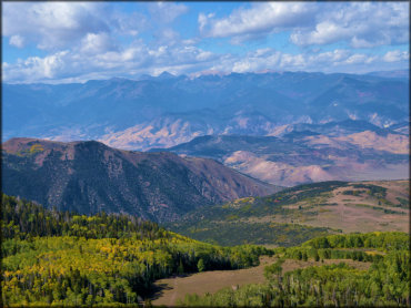
Photo Submitted 3/10/2020 (Thanks!)
Paiute ATV Trail Photo
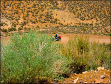
Photo Submitted 4/10/2012 (Thanks!)
Paiute ATV Trail Photo
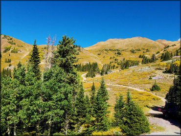
Photo Submitted 3/10/2020 (Thanks!)
Paiute ATV Trail Photo
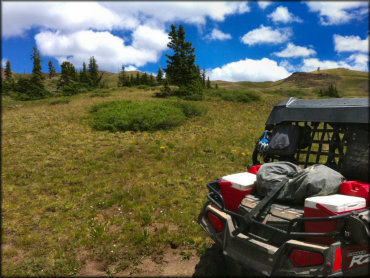
Photo Submitted 12/17/2012 (Thanks!)
Paiute ATV Trail Photo
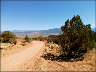
Photo Submitted 10/14/2015 (Thanks!)
Paiute ATV Trail Photo
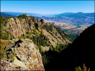
Photo Submitted 3/10/2020 (Thanks!)
Paiute ATV Trail Photo
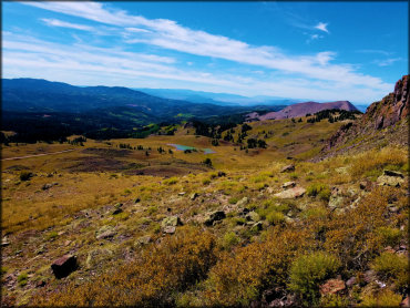
Photo Submitted 3/10/2020 (Thanks!)
Paiute ATV Trail Photo
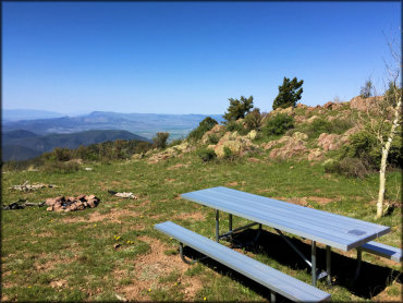
Photo Submitted 6/8/2016 (Thanks!)
Paiute ATV Trail Photo

Photo Submitted 6/8/2016 (Thanks!)
RIDER COMMENTS & REVIEWS