 |
      |
| Home > Utah > Diamond Fork |
Diamond Fork
Saturday, December 23, 2023
| Other Names | Sheep Creek, Monks Hollow, Dry Canyon, Three Forks, Red Hollow, Cottonwood Canyon, Jocks Canyon, Teat Mountain, Rough Hollow, Oak Spring, Unicorn Ridge, Sawmill Hollow, Tanner Ridge, Fifth Water Ridge, Fourth Water, Pump Ridge, Packard Canyon, Balsam Campground, Left Fork Days Canyon, Leftfork Maple Canyon, Tom Two Hill, Uinta-wasatch-cache National Forest, Spanish Fork Ranger District, Hot Pots, Diamond Fork Hot Springs, Centerline Trail |
| Last Known Status | Open |
This large area offers numerous single track trails that range from intermediate to difficult. There are many campgrounds that have direct trail access and several trailheads scattered throughout the area.
Many trails tie into roads from Diamond Fork, Sheep Creek and to the top of Strawberry Ridge. Monks Hollow Staging Area provides ample parking for trucks and trailers and is the prefered parking spot for ATVs. Sawmill, Three Forks/Fifth & Second Water Staging Areas provide access to single track trails and are open to dirt bikes only.
The Diamond Fork Hot Springs can be accessed by a hiking trail from Three Forks/Fifth & Second Water Staging Area. (Note: The hot springs are considered by many to be clothing optional, so you may encounter nude bathers.)
This trail system is generally open for riding around late April or May through the end of October. Diamond Fork Campground is open year-round but the other campgrounds generally close around October through Memorial Day weekend.
REGULATIONS
| Permit Required | Yes | UT OHV Sticker |
| Dates Open | Late April - November | |
| Other ATV Stickers Accepted | No | Non-residents must purchase a non-resident OHV permit. |
| Spark Arrestor | Yes | A spark arresting exhaust silencer or end cap is required for all vehicles. |
| Noise Limit | Yes | |
| Whip Flags | Not Required | |
| Maximum Vehicle Width | Yes (50 inches) | has entrance gate or posts |
 Motorcycles & Dirt Bikes Motorcycles & Dirt Bikes | Permitted | |
 ATVs ATVs | Some Areas | (maximum width 50 inches) permitted on designated trails |
 UTV & SXS UTV & SXS | Some Areas | (maximum width 50 inches) permitted on designated trails |
 SUVs & Jeeps (registered) SUVs & Jeeps (registered) | Prohibited | |
| Dune Buggy & Sand Rail 4x4 (unregistered) | Prohibited | |
| 2 Stroke Engines | No Restriction | |
| MX Helmet Required | Youth Only | required for persons under 18 by state law (RiderPlanet strongly recommends helmets for all riders.) |
 Camping Camping | Some Areas | (camp in developed sites only) |
 Campfires Campfires | Some Areas | (permitted in developed campsites only) |
| Night Riding | Unknown | |
| Trail Blazing | Prohibited | riders must stay on trail |
| Rule Enforcement | ||
| Comment | No specific decibel limit but excessive mechanical noise is prohibited. | |
TERRAIN
| Approx Size | 32,000 acres (50 sq mi) | |
| Miles Of Trail | 100 | |
| Climate Type | Forest | |
| Elevation | 5500 to 8500 ft. | |
| Trail Maintenance | Marked, Not Rated, Lightly Maintained | |
| Loose Dirt |  Little Little | |
| Hard Pack |  Mostly Mostly | |
| Sand | Little | |
| Mud | Little | |
| Dust | Little | |
| Rocks | Little | |
| Trees |  All All | |
| Steep Hills |  Many Many | |
| Berms |  Some Some | |
| Sand/Gravel Pits |  None None | |
| Single Track | Many | |
| Intersections | Many | |
| Hazards |  Few Few | (hazards assumed marked but use caution) |
 Novice Novice | Some | |
 Amateur Amateur | Mostly | |
 Expert Expert | Some |
TYPE OF AREA
| Area | Motorized Trails |
| Land | National Forest |
GPS POINTS


KEY SERVICES
 Gasoline Gasoline | 5-20 Miles (W) | Chevron Gas Station (801) 798-3747 |
| Diesel | 5-20 Miles (W) | Chevron Gas Station (801) 798-3747 |
 Water Water | On Site | Diamond Fork Campground |
 RV Hookup RV Hookup | 20-30 Miles (NW) | East Bay RV Park (801) 491-0700 |
 RV Disposal RV Disposal | 20-30 Miles (NW) | East Bay RV Park (801) 491-0700 |
| Campground | On Site | |
 Conv Store Conv Store | 5-20 Miles (W) | Chevron Gas Station (801) 798-3747 |
FEES & PASSES
| Parking | (None) |
| Entry | (None) |
| Riding | (None) |
| Camping | Yes Tent: $18.00 RV: $18.00 Addtl. Vehicle: $0.00 Diamond Campground Fee |
RATINGS
| Our Rating |  Very Good Very Good |
| Recommended Stay | 3-5 Days |
| Comments | (Scroll Down For Rider Reviews & Comments) |
DRIVING DIRECTIONS
| Nearest City | Spanish Fork, UT | ||
| From: Spanish Fork, UT
1) Take I-15 take Spanish Fork Exit for Hwy 6 East, continue 11.2 miles 2) Turn left (north-east) on Diamond Fork Canyon Road, continue 7.5 miles 3) Look for small turnout with a one-lane bridge crossing on the right (south), proceed over river crossing toward staging area. Note: The above directions are for Monks Hollow Staging Area. The below directions are for Three Forks/Second and Fifth Water Staging Area. 4) Continue east past the turnoff for Monks Hollow Staging about 2 miles 5) Staging are is on the right. For Sawmill Hollow Campground: 6) Continue east past Three Forks/Second and Fifth Water Staging Area for 4 miles 7) Campground is on the left. For additional staging: 8) Continue past Sawmill Hollow Campground about 1 mile 9) Staging area is on the right. |

OFFICIAL CONTACTS
| Contact Info | Uinta Wasatch Cache NF - Spanish Fork Ranger District 44 West 400 North Spanish Fork, UT 84660 (801) 798-3571 mailroom_r4_uinta@fs.fed.us www.fs.usda.gov |
| Contact Info | Utah State Parks OHV Education Office 1594 W North Temple, Suite 116 Salt Lake City, UT 84116 (800) 648-7433 ohveducation@utah.gov stateparks.utah.gov |
| Comment | OHV Permit Info |
Diamond Fork Trail Photo
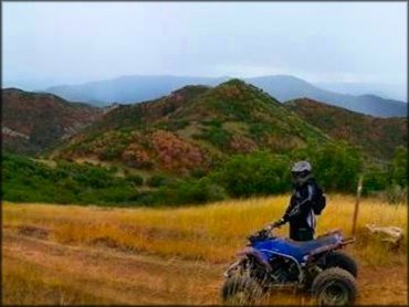
Photo Submitted 9/7/2013 (Thanks!)
Diamond Fork Trail Photo
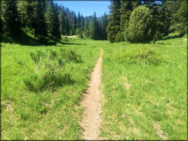
Photo Submitted 6/20/2016 (Thanks!)
Diamond Fork Trail Photo
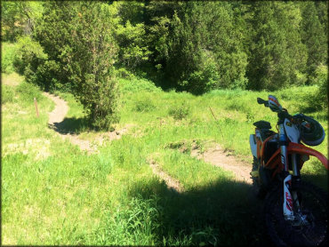
Photo Submitted 6/20/2016 (Thanks!)
Diamond Fork Trail Photo
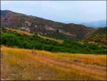
Photo Submitted 9/7/2013 (Thanks!)
Diamond Fork Trail Photo
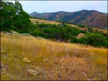
Photo Submitted 9/7/2013 (Thanks!)
RIDER COMMENTS & REVIEWS