 |
      |
| Home > Virginia > Slades Park |
Slades Park
Saturday, December 23, 2023
| Other Names | Slade's, Pooles Creek, Surry County |
| Last Known Status | Closed |
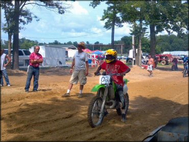
This off-road park at one time featured a good mix of narrow ATV woods and sandy trails with lots of berms, deep mud bogs and a large open play area that was perfect for beginners, but is now permanently closed. Camping was permitted and amenities included full hookups and a vault toilet.
A concession stand was available during weekends which sold bagged ice, cold drinks plus basic parts and supplies. The park also had a drag strip and several dirt drags were hosted throughout the year that were usually very popular. This listing will remain up for historical purposes and to prevent a wasted trip.
REGULATIONS
| Permit Required | No | |
| Dates Open | Closed | |
| Spark Arrestor | No | A spark arresting exhaust silencer or end cap is not required but is always recommended. |
| Noise Limit | No | |
| Whip Flags | Not Required | |
| Maximum Vehicle Width | No Restriction | |
 Motorcycles & Dirt Bikes Motorcycles & Dirt Bikes | Prohibited | |
 ATVs ATVs | Prohibited | |
 UTV & SXS UTV & SXS | Prohibited | |
 SUVs & Jeeps (registered) SUVs & Jeeps (registered) | Prohibited | |
| Dune Buggy & Sand Rail 4x4 (unregistered) | Prohibited | |
| 2 Stroke Engines | Prohibited | |
| MX Helmet Required | Yes | |
 Camping Camping | Prohibited | |
 Campfires Campfires | Prohibited | |
| Night Riding | No | |
| Alcohol | Prohibited | |
| Rule Enforcement |
TERRAIN
| Approx Size | 300 acres | |
| Miles Of Trail | 12 | |
| Climate Type | Forest | |
| Elevation | 50 to 90 ft. | |
| Trail Maintenance | Not Marked, Not Rated, Lightly Maintained | |
| Loose Dirt |  Some Some | |
| Hard Pack | Some | |
| Sand |  Mostly Mostly | |
| Mud | Some | |
| Dust | Some | |
| Rocks |  Little Little | |
| Trees |  Many Many | |
| Steep Hills |  Few Few | |
| Water Crossings | Few | |
| Small Jumps |  None None | |
| Berms | Some | |
| Sand/Gravel Pits | None | |
| Single Track | Some | |
| Roads | Few | |
| Intersections | Some | |
| Rider Traffic | Some | |
| Shade | Some | |
| Ranges/Gunfire | None | |
| Hazards | Few | (hazards assumed marked but use caution) |
 Novice Novice | Some | |
 Amateur Amateur | Mostly | |
 Expert Expert | Little |
TYPE OF AREA
| Area | Motorized Trails |
| Land | Privately Owned / Commercial |
GPS POINTS


KEY SERVICES
 Gasoline Gasoline | 5-20 Miles (NW) | 7-11 (757) 294-3147 |
| Diesel | 5-20 Miles (NW) | 7-11 (757) 294-3147 |
 Water Water | On Site | |
 RV Hookup RV Hookup | On Site | |
 RV Disposal RV Disposal | 5-20 Miles (N) | Chippokes Plantation State Park (757) 294-3625 |
| Campground | On Site | |
 Conv Store Conv Store | 5-20 Miles (NW) | Surry Quick Stop (757) 294-3435 |
FEES & PASSES
| Parking | (None) |
| Entry | Yes ($5.00 per person) Spectator Fee |
| Riding | Yes ($15.00 per OHV) |
| Camping | Yes Tent: $10.00 RV: $20.00 Addtl. Vehicle: $0.00 |
| Comment | spectator fee during race days - $15 |
RATINGS
| Our Rating |  Very Good Very Good |
| Recommended Stay | 1-2 Days |
| Comments | (Scroll Down For Rider Reviews & Comments) |
DRIVING DIRECTIONS
| Nearest City | Surry, VA | ||
| Address | 1111 Mount Ray Drive, Surry, VA 23883 | ||
| From: Suffolk, VA
1) Take SR-10 North about 26 miles 2) Turn left (south) on Mount Ray Drive, continue about 1 mile toward park entrance. |


OFFICIAL CONTACTS
Slades Park Trail Photo
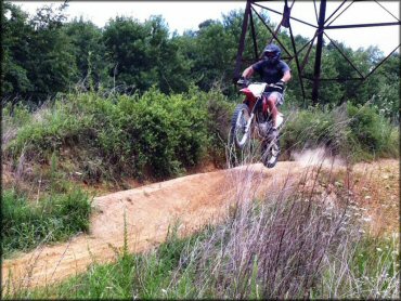
Some of the trails and play areas are located underneath the powerlines.
Slades Park Trail Photo
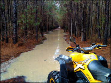
The park has deep and shallow mud pits, but most have a bypass. ATVs and UTVs will have a blast here.
Slades Park Trail Photo
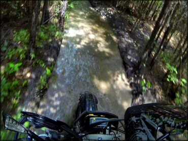
This park has a lot of deep and shallow mud pits. Most of the mud holes have a bypass.
Slades Park Trail Photo
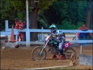
The dirt drag strip is very popular and events are hosted frequently throughout the year.
Slades Park Trail Photo
The dirt drag is mostly sand with some loamy soil mixed in.
Slades Park Trail Photo
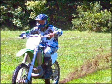
The park has a nice grassy area for open riding.
RIDER COMMENTS & REVIEWS