 |
      |
| Home > Washington > Juniper Dunes |
Juniper Dunes Area
Tuesday, February 27, 2024
| Other Names | Juniper Dunes |
| Last Known Status | Open |
Open year-round, this large area offers dunes and several trails that wind through sagebrush and juniper trees.
Primitive camping is permitted and there are no services but there are plans to add vault toilets and possibly a dumpster. There is a possibility that a staging area with a sand and gravel road may be added to the Smith Canyon area.
REGULATIONS
| Permit Required | Yes | WA ORV Tab |
| Dates Open | Year-Round | |
| Other ATV Stickers Accepted | Unknown | |
| Spark Arrestor | Yes | A spark arresting exhaust silencer or end cap is required for all vehicles. |
| Noise Limit | Yes (105 dB) | |
| Whip Flags | Yes (96 inches) | Whip Flags Required For Safety |
| Maximum Vehicle Width | No Restriction | |
 Motorcycles & Dirt Bikes Motorcycles & Dirt Bikes | Some Areas | not permitted in designated wilderness area |
 ATVs ATVs | Some Areas | not permitted in designated wilderness area |
 UTV & SXS UTV & SXS | Some Areas | not permitted in designated wilderness area |
 4x4 & Jeeps (registered) 4x4 & Jeeps (registered) | Some Areas | not permitted in designated wilderness area |
| Dune Buggy & Sand Rail 4x4 (unregistered) | Some Areas | not permitted in designated wilderness area |
| 2 Stroke Engines | Some Areas | not permitted in designated wilderness area |
 Camping Camping | No Restriction | (camp anywhere) |
 Campfires Campfires | Prohibited | open fires prohibited, restricted to camp stoves only |
| Night Riding | Unknown | Not Recommended |
| Rule Enforcement | Some | Dedicated Rangers/Officers Armed Officers |
| Comment | Permit is required to enter wilderness area (non-motorized use only), or if a party is more than 15 people. Call (509) 536-1200 for details. | |
Advertisement
TERRAIN
| Approx Size | 3,920 acres (6 sq mi) | |
| Climate Type | Desert | |
| Elevation | 850 to 1000 ft. | |
| Trail Maintenance | Unknown | |
| Loose Dirt |  None None | |
| Hard Pack | None | |
| Sand |  All All | paddle or sand tire recommended for best experience |
| Mud | None | |
| Dust | None | |
| Rocks | None | |
| Trees | None | |
| Steep Hills |  Some Some | |
| Water Crossings | None | |
| Small Jumps | Some | |
| Large Jumps | Some | |
| Berms | Some | |
| Single Track | None | |
| Roads | None | |
| Shade | None | |
| Hazards |  Few Few | (hazards assumed marked but use caution) |
 Novice Novice | Some | |
 Amateur Amateur |  Mostly Mostly | |
 Expert Expert |  Little Little |
TYPE OF AREA
| Area | Motorized Trails, Off-Road Dunes |
| Land | BLM |


KEY SERVICES
 Gasoline Gasoline | 5-20 Miles (SW) | Kahlotus Korners (509) 547-6640 |
| Diesel | 5-20 Miles (SW) | Kahlotus Korners (509) 547-6640 |
 Water Water | 5-20 Miles (SE) | Charbonneau Park (509) 547-2048 |
 RV Hookup RV Hookup | 5-20 Miles (SE) | Charbonneau Park (509) 547-2048 |
 RV Disposal RV Disposal | 5-20 Miles (SE) | Charbonneau Park (509) 547-2048 |
| Campground | 5-20 Miles (SE) | Charbonneau Park (509) 547-2048 |
 Conv Store Conv Store | 5-20 Miles (SW) | Kahlotus Korners (509) 547-6640 |
FEES & PASSES
| Parking | (None) |
| Entry | (None) |
| Riding | (None) |
| Camping | (None) |
RATINGS
| Our Rating |  Good Good |
| Recommended Stay | Full Day |
| Comments | (Scroll Down For Rider Reviews & Comments) |
DRIVING DIRECTIONS
| Nearest City | Pasco, WA | ||
| Address | Juniper Dunes Road, Pasco, WA 99301 | ||
| From: Pasco, WA
1) Take US-12 to Exit for Pasco-Kahlotus Road 2) Turn east on Pasco-Kahlotus Road, continue 6.5 miles 3) Turn left (north) onto Juniper Dunes Road*, continue 4.5 miles toward the staging area. *Note: Do not turn north onto Peterson Road. This is a private road and is no longer the main access road to the dune area. |


OFFICIAL CONTACTS
| Contact Info | BLM - Spokane District 1103 N. Fancher Spokane, WA 99212 (509) 536-1200 blm_or_sp_mail@blm.gov www.blm.gov |
Juniper Dunes OHV Area Photo
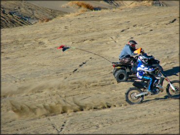
Photo Submitted 3/6/2012 (Thanks!)
Juniper Dunes OHV Area Photo
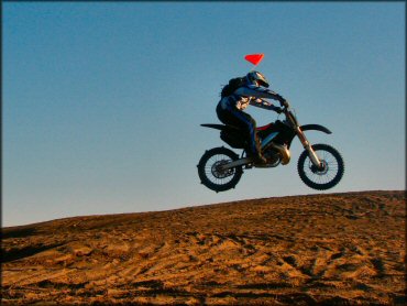
Photo Submitted 3/6/2012 (Thanks!)
Juniper Dunes OHV Area Photo
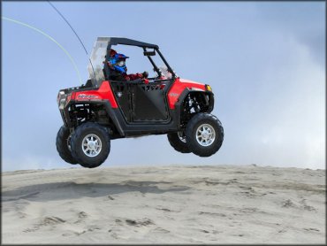
Photo Submitted 4/1/2014 (Thanks!)
Juniper Dunes OHV Area Photo
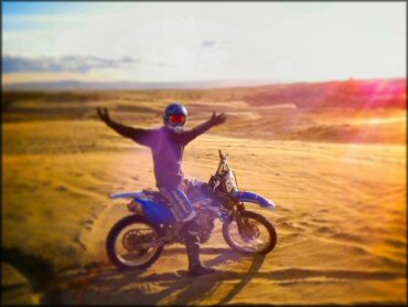
Photo Submitted 3/65/2013 (Thanks!)
RIDER COMMENTS & REVIEWS