 |
      |
| Home > Montana |
 7R Guest Ranch
Status: Open
Type: Trail (Privately Owned / Commercial)
Location: Wolf Creek, MT
Difficulty:

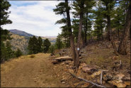
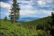
Located in the mountains of central Montana, this property offers about 35 miles of single track and double track trails that wind through 1,500 private acres. More...
 Anaconda MX Track
 Status: Open (Open To Members Only)
Type: Track (Privately Owned / Commercial)
Location: Anaconda, MT
Difficulty:

This one mile long motocross track is located next to a dormant copper smelter and consists mainly of hardpacked soil with large jumps and 150' climbs, with half the track built into the side of a hill. More...
 Ashley Lake OHV Trail System
 Status: Closed For Season
Type: Trail (National Forest)
Location: Kalispell, MT
Difficulty:
This area offers around 25 miles of multiple-use trails with seven miles set aside for ATVs. More...
Bitter Creek Trail System Status: Closed For Season
Type: Trail (National Forest)
Location: Wilsall, MT
Difficulty:
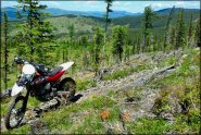
This trail system has around 25 miles of single track motorcycle trails that offer views of the surrounding mountains and open meadows. More...
 Blacktail Wild Bill OHV Trail System
 Status: Open
Type: Trail (National Forest)
Location: Lakeside, MT
Difficulty:
Designed mainly for 4x4s, this trail system is open to all vehicle types. More...
 Blue Mountain Recreation Area
 Status: Closed For Season
Type: Trail (National Forest)
Location: Missoula, MT
Difficulty:
This part of the Lolo National Forest has about 14.5 miles of motorized trails open to dirt bikes with around four miles open to ATV use. More...
 Camp Creek Recreation Area
 Status: Open
Type: Trail (BLM)
Location: Zortman, MT
Difficulty:
This remote recreation area offers two campgrounds and a day use area that provide direct access to miles of designated ATV trails that wind through the Little Rocky Mountains. More...
Castle Mountains Status: Open
Type: Trail (National Forest)
Location: White Sulpher Springs, MT
Difficulty:
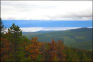
This remote area has about 50 miles of mostly single track trails that wind through the Castle Mountains. More...
 Clancy OHV Area
 Status: Open
Type: Trail (BLM)
Location: Clancy, MT
Difficulty:
This BLM area is open year-round and offers about ten miles of woods trails for motorcycles, ATVs and UTVs. More...
 Cokedale Motocross
 Status: Open
Type: Track (Privately Owned / Commercial)
Location: Livingston, MT
Difficulty:
This natural terrain motocross track is over a mile long and has most sections built into the bordering hillsides. More...
(Page 1 of 5)
(Page 1 of 5)