 |
      |
| Home > West Virginia |

 Bearwallow Trail System
Status: Open
Type: Trail (County Land)
Location: Logan, WV
Difficulty:

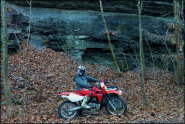
One of the original Hatfield McCoy Trail Systems, Bearwallow offers about 100 miles of equal amounts of novice, amateur and expert level trails with some decent single track. More...
 Buffalo Mountain ATV Trails
Status: Open
Type: Trail (County Land)
Location: Delbarton, WV
Difficulty:

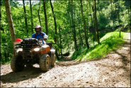
Of the ten Hatfield McCoy Trail Systems, this area offers the largest amount of challenging single track and ATV trails. More...
 Burning Rock Offroad Park
 Status: Open
Type: Combo (Privately Owned / Commercial)
Location: Tams, WV
Difficulty:
This large offroad park has over 100 miles of ATV trails that wind through 10,000 acres of forest. More...
 Cabwaylingo State Forest
 Status: Open
Type: Trail (State Forest)
Location: Dunlow, WV
Difficulty:
This state forest features over 100 miles of motorized trails that are open to all OHV types. More...
Chaos Offroad Park Status: Open (open during select weekends)
Type: Trail (Privately Owned / Commercial)
Location: Capon Bridge, WV
Difficulty:
This offroad park offers a bit of everything that ranges from shallow to deep mud pits, scattered rock gardens plus miles of mountain trails that range from smooth and fast to rugged and slow. More...
Devil Anse Status: Open
Type: Trail (County Land)
Location: Matewan, WV
Difficulty:
Located in southern West Virginia, this part of the Hatfield McCoy Trail System has about 300 miles of trails that also connect to nearby Rockhouse and Buffalo Mountain. More...
Good Evening Ranch Status: Open
Type: Trail (Privately Owned / Commercial)
Location: Canvas, WV
Difficulty:
This privately owned family friendly ranch offers 500 acres of rolling hills, scattered ponds and offroad woods trails that cater to all skill levels. More...
 Hatfield McCoy Trails
 Status: Open
Type: Trail (County Land)
Location: Julian, WV
Difficulty:
One of the premier destinations in the country for off-road enthusiasts, Hatfield McCoy is actually a combination of ten individual trail systems that range from smooth and hard packed ATV trails with shallow stream crossings to chunky, steep and rugged single track for dirt bikes. More...
 Indian Ridge ATV Trails
 Status: Open
Type: Trail (County Land)
Location: Bluefield, WV
Difficulty:
One of the newest additions to the Hatfield McCoy Trail System, this area has about 63 miles of trails. More...
Ivy Branch Trail System Status: Open
Type: Trail (County Land)
Location: Julian, WV
Difficulty:
This part of the Hatfield McCoy Trail System features about 60 miles of moderately challenging trails that are open to all offroad vehicles. More...
(Page 1 of 3)
(Page 1 of 3)