 |
      |
| Home > Colorado > Kingston Peak |
Kingston Peak Trail
Saturday, December 23, 2023
| Other Names | Apex / Kingston Peak Road, Arapaho National Forest, Clear Creek Ranger District, Mammoth Gulch Road, Fall River Road, Yankee Hill, Jenny Creek, Chins Lake, Loch Lomond, Stone House |
| Last Known Status | Open |
This part of the Arapaho National Forest offers about eight miles of steep and rugged 4x4 roads that form a loop. One of the popular destinations to take a break is at the top of Mammoth Gulch, which has a mail box surrounded by large rocks.
The trail has numerous scenic mountain, valley and lake views, so bring the camera. All vehicle types are permitted but this trail is very popular with Jeeps and 4x4s.
The trail is open to motorized use around mid June through late September but exact dates vary. The trail is gated so call first before heading out. Please note that temperatures can be chilly even during summer months so come prepared.
REGULATIONS
| Permit Required | Yes | Colorado OHV Sticker |
| Dates Open | Spring - Fall | |
| Other ATV Stickers Accepted | No | Colorado Non-Resident OHV permit required. |
| Spark Arrestor | Yes | A spark arresting exhaust silencer or end cap is required for all vehicles. |
| Noise Limit | Yes (96 dB) | (1998/older limit 99 dB, 1998/newer limit 96 dB) |
| Whip Flags | Not Required | |
| Maximum Vehicle Width | No Restriction | |
 Motorcycles & Dirt Bikes Motorcycles & Dirt Bikes | Permitted | |
 ATVs ATVs | Permitted | |
 UTV & SXS UTV & SXS | Permitted | |
 4x4 & Jeeps (registered) 4x4 & Jeeps (registered) | Permitted | |
| Dune Buggy & Sand Rail 4x4 (unregistered) | Permitted | |
| 2 Stroke Engines | No Restriction | |
 Camping Camping | ||
 Campfires Campfires | ||
| Night Riding | Unknown | |
| Trail Blazing | Prohibited | riders must stay on trail |
| Rule Enforcement |
TERRAIN
| Miles Of Trail | 8 | |
| Climate Type | Forest | |
| Elevation | 9500 to 12000 ft. | |
| Trail Maintenance | Marked, Not Rated, Lightly Maintained | |
| Loose Dirt |  None None | |
| Hard Pack |  Mostly Mostly | |
| Sand | None | |
| Mud |  Little Little | |
| Dust | Little | |
| Rocks |  Some Some | |
| Trees |  Many Many | |
| Steep Hills | Some | |
| Water Crossings |  Few Few | |
| Small Jumps | None | |
| Large Jumps | None | |
| Berms | None | |
| Sand/Gravel Pits | None | |
| Single Track | None | |
| Roads | Mostly | |
| Intersections | Few | |
| Rider Traffic | Some | |
| Shade | Many | |
| Hazards | Few | (hazards assumed marked but use caution) |
 Novice Novice | Little | |
 Amateur Amateur | Mostly | |
 Expert Expert | Some |
TYPE OF AREA
| Area | Motorized Trails |
| Land | National Forest |

KEY SERVICES
 Gasoline Gasoline | 5-20 Miles (SE) | Shell (303) 567-0339 |
| Diesel | 5-20 Miles (SE) | Shell (303) 567-0339 |
 Water Water | 5-20 Miles (SE) | Denver City West KOA (303) 582-3043 |
 RV Hookup RV Hookup | 5-20 Miles (SE) | Denver City West KOA (303) 582-3043 |
 RV Disposal RV Disposal | 5-20 Miles (SE) | Denver City West KOA (303) 582-3043 |
| Campground | 5-20 Miles (E) | Pickle Gulch Campground (303) 567-3000 |
 Conv Store Conv Store | 5-20 Miles (NW) | Shell (303) 567-0339 |
FEES & PASSES
| Parking | (None) |
| Entry | (None) |
| Riding | (None) |
| Camping | (None) |
RATINGS
| Our Rating |  Good Good |
| Recommended Stay | Full Day |
| Comments | (Scroll Down For Rider Reviews & Comments) |
DRIVING DIRECTIONS
| Nearest City | Idaho Springs, CO | ||
| From: Denver, CO
1) Take I-70 West to Exit 244 2) Turn right (east) on US-6, continue 2.8 miles 3) Turn left (north) on SR-119, continue 21 miles 4) Turn left (west) on CR-16, continue 5 miles 5) Turn left (south) on FS 176/Mammoth Gulch Road, continue 1.5 miles. |


OFFICIAL CONTACTS
| Contact Info | Arapaho National Forest - Clear Creek Ranger District 101 Highway 103 Idaho Springs, CO 80452 (303) 567-3000 mailroom_r2_arapaho_roosevelt@fs.fed.us www.fs.usda.gov |
| Contact Info | Colorado Parks And Wildlife - Registration Unit 13787 South Highway 85 Littleton, CO 80125 (303) 791-1920 dnr.ivrsparks@state.co.us cpw.state.co.us |
| Comment | Colorado OHV Registration Info |
| Contact Info | Mile High Adventure Rentals 1044 S Grapevine Road Golden, CO 80401 (303) 929-7239 milehighadventures@outlook.com |
| Comment | ATV, UTV, dirt bike and snowmobile rentals |
Kingston Peak Trail Photo
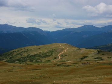
Photo Submitted 2/13/2016 (Thanks!)
Kingston Peak Trail Photo
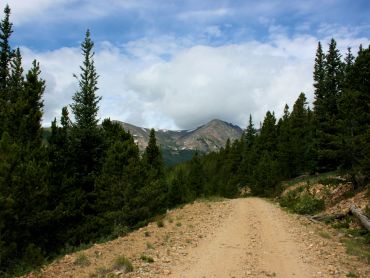
Photo Submitted 2/13/2016 (Thanks!)
Kingston Peak Trail Photo
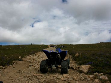
Photo Submitted 2/13/2016 (Thanks!)
Kingston Peak Trail Photo
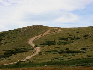
Photo Submitted 2/13/2016 (Thanks!)
Kingston Peak Trail Photo
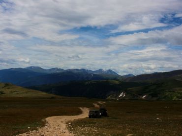
Photo Submitted 2/13/2016 (Thanks!)
Kingston Peak Trail Photo

Photo Submitted 7/17/2016 (Thanks!)
Kingston Peak Trail Photo
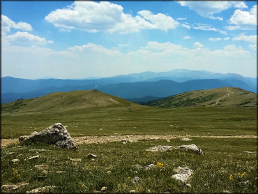
Photo Submitted 7/17/2016 (Thanks!)
Kingston Peak Trail Photo
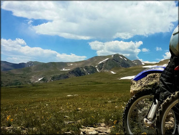
Photo Submitted 7/17/2016 (Thanks!)
RIDER COMMENTS & REVIEWS