 |
      |
| Home > Colorado > Rampart Range |
Rampart Range
Thursday, March 7, 2024
| Other Names | Bar Motorized Trail, Trail #673, Pike National Forest, Bear Creek, Sprucewood, Flat Rocks Campground, Indian Creek, Devils Head, Turtle Mountain, Dakan Mountain, South Platte Ranger District, Bear Creek Motorized Trail |
| Last Known Status | Closed For Season |
This locals favorite has about 200 miles of ATV and motorcycle trails. There are multiple staging areas and a couple developed campgrounds to choose from.
The most popular campground is Flat Rocks which provides not only direct trail access but also connects to the Bar Motorized trail, a very popular trail that leads directly to the Sprucewood Inn, an OHV friendly restaurant and bar.
The developed campgrounds are first come, first serve however dispersed camping is permitted throughout the forest.
REGULATIONS
| Permit Required | Yes | Colorado OHV Sticker |
| Dates Open | Late May until December 1, weather permitting | |
| Other ATV Stickers Accepted | No | Colorado Non-Resident OHV permit required. |
| Spark Arrestor | Yes | A spark arresting exhaust silencer or end cap is required for all vehicles. |
| Noise Limit | Yes (96 dB) | (1998/older limit 99 dB, 1998/newer limit 96 dB) |
| Whip Flags | Not Required | |
| Maximum Vehicle Width | Yes (50 inches) | has entrance gate and narrow terrain |
 Motorcycles & Dirt Bikes Motorcycles & Dirt Bikes | Permitted | |
 ATVs ATVs | Permitted | (maximum width 50 inches) |
 UTV & SXS UTV & SXS | Permitted | (maximum width 50 inches) |
 4x4 & Jeeps (registered) 4x4 & Jeeps (registered) | Prohibited | |
| Dune Buggy & Sand Rail 4x4 (unregistered) | Prohibited | |
| 2 Stroke Engines | No Restriction | |
| MX Helmet Required | Yes | |
 Camping Camping | Some Areas | (camp in developed sites only) |
 Campfires Campfires | Some Areas | (permitted in developed campsites only) |
| Night Riding | Unknown | |
| Trail Blazing | Prohibited | keep vehicle on trail |
| Alcohol | No Restriction | |
| Rule Enforcement |
TERRAIN
| Approx Size | 1,280 acres (2 sq mi) | |
| Miles Of Trail | 200 | |
| Climate Type | Forest | |
| Elevation | 6500 to 8500 ft. | |
| Trail Maintenance | Marked, Rated, Lightly Maintained | |
| Loose Dirt |  Some Some | |
| Hard Pack | Some | |
| Sand |  None None | |
| Mud |  Little Little | |
| Dust | Little | |
| Rocks | Some | |
| Trees |  All All | |
| Steep Hills | Some | |
| Berms |  Few Few | |
| Sand/Gravel Pits | None | |
| Roads | Few | |
| Intersections | Some | |
| Rider Traffic | Some | |
| Shade | All | |
| Ranges/Gunfire | None | |
| Hazards | Few | (hazards assumed marked but use caution) |
 Novice Novice | Some | |
 Amateur Amateur |  Mostly Mostly | |
 Expert Expert | Little |
TYPE OF AREA
| Area | Motorized Trails |
| Land | National Forest |


KEY SERVICES
 Gasoline Gasoline | 5-20 Miles (NE) | Sedalia |
| Diesel | 5-20 Miles (NE) | Castle Rock |
 Water Water | 5-20 Miles (NE) | Sedalia |
 RV Hookup RV Hookup | 20-30 Miles (S) | Diamond Campground & RV Park (719) 687-9684 |
 RV Disposal RV Disposal | 20-30 Miles (S) | Diamond Campground & RV Park (719) 687-9684 |
| Campground | On Site | Flat Rock Campground |
 Conv Store Conv Store | 5-20 Miles (NE) | Bugling Bull Trading Post (303) 688-9701 |
FEES & PASSES
| Parking | Yes ($10.00) Day use fee at Flat Rocks Campground |
| Entry | (None) |
| Riding | (None) |
| Camping | Yes Tent: $25.00 RV: $25.00 Addtl. Vehicle: $10.00 Flat Rocks Campground Fees |
RATINGS
| Pros | scenic views, moderate difficulty |
| Cons | trail is seasonal |
| Our Rating |  Good Good |
| Recommended Stay | 1-2 Days Summer |
| Comments | (Scroll Down For Rider Reviews & Comments) |
DRIVING DIRECTIONS
| Nearest City | Sedalia, CO | ||
| Address | Rampart Range Road, Sedalia, CO 80135 | ||
| From: Sedalia, CO
1) Take Hwy 67 South about 10 miles 2) Turn left (south) onto Rampart Range Road 3) Staging area is on the right (west). For Flat Rocks Campground: 4) Continue south on Rampart Range Road 4.5 miles 5) Campground entrance is on the right (west). |


OFFICIAL CONTACTS
| Contact Info | Pike National Forest - South Platte Ranger District 19316 Goddard Ranch Court Morrison, CO 80465 (303) 275-5610 mailroom_r2_pike_san_isabel@fs.fed.us www.fs.usda.gov |
| Contact Info | Rampart Range Motorcycle Management Committee P.O. Box 3511 Englewood, CO 80155 info@rampartrange.org rampartrange.org |
| Contact Info | Colorado State Parks - Registration Unit 13787 South Highway 85 Littleton, CO 80125 (303) 791-1920 dnr.ivrsparks@state.co.us cpw.state.co.us |
| Comment | Colorado OHV Registration Info |
| Contact Info | Mile High Adventure Rentals 1044 S Grapevine Road Golden, CO 80401 (303) 929-7239 milehighadventures@outlook.com |
| Comment | ATV, UTV, dirt bike and snowmobile rentals |
Rampart Range Trail Photo
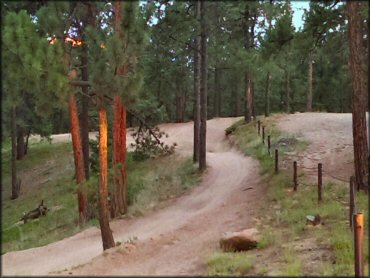
A good example of what to expect here - mostly smooth, fast and twisty trails.
Rampart Range Trail Photo
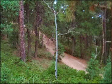
The trails are mostly smooth and wide enough for ATVs.
Rampart Range Trail Photo
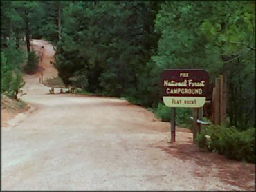
This is the main entrance for Flat Rocks Campground, which has 19 sites that can accommodate RV up to 30 feet long.
Rampart Range Trail Photo
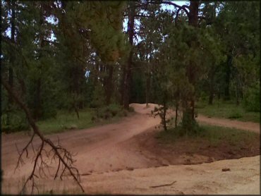
Photo Submitted 7/14/2013 (Thanks!)
Rampart Range Trail Photo
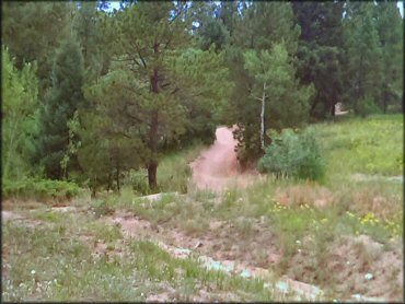
Photo Submitted 7/14/2013 (Thanks!)
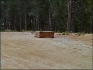
Rampart Range Trail Photo
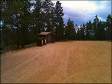
Most of the staging areas have vault toilets.
Rampart Range Trail Photo
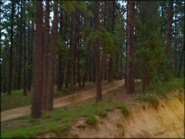
Photo Submitted 7/14/2013 (Thanks!)
Rampart Range Trail Photo
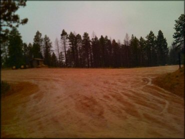
A view of one of the staging areas. This one has plenty of flat, level parking and a vault toilet.
Rampart Range Trail Photo
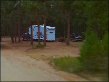
Another view of a primitive campsite. Sites are nice and flat and surrounded by tall pine trees.
Rampart Range Trail Photo
Some of the staging areas have loading ramps.
Rampart Range Trail Photo
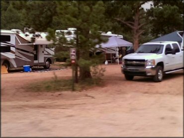
Another view of Flat Rocks Campground. There are no electric hookups but there are several water spigots and some garbage cans provided.
RIDER COMMENTS & REVIEWS