 |
      |
| Home > Mississippi > Trace State Park |
Trace State Park
Saturday, May 10, 2025
| Other Names | Old Natchez Trace Lake |
| Last Known Status | Open |
This state park has about 35 miles of multiple use trails that wind through a mixed hardwood forest, rolling hills and swamps. The trails are open to motorized use but are also popular with horseback riders, bicyclists and hikers. Other activities include fishing and boating.
The park offers RV hookups, cabin and cottage rentals, laundry facilities, hot showers, a children’s playground and scattered day use areas with BBQ grills and picnic tables. The forest is open daily from 8am to 5pm daily but is closed for Thanksgiving, Christmas and New Years Day.
REGULATIONS
| Permit Required | No | |
| Dates Open | Open daily except Thanksgiving, Christmas and New Years Day. | |
| Other ATV Stickers Accepted | Unknown | |
| Spark Arrestor | Yes | A spark arresting exhaust silencer or end cap is required for all vehicles. |
| Noise Limit | Yes (90 dB) | |
| Whip Flags | Not Required | |
| Maximum Vehicle Width | Yes (50 inches) | has entrance gate or posts |
 Motorcycles & Dirt Bikes Motorcycles & Dirt Bikes | Permitted | |
 Four Wheelers Four Wheelers | Permitted | (maximum width 50 inches) |
 UTV & SXS UTV & SXS | Permitted | (maximum width 50 inches) |
 SUVs & Jeeps (registered) SUVs & Jeeps (registered) | Prohibited | |
| Dune Buggy & Sand Rail 4x4 (unregistered) | Prohibited | |
| 2 Stroke Engines | No Restriction | |
| MX Helmet Required | Yes | |
 Camping Camping | Some Areas | (camp in developed sites only) |
 Campfires Campfires | Some Areas | (permitted in developed campsites only) |
| Night Riding | No | riding hours 8am-sunset |
| Trail Blazing | Prohibited | riders must stay on trail |
| Alcohol | Prohibited | |
| Rule Enforcement |
TERRAIN
| Approx Size | 2,560 acres (4 sq mi) | |
| Miles Of Trail | 35 | |
| Climate Type | Forest | |
| Elevation | 350 to 500 ft. | |
| Trail Maintenance | Marked, Rated, Lightly Maintained | |
| Loose Dirt |  Little Little | |
| Hard Pack |  Mostly Mostly | |
| Sand |  None None | |
| Mud | Little | |
| Dust | Little | |
| Rocks | Little | |
| Trees |  Many Many | |
| Steep Hills |  Few Few | |
| Water Crossings | None | |
| Small Jumps | None | |
| Large Jumps | None | |
| Berms |  Some Some | |
| Sand/Gravel Pits | None | |
| Single Track | Some | |
| Roads | None | |
| Shade | Many | |
| Hazards | Few | (hazards assumed marked but use caution) |
 Novice Novice | Some | |
 Amateur Amateur | Some | |
 Expert Expert | Little |
TYPE OF AREA
| Area | Motorized Trails |
| Land | State Recreation |


KEY SERVICES
 Gasoline Gasoline | Pontotoc, MS | |
| Diesel | Pontotoc, MS | |
 Water Water | On Site | |
 RV Hookup RV Hookup | On Site | |
 RV Disposal RV Disposal | On Site | |
| Campground | On Site | |
 Conv Store Conv Store | Pontotoc, MS |
FEES & PASSES
| Parking | (None) |
| Entry | (None) |
| Riding | Yes ($8.00 per rider) mountain bike fee - $5/person |
| Camping | Yes Tent: $15.00 RV: $24.00 Addtl. Vehicle: $0.00 |
| Comment | Call for cabin rental rates and availability. |
RATINGS
| Our Rating |  |
| Recommended Stay | Full Day |
| Comments | (Scroll Down For Rider Reviews & Comments) |
DRIVING DIRECTIONS
| Nearest City | Pontotoc, MS | ||
| Address | 2139 Faulkner Road, Belden, MS 38826 | ||
| From: Tupelo, MS
1) Take SR-6 West about 10 miles 2) Turn right (north) on CR-65 (Faulkner Road), continue 2.1 miles 3) Turn left at T-intersection, continue a few yards 4) At next T-intersection turn right, proceed about 1 mile toward the staging area. |


OFFICIAL CONTACTS
| Contact Info | Trace State Park 2139 Faulkner Road Belden, MS 38826 (662) 489-2958 trace@mdwfp.state.ms.us www.mdwfp.com |
Trace State Park Trail Photo
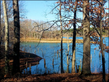
Photo Submitted 12/17/2017 (Thanks!)
Trace State Park Trail Photo
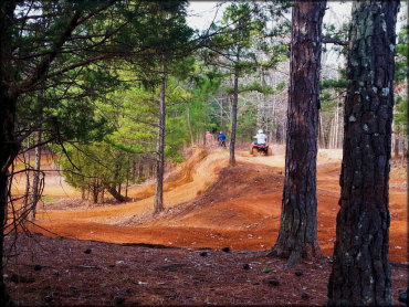
Photo Submitted 12/17/2017 (Thanks!)
Trace State Park Trail Photo
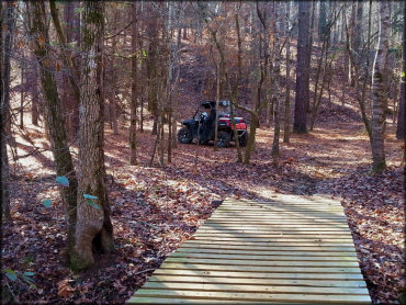
Photo Submitted 12/17/2017 (Thanks!)
Trace State Park Trail Photo
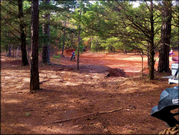
Photo Submitted 3/18/2021 (Thanks!)
Trace State Park Trail Photo
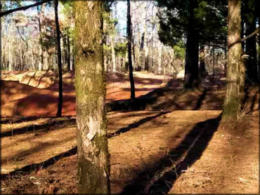
Photo Submitted 3/18/2021 (Thanks!)
Trace State Park Trail Photo
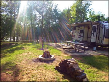
Photo Submitted 3/18/2021 (Thanks!)
Trace State Park Trail Photo
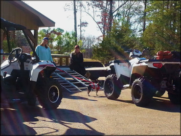
Photo Submitted 12/17/2017 (Thanks!)
Trace State Park Trail Photo
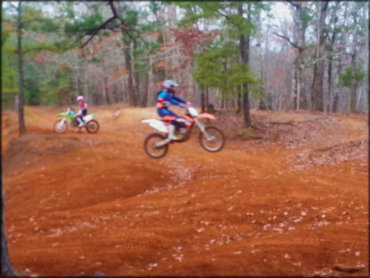
Photo Submitted 12/17/2017 (Thanks!)
RIDER COMMENTS & REVIEWS