 |
      |
| Home > Ohio > Monday Creek |
Monday Creek ORV Area
Sunday, December 14, 2025
| Other Names | Wayne National Forest, The Wayne, Athens Ranger District, Begley's ATV Campground, Williams Connector Trail, Snake Hollow Trail, Dorr Run, Door Run |
| Last Known Status | Closed For Season |
About 75 miles of trails that are marked and rated for difficulty can be found in this area of the Wayne National Forest. The trails are generally smooth and fast and consists of mostly hard pack with some occasional berms.
A permit is required to ride here which must be obtained prior to arrival since there is currently no self pay kiosk at the trailheads. Permits can be obtained by contacting one of the Wayne National Forest district offices, online or by visiting local vendors.
The trail system has multiple access points and primitive camping is permitted at the staging areas. Nearby Begley’s Campground offers electric hookups, cabin rentals, hot showers plus direct trail access.
REGULATIONS
| Permit Required | Yes | Wayne NF Trail Permit and Ohio APV Tag |
| Dates Open | April 1 - December 15 | |
| Other ATV Stickers Accepted | Unknown | |
| Spark Arrestor | Yes | A spark arresting exhaust silencer or end cap is required for all vehicles. |
| Noise Limit | Yes | |
| Whip Flags | Not Required | |
| Maximum Vehicle Width | Yes (50 inches) | |
 Motorcycles & Dirt Bikes Motorcycles & Dirt Bikes | Permitted | |
 ATVs ATVs | Permitted | (maximum width 50 inches) |
 UTV & SXS UTV & SXS | Permitted | (maximum width 50 inches) |
 SUVs & Jeeps (registered) SUVs & Jeeps (registered) | Prohibited | |
| Dune Buggy & Sand Rail 4x4 (unregistered) | Prohibited | |
| 2 Stroke Engines | No Restriction | |
 Camping Camping | Some Areas | |
 Campfires Campfires | Some Areas | campfires must have 10' clearance and have a ring of rocks |
| Night Riding | Unknown | |
| Trail Blazing | Prohibited | keep vehicle on trail |
| Alcohol | Prohibited | |
| Rule Enforcement |
TERRAIN
| Approx Size | 28,800 acres (45 sq mi) | |
| Miles Of Trail | 75 | |
| Climate Type | Forest | |
| Elevation | 650 to 1100 ft. | |
| Trail Maintenance | Marked, Rated, Lightly Maintained | |
| Loose Dirt |  Some Some | |
| Hard Pack | Some | |
| Sand |  Little Little | |
| Mud | Little | |
| Dust | Little | |
| Rocks | Some | |
| Trees |  Many Many | |
| Steep Hills |  Few Few | |
| Water Crossings | Few | |
| Small Jumps | Few | |
| Large Jumps | Few | |
| Berms | Some | |
| Sand/Gravel Pits |  None None | |
| Single Track | Some | |
| Roads | Some | |
| Intersections | Few | |
| Rider Traffic | Few | |
| Shade | Many | |
| Ranges/Gunfire | None | |
| Hazards | Few | (hazards assumed marked but use caution) |
 Novice Novice | Some | |
 Amateur Amateur |  Mostly Mostly | |
 Expert Expert | Some |
TYPE OF AREA
| Area | Motorized Trails |
| Land | National Forest |
GPS POINTS


KEY SERVICES
 Gasoline Gasoline | 1-5 Miles (N) | B&C Gas Station (740) 394-2226 |
| Diesel | 1-5 Miles (N) | B&C Gas Station (740) 394-2226 |
 Water Water | On Site | Begley's Campground (740) 394-2539 |
 RV Hookup RV Hookup | On Site | Begley's Campground (740) 394-2539 |
 RV Disposal RV Disposal | On Site | Begley's Campground (740) 394-2539 |
| Campground | On Site | Begley's Campground (740) 394-2539 |
 Conv Store Conv Store | 1-5 Miles (N) | B&C Gas Station (740) 394-2226 |
FEES & PASSES
| Parking | (None) |
| Entry | (None) |
| Riding | Yes ($20.00 per rider) Wayne National Forest ATV Permit - Three Day - $20; Seasonal - $35 |
| Camping | (None) |
RATINGS
| Our Rating |  |
| Recommended Stay | Full Day |
| Comments | (Scroll Down For Rider Reviews & Comments) |
DRIVING DIRECTIONS
| Nearest City | New Straitsville, OH | ||
| From: Lancaster, OH
1) Take US-33 South toward the town of Logan, about 18 miles 2) Take exit for SR-93 3) At end of exit ramp turn right (north) on SR-93, continue .4 miles 4) Turn right on Hunter Street/SR-93, continue about 12 miles 5) Turn right on SR-595/Plummer Hill Road, continue about 1 mile 6) Veer left on unmarked dirt road, continue toward the staging area. |


OFFICIAL CONTACTS
| Contact Info | Wayne National Forest - Athens Ranger District 13700 US Highway 33 Nelsonville, OH 45764 (740) 753-0101 mailroom_r9_wayne@fs.fed.us www.fs.usda.gov |
| Contact Info | Begley's ATV Campground 214 East Main Street New Straitsville, OH 43766 (740) 394-2539 www.begleyscampground.com |
| Comment | Private campground with direct trail access. |
| Contact Info | Ohio Bureau of Motor Vehicles 1970 West Broad Street Columbus, OH 43223 (614) 752-7800 webmaster@dps.state.oh.us www.bmv.ohio.gov |
| Comment | ATV and Motorcycle Registration Info |
Monday Creek Trail Photo
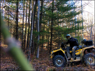
Photo Submitted 3/11/2016 (Thanks!)
Monday Creek Trail Photo
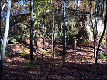
Photo Submitted 10/31/2014 (Thanks!)
Monday Creek Trail Photo
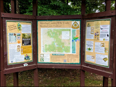
Photo Submitted 6/29/2017 (Thanks!)
Monday Creek Trail Photo
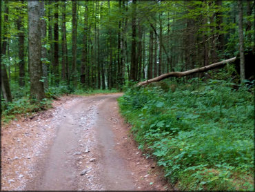
Photo Submitted 6/29/2017 (Thanks!)
Monday Creek Trail Photo
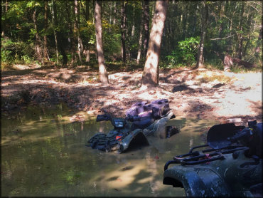
Photo Submitted 6/29/2017 (Thanks!)
Monday Creek Trail Photo

Photo Submitted 11/28/2012 (Thanks!)
RIDER COMMENTS & REVIEWS