 |
      |
| Home > South Carolina > Enoree |
Enoree OHV Trail
Wednesday, August 20, 2025
| Other Names | Sumter National Forest, Sumpter National Forest, Enoree Ranger District, South Fork Duncan Creek, Piedmont OHV Trails |
| Last Known Status | Variable Schedule (Depends on daily conditions. Call (803) 561-4025 x 1 for recorded message.) |
This part of the Sumter National Forest offers about 23 miles of multiple use trails that form long, interconnecting loops and a separate, one-way only beginners loop. The trails are marked and mainly consist of double track dirt and sandy washes with some particularly narrow sections.
The staging area has plenty of space for large trailers and has loading ramps and a vault toilet. Both the trails and staging area are only open for day use but nearby Brickhouse Campground is just a few minutes away.
Visitors should note that this trail system is likely to be closed during and after bad weather so check the hotline for current conditions before heading out.
***ANNOUNCEMENTS***
Permit Update
Both day and annual passes can now be purchased through recreation.gov or by calling (877) 444-6777. Passes can be printed out and placed on the dash as proof of payment. Self pay fee tubes are no longer available.
REGULATIONS
| Permit Required | No | |
| Dates Open | Last Friday in March through first Monday after January 1. Call first for current conditions - (803) 561-4025 x 1. | |
| Other ATV Stickers Accepted | Unknown | |
| Spark Arrestor | Yes | A spark arresting exhaust silencer or end cap is required for all vehicles. |
| Noise Limit | Yes (96 dB) | |
| Whip Flags | Not Required | |
| Maximum Vehicle Width | Yes (50 inches) | has entrance gate or posts |
 Motorcycles & Dirt Bikes Motorcycles & Dirt Bikes | Permitted | |
 Four Wheelers Four Wheelers | Permitted | (maximum width 50 inches) |
 UTV & SXS UTV & SXS | Prohibited | |
 SUVs & Jeeps (registered) SUVs & Jeeps (registered) | Prohibited | |
| Dune Buggy & Sand Rail 4x4 (unregistered) | Prohibited | |
| 2 Stroke Engines | No Restriction | |
| MX Helmet Required | Yes | |
 Camping Camping | Prohibited | permitted at Brickhouse Campground |
 Campfires Campfires | Prohibited | |
| Night Riding | No | riding hours dawn to dusk |
| Trail Blazing | Prohibited | stay on designated trails |
| Rule Enforcement |
TERRAIN
| Approx Size | 2,560 acres (4 sq mi) | |
| Miles Of Trail | 23 | |
| Climate Type | Forest | |
| Elevation | 400 to 500 ft. | |
| Trail Maintenance | Marked, Not Rated, Lightly Maintained | One way trails marked in orange, two-way trails marked in white. |
| Loose Dirt |  Little Little | |
| Hard Pack |  Some Some | |
| Sand |  Mostly Mostly | sand and piedmont clay |
| Mud | Little | |
| Dust | Little | |
| Rocks | Little | |
| Trees |  All All | |
| Steep Hills |  None None | |
| Water Crossings | None | |
| Small Jumps | None | |
| Large Jumps | None | |
| Berms |  Few Few | |
| Sand/Gravel Pits | None | |
| Roads | None | |
| Intersections | Some | |
| Rider Traffic | Some | |
| Shade | Some | |
| Hazards | Few | (hazards assumed marked but use caution) |
 Novice Novice | Some | |
 Amateur Amateur | Mostly | |
 Expert Expert | Little | |
| Comment | Terrain mainly consists of sand and piedmont clay. | |
TYPE OF AREA
| Area | Motorized Trails |
| Land | National Forest |


KEY SERVICES
 Gasoline Gasoline | 5-20 Miles (SW) | Royal Food Store (864) 697-4890 |
| Diesel | 5-20 Miles (SW) | Royal Food Store (864) 697-4890 |
 Water Water | 5-20 Miles (SE) | Magnolia RV Park & Campground (864) 697-1214 |
 RV Hookup RV Hookup | 5-20 Miles (SE) | Magnolia RV Park & Campground (864) 697-1214 |
 RV Disposal RV Disposal | 5-20 Miles (SE) | Magnolia RV Park & Campground (864) 697-1214 |
| Campground | 1-5 Miles (S) | Brickhouse Campground (803) 276-4810 |
 Conv Store Conv Store | 5-20 Miles (SW) | Royal Food Store (864) 697-4890 |
FEES & PASSES
| Parking | (None) |
| Entry | (None) |
| Riding | Yes ($5.00 per OHV) Self pay kiosk is no longer available at staging area. Passes must be purchased online. |
| Camping | Yes Tent: $5.00 RV: $5.00 Addtl. Vehicle: $0.00 Brick House Campground Fee |
RATINGS
| Our Rating |  |
| Recommended Stay | Full Day |
| Comments | (Scroll Down For Rider Reviews & Comments) |
DRIVING DIRECTIONS
| Nearest City | Clinton, SC | ||
| Address | Garlington School Road, Clinton, SC 29325 | ||
| From: Columbia, SC
1) Take I-26 (US-76) North to Exit 60, about 47 miles 2) Turn right off the exit ramp on SR-66, continue 3.6 miles 3) Turn left (north) on SR-S 30-278, continue 2.2 miles 4) Veer right on Garlington School Road, continue about .5 miles. 5) Staging area is on the right. |


OFFICIAL CONTACTS
| Contact Info | OHV Trail Hotline (803) 561-4025 www.fs.usda.gov |
| Comment | Extension 1 |
| Contact Info | Francis Marion & Sumter National Forest - Enoree Ranger District 20 Work Center Road Whitmire, SC 29178 (803) 276-4810 sm.fs.fmrd@usda.gov www.fs.usda.gov |
Enoree Trail Photo
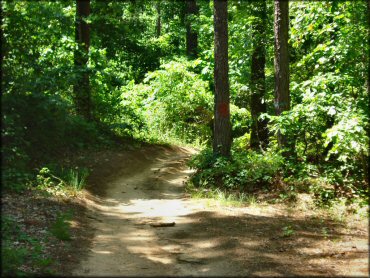
Photo Submitted 8/20/2011 (Thanks!)
Enoree Trail Photo
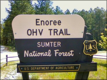
Photo Submitted 6/13/2012 (Thanks!)
Enoree Trail Photo
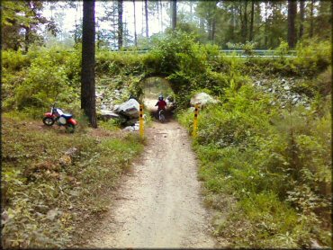
Photo Submitted 7/1/2012 (Thanks!)
Enoree Trail Photo
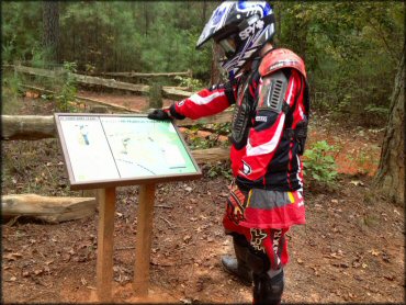
Photo Submitted 11/11/2012 (Thanks!)
RIDER COMMENTS & REVIEWS