 |
      |
| Home > Arizona > Florence Coke Ovens |
Florence Coke Ovens
Thursday, March 20, 2025
| Other Names | Martinez Canyon, Box Canyon, Queen Valley, Florence Junction, Walnut Canyon, Ajax Mine, Double Peaks, Mineral Mountain, North Butte, Bell Butte, The Rincon, Gila River, Cottonwood Canyon Road, Diversion Dam Road, Cochran Coke Ovens |
| Last Known Status | Open |
This area is very popular with the locals and if you go there you will know why.
Among the many things to see here is the "Box Canyon", a tall, narrow and colorful canyon that has a small runoff stream that flows through the center during the winter months. Old mines, houses and abandoned cabins are among other things to see. If coming in from the center of Florence, keep to the main road to reach the box canyon.
Some of the rock-face climbs will be challenging for some jeeps and trucks, however most intermediate motorcycle riders and ATVers should not have too much of a problem.
Do beware of the potential for flash flooding of the box canyon area during and after heavy rain. This is a great trail for any type of vehicle - lifted 4x4, Jeep, motorcycle, or ATV. A good time is guaranteed.
***ANNOUNCEMENTS***
Coke Ovens on Private Property
Please note that the coke ovens are located on private property. The trails themselves leading to the ovens are not closed or private but the property lines do cross the trail with no signs. Signs have been placed however someone keeps taking them down. We ask that you please respect the property owners wishes and to not remove any signage. Several clubs are trying to work with the owner to provide access.
REGULATIONS
| Permit Required | Yes | AZGFD sticker required AZ State Trust Land Recreation Permit |
| Dates Open | Year-Round | |
| Spark Arrestor | Yes | A spark arresting exhaust silencer or end cap is required for all vehicles. |
| Noise Limit | Yes (96 dB) | |
| Whip Flags | Not Required | |
| Maximum Vehicle Width | No Restriction | |
 Motorcycles & Dirt Bikes Motorcycles & Dirt Bikes | Permitted | |
 ATVs ATVs | Permitted | |
 UTV & SXS UTV & SXS | Permitted | |
 SUVs & Jeeps (registered) SUVs & Jeeps (registered) | Permitted | |
| Dune Buggy & Sand Rail 4x4 (unregistered) | Permitted | |
| 2 Stroke Engines | No Restriction | |
| MX Helmet Required | Youth Only | required for persons under 18 by state law (RiderPlanet strongly recommends helmets for all riders.) |
 Camping Camping | No Restriction | (camp anywhere) |
 Campfires Campfires | No Restriction | |
| Night Riding | Yes | Not Recommended |
| Trail Blazing | Prohibited | stay on designated trails |
| Alcohol | Prohibited | |
| Rule Enforcement | Few/Periodic |
TERRAIN
| Approx Size | 32,000 acres (50 sq mi) | |
| Miles Of Trail | 50 | |
| Climate Type | Desert | |
| Elevation | 1500 to 2500 ft. | |
| Trail Maintenance | Not Marked, Not Rated, Lightly Maintained | |
| Loose Dirt |  Little Little | |
| Hard Pack |  Some Some | |
| Sand | Some | |
| Mud | Little | |
| Dust | Little | |
| Rocks | Some | |
| Trees | Some | |
| Steep Hills | Some | side trails |
| Water Crossings |  Many Many | |
| Small Jumps | Some | |
| Large Jumps |  None None | |
| Berms | Some | |
| Sand/Gravel Pits |  Few Few | not legal |
| Single Track | None | |
| Roads |  Mostly Mostly | |
| Intersections | Many | |
| Rider Traffic | Many | |
| Shade | Some | |
| Ranges/Gunfire | Few | |
| Hazards | Few | (hazards not marked) Beware of open mine shafts. rider traffic in canyon, flash floods |
 Novice Novice | Mostly | |
 Amateur Amateur | Some | |
 Expert Expert | Some | side trails |
TYPE OF AREA
| Area | Motorized Trails |
| Land | State Trust Land |


KEY SERVICES
 Gasoline Gasoline | 5-20 Miles (S) | Chevron/Florence |
| Diesel | 5-20 Miles (NW) | Shell/Gold Canyon (480) 671-7182 |
 Water Water | 5-20 Miles (S) | Chevron/Florence |
 RV Hookup RV Hookup | 5-20 Miles (NW) | KOA/Apache Junction (480) 982-4015 |
 RV Disposal RV Disposal | 5-20 Miles (NW) | KOA/Apache Junction (480) 982-4015 |
| Campground | 5-20 Miles (NW) | KOA/Apache Junction (480) 982-4015 |
 Conv Store Conv Store | 5-20 Miles (S) | Florence |
FEES & PASSES
| Parking | (None) |
| Entry | (None) |
| Riding | (None) |
| Camping | (None) |
RATINGS
| Pros | top notch scenery, very fun narrow and tall canyon with many shallow water crossings |
| Cons | trails are not marked, busy, unclear about legal and illegal boundaries, no clear staging area, super long access road |
| Our Rating |  Excellent Excellent |
| Recommended Stay | 1-2 Days Winter/Spring |
| Comments | (Scroll Down For Rider Reviews & Comments) |
DRIVING DIRECTIONS
| Nearest City | Florence, AZ | ||
| From: Mesa, AZ
1) Take Hwy 60 East to Exit 212 (Florence Junction) 2) Turn right (south) off the exit ramp onto Hwy 79, continue 5.4 miles 3) Look for a cattle guard on the left (east), turn here. For the south entrance staging area 4) Continue 9.9 miles 5) Turn left (east) on Diversion Dam Road, continue 5.1 miles 6) Look for a large flat open area on the left, turn here. |


OFFICIAL CONTACTS
| Contact Info | Arizona State Land Department 1616 W. Adams Street Phoenix, AZ 85007 (602) 364-2753 land.az.gov |
| Contact Info | BLM - Arizona State Office One North Central Ave. Suite 800 Phoenix, AZ 85004-4427 (602) 417-9200 asoweb_az@blm.gov www.blm.gov |
| Contact Info | Arizona ATV Adventure Tours 3301 North State Rte 79 Florence, AZ 85232 (800) 242-6335 (520) 577-1824 azatv777@hotmail.com www.arizonaatvadventures.com |
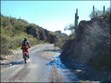
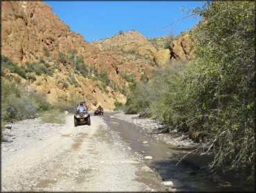
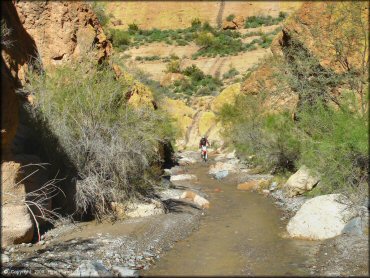
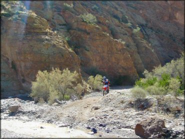
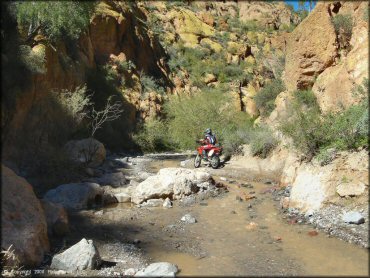
Florence Coke Ovens Trail Photo
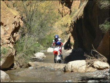
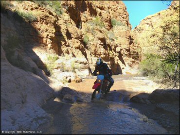
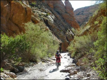
The box canyon portion of the trail has high walls and shallow water (usually).
Florence Coke Ovens Trail Photo
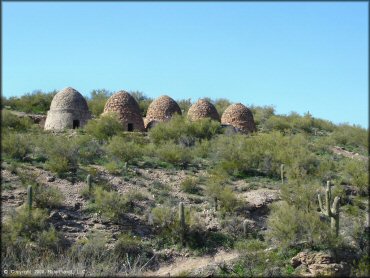
The beehived shaped ovens were once used to produce coke for smelting gold and silver ore during the late 1800's. The ovens are on private property, and are off limits to the public.
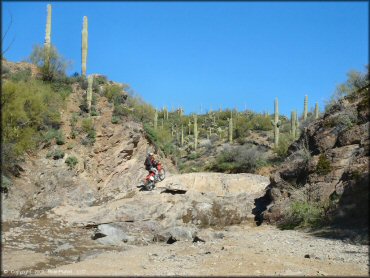
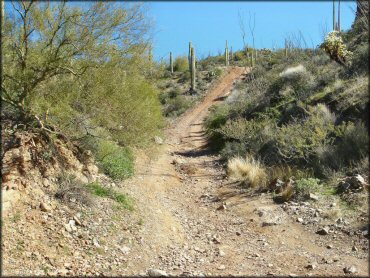
Florence Coke Ovens Trail Photo
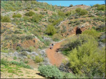
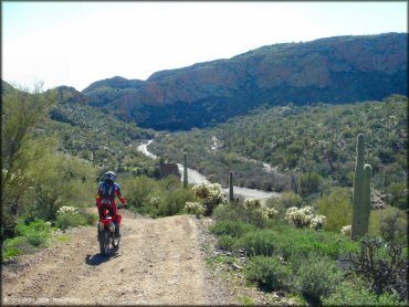
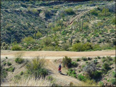
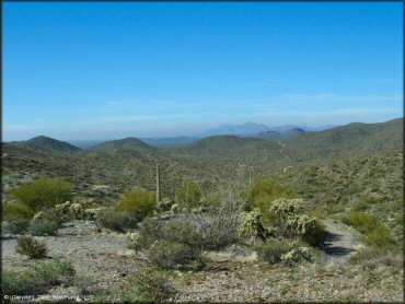
There are also some abandoned mines to see and great desert scenery. The trails are wide, but not always smooth.
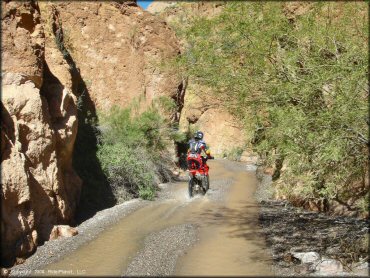
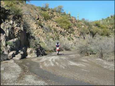
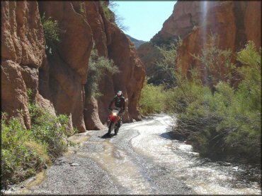
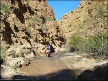
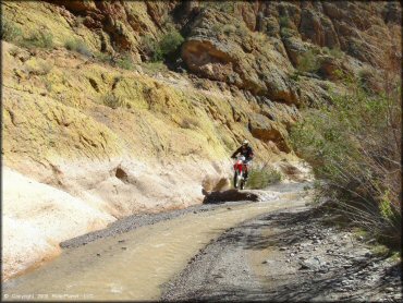
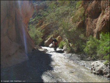
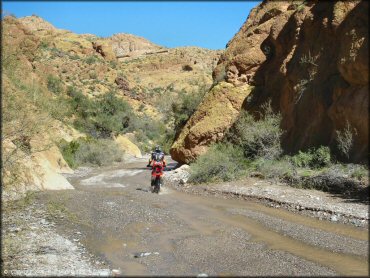
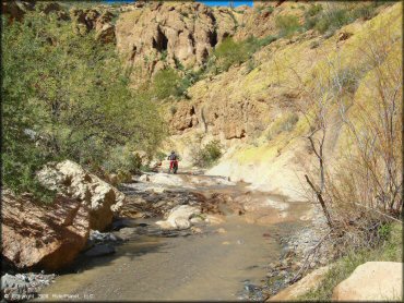
Florence Coke Ovens Trail Photo
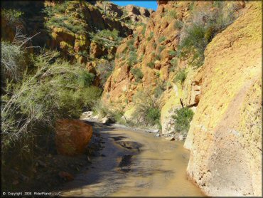
The box canyon gets pretty narrow where the stream becomes the trail. Full size trucks will not find much room to spare.
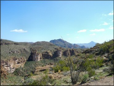
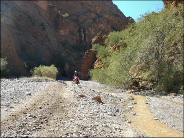
Florence Coke Ovens Trail Photo
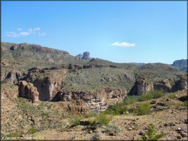
There are plenty of rugged cliffs and canyons in the area.
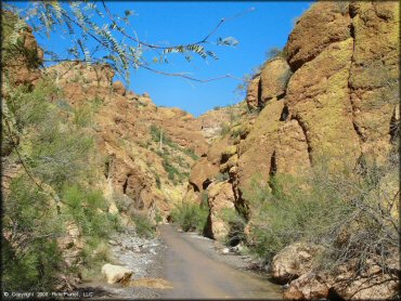
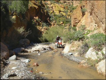
Florence Coke Ovens Trail Photo
The box canyon is narrow with steep and rugged walls. The stream is seasonal but is usually pretty shallow.
Florence Coke Ovens Trail Photo
The area is popular with all vehicle types, especially with 4x4s and ATVs.
Florence Coke Ovens Trail Photo
This is probably one of the most unique places to ride in the United States. Where else can you pop a wheelie with this kind of scenery?
Florence Coke Ovens Trail Photo
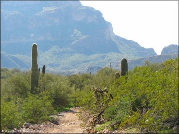
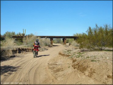
In some parts you can see an old train bridge that crosses the Gila River in the distance.
Florence Coke Ovens Trail Photo
These trails are actually old mining roads and are wide enough for trucks and side by sides.
Florence Coke Ovens Trail Photo
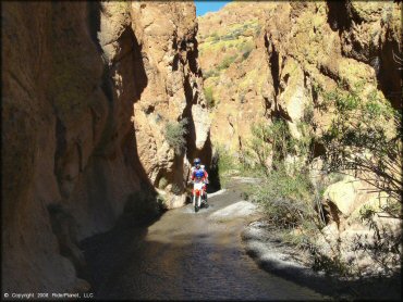
The box canyon is about a mile long each way. The ride is so much fun you will want to go through it at least several times.
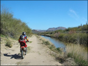
Florence Coke Ovens Trail Photo
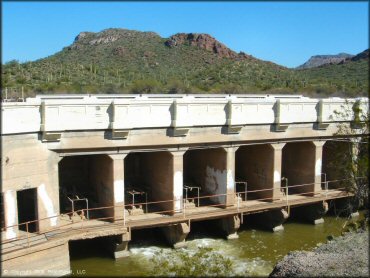
You'll pass by the dam if you come in from Florence. You can often cross the river below the dam, to reach the sand pits.
Florence Coke Ovens Trail Photo
This wash is another diversion off the main road coming in from Florence (south entrance).
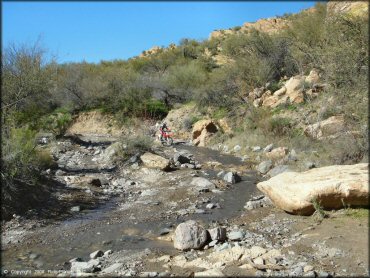
Florence Coke Ovens Trail Photo
Some sections of the stream can be a little deep but nothing too bad.
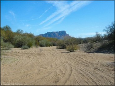
Florence Coke Ovens Trail Photo
You can find just about every type of terrain in this area.
Florence Coke Ovens Trail Photo
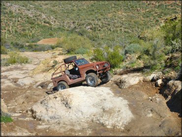
Compact and modified trucks will have a blast here. This is the perfect place to test those rock crawling skills.
Florence Coke Ovens Trail Photo
Entering the box canyon. Creosote, mesquite and various cacti line the edges of the canyon.
Florence Coke Ovens Trail Photo
There are plenty of side roads to explore. Some are dead-ends but are still fun to check out.
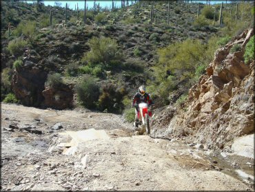
Florence Coke Ovens Trail Photo
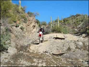
A rugged little section called the "Stair Steps". Careful wheel placement is required for those with four wheels, but dirt bikes will have an easier time (if choosing the right line).
Florence Coke Ovens Trail Photo
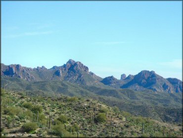
The area is surrounded by rugged mountains.
Florence Coke Ovens Trail Photo
Riding through the stream and pea sized gravel was a lot of fun.
Florence Coke Ovens Trail Photo
One of the wider sections of the stream before it enters the box canyon.
Florence Coke Ovens Trail Photo
Some sections of the stream are a little chunky, but most rocks can be easily avoided on the dirt bike.
Florence Coke Ovens Trail Photo
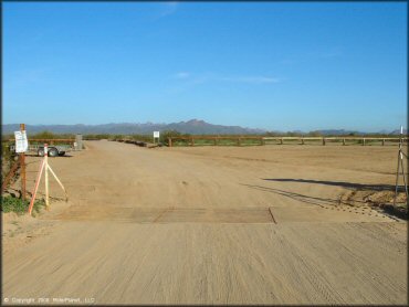
This is the main staging area (northern). You can access the trails from here by following Cottonwood Canyon Road.
Florence Coke Ovens Trail Photo
Like most of Arizona, the scenery is top notch. You have to really try to not get a good photo.
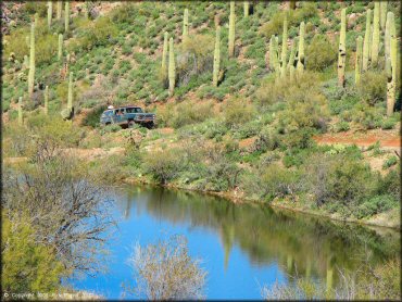
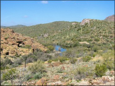
Florence Coke Ovens Trail Photo
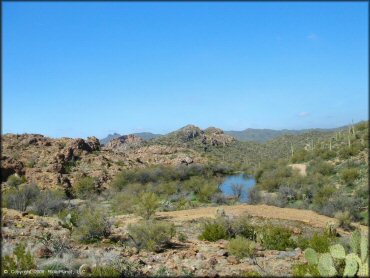
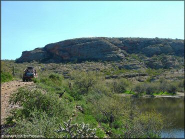
Another view of one of the seasonal ponds.
Florence Coke Ovens Trail Photo
This was the perfect day to ride - mid 70's, not a cloud in the sky and beautiful scenery everywhere you looked.
Florence Coke Ovens Trail Photo
Florence Coke Ovens Trail Photo
There are some great ATV guided tours that run up this canyon from Florence.
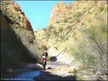
Florence Coke Ovens Trail Photo
Another view of riding through the box canyon.
Florence Coke Ovens Trail Photo
A rugged little section called the "Stair Steps".
Florence Coke Ovens Trail Photo
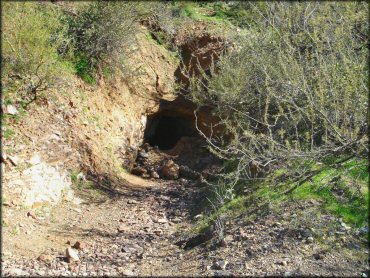
One of the many abandoned mines. During the late 1800's and early 1900's, this area was known for its gold, silver and copper mines.
Florence Coke Ovens Trail Photo
Several rocks like this can be found throughout the canyon, where you can get a little air or pop a wheelie.
Florence Coke Ovens Trail Photo
Picking the right line can make going up and down the stair steps much easier.
Florence Coke Ovens Trail Photo
Another example of where the stream becomes the trail.
Florence Coke Ovens Trail Photo
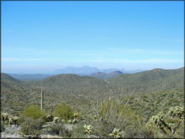
Fantastic views of the nearby mountains and desert flora are found at almost every turn.
Florence Coke Ovens Trail Photo
This small runoff stream is a lot of fun to ride through. Going through it once is not enough.
Florence Coke Ovens Trail Photo
This is a one of a kind destination that offroad enthusiasts need to visit at least once. A good time is guaranteed.
Florence Coke Ovens Trail Photo
This canal is on the south side of the river and this road leads to some sandy play pits.
Florence Coke Ovens Trail Photo
Yep, there is sand here too.
Florence Coke Ovens Trail Photo
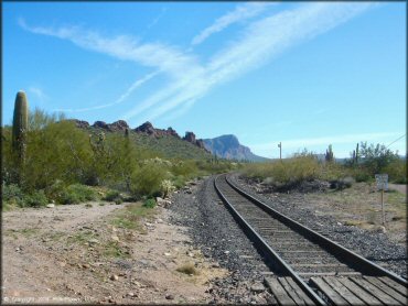
If staging to the south off Price Station Road, you will have to cross the railroad tracks to reach the trails and box canyon.
Florence Coke Ovens Trail Photo
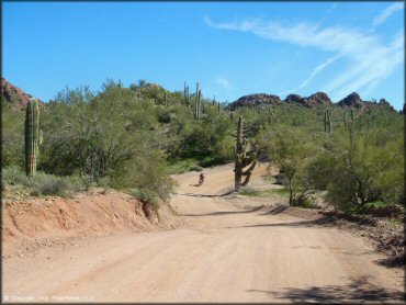
Both routes (northern and southern entrances) start out pretty smooth. Just stay on the main road and you'll reach the canyon.
Florence Coke Ovens Trail Photo
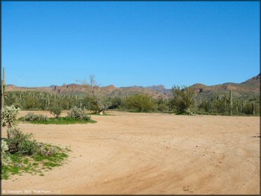
One of the staging areas (southern entrance) off Box Canyon Road. Trailers should have no problem parking here.
Florence Coke Ovens Trail Photo
Aproaching the box canyon from the south.
Florence Coke Ovens Trail Photo
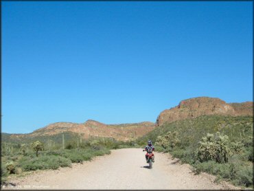
One of the side routes to explore. The rugged scenery and terrain is amazing.
Florence Coke Ovens Trail Photo
Florence Coke Ovens Trail Photo
Dirt bikes and smaller ATVs will have no problem navigating the canyon. Jeeps and trucks will have to be more careful about tire placement.
Florence Coke Ovens Trail Photo
One of the seasonal ponds in the area. You can see one of the 4x4 trails in the back.
Florence Coke Ovens Trail Photo
Following the stream will take you though some twisty sections of the canyon.
Florence Coke Ovens Trail Photo
Some sections of the box canyon have some cool rock obstacles to pass through.
Florence Coke Ovens Trail Photo
A good view of what most of the trails look like.
Florence Coke Ovens Trail Photo
RIDER COMMENTS & REVIEWS