 |
      |
| Home > Arizona |

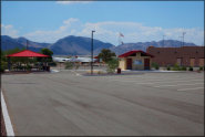
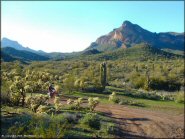
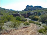 Agua Caliente
Status: Open
Type: Trail (BLM)
Location: Arlington, AZ
Difficulty:

Because it is so hot and dry, Agua Caliente is best explored during the winter or spring months. More...
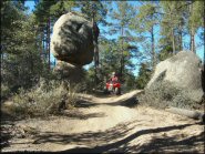 Alto Pit OHV Area
 Status: Open
Type: Trail (National Forest)
Location: Prescott, AZ
Difficulty:
This OHV area consists of a granite pit and many surrounding ATV trails that range from beginner to intermediate. More...
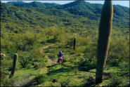
 Antelope Valley
 Status: Open
Type: Trail (National Forest)
Location: Heber-overgaard, AZ
Difficulty:
This part of Arizona offers miles of forest service roads and ATV trails to explore. More...
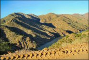 Apache Trail
Status: Open
Type: Other (National Forest, Wilderness)
Location: Apache Juntion, AZ
Difficulty:
Apache Trail is a 200 mile mostly paved scenic byway loop that starts from Apache Junction and connects Hwy 88 to I-60 back to Apache Junction. More...
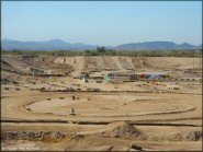 Arizona Cycle Park
Status: Open
Type: Combo (Privately Owned / Commercial)
Location: Buckeye, AZ
Difficulty:
This motocross park has four tracks that cater to all levels of dirt bike riding including MX, MX 85, amateur supercross and pit bikes. More...
 Arizona Peace Trail
 Status: Open
Type: Trail (BLM)
Location: Quartzsite, AZ
Difficulty:
This offroad trail forms a long loop with multiple access points to the surrounding towns of Bouse, Parker, Lake Havasu, Salome, Quartzsite, Cibola and Wikieup. More...
 Black Hills Box Canyon
 Status: Open
Type: Trail (AZ State Trust Land)
Location: Wickenburg, AZ
Difficulty:
If you are looking for an alternative to the Florence Box Canyon you can check out this place near Wickenburg. More...
 Boulders OHV Area
 Status: Open
Type: Trail (BLM, State Trust Land)
Location: Peoria, AZ
Difficulty:
This area has many miles of designated off-road trails with sand washes that wind past old windmills and corrals in the rolling desert hills. More...
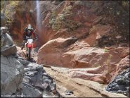
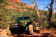 Broken Arrow Trail
 Status: Open
Type: Trail (National Forest)
Location: Sedona, AZ
Difficulty:
This popular 4x4 trail is known for its spectacular views of canyons, reddish/orange colored cliffs and tall hoodoos. More...
 Bulldog Canyon OHV Area
 Status: Open
Type: Trail (National Forest)
Location: Mesa, AZ
Difficulty:
Primarily a 4x4 playground, this area has numerous rocky desert trails with some great scenery. More...
(Page 1 of 8)

Coke Ovens on Private Property
Florence Coke Ovens
Please note that the coke ovens are located on private property. The trails themselves leading to the ovens are not closed or private but the property lines do cross the trail with no signs. Signs have been placed however someone keeps taking them down. We ask that you please respect the property owners wishes and to not remove any signage. Several clubs are trying to work with the owner to provide access.
Details... Map...
4th Annual Cherry Creek UTV Fest
4th Annual Cherry Creek UTV Fest A Fun Weekend For ATVs And Side By Sides! The 4th Annual Cherry Creek UTV Fest is scheduled for May 17-19 near Heber-Young, Arizona. For more information e-mail kyle@utvoffroadadventures.com or call (623) 363-9665.
Details...North Rim UTV Fun Run
North Rim UTV Fun Run A Fun Weekend For ATVs And Side By Sides! A UTV and ATV Fun Run is scheduled for July 5-7 near Fredonia, AZ. For more information e-mail kyle@utvoffroadadventures.com or call (623) 363-9665.
Details...Williams To the Grand Canyon UTV Fun Run
Williams To the Grand Canyon UTV Fun Run A Fun Weekend For ATVs And Side By Sides! A UTV and ATV Fun Run is scheduled for July 19-21 near Williams, AZ. For more information e-mail kyle@utvoffroadadventures.com or call (623) 363-9665.
Details...(Page 1 of 8)