 |
      |
| Home > Arizona > Bulldog Canyon |
Bulldog Canyon OHV Area
Wednesday, December 31, 2025
| Other Names | Dome Mountain, Orophi Mountains, Pass Mountain, Goldfield Mountains, Salt River, Tonto National Forest, Mesa Ranger District |
| Last Known Status | Open |
Primarily a 4x4 playground, this area has numerous rocky desert trails with some great scenery. A gate combination code and a permit is required to access the area, which can be obtained online. There is a small fee charged for the permit but the process is quite simple and only takes a few minutes.
The south staging area has a really fun play pit with numerous trails and it comprises the most interesting terrain for ATVs and motorcycles. The rules state clearly that you need to stay on marked trails only, and that only some trails are open for vehicles, but the markings for motorized use can only be seen on the map that you receive with your pass so be sure to bring it on the trail with you.
Most of the motorized routes are simply 4x4 roads but the scenery is great here. ATV riders will probably have more fun than motorcyclists, primarily because one route is extremely chunky, and the other is relatively smooth and unchallenging. Primitive camping is permitted but there are no services.
REGULATIONS
| Permit Required | Yes | AZGFD sticker required Tonto FS Permit |
| Dates Open | Year-Round | |
| Other ATV Stickers Accepted | No | All non-residents must purchase an Arizona OHV decal. |
| Spark Arrestor | Yes | A spark arresting exhaust silencer or end cap is required for all vehicles. |
| Noise Limit | Yes (96 dB) | |
| Whip Flags | Not Required | |
| Maximum Vehicle Width | No Restriction | |
 Motorcycles & Dirt Bikes Motorcycles & Dirt Bikes | Permitted | |
 ATVs ATVs | Permitted | |
 UTV & SXS UTV & SXS | Permitted | |
 SUVs & Jeeps (registered) SUVs & Jeeps (registered) | Permitted | |
| Dune Buggy & Sand Rail 4x4 (unregistered) | Permitted | |
| 2 Stroke Engines | No Restriction | |
| MX Helmet Required | Youth Only | required for persons under 18 by state law (RiderPlanet strongly recommends helmets for all riders.) |
 Camping Camping | Some Areas | |
 Campfires Campfires | Prohibited | |
| Night Riding | Yes | |
| Trail Blazing | Prohibited | stay on the trail |
| Rule Enforcement | Few/Periodic |
TERRAIN
| Approx Size | 34,000 acres (53 sq mi) | |
| Miles Of Trail | 20 | |
| Climate Type | Desert | |
| Elevation | 1500 to 2500 ft. | |
| Trail Maintenance | Marked, Not Rated, Lightly Maintained | |
| Loose Dirt |  Some Some | |
| Hard Pack | Some | |
| Sand |  Little Little | |
| Mud | Little | |
| Dust | Little | |
| Rocks |  Mostly Mostly | |
| Trees |  None None | |
| Steep Hills |  Few Few | |
| Water Crossings |  Many Many | seasonal |
| Small Jumps | Few | |
| Large Jumps | None | |
| Berms | Few | |
| Sand/Gravel Pits | None | |
| Single Track | None | |
| Roads |  All All | |
| Intersections | Few | |
| Rider Traffic | Few | |
| Shade | None | |
| Ranges/Gunfire | Few | |
| Hazards | Few | (hazards not marked) loose boulders |
 Novice Novice | Little | |
 Amateur Amateur | Mostly | |
 Expert Expert | Some | |
| Comment | Trail 10 is extremely rocky, 1356 is somewhat rocky but more smoother for motorcycles. | |
TYPE OF AREA
| Area | Motorized Trails |
| Land | National Forest |
GPS POINTS


KEY SERVICES
 Gasoline Gasoline | 5-20 Miles (SW) | Chevron/Mesa (480) 357-3822 |
| Diesel | 5-20 Miles (SW) | Chevron/Mesa (480) 357-3822 |
 Water Water | 5-20 Miles (SW) | Chevron/Mesa (480) 357-3822 |
 RV Hookup RV Hookup | 5-20 Miles (SE) | Lost Dutchman State Park (480) 982-4485 |
 RV Disposal RV Disposal | 5-20 Miles (SE) | Lost Dutchman State Park (480) 982-4485 |
| Campground | 5-20 Miles (SE) | Lost Dutchman State Park (480) 982-4485 |
 Conv Store Conv Store | 5-20 Miles (SW) | Chevron/Mesa (480) 357-3822 |
FEES & PASSES
| Parking | (None) |
| Entry | (None) |
| Riding | Yes ($10.00 per rider) $10 for 3-day permit, $60 for 6-month permit, $80 for annual permit |
| Camping | (None) |
RATINGS
| Pros | free, spectacular desert scenery |
| Cons | need to get permit & gate combo from forest service, no actual trails only roads, can ride roads only, trails are extremely rocky, trails are difficult to determine, no services |
| Our Rating |  Fair Fair |
| Recommended Stay | Half Day Spring |
| Comments | (Scroll Down For Rider Reviews & Comments) |
DRIVING DIRECTIONS
| Nearest City | Mesa, AZ | ||
| Address | Cactus Road, Mesa, AZ 85215 | ||
| From: Phoenix, AZ
1) Take Hwy 60 East to Exit 196 2) Turn left (north) off the exit ramp onto Idaho Road, continue 5.3 miles 3) Turn right (east) onto McKellips Blvd, continue .5 miles 4) Turn left (north) on Wolverine Pass Road, continue .9 miles 5) Veer right on Tonto Street, continue .2 miles 6) Turn left (north) onto Cactus Road, continue .2 miles to staging area. |


OFFICIAL CONTACTS
| Contact Info | Tonto National Forest - Mesa Ranger District 5140 E. Ingram Street Mesa, AZ 85205 (480) 610-3300 sm.fs.tontowebmail@usda.gov www.fs.usda.gov |
| Contact Info | Arizona State Parks OHV Program (602) 542-6942 (602) 542-2146 mrogers@azstateparks.gov meberhart@azstateparks.gov azstateparks.com |
| Comment | Arizona State Parks OHV Grants Program |
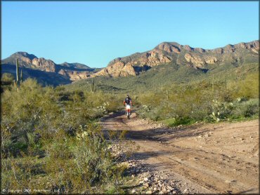
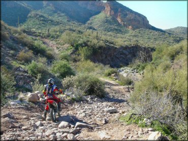
Bulldog Canyon Trail Photo
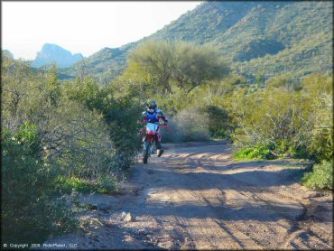
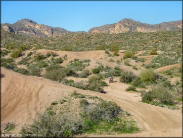
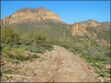
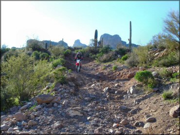
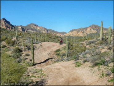
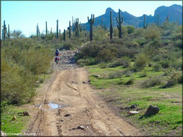
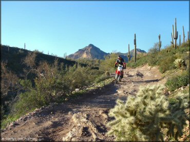
This is the smoother of the two main motorized routes. The scenery was great but the trail is really just a road.
Bulldog Canyon Trail Photo
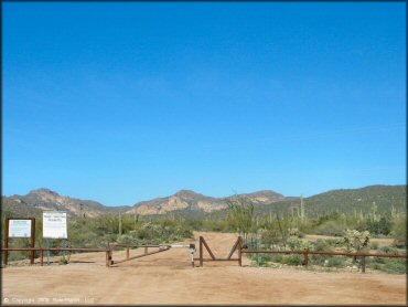
The access gate is locked and a combination and pass are required to enter. There is a small parking area outside the gate.
Bulldog Canyon Trail Photo
Bulldog Canyon Trail Photo
Bulldog Canyon Trail Photo
Bulldog Canyon Trail Photo
Bulldog Canyon Trail Photo
Bulldog Canyon Trail Photo
Bulldog Canyon Trail Photo
Bulldog Canyon Trail Photo
Bulldog Canyon Trail Photo
Bulldog Canyon Trail Photo
Bulldog Canyon Trail Photo
Bulldog Canyon Trail Photo
Bulldog Canyon Trail Photo
Bulldog Canyon Trail Photo
Bulldog Canyon Trail Photo
Bulldog Canyon Trail Photo
Bulldog Canyon Trail Photo
Bulldog Canyon Trail Photo
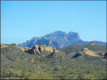
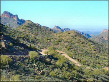
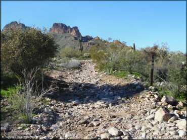
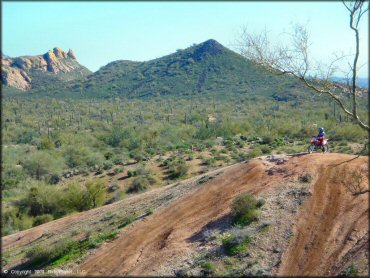
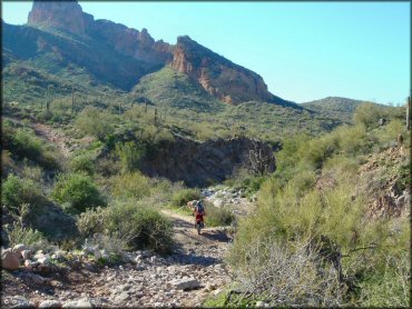
A view from the access road.
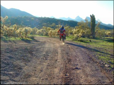
Bulldog Canyon Trail Photo
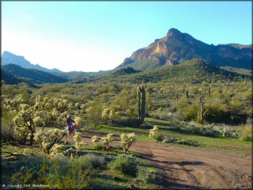
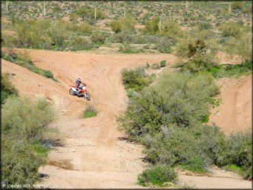
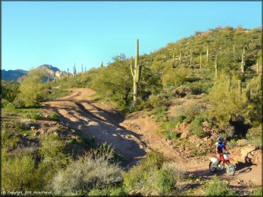
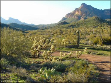
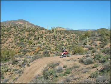
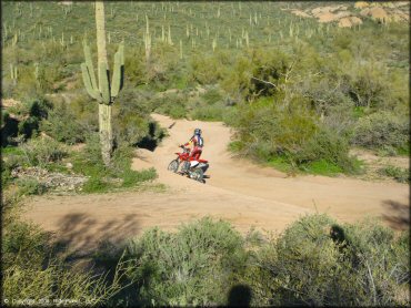
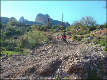
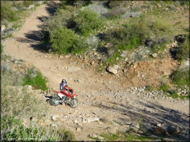
The play area was the best part for motorcycles.
Bulldog Canyon Trail Photo
Bulldog Canyon Trail Photo
Bulldog Canyon Trail Photo
Bulldog Canyon Trail Photo
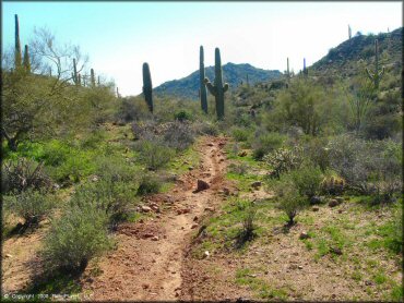
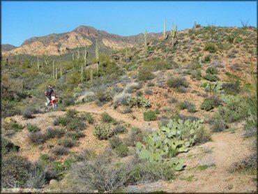
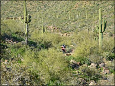
This single track looked great, but according to the map it's off limits.
Bulldog Canyon Trail Photo
Bulldog Canyon Trail Photo
Bulldog Canyon Trail Photo
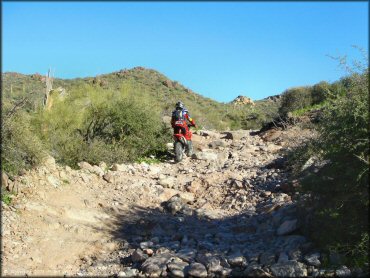
Bulldog Canyon Trail Photo
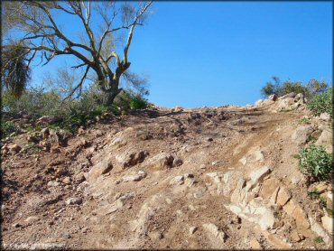
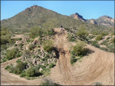
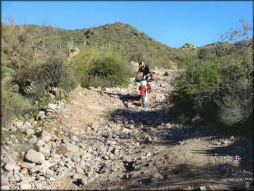
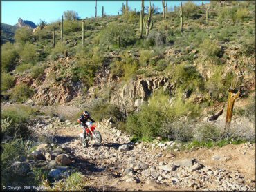
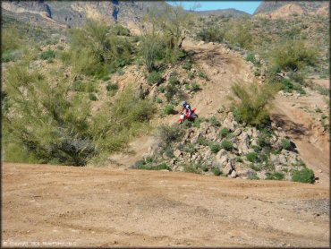
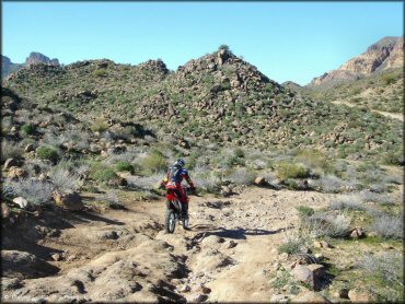
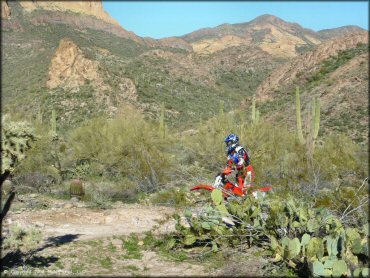
It was rare to get more than a 20 yard section of smooth trail on this route... very rocky.
Bulldog Canyon Trail Photo
Bulldog Canyon Trail Photo
Bulldog Canyon Trail Photo
Bulldog Canyon Trail Photo
Bulldog Canyon Trail Photo
Bulldog Canyon Trail Photo
RIDER COMMENTS & REVIEWS