 |
      |
| Home > Arizona > Agua Caliente |
Agua Caliente
Saturday, May 10, 2025
| Other Names | Agua Caliente Scenic Drive, Yellow Medicine Hills, Gila Bend Mountains, Sonoran Desert, Gila Compressor Station, Eagletail Mountain Wilderness, Saddle Mountain, Black Butte, Fourth Of July Butte, Face Mountain, Coppper Wash |
| Last Known Status | Open |
Because it is so hot and dry, Agua Caliente is best explored during the winter or spring months. Old mines and some narrow washes are among the many things to discover. (There used be a ghost town at Sundad but it has been leveled.) Although you won't find a lot of challenging terrain or specific motorcycle or ATV trails, there is still a large network of sand washes and general 4x4 roads in a very remote setting. It's a good place for cruising.
This area was a popular place to go in the late 1880's and early 1900's and the hot springs in the area were used for medicinal purposes. The sandy trails are surrounded by beautiful desert vegetation with the southern route climbing onto the Sentinel Plain lava flow - a landscape of lava from 15 to 45 meters thick.
There are no services and no drinking water in the area, but nearby Painted Rock Campground does have picnic tables, BBQ grills, fire rings and vault toilets, plus an opportunity to view the prehistoric petroglyphs.
REGULATIONS
| Permit Required | Yes | AZGFD sticker required |
| Dates Open | Year-Round | |
| Other ATV Stickers Accepted | No | All non-residents must purchase an Arizona OHV decal. |
| Spark Arrestor | No | A spark arresting exhaust silencer or end cap is not required but is always recommended. |
| Noise Limit | Yes (96 dB) | |
| Whip Flags | Not Required | |
| Maximum Vehicle Width | No Restriction | |
 Motorcycles & Dirt Bikes Motorcycles & Dirt Bikes | Permitted | |
 ATVs ATVs | Permitted | |
 UTV & SXS UTV & SXS | Permitted | |
 SUVs & Jeeps (registered) SUVs & Jeeps (registered) | Permitted | |
| Dune Buggy & Sand Rail 4x4 (unregistered) | Permitted | |
| 2 Stroke Engines | No Restriction | |
| MX Helmet Required | Youth Only | required for persons under 18 by state law (RiderPlanet strongly recommends helmets for all riders.) |
 Camping Camping | No Restriction | (camp anywhere) |
 Campfires Campfires | No Restriction | |
| Night Riding | Yes | |
| Trail Blazing | Prohibited | riders must stay on trail |
| Rule Enforcement | Few/Periodic |
TERRAIN
| Approx Size | 128,000 acres (200 sq mi) | |
| Miles Of Trail | 25 | |
| Climate Type | Desert | |
| Elevation | 800 to 1700 ft. | |
| Trail Maintenance | Not Marked, Not Rated, Lightly Maintained | |
| Loose Dirt |  Little Little | |
| Hard Pack |  Mostly Mostly | |
| Sand |  Some Some | |
| Mud |  None None | |
| Dust | Little | |
| Rocks | Little | |
| Trees | None | |
| Steep Hills |  Few Few | |
| Water Crossings | Few | seasonal |
| Small Jumps | Few | |
| Large Jumps | Few | |
| Berms | None | |
| Sand/Gravel Pits | None | |
| Single Track | Few | |
| Roads | Mostly | |
| Intersections | Some | |
| Rider Traffic | Few | |
| Shade | Few | |
| Ranges/Gunfire | Few | |
| Hazards | None | |
 Novice Novice | Mostly | |
 Amateur Amateur | Some | |
 Expert Expert | Little |
TYPE OF AREA
| Area | Motorized Trails |
| Land | BLM |
GPS POINTS


KEY SERVICES
 Gasoline Gasoline | 5-20 Miles (NE) | Shell/Buckeye |
| Diesel | 5-20 Miles (NE) | Shell/Buckeye |
 Water Water | 5-20 Miles (NE) | Shell/Buckeye |
 RV Hookup RV Hookup | 20-30 Miles (S) | Augie's Quail Trail RV Park/Gila Bend (928) 683-2850 |
 RV Disposal RV Disposal | 20-30 Miles (S) | Augie's Quail Trail RV Park/Gila Bend (928) 683-2850 |
| Campground | 5-20 Miles (E) | Buckeye Hills Regional Park (623) 932-3811 |
 Conv Store Conv Store | 5-20 Miles (NE) | Shell/Buckeye |
FEES & PASSES
| Parking | (None) |
| Entry | (None) |
| Riding | (None) |
| Camping | (None) |
RATINGS
| Pros | large area, beautiful desert scenery |
| Cons | no services |
| Our Rating |  Good Good |
| Recommended Stay | Full Day |
| Comments | (Scroll Down For Rider Reviews & Comments) |
DRIVING DIRECTIONS
| Nearest City | Arlington, AZ | ||
| Address | Agua Caliente Road, Arlington, AZ 85322 | ||
| From: Phoenix, AZ
1) Take I-10 West to Exit 112 2) Merge onto Hwy 85 South, continue 3.5 miles 3) Turn right (west) onto Baseline Road, continue about 3 miles 4) Turn left (south) onto Palo Verde Road, continue 2 miles 5) Turn right (west) onto Old Hwy 80, continue about 11 miles 6) Turn right (west) onto Agua Caliente Road, continue .7 miles 7) Veer right to stay on Agua Caliente Road, continue about 300 yards 8) Turn left onto gravel road, stage here. |


OFFICIAL CONTACTS
| Contact Info | BLM - Phoenix Field Office 21605 N. 7th Ave Phoenix, AZ 85027-2099 (623) 580-5500 asoweb_az@blm.gov www.blm.gov |
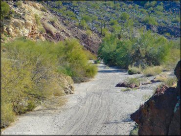
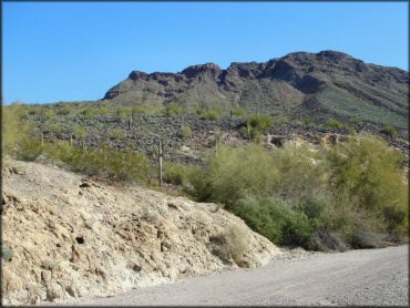
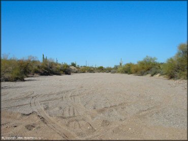
Agua Caliente Trail Photo
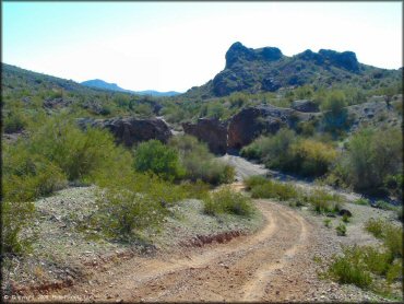
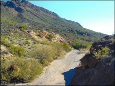
The area consists mostly of sand washes and 4x4 roads like this one.
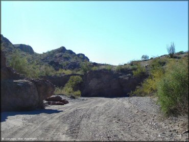
Agua Caliente Trail Photo
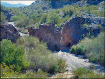
There are some really cool sand washes and channels.
Agua Caliente Trail Photo
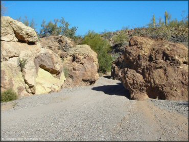
Some of the channels look pretty narrow but there wasn't anything too narrow for a compact truck.
Agua Caliente Trail Photo
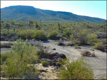
Agua Caliente Trail Photo
Although the terrain is pretty mild, the rules of the Arizona desert still apply. Be sure to bring supplies, especially water.
Agua Caliente Trail Photo
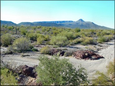
The main route is basically just a well maintained dirt road.
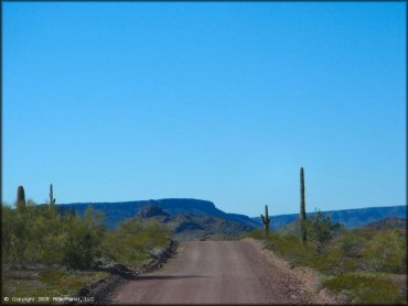
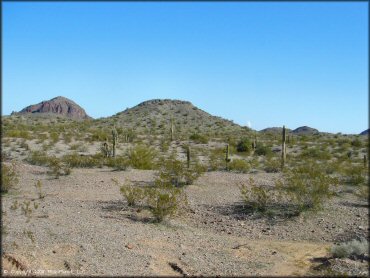
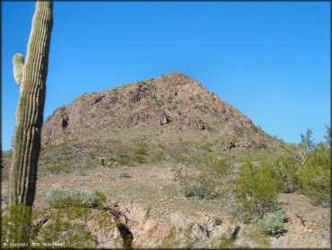
Agua Caliente Trail Photo
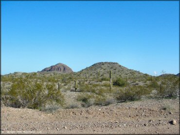
If you enjoy huge open spaces and appreciate scenic views you'll have a nice drive or ride.
Agua Caliente Trail Photo
These channels in the sand wash were kind of fun.
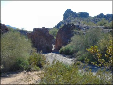
Agua Caliente Trail Photo
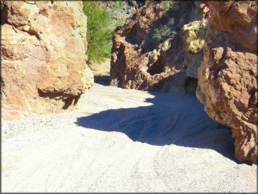
This was probably the narrowest of the channels we saw. A full size truck could maybe lose some paint here.
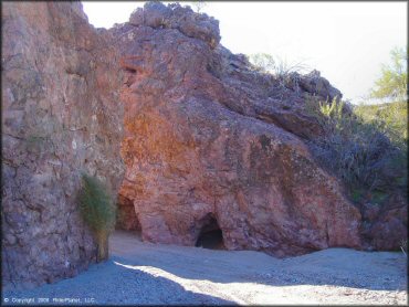
Agua Caliente Trail Photo
Agua Caliente Trail Photo
Agua Caliente Trail Photo
Agua Caliente Trail Photo
Agua Caliente Trail Photo
Agua Caliente Trail Photo
Agua Caliente Trail Photo
Agua Caliente Trail Photo
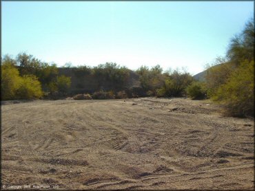
One of the places to set up camp.
Agua Caliente Trail Photo
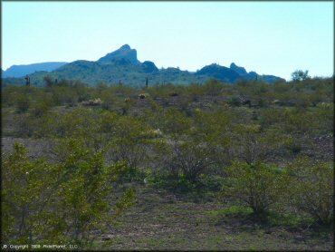
Agua Caliente Trail Photo
Some nice scenery.
RIDER COMMENTS & REVIEWS