 |
      |
| Home > California > Clay Pit |
Clay Pit SVRA
Wednesday, September 3, 2025
| Other Names | Oroville, Feather River Valley, Thermalito |
| Last Known Status | Open |
This 220 acre riding area was created in the depression left from where clay was excavated to build the Lake Oroville Dam. And depression, is what you are going to feel if you drive more than 30 miles to get there.
This is not a vacation destination. It's a small, flat practice area where an average 2WD car could tackle 90% of the terrain. The are a few trees and a couple of small pop-up jumps, and when we say a couple, we mean... one.
Ok, we're sorry. It's a great place for the local kids, for giving ATV lessons, or for breaking in a new top end, and as riders we are grateful for any public land we have. The area is lightly patrolled, with one hazard that is clearly marked, and no services.
REGULATIONS
| Permit Required | Yes | CA OHMVR stickers required |
| Dates Open | Daily 8am to sunset | CA OHMVR red sticker vehicles permitted from 9/1 to 6/30 |
| Other ATV Stickers Accepted | Yes | Residents of any state not listed must purchase a Nonresident OHV Use Permit. (AR, AZ, CA, CO, CT, DE, IA, ID, IN, LA, MA, MD, ME, MI, MN, MO, MT, ND, NH, NJ, NM, NV, NY, OH, OK, OR, PA, RI, TX, UT, VT, WA, WI, WY) |
| Spark Arrestor | Yes | A spark arresting exhaust silencer or end cap is required for all vehicles. |
| Noise Limit | Yes (96 dB) | CA OHMVR noise limits apply (1985/older limit 101 dB, 1986/newer limit 96 dB) |
| Whip Flags | Not Required | |
| Maximum Vehicle Width | No Restriction | |
 Motorcycles & Dirt Bikes Motorcycles & Dirt Bikes | Permitted | CA OHMVR stickers required |
 ATVs ATVs | Permitted | CA OHMVR stickers required |
 UTV & SXS UTV & SXS | Permitted | CA OHMVR stickers required |
 SUVs & Jeeps (registered) SUVs & Jeeps (registered) | Permitted | |
| Dune Buggy & Sand Rail 4x4 (unregistered) | Permitted | CA OHMVR stickers required |
| 2 Stroke Engines | Certain Times | CA OHMVR restrictions apply |
| MX Helmet Required | Yes | helmets required by state law |
 Camping Camping | Prohibited | |
 Campfires Campfires | Prohibited | |
| Night Riding | No | riding hours 8am to sunset |
| Trail Blazing | Permitted | |
| Alcohol | Some Areas | CA open container laws |
| Rule Enforcement | None |
TERRAIN
| Approx Size | 220 acres | |
| Miles Of Trail | 3 | |
| Climate Type | Large Clay Pit | |
| Elevation | 50 to 150 ft. | |
| Trail Maintenance | Not Marked, Not Rated, Not Maintained | |
| Loose Dirt |  None None | |
| Hard Pack |  All All | |
| Sand | None | |
| Mud |  Some Some | |
| Dust | Some | |
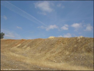
| Rocks | Some | lots of loose baseball sized sharp rocks |
| Trees |  Few Few | |
| Steep Hills | None | |
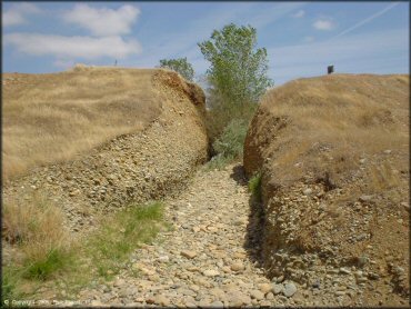
| Water Crossings | Few | couple crossings irrigation/drainage ditch aprox 12ft wide |
| Small Jumps | Few | |
| Large Jumps | None | |
| Berms | None | |
| Sand/Gravel Pits | None | |
| Single Track | None | |
| Roads |  Mostly Mostly | |
| Intersections | Some | |
| Rider Traffic | Few | |
| Shade | Few | adequate - 10-20 shady parking spots from trees |
| Ranges/Gunfire | None | prohibited, but firing range adjacent (to the south) |
| Hazards | Few | (hazards not marked) |
 Novice Novice | All | |
 Amateur Amateur |  Little Little | |
 Expert Expert | None | |
| Comment | easy terrain - novice | |
TYPE OF AREA
| Area | Gravel Pit, area is a large open pit |
| Land | State Recreation |
GPS POINTS


KEY SERVICES
 Gasoline Gasoline | 5-20 Miles (NE) | Jiffy Food Stores (530) 534-5015 |
| Diesel | 5-20 Miles (NE) | Valero Gas Station (530) 533-3560 |
 Water Water | 5-20 Miles (NE) | River One RV Park (530) 533-8679 |
 RV Hookup RV Hookup | 5-20 Miles (NE) | River One RV Park (530) 533-8679 |
 RV Disposal RV Disposal | 5-20 Miles (NE) | River One RV Park (530) 533-8679 |
| Campground | 1-5 Miles (S) | Oroville Wildlife Area Campground (530) 538-2236 |
 Conv Store Conv Store | 5-20 Miles (NE) | Jiffy Food Stores (530) 534-5015 |
FEES & PASSES
| Parking | (None) |
| Entry | (None) |
| Riding | (None) |
| Camping | (None) |
RATINGS
| Pros | not very busy, not patrolled, good for novices, good place to learn or fix bike, have picnic, all hazards are clearly marked |
| Cons | no services, no challenging terrain |
| Our Rating |  Fair Fair |
| Recommended Stay | Half Day |
| Comments | (Scroll Down For Rider Reviews & Comments) |
DRIVING DIRECTIONS
| Nearest City | Oroville, CA | ||
| Address | 4900 Larkin Road, Oroville, CA 95965 | ||
| From: Sacramento, CA
1) Take Highway 70 North to Exit 46 2) Turn left (west) onto Oroville Dam Blvd, continue 2 miles 3) Turn left (south) on Larkin Road, continue 2 miles 4) Park entrance is on the left (south-east). |


OFFICIAL CONTACTS
| Contact Info | Clay Pit SVRA 400 Glen Drive Oroville, CA 95966-9222 (530) 538-2212 (916) 985-7378 ohvinfo.ohv@parks.ca.gov ohv.parks.ca.gov |
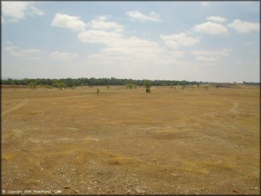
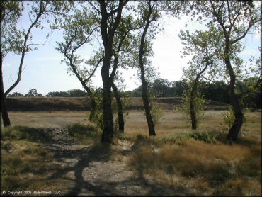
Clay Pit Riding Area Photo
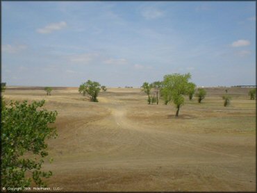
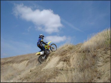
Plenty of open space to teach a beginner.
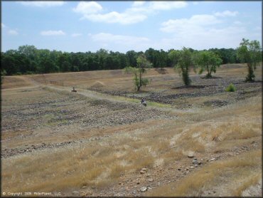
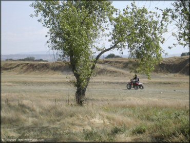
Clay Pit Riding Area Photo
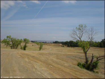
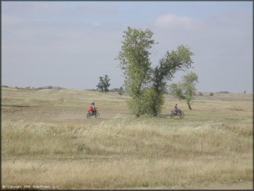
Clay Pit Riding Area Photo
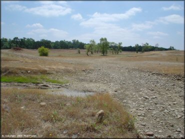
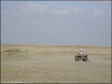
Clay Pit Riding Area Photo
Clay Pit Riding Area Photo
The park is only open for day use only but amenities include picnic tables, shade ramadas and a vault toilet.
Clay Pit Riding Area Photo
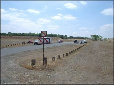
Clay Pit Riding Area Photo
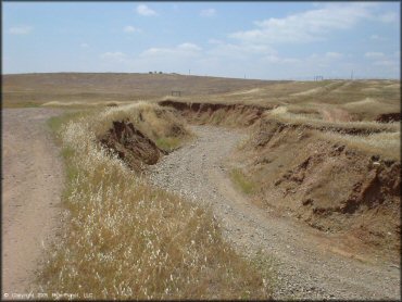
The only "real" hazard.
Clay Pit Riding Area Photo
Clay Pit Riding Area Photo
Clay Pit Riding Area Photo
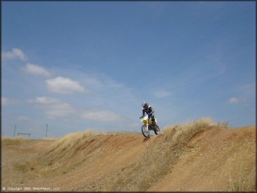
One of the few pop-up jumps in the area.
Clay Pit Riding Area Photo
Clay Pit Riding Area Photo
Clay Pit Riding Area Photo
Clay Pit Riding Area Photo
Clay Pit Riding Area Photo
Clay Pit Riding Area Photo
RIDER COMMENTS & REVIEWS