 |
      |
| Home > California > Hull and Trout Creek |
Hull Creek And Trout Creek OHV Area
Sunday, December 14, 2025
| Other Names | Stanislaus National Forest, Bourland Mountain, Long Barn, Hull/Trout Creek, Mi-Wuk Ranger District, Mi Wok Ranger District |
| Last Known Status | Closed For Season |
This popular trail system has about 20 miles of designated ATV trails and around 100 miles of forest service roads to explore. The trails are mostly hard packed dirt with some scattered loose chunk rock. There are a handful of single track trails but this part of the forest is best explored on an ATV or dual sport motorcycle. Nearby Crandall Peak and Deer Creek has a larger portion of designated single track/motorcycle only trails.
Camping with direct trail access can be found at Hull Creek Campground, which has 23 sites available on a first come, first serve basis. Each site comes with a picnic table, fire ring and BBQ grill. A vault toilet and a hand pump water spigot are among the amenities.
The trails and campground are open seasonally around mid April through mid December, but exact dates vary. During the winter months the region usually receives heavy snowfall, making the trails and campground inaccessible.
REGULATIONS
| Permit Required | Yes | CA OHMVR stickers required |
| Dates Open | April 15 - December 15 | CA OHMVR red sticker vehicles permitted from 10/1 to 5/31 |
| Other ATV Stickers Accepted | Yes | Residents of any state not listed must purchase a Nonresident OHV Use Permit. (AR, AZ, CA, CO, CT, DE, IA, ID, IN, LA, MA, MD, ME, MI, MN, MO, MT, ND, NH, NJ, NM, NV, NY, OH, OK, OR, PA, RI, TX, UT, VT, WA, WI, WY) |
| Spark Arrestor | Yes | A spark arresting exhaust silencer or end cap is required for all vehicles. |
| Noise Limit | Yes (96 dB) | CA OHMVR noise limits apply (1985/older limit 101 dB, 1986/newer limit 96 dB) |
| Whip Flags | Not Required | |
| Maximum Vehicle Width | No Restriction | |
 Motorcycles & Dirt Bikes Motorcycles & Dirt Bikes | Permitted | CA OHMVR stickers required |
 ATVs ATVs | Permitted | CA OHMVR stickers required |
 UTV & SXS UTV & SXS | Permitted | CA OHMVR stickers required |
 SUVs & Jeeps (registered) SUVs & Jeeps (registered) | Permitted | |
| Dune Buggy & Sand Rail 4x4 (unregistered) | Permitted | CA OHMVR stickers required |
| 2 Stroke Engines | Certain Times | CA OHMVR restrictions apply |
| MX Helmet Required | Yes | helmets required by state law |
 Camping Camping | Some Areas | (camp in developed sites only) |
 Campfires Campfires | Some Areas | (permitted in developed campsites only) |
| Night Riding | Unknown | |
| Trail Blazing | Prohibited | no trailblazing |
| Rule Enforcement |
TERRAIN
| Miles Of Trail | 20 | |
| Climate Type | Forest | |
| Elevation | 4500 to 7600 ft. | |
| Trail Maintenance | Marked, Not Rated, Lightly Maintained | |
| Loose Dirt |  Some Some | |
| Hard Pack |  Mostly Mostly | |
| Sand |  None None | |
| Mud |  Little Little | |
| Dust | Some | |
| Rocks | Little | |
| Trees |  All All | |
| Steep Hills | Some | |
| Water Crossings |  Few Few | |
| Small Jumps | None | |
| Large Jumps | None | |
| Berms | Few | |
| Sand/Gravel Pits | None | |
| Single Track | Some | |
| Roads | Mostly | |
| Shade | All | |
| Hazards | Few | (hazards assumed marked but use caution) |
 Novice Novice | Some | |
 Amateur Amateur | Mostly | |
 Expert Expert | Little |
TYPE OF AREA
| Area | Motorized Trails |
| Land | National Forest |


KEY SERVICES
 Gasoline Gasoline | 5-20 Miles (SW) | Chevron (209) 586-3552 |
| Diesel | 5-20 Miles (SW) | Chevron (209) 586-3552 |
 Water Water | On Site | Hull Creek Campground (209) 586-3234 |
 RV Hookup RV Hookup | 5-20 Miles (SW) | Sugar Pine RV Park (209) 586-4631 |
 RV Disposal RV Disposal | 5-20 Miles (SW) | Sugar Pine RV Park (209) 586-4631 |
| Campground | On Site | Hull Creek Campground (209) 586-3234 |
 Conv Store Conv Store | 5-20 Miles (SW) | Sonny's Mini Mart (209) 586-4662 |
FEES & PASSES
| Parking | (None) |
| Entry | (None) |
| Riding | (None) |
| Camping | Yes Tent: $25.00 RV: $25.00 Addtl. Vehicle: $0.00 Hull Creek Campground Fee |
RATINGS
| Our Rating |  Good Good |
| Recommended Stay | Full Day |
| Comments | (Scroll Down For Rider Reviews & Comments) |
DRIVING DIRECTIONS
| Nearest City | Long Barn, CA | ||
| From: Modesto, CA
1) Take SR-108 East about 60 miles 2) Turn right on Long Barn Road, continue .1 miles 3) Turn left (south) on Merrill Spring Road, continue .5 miles 4) Turn left (east) on North Fork Road, continue about 7 miles toward Hull Creek Campground. |


OFFICIAL CONTACTS
| Contact Info | Stanislaus National Forest - Mi-wok Ranger District P.O. Box 100 Mi-wuk Village, CA 95346 (209) 586-3234 sm.fs.stanislausnf@usda.gov www.fs.usda.gov |
Hull and Trout Creek Trail Photo
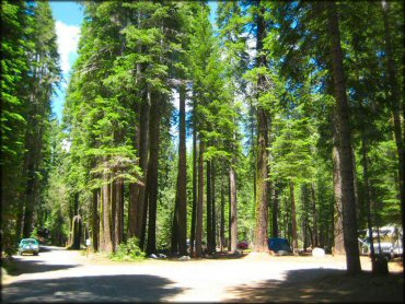
This is the entrance to Hull Creek Campground which has 23 sites. Photo Submitted 7/23/2011 (Thanks!)
Hull and Trout Creek Trail Photo
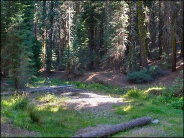
Photo Submitted 10/2/2013 (Thanks!)
Hull and Trout Creek Trail Photo
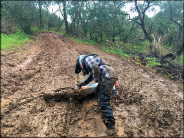
Photo Submitted 11/23/2018 (Thanks!)
Hull and Trout Creek Trail Photo
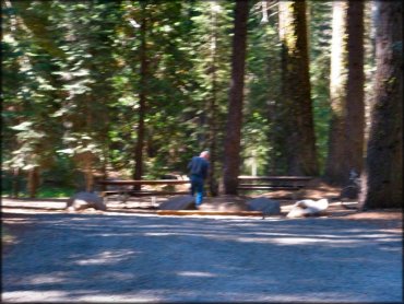
Photo Submitted 10/2/2013 (Thanks!)
RIDER COMMENTS & REVIEWS