 |
      |
| Home > California > Crandall and Deer Creek |
Crandall Peak And Deer Creek OHV Area
Saturday, April 13, 2024
| Other Names | Stanislaus National Forest, Mi-Wuk Ranger District, Mi Wuk, Mi Wok Road, Mi Wok Ranger District |
| Last Known Status | Closed For Season |
This part of the Stanislaus National Forest offers about 40 miles of designated trails for motorcycles and 140 miles of forest service roads. The single track trails are narrow and twisty and feature lots of elevation changes, berms and small jumps.
There is no fee charged to camp or park at Crandall OHV Campground but no there is no water. The campground does offer direct trail access, parking and vault toilets. Dispersed camping is permitted but there are no other services, so come prepared.
Note that this trail system closes seasonally to motorized use around December until mid April. Exact opening dates may vary so contact the Mi-Wok Ranger District before heading out.
REGULATIONS
| Permit Required | Yes | CA OHMVR stickers required |
| Dates Open | April 15 - December 15 | CA OHMVR red sticker vehicles permitted from 10/1 to 5/31 |
| Other ATV Stickers Accepted | Yes | Residents of any state not listed must purchase a Nonresident OHV Use Permit. (AR, AZ, CA, CO, CT, DE, IA, ID, IN, LA, MA, MD, ME, MI, MN, MO, MT, ND, NH, NJ, NM, NV, NY, OH, OK, OR, PA, RI, TX, UT, VT, WA, WI, WY) |
| Spark Arrestor | Yes | A spark arresting exhaust silencer or end cap is required for all vehicles. |
| Noise Limit | Yes (96 dB) | CA OHMVR noise limits apply (1985/older limit 101 dB, 1986/newer limit 96 dB) |
| Whip Flags | Not Required | |
| Maximum Vehicle Width | No Restriction | |
 Motorcycles & Dirt Bikes Motorcycles & Dirt Bikes | Permitted | CA OHMVR stickers required |
 ATVs ATVs | Permitted | CA OHMVR stickers required |
 UTV & SXS UTV & SXS | Permitted | CA OHMVR stickers required |
 SUVs & Jeeps (registered) SUVs & Jeeps (registered) | Some Areas | permitted on designated forest service roads |
| Dune Buggy & Sand Rail 4x4 (unregistered) | Some Areas | CA OHMVR stickers required permitted on designated forest service roads |
| 2 Stroke Engines | Certain Times | CA OHMVR restrictions apply |
| MX Helmet Required | Yes | helmets required by state law |
 Camping Camping | Some Areas | (camp in developed sites only) |
 Campfires Campfires | ||
| Night Riding | Unknown | |
| Trail Blazing | Prohibited | stay on the trail |
| Rule Enforcement |
TERRAIN
| Approx Size | 6,400 acres (10 sq mi) | |
| Miles Of Trail | 40 | |
| Climate Type | Forest | |
| Elevation | 3500 to 5500 ft. | |
| Trail Maintenance | Marked, Not Rated, Lightly Maintained | |
| Loose Dirt |  Mostly Mostly | |
| Hard Pack |  Little Little | |
| Sand |  None None | |
| Mud |  Some Some | |
| Dust | Little | |
| Rocks | Little | |
| Trees |  All All | |
| Steep Hills | Some | |
| Water Crossings |  Few Few | |
| Small Jumps | None | |
| Large Jumps | None | |
| Berms |  Many Many | |
| Sand/Gravel Pits | None | |
| Single Track | Some | |
| Roads | Few | |
| Shade | Many | |
| Hazards | Few | (hazards assumed marked but use caution) |
 Novice Novice | Some | |
 Amateur Amateur | Mostly | |
 Expert Expert | Little |
TYPE OF AREA
| Area | Motorized Trails |
| Land | National Forest |
GPS POINTS


KEY SERVICES
 Gasoline Gasoline | 5-20 Miles (SW) | Chevron (209) 586-3552 |
| Diesel | 5-20 Miles (SW) | Chevron (209) 586-3552 |
 Water Water | 5-20 Miles (SW) | Sugar Pine RV Park (209) 586-4631 |
 RV Hookup RV Hookup | 5-20 Miles (SW) | Sugar Pine RV Park (209) 586-4631 |
 RV Disposal RV Disposal | 5-20 Miles (SW) | Sugar Pine RV Park (209) 586-4631 |
| Campground | On Site | |
 Conv Store Conv Store | 5-20 Miles (SW) | Sonny's Mini Mart (209) 586-4662 |
FEES & PASSES
| Parking | (None) |
| Entry | (None) |
| Riding | (None) |
| Camping | (None) |
RATINGS
| Our Rating |  Very Good Very Good |
| Recommended Stay | 1-2 Days |
| Comments | (Scroll Down For Rider Reviews & Comments) |
DRIVING DIRECTIONS
| Nearest City | Mi-Wuk Village, CA | ||
| From: Modesto, CA
1) Take SR-108 East about 65 miles 2) Turn left on FS-4N01 (Spring Gap Turnoff), continue about 7 miles 3) Staging are is located between intersection of FS-4N01 and FS-4N88. |


OFFICIAL CONTACTS
| Contact Info | Stanislaus National Forest - Mi-wok Ranger District P.O. Box 100 Mi-wuk Village, CA 95346 (209) 586-3234 sm.fs.stanislausnf@usda.gov www.fs.usda.gov |
Crandall and Deer Creek Trail Photo
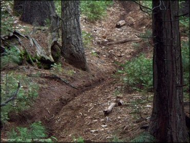
Photo Submitted 12/2/2009 (Thanks!)
Crandall and Deer Creek Trail Photo
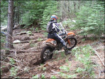
Photo Submitted 12/2/2009 (Thanks!)
Crandall and Deer Creek Trail Photo
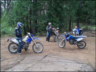
Photo Submitted 12/2/2009 (Thanks!)
Crandall and Deer Creek Trail Photo
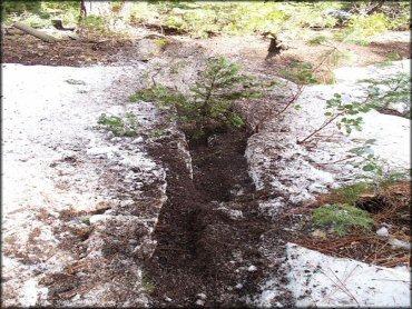
Photo Submitted 12/2/2009 (Thanks!)
Crandall and Deer Creek Trail Photo
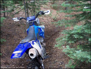
Photo Submitted 12/2/2009 (Thanks!)
Crandall and Deer Creek Trail Photo
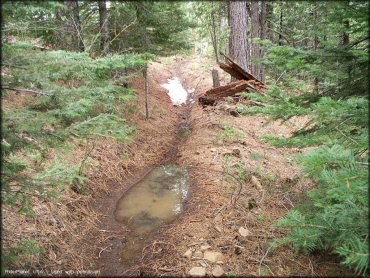
Photo Submitted 12/2/2009 (Thanks!)
Crandall and Deer Creek Trail Photo
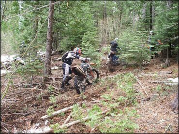
Photo Submitted 12/2/2009 (Thanks!)
RIDER COMMENTS & REVIEWS