 |
      |
| Home > California > Johnson Valley |
Johnson Valley OHV
Friday, February 7, 2025
| Other Names | Camp Rock Rd, Anderson Dry Lake, Lucerne Valley, Hatvelle Hills, Melville Dry Lake, Camp Rock Road, Johnson Valley OHV Recreation Area, Hartwell Hills, Mojave Desert |
| Last Known Status | Open |
This part of the Mojave Desert offers a good mix of mostly easy to moderate terrain, rugged mountain scenery, hundreds of miles of open space and several dry lake beds that are open to all OHVs. For expert level, low gear rock crawling trails and hill climbs stage across from Means Dry Lake.
During the month of February for nine consecutive days Johnson Valley becomes home to the "King of the Hammers", a 165-mile race that attracts up to 60,000 spectators. This is also the largest offroad race in the country and is broadcasted live. More than 400 teams participate and the event is open to ATVs, dirt bikes, Side by Sides and trucks.
Besides the handful of Joshua trees and occasional scrub brush, vegetation is sparse, so expect hot, dry and sometimes windy conditions.
Camping is free but there are no services. Cross-county travel is permitted, but steer clear of the desert tortoise, a threatened and highly protected species.
REGULATIONS
| Permit Required | Yes | CA OHMVR stickers required |
| Dates Open | Year-Round | CA OHMVR red sticker vehicles permitted from 9/1 to 5/31 |
| Other ATV Stickers Accepted | Yes | Residents of any state not listed must purchase a Nonresident OHV Use Permit. (AR, AZ, CA, CO, CT, DE, IA, ID, IN, LA, MA, MD, ME, MI, MN, MO, MT, ND, NH, NJ, NM, NV, NY, OH, OK, OR, PA, RI, TX, UT, VT, WA, WI, WY) |
| Spark Arrestor | Yes | A spark arresting exhaust silencer or end cap is required for all vehicles. |
| Noise Limit | Yes (96 dB) | CA OHMVR noise limits apply (1985/older limit 101 dB, 1986/newer limit 96 dB) |
| Whip Flags | Not Required | |
| Maximum Vehicle Width | No Restriction | |
 Motorcycles & Dirt Bikes Motorcycles & Dirt Bikes | Permitted | CA OHMVR stickers required |
 ATVs ATVs | Permitted | CA OHMVR stickers required |
 UTV & SXS UTV & SXS | Permitted | CA OHMVR stickers required |
 SUVs & Jeeps (registered) SUVs & Jeeps (registered) | Permitted | |
| Dune Buggy & Sand Rail 4x4 (unregistered) | Permitted | CA OHMVR stickers required |
| 2 Stroke Engines | Certain Times | CA OHMVR restrictions apply |
| MX Helmet Required | Yes | helmets required by state law |
 Camping Camping | No Restriction | (camp anywhere) |
 Campfires Campfires | Some Areas | recommended use of established pits only |
| Night Riding | Unknown | |
| Trail Blazing | Permitted | |
| Alcohol | No Restriction | CA open container laws apply |
| Rule Enforcement | ||
| Comment | Eastern boundary is Twenty Nine Palms Marine Air Guard Combat Center - No Trespassing. | |
TERRAIN
| Approx Size | 96,000 acres (150 sq mi) | |
| Miles Of Trail | 1000 | |
| Climate Type | Desert | |
| Elevation | 2300 to 4600 ft. | |
| Trail Maintenance | Not Marked, Not Rated, Not Maintained | |
| Loose Dirt |  Little Little | |
| Hard Pack |  Some Some | |
| Sand | Some | |
| Mud | Little | |
| Dust |  Mostly Mostly | |
| Rocks | Mostly | |
| Trees |  None None | |
| Steep Hills | Some | |
| Water Crossings | None | |
| Small Jumps |  Few Few | |
| Large Jumps | None | |
| Berms | Few | |
| Sand/Gravel Pits | None | |
| Single Track | Some | |
| Roads | Few | |
| Intersections | Some | |
| Rider Traffic | Few | |
| Shade | None | |
| Ranges/Gunfire | Some | |
| Hazards | Few | (hazards not marked) beware mine shafts & unexplored ordinances |
 Novice Novice | Mostly | |
 Amateur Amateur | Some | |
 Expert Expert | Little |
TYPE OF AREA
| Area | Motorized Trails, mountains, rolling hill and dry lake bed |
| Land | BLM |


KEY SERVICES
 Gasoline Gasoline | 5-20 Miles (SW) | 76 (760) 248-7998 |
| Diesel | 5-20 Miles (SW) | 76 (760) 248-7998 |
 Water Water | 5-20 Miles (SW) | Mojave Narrows Campground (760) 245-2226 |
 RV Hookup RV Hookup | 5-20 Miles (SW) | Mojave Narrows Campground (760) 245-2226 |
 RV Disposal RV Disposal | 5-20 Miles (SW) | Mojave Narrows Campground (760) 245-2226 |
| Campground | On Site | |
 Conv Store Conv Store | 5-20 Miles (SW) | 76 (760) 248-7998 |
FEES & PASSES
| Parking | (None) |
| Entry | (None) |
| Riding | (None) |
| Camping | (None) |
RATINGS
| Pros | wide open spaces, large, few regulations |
| Cons | no services, easy & moderate terrain, dry and windy & hot |
| Our Rating |  Good Good |
| Recommended Stay | 1-2 Days |
| Comments | (Scroll Down For Rider Reviews & Comments) |
DRIVING DIRECTIONS
| Nearest City | Lucerne Valley, CA | ||
| Address | Camp Rock Road, Lucerne Valley, CA 92356 | ||
| From: Victorville, CA
1) Take I-15 to Exit 153A 2) Turn (east) off the exit ramp onto CA-18, continue 23 miles 3) Continue straight (east) onto SR-247/Old Woman Springs Road, continue 5.6 miles 4) Turn left (north) onto Camp Rock Road, continue 4 miles 5) Veer right to stay on Camp Rock Road, continue about 3 miles toward staging areas. |


OFFICIAL CONTACTS
| Contact Info | BLM - Barstow Field Office 2601 Barstow Road Barstow, CA 92311 (760) 252-6000 blm_ca_listening@blm.gov www.blm.gov |
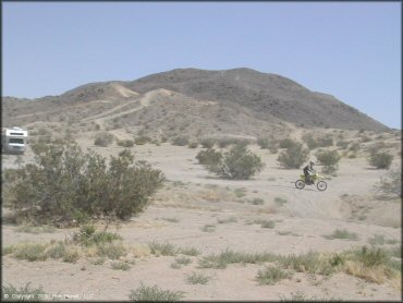
Johnson Valley Trail Photo
What you see is what you get - just miles and miles of open space. Large trailers and RVs will have no problem finding a place to camp.
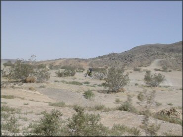
Johnson Valley Trail Photo
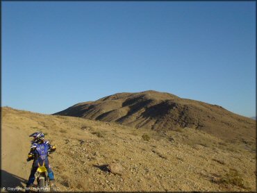
The scenery is pretty barren but what the area lacks in vegetation it makes up in 96,000 acres of free public land to enjoy. Just remember to bring shade and water.
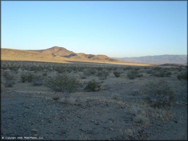
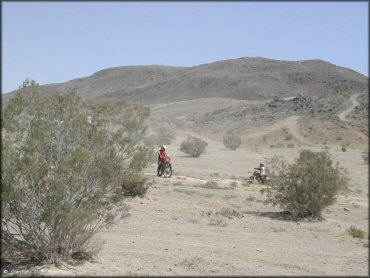
Johnson Valley Trail Photo
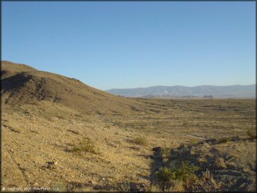
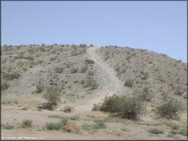
A good example of the overall scenery and trails you will find here. Nothing fancy but its free and open.
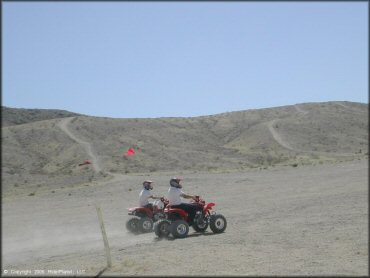
Johnson Valley Trail Photo
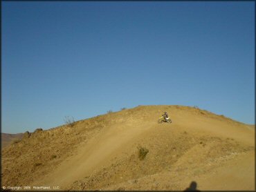
One of the many play areas.
Johnson Valley Trail Photo
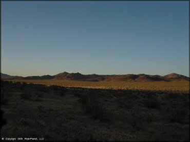
Sunset at Johnson Valley.
Johnson Valley Trail Photo
Shade and water is a must whether coming here for a day or for the weekend.
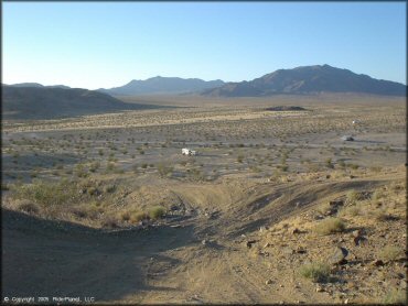
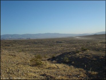
Johnson Valley Trail Photo
You can see the numerous trailers and RVs camping out in the distance. Even if you run short on supplies, Lucerne Valley is about 15 miles away which has basic supplies.
Johnson Valley Trail Photo
Another view of the sun going down in the desert.
Johnson Valley Trail Photo
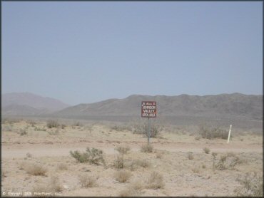
This sigange can be found off Camp Rock Road.
Johnson Valley Trail Photo
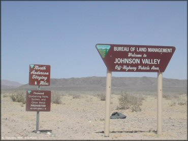
Johnson Valley signage for the main entrance.
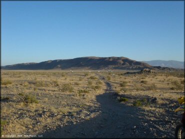
Johnson Valley Trail Photo
The trails here are hard packed and very dusty.
Johnson Valley Trail Photo
Dry and dusty conditions are expected during most of the year.
Johnson Valley Trail Photo
There is no shortage of places to stage and camp.
Johnson Valley Trail Photo
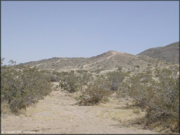
With the exception of the occasional greasewood, vegetation is limited.
Johnson Valley Trail Photo
This is a good place to get away from the city and bring the family for a weekend of camping and riding.
Johnson Valley Trail Photo
Not a bad idea to bring a cooler packed with ice, cold drinks and snacks.
RIDER COMMENTS & REVIEWS