 |
      |
| Home > California > Stoddard Valley |
Stoddard Valley OHV Area
Friday, February 7, 2025
| Other Names | Stoddard Valley Motorized Trail, Stoddard Peak, Turtle Valley, Hodge Road, Lucerne Valley Cut-off, Barstow Resource Area, Stoddard Valley OHV Recreation Area, Stoddard Wells, Mojave Desert, Slash X |
| Last Known Status | Open |
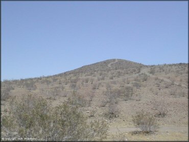
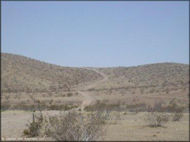
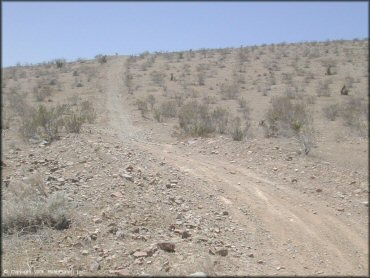
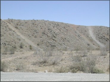
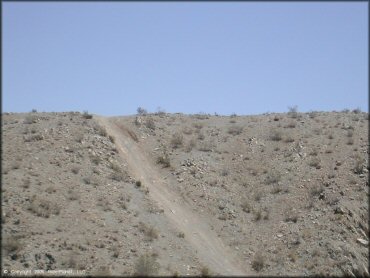
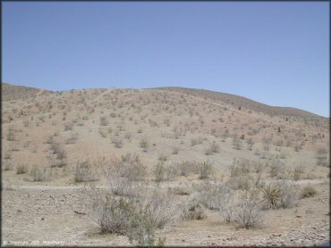
This part of the Mojave Desert offers 53,000 acres of public land that is used periodically for races and scrambles that run between Barstow and Victorville. This area features terrain that consists of dry and hard packed ATV trails, sandy washes, rugged and rocky hill climbs and dry flat valleys. Vegetation is sparse and consists of creosote scrub brush and the occasional Joshua Tree.
There are two main access points into Stoddard Valley. The main entrance located off Exit 169 from I-15 is graveled and offers many areas to stage and set up camp. From here there are several informational kiosks and a vault toilet located near the rock quarry off Hodge Road. The trails here are rated as mostly easy to moderately challenging and is a decent choice for the family that wants to avoid holiday crowds.
The second entrance is located behind the Slash X Ranch Cafe off Barstow Road but features more challenging trails that are suited for the experienced rider. The cafe is also a popular destination and caters to dirt bike, ATV and UTV riders.
REGULATIONS
| Permit Required | Yes | CA OHMVR stickers required |
| Dates Open | Year-Round | CA OHMVR red sticker vehicles permitted from 9/1 to 5/31 |
| Other ATV Stickers Accepted | Yes | Residents of any state not listed must purchase a Nonresident OHV Use Permit. (AR, AZ, CA, CO, CT, DE, IA, ID, IN, LA, MA, MD, ME, MI, MN, MO, MT, ND, NH, NJ, NM, NV, NY, OH, OK, OR, PA, RI, TX, UT, VT, WA, WI, WY) |
| Spark Arrestor | Yes | A spark arresting exhaust silencer or end cap is required for all vehicles. |
| Noise Limit | Yes (96 dB) | CA OHMVR noise limits apply (1985/older limit 101 dB, 1986/newer limit 96 dB) |
| Whip Flags | Not Required | |
| Maximum Vehicle Width | No Restriction | |
 Motorcycles & Dirt Bikes Motorcycles & Dirt Bikes | Permitted | CA OHMVR stickers required |
 ATVs ATVs | Permitted | CA OHMVR stickers required |
 UTV & SXS UTV & SXS | Permitted | CA OHMVR stickers required |
 SUVs & Jeeps (registered) SUVs & Jeeps (registered) | Permitted | |
| Dune Buggy & Sand Rail 4x4 (unregistered) | Permitted | CA OHMVR stickers required |
| 2 Stroke Engines | Certain Times | CA OHMVR restrictions apply |
| MX Helmet Required | Yes | helmets required by state law |
 Camping Camping | No Restriction | (camp anywhere) |
 Campfires Campfires | No Restriction | fire season permitting |
| Night Riding | Unknown | |
| Trail Blazing | Prohibited | stay on trail |
| Alcohol | No Restriction | CA open container laws apply |
| Rule Enforcement | None |
TERRAIN
| Approx Size | 53,000 acres (83 sq mi) | |
| Miles Of Trail | 100 | |
| Climate Type | Desert | |
| Elevation | 2800 to 5000 ft. | |
| Trail Maintenance | Not Marked, Not Rated, Not Maintained | |
| Loose Dirt |  None None | |
| Hard Pack |  Some Some | |
| Sand | Some | |
| Mud | None | |
| Dust |  All All | |
| Rocks |  Mostly Mostly | |
| Trees | None | |
| Steep Hills |  Few Few | |
| Water Crossings | None | |
| Small Jumps | Few | |
| Large Jumps | Few | |
| Berms | Few | |
| Sand/Gravel Pits | Few | off limits |
| Single Track | Few | |
| Roads | Few | |
| Intersections | Some | |
| Rider Traffic | Few | |
| Shade | None | |
| Ranges/Gunfire | Few | |
| Hazards | Few | (hazards not marked) |
 Novice Novice | Some | |
 Amateur Amateur | Mostly | |
 Expert Expert |  Little Little |
TYPE OF AREA
| Area | Motorized Trails |
| Land | BLM |


KEY SERVICES
 Gasoline Gasoline | 5-20 Miles (NE) | Chevron (760) 253-7106 |
| Diesel | 5-20 Miles (NE) | Chevron (760) 253-7106 |
 Water Water | 5-20 Miles (SW) | Shady Oasis Kampground (760) 245-6867 |
 RV Hookup RV Hookup | 5-20 Miles (SW) | Shady Oasis Kampground (760) 245-6867 |
 RV Disposal RV Disposal | 5-20 Miles (SW) | Shady Oasis Kampground (760) 245-6867 |
| Campground | On Site | camp anywhere - no services |
 Conv Store Conv Store | 5-20 Miles (NE) | Chevron (760) 253-7106 |
FEES & PASSES
| Parking | (None) |
| Entry | (None) |
| Riding | (None) |
| Camping | (None) |
RATINGS
| Pros | open area, few restrictions, little enforcement, little hassle, easy to access without 4x4 |
| Cons | dry, hot, dusty, no shade, rocky |
| Our Rating |  Fair Fair |
| Recommended Stay | Full Day |
| Comments | (Scroll Down For Rider Reviews & Comments) |
DRIVING DIRECTIONS
| Nearest City | Barstow, CA | ||
| Address | Hodge Road, Apple Valley, CA 92307 | ||
| From: Victorville, CA
1) Take I-15 North to Exit 169 2) Turn right (east) off the exit ramp onto Hodge Road, continue about .25 miles. 3) Stage anywhere. |


OFFICIAL CONTACTS
| Contact Info | BLM - Barstow Field Office 2601 Barstow Road Barstow, CA 92311 (760) 252-6000 blm_ca_web_ba@blm.gov www.blm.gov |
| Contact Info | Slash X Ranch Cafe 28040 Barstow Road Barstow, CA 92311 (760) 252-1197 info@slashxoffroad.com |
Stoddard Valley Trail Photo
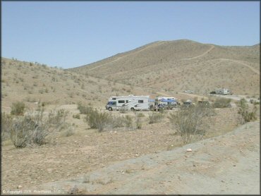
Plenty of staging and camping opportunities.
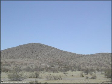
Stoddard Valley Trail Photo
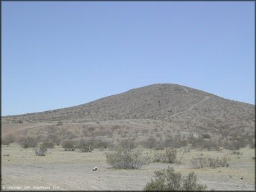
Stoddard Valley Trail Photo
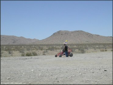
Stoddard Valley Trail Photo
Stoddard Valley Trail Photo
Stoddard Valley Trail Photo
Stoddard Valley Trail Photo
Stoddard Valley Trail Photo
Stoddard Valley Trail Photo
Stoddard Valley Trail Photo
Stoddard Valley Trail Photo
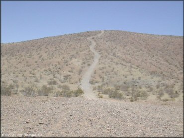
The trails are mostly rocky, hard packed and dusty.
Stoddard Valley Trail Photo
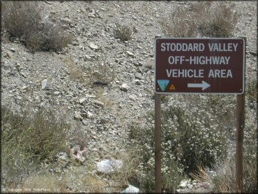
Main entrance.
RIDER COMMENTS & REVIEWS