 |
      |
| Home > California > Penny Pines |
Penny Pines
Monday, September 8, 2025
| Other Names | Elk Mountain, Mendocino National Forest, Upper Lake Ranger District, Lake Pillsbury, Deer Valley Camp, Lake Pillsbury Basin, Middle Creek, Potato Hill |
| Last Known Status | Open |
This trail system has three main staging areas and caters to the more experienced rider who is looking for steeper and more challenging terrain. The Penny Pines and Deer Valley staging areas offer the best camping for access to 135 miles of challenging (many black diamond) trails.
Middlecreek staging area, to the south, has paved access, camping and a day use area with a pee-wee play area, dry river bed play area, and access to a handful of easier trails. Lake Pillsbury (to the north) offers great camping, lake access, and access to 33 miles of 4x4 trails, but is closed to OHVs from 5/18 - 9/8 annually.
Most trails in the area are marked and rated for difficulty. Drawbacks would be that the campsites fill up quickly on weekends, and there is not really any shade in the day use areas.
REGULATIONS
| Permit Required | Yes | CA OHMVR stickers required |
| Dates Open | Year-Round | CA OHMVR red sticker vehicles permitted year round |
| Other ATV Stickers Accepted | Yes | Residents of any state not listed must purchase a Nonresident OHV Use Permit. (AR, AZ, CA, CO, CT, DE, IA, ID, IN, LA, MA, MD, ME, MI, MN, MO, MT, ND, NH, NJ, NM, NV, NY, OH, OK, OR, PA, RI, TX, UT, VT, WA, WI, WY) |
| Spark Arrestor | Yes | A spark arresting exhaust silencer or end cap is required for all vehicles. |
| Noise Limit | Yes (96 dB) | CA OHMVR noise limits apply (1985/older limit 101 dB, 1986/newer limit 96 dB) |
| Whip Flags | Not Required | |
| Maximum Vehicle Width | Yes (50 inches) | has entrance gate or posts |
 Motorcycles & Dirt Bikes Motorcycles & Dirt Bikes | Permitted | CA OHMVR stickers required |
 ATVs ATVs | Permitted | CA OHMVR stickers required (maximum width 50 inches) |
 UTV & SXS UTV & SXS | Permitted | CA OHMVR stickers required (maximum width 50 inches) |
 SUVs & Jeeps (registered) SUVs & Jeeps (registered) | Some Areas | permitted on designated forest service roads |
| Dune Buggy & Sand Rail 4x4 (unregistered) | Some Areas | CA OHMVR stickers required (maximum width 50 inches) permitted on designated forest service roads |
| 2 Stroke Engines | No Restriction | CA OHMVR restrictions apply |
| MX Helmet Required | Yes | helmets required by state law |
 Camping Camping | Some Areas | (camp in developed sites only) |
 Campfires Campfires | Some Areas | (permitted in developed campsites only) |
| Night Riding | No | |
| Trail Blazing | Some Areas | permitted in riverbed |
| Alcohol | No Restriction | |
| Rule Enforcement | Few/Periodic | Dedicated Rangers/Officers Jeep/SUV Patrol |
TERRAIN
| Approx Size | 32,000 acres (50 sq mi) | |
| Miles Of Trail | 135 | |
| Climate Type | Forest | |
| Elevation | 1600 to 4500 ft. | |
| Trail Maintenance | Marked, Rated, Heavily Maintained | |
| Loose Dirt |  Some Some | |
| Hard Pack | Some | |
| Sand |  Little Little | |
| Mud |  None None | |
| Dust | Some | |
| Rocks | Some | |
| Trees |  Many Many | |
| Steep Hills | Many | |
| Water Crossings | Some | many crossings just north of middle creek camp |
| Small Jumps | Some | |
| Large Jumps | None | |
| Berms | Some | |
| Sand/Gravel Pits | None | |
| Single Track | Some | |
| Roads | Some | |
| Intersections | Some | |
| Rider Traffic |  Few Few | |
| Shade | Many | |
| Ranges/Gunfire | None | |
| Hazards | Some | (hazards not marked) Beware of cliffs. some deep water and cliffs |
 Novice Novice | Little | |
 Amateur Amateur | Some | |
 Expert Expert |  Mostly Mostly | |
| Comment | Most of the novice terrain is at Middle Creek Camp, northern areas can get very challenging. | |
TYPE OF AREA
| Area | Motorized Trails |
| Land | National Forest |
GPS POINTS

KEY SERVICES
 Gasoline Gasoline | 5-20 Miles (N) | Lake Pillsbury Resort and Marina (707) 743-9935 |
| Diesel | 5-20 Miles (S) | Highway Quik Market (707) 275-0522 |
 Water Water | On Site | Middle Creek Campground |
 RV Hookup RV Hookup | 5-20 Miles (N) | Lake Pillsbury Resort and Marina (707) 743-9935 **has two RV sites available** |
 RV Disposal RV Disposal | 5-20 Miles (SW) | The Narrows Lodge Resort (707) 275-2718 or (800) 476-2776 |
| Campground | On Site | |
 Conv Store Conv Store | 5-20 Miles (S) | Highway Quik Market (707) 275-0522 |
FEES & PASSES
| Parking | (None) |
| Entry | (None) |
| Riding | (None) |
| Camping | Yes Tent: $8.00 RV: $8.00 Addtl. Vehicle: $2.00 Middle Creek Campground Fees (limit two vehicles per site) |
| Comment | Deer Valley and Penny Pines Campgrounds are $6/night, Oak Flat Campground is $10/night |
RATINGS
| Pros | many water crossings, swimming holes, paved entrance & campground, some nice bermed trails with many banked turns with brush tunnels |
| Cons | not enough camp sites, no shade in day use area, not enough moderate/easy terrain |
| Our Rating |  Excellent Excellent |
| Recommended Stay | Full Day |
| Comments | (Scroll Down For Rider Reviews & Comments) |
DRIVING DIRECTIONS
| Nearest City | Upper Lake, CA | ||
| Address | Elk Mountain Road, Upper Lake, CA 95485 | ||
| From: Sacramento, CA
1) I-5 N to Williams 2) CA-20 W past Clearlake to town of Upperlake 3) At center of town turn right on Mendenhall Road (north) just after Treasure Cove Pizza 4) Follow signs to Middle Creek campground 5) Entrance on right to Middle Creek camping/staging area or... 6) Continue north on Elk Mountain Road 2 miles to Penny Pines staging area which also has camping. |


OFFICIAL CONTACTS
| Contact Info | Mendocino National Forest (707) 275-1430 |
| Comment | Trail Hotline |
| Contact Info | Mendocino National Forest - Upper Lake Ranger District 10025 Elk Mountain Road Upper Lake, CA 95485 (707) 275-2361 mailroom_r5_mendocino@fs.fed.us www.fs.usda.gov |
Penny Pines Trail Photo
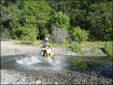
One of the numerous creek crossings from the early part of the connecting trails near Middlecreek staging area.
Penny Pines Trail Photo
Along the trail from Middlecreek.
Penny Pines Trail Photo
Open play area at the Middlecreek staging area.
Penny Pines Trail Photo
The riverbed.
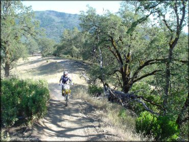
Penny Pines Trail Photo
One of the smoother and easier trails from the upper elevations.
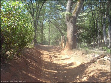
Penny Pines Trail Photo
Upper elevation trails. Almost single track in parts.
Penny Pines Trail Photo
Penny Pines Trail Photo
Penny Pines Trail Photo
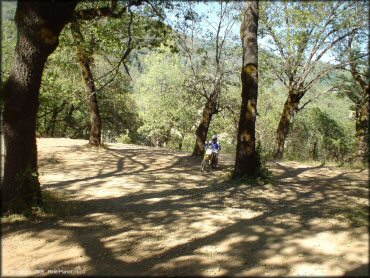
Penny Pines Trail Photo
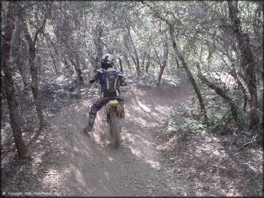
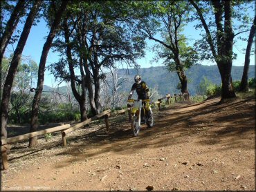
One of the trails that is surrounded by low hanging trees, creating a cool "tunnel" effect.
Penny Pines Trail Photo
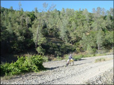
Playing around neer the Middlecreek staging area.
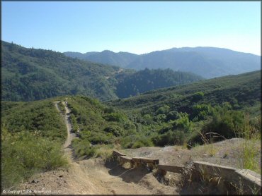
Penny Pines Trail Photo
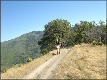
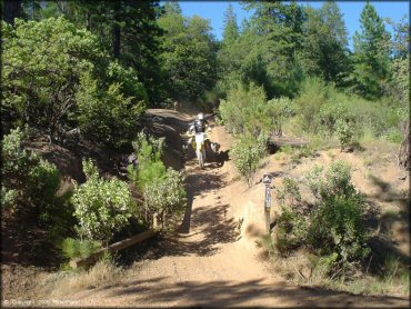
Along the ridgetops on one of the connecting trails from Middlecreek to Penny Pines staging.
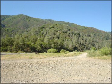
Penny Pines Trail Photo
Penny Pines Trail Photo
Great scenery.
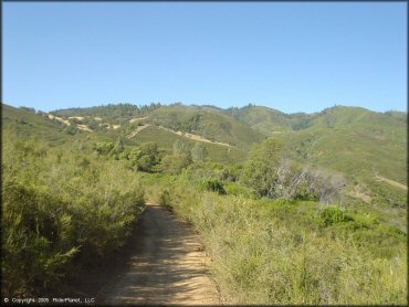
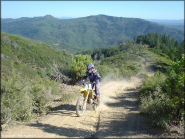
Penny Pines Trail Photo
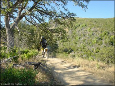
Looks tame here, but these trails gets more fun and challenging the further you go up.
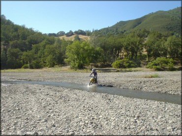
Penny Pines Trail Photo
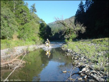
Another shallow crossing near the start of the Middlecreek connecting trails.
RIDER COMMENTS & REVIEWS