 |
      |
| Home > California > Billy Hill |
Billy Hill OHV Route
Thursday, April 25, 2024
| Other Names | Truckee, Hobart Hills, Stampede Reservoir, Russel Valley, Dry Creek, Dog Valley Rd, Tahoe National Forest, Truckee Ranger District, Boca Reservoir, Prosser Creek Reservoir |
| Last Known Status | Open |
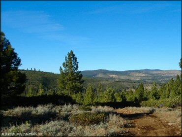
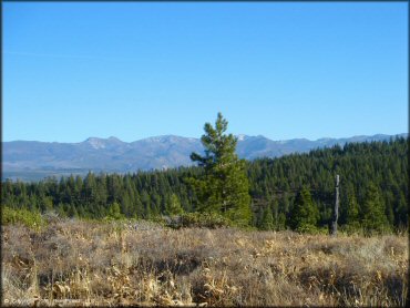
This part of the Tahoe National Forest is the northernmost section of a three-part area that is surrounded by three reservoirs; Boca Reservoir, Prosser Reservoir and Stampede Reservoir. The trails here consist mostly of mild 4x4 roads but there are also various single track loops if you keep your eyes open (see map).
There is a boat ramp and plenty of camping opportunities in this area. The trails here tie into Boca Reservoir (east) and Prosser Pits (south). For those looking for a challenging single track check out Prosser Hill (to the west of 89).
REGULATIONS
| Permit Required | Yes | CA OHMVR stickers required |
| Dates Open | April 24 - December 31 | CA OHMVR red sticker vehicles permitted year round |
| Other ATV Stickers Accepted | Yes | Residents of any state not listed must purchase a Nonresident OHV Use Permit. (AR, AZ, CA, CO, CT, DE, IA, ID, IN, LA, MA, MD, ME, MI, MN, MO, MT, ND, NH, NJ, NM, NV, NY, OH, OK, OR, PA, RI, TX, UT, VT, WA, WI, WY) |
| Spark Arrestor | Yes | A spark arresting exhaust silencer or end cap is required for all vehicles. |
| Noise Limit | Yes (96 dB) | CA OHMVR noise limits apply (1985/older limit 101 dB, 1986/newer limit 96 dB) |
| Whip Flags | Not Required | |
| Maximum Vehicle Width | No Restriction | |
 Motorcycles & Dirt Bikes Motorcycles & Dirt Bikes | Permitted | CA OHMVR stickers required |
 ATVs ATVs | Permitted | CA OHMVR stickers required |
 UTV & SXS UTV & SXS | Permitted | CA OHMVR stickers required |
 SUVs & Jeeps (registered) SUVs & Jeeps (registered) | Permitted | |
| Dune Buggy & Sand Rail 4x4 (unregistered) | Permitted | CA OHMVR stickers required |
| 2 Stroke Engines | Certain Times | CA OHMVR restrictions apply |
| MX Helmet Required | Yes | helmets required by state law |
 Camping Camping | Some Areas | (camp in developed sites only) |
 Campfires Campfires | Some Areas | (permitted in developed campsites only) |
| Night Riding | Yes | Not Recommended |
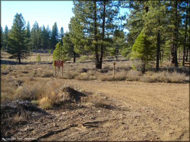
| Trail Blazing | Prohibited | vehicles must stay on trail |
| Alcohol | No Restriction | |
| Rule Enforcement | Few/Periodic | |
| Comment | This area is not well organized, caters to mountain bikers & boaters. Not much here for OHVs. | |
TERRAIN
| Approx Size | 12,800 acres (20 sq mi) | |
| Miles Of Trail | 45 | |
| Climate Type | Forest | |
| Elevation | 5800 to 6500 ft. | |
| Trail Maintenance | Marked, Not Rated, Lightly Maintained | |
| Loose Dirt |  Little Little | |
| Hard Pack |  Some Some | |
| Sand |  None None | |
| Mud | Little | |
| Dust | Some | |
| Rocks | Some | |
| Trees |  Many Many | |
| Steep Hills | None | |
| Water Crossings | None | |
| Small Jumps | None | |
| Large Jumps | None | |
| Berms | None | |
| Sand/Gravel Pits | None | |
| Single Track | None | |
| Roads |  All All | |
| Intersections | Some | |
| Rider Traffic | None | |
| Shade | Many | |
| Ranges/Gunfire |  Few Few | |
| Hazards | Few | (hazards not marked) road crossings |
 Novice Novice |  Mostly Mostly | |
 Amateur Amateur | Little | |
 Expert Expert | None | |
| Comment | just roads, pretty rocky, not too interesting | |
TYPE OF AREA
| Area | Motorized Trails |
| Land | National Forest |

| Features | Public |
| Max Engine Size | No Maximum |
| Min Engine Size | No Minimum |
GPS POINTS


KEY SERVICES
 Gasoline Gasoline | 5-20 Miles (S) | Shell (530) 587-3853 |
| Diesel | 5-20 Miles (S) | Truckee |
 Water Water | 1-5 Miles (N) | Logger Campground (877) 444-6777 |
 RV Hookup RV Hookup | 5-20 Miles (SW) | Coachland RV Park (530) 587-3071 |
 RV Disposal RV Disposal | 1-5 Miles (N) | Logger Campground (877) 444-6777 |
| Campground | 1-5 Miles (N) | Logger Campground & Emigrant Campground (877) 444-6777 |
 Conv Store Conv Store | 5-20 Miles (SW) | Safeway (530) 582-7950 |
FEES & PASSES
| Parking | (None) |
| Entry | (None) |
| Riding | (None) |
| Camping | Yes Tent: $23.00 RV: $23.00 Addtl. Vehicle: $0.00 Logger Campground Fee |
RATINGS
| Pros | secluded, near reservoir |
| Cons | no good trails, the only single track is for mountain bikes only |
| Our Rating |  Fair Fair |
| Recommended Stay | Half Day Fall/Winter |
| Comments | (Scroll Down For Rider Reviews & Comments) |
DRIVING DIRECTIONS
| Nearest City | Truckee, CA | ||
| From: Reno, NV
1) I-80 West to Exit 188 2) Turn right (north) off the exit ramp onto Hwy 89, continue .2 miles 3) Proceed through roundabout to continue on Hwy 89, continue .3 miles 4) Proceed through second roundabout to stay on Hwy 89, continue 3.9 miles 5) Turn right (east) on Hobart Mills 6) Turn left at the T, go through the gravel pit 7) Veer right at the next fork, stay on the paved road 8) Follow the paved road all the way to the stop sign 9) Turn left on Dog Valley Road, stay to the left, road turns to gravel 10) Follow gravel road 1.5 miles to staging area on left 11) Additional staging straight ahead, veer left when road turns back to pavement. |


OFFICIAL CONTACTS
| Contact Info | Tahoe National Forest - Truckee Ranger District 10811 Stockrest Springs Road Truckee, CA 96161 (530) 536-0417 (530) 587-3558 mailroom_r5_tahoe@fs.fed.us www.fs.usda.gov |
Billy Hill Trail Photo
Billy Hill Trail Photo
Billy Hill Trail Photo
Billy Hill Trail Photo
Billy Hill Trail Photo
Billy Hill Trail Photo
Billy Hill Trail Photo
Billy Hill Trail Photo
Billy Hill Trail Photo
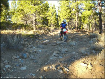
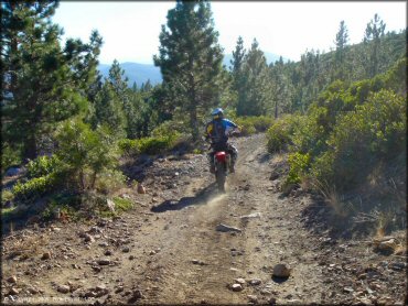
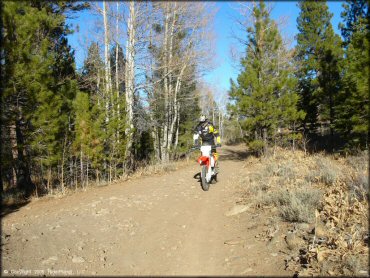
This section is extremely rocky but is not typical for the trails in this area.
Billy Hill Trail Photo
Billy Hill Trail Photo
Billy Hill Trail Photo

Billy Hill Trail Photo
Billy Hill Trail Photo
Billy Hill Trail Photo
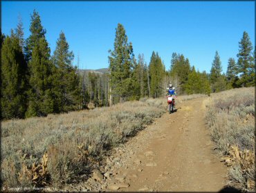
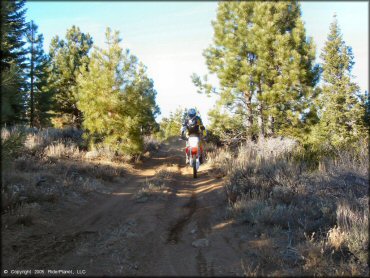
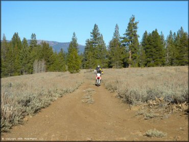
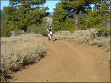
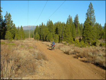
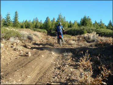
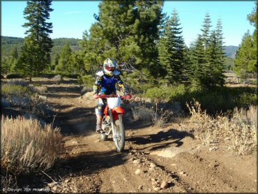
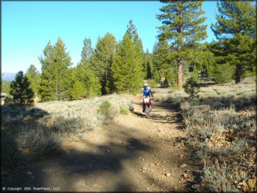
Most of the trails are just rocky dirt roads.
Billy Hill Trail Photo
Billy Hill Trail Photo
Billy Hill Trail Photo
Billy Hill Trail Photo
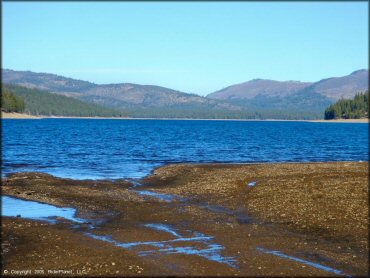
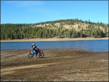
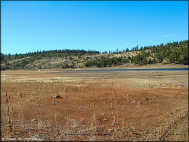
Stampede Reservoir offers fishing, boating and camping.
Billy Hill Trail Photo
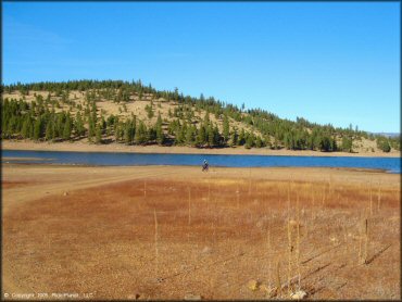
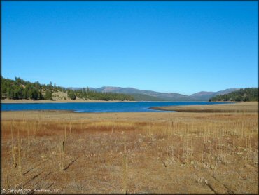
Some trails lead right down to the banks of Stampede Reservoir.
Billy Hill Trail Photo
Billy Hill Trail Photo
RIDER COMMENTS & REVIEWS