 |
      |
| Home > California > Kennedy Meadows |
Kennedy Meadows
Tuesday, January 30, 2024
| Other Names | Cannell Ranger District, Fish Creek Meadow, Pine Mountain, Jackass Meadows, Little Troy Meadows, Hooker Meadow, Smith Mountain, Sequoia National Forest, Ball Mountain, Bonita Meadows, West Meadow, Lookout Mountain, Danner Meadow, Corral Meadow, Stoney Meadow, Sherman Peak, Mahogany Creek, Trout Creek, Kern River, Monache Meadows, Kern Plateau OHV Area, Kern River Ranger District, Jackass Peak Motorized Trail, Kern Plateau, Rattlesnake Trail |
| Last Known Status | Closed For Season |
This riding area has multiple campgrounds and staging opportunities plus about 150 miles of challenging single track trails, making this one of the most popular places to go for woods riding in southern California. There are a couple 4x4 roads for larger vehicles and ATVs (Sherman Pass and Monache Jeep Roads) but this trail system primarily caters to dirt bikes.
There are two designated campgrounds that provide direct trail access. Fish Creek Campground features 40 sites that can accommodate trailers up to 27 feet. There is no running water at Fish Creek but there are a few vault toilets and the main entrance loop is paved. Troy Meadows Campground is located about two miles further west and offers 73 sites that can accommodate trailers up to 24 feet. Each site comes with a picnic table, BBQ grill, concrete pad and access to several water spigots. Sites are first come, first serve and fill up fast, but adjacent to each campground is an overflow area.
The trails and campgrounds are generally open from mid-June until the first snowfall, which is usually the first week of November. Exact dates vary, so check with the ranger station before heading out.
Nearby services include Kennedy Meadows General Store and the Grumpy Bear Saloon which has a full service bar and live bands that play on Saturday nights.
REGULATIONS
| Permit Required | Yes | CA OHMVR stickers required |
| Dates Open | Mid June - November | CA OHMVR red sticker vehicles permitted year round |
| Other ATV Stickers Accepted | Yes | Residents of any state not listed must purchase a Nonresident OHV Use Permit. (AR, AZ, CA, CO, CT, DE, IA, ID, IN, LA, MA, MD, ME, MI, MN, MO, MT, ND, NH, NJ, NM, NV, NY, OH, OK, OR, PA, RI, TX, UT, VT, WA, WI, WY) |
| Spark Arrestor | Yes | A spark arresting exhaust silencer or end cap is required for all vehicles. |
| Noise Limit | Yes (96 dB) | CA OHMVR noise limits apply (1985/older limit 101 dB, 1986/newer limit 96 dB) |
| Whip Flags | Not Required | |
| Maximum Vehicle Width | ||
 Motorcycles & Dirt Bikes Motorcycles & Dirt Bikes | Permitted | CA OHMVR stickers required most trails are single track only |
 ATVs ATVs | Some Areas | Not Recommended CA OHMVR stickers required permitted on Monache and Sherman 4x4 Roads |
 UTV & SXS UTV & SXS | Some Areas | Not Recommended CA OHMVR stickers required permitted on Monache and Sherman 4x4 Roads |
 SUVs & Jeeps (registered) SUVs & Jeeps (registered) | Some Areas | Not Recommended permitted on Monache and Sherman 4x4 Roads |
| Dune Buggy & Sand Rail 4x4 (unregistered) | Some Areas | CA OHMVR stickers required permitted on Monache and Sherman 4x4 Roads |
| 2 Stroke Engines | No Restriction | CA OHMVR restrictions apply |
| MX Helmet Required | Yes | helmets required by state law |
 Camping Camping | Some Areas | (camp in developed sites only) |
 Campfires Campfires | Some Areas | (permitted in developed campsites only) |
| Night Riding | Unknown | Not Recommended |
| Trail Blazing | Prohibited | riders must stay on trail |
| Rule Enforcement | ||
| Comment | Fish Creek Campground can accommodate trailers up to 27 feet and Troy Meadows up to 24 feet. Longer trailers can fit at overflow campgrounds. | |
TERRAIN
| Approx Size | 160,000 acres (250 sq mi) | |
| Miles Of Trail | 150 | |
| Climate Type | Forest | |
| Elevation | 7500 to 9900 ft. | |
| Trail Maintenance | Marked, Rated, Lightly Maintained | |
| Loose Dirt |  Little Little | |
| Hard Pack |  Mostly Mostly | |
| Sand |  None None | |
| Mud | Little | |
| Dust | Little | |
| Rocks |  Some Some | |
| Trees |  All All | |
| Steep Hills | Some | |
| Water Crossings | Some | |
| Small Jumps |  Few Few | |
| Large Jumps | None | |
| Berms | Some | |
| Sand/Gravel Pits | None | |
| Single Track |  Many Many | |
| Roads | Few | |
| Intersections | Some | |
| Rider Traffic | Some | |
| Shade | All | |
| Hazards | Few | (hazards assumed marked but use caution) |
 Novice Novice | Little | |
 Amateur Amateur | Mostly | |
 Expert Expert | Some |
TYPE OF AREA
| Area | Motorized Trails |
| Land | National Forest |
GPS POINTS


KEY SERVICES
 Gasoline Gasoline | 1-5 Miles (SE) | Kennedy Meadows General Store (559) 850-5647 |
| Diesel | 30+ Miles (SE) | Shell (760) 377-5353 |
 Water Water | On Site | Troy Meadows Campground |
 RV Hookup RV Hookup | 30+ Miles (E) | Boulder Creek RV Resort (760) 876-4243 |
 RV Disposal RV Disposal | On Site | Grumpy Bears Retreat (559) 850-2327 |
| Campground | On Site | |
 Conv Store Conv Store | 1-5 Miles (SE) | Kennedy Meadows General Store (559) 850-5647 |
FEES & PASSES
| Parking | (None) |
| Entry | (None) |
| Riding | (None) |
| Camping | Yes Tent: $17.00 RV: $17.00 Addtl. Vehicle: $0.00 Troy Meadow and Fish Creek Campground Fees |
| Comment | No fees charged if using overflow campgrounds. |
RATINGS
| Our Rating |  Very Good Very Good |
| Recommended Stay | 1-2 Days |
| Comments | (Scroll Down For Rider Reviews & Comments) |
DRIVING DIRECTIONS
| Nearest City | Inyokern, CA | ||
| Address | Sherman Pass Road, Inyokern, CA 93527 | ||
| From: Ridgecrest, CA
1) Take US-395 North about 15 miles 2) Turn left (west) onto Nine Mile Canyon Road, continue 24 miles (*see warning below) 3) Veer left (north-west) onto Sherman Pass Road, continue 8.5 miles 4) Fish Creek Campground is on the left (south). Overflow campground is on the right (north). For Troy Meadows Campground: 5) Continue west past Fish Creek Campground 1.7 miles 6) Troy Meadows Campground is on the right (north). Overflow campground is on the left (south). *Note: This road is affectionately known as "Transmission Alley", so trucks should be in good working order, especially if towing. Transmission and brakes will get worked pretty hard. Roads are steep and narrow with only a few turnouts. |


OFFICIAL CONTACTS
| Contact Info | Sequoia National Forest - Kern River Ranger District 105 Whitney Road Kernville, CA 93238 (760) 376-3781 sm.fs.sequoianf@usda.gov www.fs.usda.gov |
| Comment | Extension 633 |
| Contact Info | Sequoia National Forest - Black Rock Ranger District 105 Whitney Road Kernville, CA 93238 (559) 539-2607 |
| Comment | Extension 276
Office opens in the spring through first week of November. |
| Contact Info | Grumpy Bears Retreat Restaurant And Tavern 98887 Kennedy Meadows Road Inyokern, CA 93527 (559) 850-2327 info@grumpybearsretreat.com |
| Contact Info | Kennedy Meadows General Store 96740 Beach Meadow Road Inyokern, CA 93527 (559) 850-5647 9ckmgs@gmail.com www.kennedymeadowsgeneralstore.com |
| Contact Info | Stewards of the Sequoia P.O. Box 1246 Wofford Heights, CA 93285 info@stewardsofthesequoia.org stewardsofthesequoia.org |
Kennedy Meadows Trail Photo
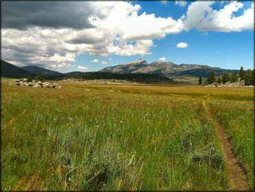
Photo Submitted 8/1/2011 (Thanks!)
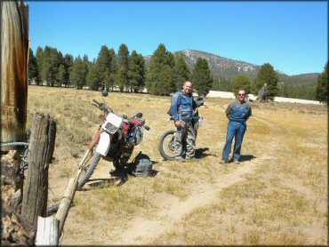
Kennedy Meadows Trail Photo
Kennedy Meadows Trail Photo
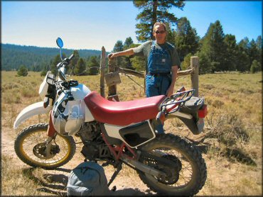
Kennedy Meadows Trail Photo
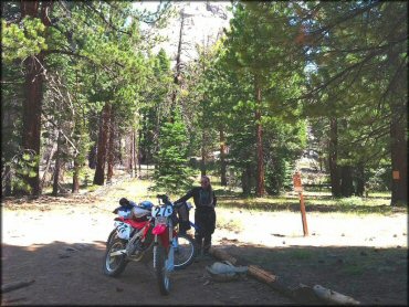
Photo Submitted 8/1/2011 (Thanks!)
Kennedy Meadows Trail Photo
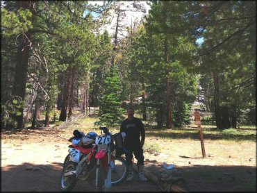
Photo Submitted 8/1/2011 (Thanks!)
Kennedy Meadows Trail Photo

RIDER COMMENTS & REVIEWS