 |
      |
| Home > California > Lower Blue Lake |
Lower Blue Lake
Saturday, December 23, 2023
| Other Names | Eldorado National Forest, Amador Ranger District, Clover Valley, Deer Valley, Stanislaus National Forest, Calaveras Ranger District, Hermit Valley |
| Last Known Status | Closed For Season |
Beautiful forest scenery, technical rocky sections and several deep stream crossings make up this challenging seven mile 4x4 trail. There is no single track but there are some rocky sections that could easily have a black diamond rating.
Most of the rocky sections have a less direct or alternate line to take however novices and young kids might still be advised to not attempt this trail. For instance, the last section of the trail before you reach Hermit Valley Campground is a very steep and rocky descent with loose dirt, rocks and roots. Once you go down it, the only way out is to go back up (or take the road if you are street legal).
Camping can be found next to Upper and Lower Blue Lakes which feature mostly paved sites with picnic tables and BBQ grills. There is a fee charged to camp at the sites near the Blue Lakes however Hermit Valley Campground is free but primitive.
The area is generally snow free by late June or early July, but exact dates vary. For current conditions check with the Amador Ranger District.
REGULATIONS
| Permit Required | Yes | CA OHMVR stickers required |
| Dates Open | April - December | CA OHMVR red sticker vehicles permitted year round |
| Other ATV Stickers Accepted | Yes | Residents of any state not listed must purchase a Nonresident OHV Use Permit. (AR, AZ, CA, CO, CT, DE, IA, ID, IN, LA, MA, MD, ME, MI, MN, MO, MT, ND, NH, NJ, NM, NV, NY, OH, OK, OR, PA, RI, TX, UT, VT, WA, WI, WY) |
| Spark Arrestor | Yes | A spark arresting exhaust silencer or end cap is required for all vehicles. |
| Noise Limit | Yes (96 dB) | CA OHMVR noise limits apply (1985/older limit 101 dB, 1986/newer limit 96 dB) |
| Whip Flags | Not Required | |
| Maximum Vehicle Width | No Restriction | |
 Motorcycles & Dirt Bikes Motorcycles & Dirt Bikes | Permitted | CA OHMVR stickers required |
 ATVs ATVs | Permitted | CA OHMVR stickers required |
 UTV & SXS UTV & SXS | Permitted | Not Recommended CA OHMVR stickers required |
 SUVs & Jeeps (registered) SUVs & Jeeps (registered) | Permitted | |
| Dune Buggy & Sand Rail 4x4 (unregistered) | Permitted | CA OHMVR stickers required not recommended, trail recommended for high clearance vehicles |
| 2 Stroke Engines | No Restriction | CA OHMVR restrictions apply |
| MX Helmet Required | Yes | helmets required by state law |
 Camping Camping | No Restriction | (camp anywhere) |
 Campfires Campfires | No Restriction | |
| Night Riding | Yes | Not Recommended |
| Trail Blazing | Prohibited | keep on designated trails |
| Alcohol | No Restriction | |
| Rule Enforcement | Few/Periodic |
TERRAIN
| Approx Size | 4,480 acres (7 sq mi) | |
| Miles Of Trail | 7 | |
| Climate Type | Forest | |
| Elevation | 7000 to 8000 ft. | |
| Trail Maintenance | Marked, Not Rated, Lightly Maintained | |
| Loose Dirt |  Some Some | |
| Hard Pack | Some | |
| Sand |  None None | |
| Mud |  Little Little | |
| Dust | Little | |
| Rocks |  Mostly Mostly | |
| Trees |  All All | |
| Steep Hills | Some | |
| Water Crossings | Some | |
| Small Jumps |  Few Few | |
| Large Jumps | None | |
| Berms | None | |
| Sand/Gravel Pits | None | |
| Single Track | None | |
| Roads | None | |
| Intersections | None | |
| Rider Traffic | Few | |
| Shade | All | |
| Ranges/Gunfire | Few | |
| Hazards | Some | (hazards not marked) steep hills with technical sections |
 Novice Novice | None | |
 Amateur Amateur | Some | |
 Expert Expert | Mostly |
TYPE OF AREA
| Area | Motorized Trails |
| Land | National Forest |


KEY SERVICES
 Gasoline Gasoline | 20-30 Miles (N) | Woodfords Station (530) 694-2930 |
| Diesel | 30+ Miles (NE) | AM-PM (775) 782-8200 |
 Water Water | 1-5 Miles (N) | Lower Blue Lake Campground |
 RV Hookup RV Hookup | 5-20 Miles (N) | KOA - S. Lake Tahoe (530) 577-3693 |
 RV Disposal RV Disposal | 5-20 Miles (N) | KOA - S. Lake Tahoe (530) 577-3693 |
| Campground | On Site | |
 Conv Store Conv Store | 5-20 Miles (N) | Liras Supermarket (530) 577-5399 |
FEES & PASSES
| Parking | (None) |
| Entry | (None) |
| Riding | (None) |
| Camping | Yes Tent: $23.00 RV: $23.00 Addtl. Vehicle: $0.00 Blue Lake Upper, Lower and Dam Campground Fees |
| Comment | No camping fee at Hermit Valley Campground. |
RATINGS
| Pros | decent forest scenery, several deep stream crossings |
| Cons | not for novice riders, no single track, some sections are very rocky and challenging |
| Our Rating |  Good Good |
| Recommended Stay | 1-2 Days Summer/Fall |
| Comments | (Scroll Down For Rider Reviews & Comments) |
DRIVING DIRECTIONS
| Nearest City | Woodfords, CA | ||
| Address | Blue Lakes Road, Markleeville, CA 96120 | ||
| From: South Lake Tahoe, CA
1) Take Hwy 89 South to Hwy 88 West 2) Proceed about 2.5 miles on Hwy 88 West 3) Turn left (south) on Blue Lakes Road 4) Continue south on Blue Lakes Road toward Lower Blue Lake, about 12 miles (Blue Lakes Road turns into Forestdale Road) 5) Veer left at the fork (you will see a large kiosk in front of you and Lower Blue Lake Campground to your right) 6) Proceed about 230 yards to the staging area. Note: This staging area is not recommended for long RVs. |


OFFICIAL CONTACTS
| Contact Info | Eldorado National Forest - Amador Ranger District 26820 Silver Drive Pioneer, CA 95666 (209) 295-4251 mailroom_r5_eldorado@fs.fed.us www.fs.usda.gov |
| Contact Info | Stanislaus National Forest - Calaveras Ranger District 5519 Highway 4, P.O. Box 500 Hathaway Pines, CA 95233 (209) 795-1381 sm.fs.stanislausnf@usda.gov www.fs.usda.gov |
| Comment | Contact for Hermit Valley Campground |
| Contact Info | Pacific Gas And Electric - Campground Reservations recinfo@pge.com recreation.pge.com |
| Contact Info | Alpine County Road Conditions 50 Diamond Valley Road Markleeville, CA 96120 (530) 694-2140 www.alpinecountyca.gov |
| Comment | contact for road conditions |
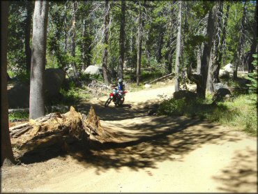
Lower Blue Lake Trail Photo
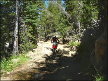
The first mile or two is a blast and a moderate challenge. There are big rocks, but they are far enough apart be avoided.
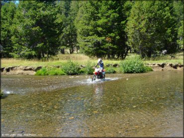
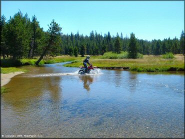
Lower Blue Lake Trail Photo
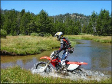
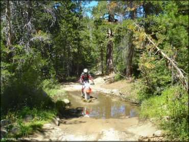
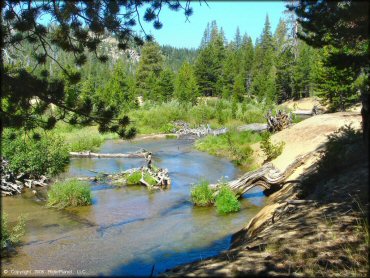
The first water crossing is deep and wide. We suggest you hug the shoreline wherever possible.
Lower Blue Lake Trail Photo
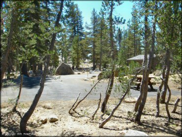
One of the expansion campgrounds at Upper Blue Lake. There are four campgrounds in all.
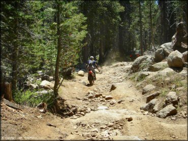
Lower Blue Lake Trail Photo
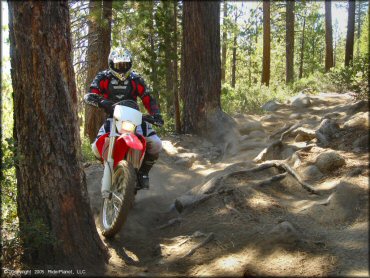
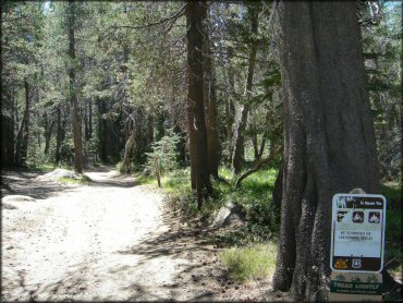
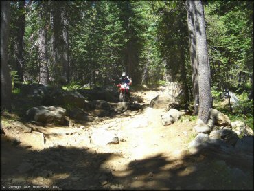
An early part of the trail.
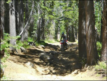
Lower Blue Lake Trail Photo
A pretty good variety of stuff to be found. The trail was pretty wide in this part.
Lower Blue Lake Trail Photo
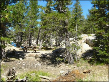
The day-use area sits on the shore of Lower Blue Lake and has restrooms, tables, and fire rings.
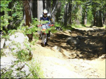
Lower Blue Lake Trail Photo
The first part of the trail was especially fun.
Lower Blue Lake Trail Photo
One of the many many mud puddles in the first couple of miles.
Lower Blue Lake Trail Photo
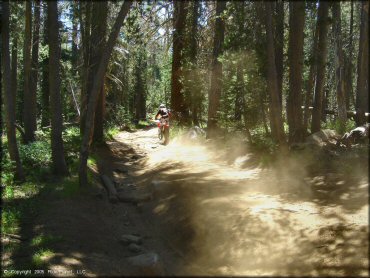
Then it got a little dusty.
Lower Blue Lake Trail Photo
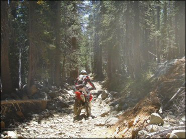
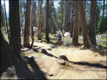
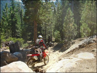
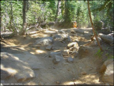
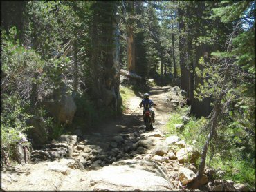
Then it got really rocky. This is one of the more technical portions of the trail. There are about 2 miles of this.
Lower Blue Lake Trail Photo
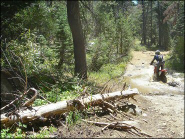
This part was something less than fun on a bike. There were two sections like this.
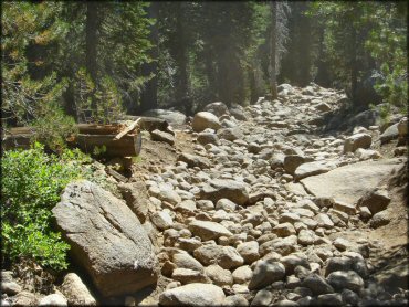
Lower Blue Lake Trail Photo
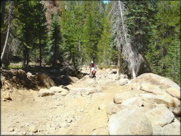
This is about as chunky as the trail got, until the last mile, which was similar but steeper. There are bypass trails for some of it though.
Lower Blue Lake Trail Photo
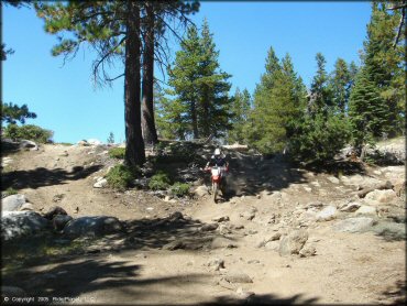
Coming down the hill towards the end. Not easy going down. (Not easy going back up either, which you will have to do.)
Lower Blue Lake Trail Photo
Overall it was a pretty fun ride.
Lower Blue Lake Trail Photo
Start of the descent to the campground. Almost there.
Lower Blue Lake Trail Photo
Getting the hang of it.
Lower Blue Lake Trail Photo
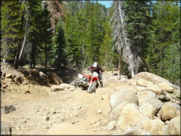
Looks bad, but there is actually a smooth line through most of these sections if you are on a bike. Check out the left.
Lower Blue Lake Trail Photo
Did we mention there are a lot of rocks?
Lower Blue Lake Trail Photo
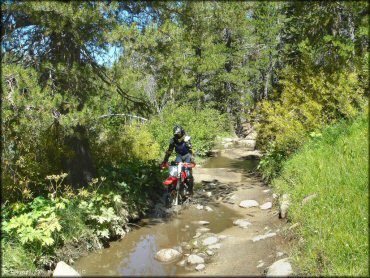
The second crossing was wider, but also more shallow. But this was dry season so this may be as low as the water gets.
Lower Blue Lake Trail Photo
Fun for jeeps too.
Lower Blue Lake Trail Photo
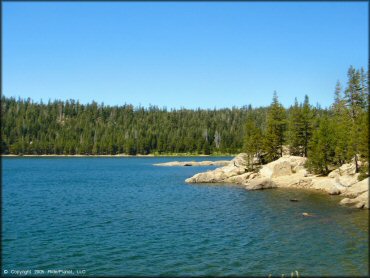
These rocks shoot out all along the shore of Lower Blue Lake in front of the day-use area.
Lower Blue Lake Trail Photo
Great views of the lake everywhere.
Lower Blue Lake Trail Photo
This is the main trailhead, which can be found at the south end of the lake under the dam.
Lower Blue Lake Trail Photo
There are also some hiking trails on and around the dam.
Lower Blue Lake Trail Photo
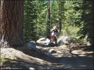
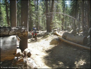
Just getting started...
Lower Blue Lake Trail Photo
Typical section of the early part.
Lower Blue Lake Trail Photo
Every section of this trail presents a different challenge. That's what made it so fun.
Lower Blue Lake Trail Photo
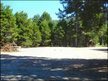
This is the Hermit Valley Campground and staging area you will find at the end of this trail. The trail is 7 miles each way.
Lower Blue Lake Trail Photo
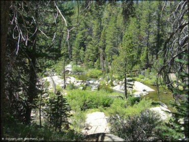
Once you get up the mountain, things smooth out for a couple of miles.
Lower Blue Lake Trail Photo
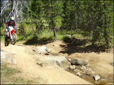
The water crossings are deep in the middle if you go straight across. You may want to pick a less direct line like this.
Lower Blue Lake Trail Photo
Lower Blue Lake Trail Photo
Lower Blue Lake Trail Photo
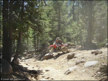
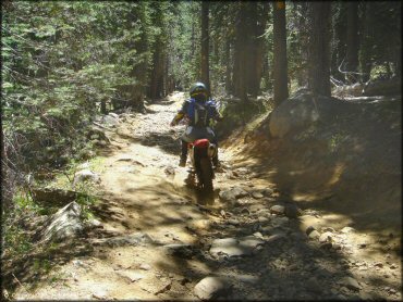
Ninety percent of the trail looks something like this. A little chunky for bikes, sure, but still very fun.
Lower Blue Lake Trail Photo
Some evidence of trail maintenance.
Lower Blue Lake Trail Photo
After you get down it, you have to turn around and go back up.
Lower Blue Lake Trail Photo
Typical trail.
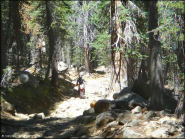
Lower Blue Lake Trail Photo
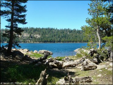
Some scenery from a stopping point during the early part.
Lower Blue Lake Trail Photo
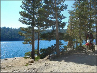
Cruising along the road between the campgrounds.
RIDER COMMENTS & REVIEWS