 |
      |
| Home > California > Sopiago Springs Resort |
Sopiago Springs Resort
Saturday, May 10, 2025
| Other Names | Eldorado National Forest, Gold Note Trails, Elkins Flat Trails, Sopiago Creek |
| Last Known Status | Closed |
This offroad resort at one time was open to both dualsport and dirt riders but is now closed with no plans to reopen. Nearby riding and camping can be found at Gold Note and Elkins Flat.
REGULATIONS
| Permit Required | Yes | CA OHMVR stickers required |
| Dates Open | Closed | CA OHMVR red sticker vehicles permitted year round |
| Spark Arrestor | Yes | A spark arresting exhaust silencer or end cap is required for all vehicles. |
| Noise Limit | Yes (96 dB) | CA OHMVR noise limits apply (1985/older limit 101 dB, 1986/newer limit 96 dB) |
| Whip Flags | Not Required | |
| Maximum Vehicle Width | ||
 Motorcycles & Dirt Bikes Motorcycles & Dirt Bikes | Prohibited | CA OHMVR stickers required |
 ATVs ATVs | Prohibited | CA OHMVR stickers required |
 UTV & SXS UTV & SXS | Prohibited | CA OHMVR stickers required |
 SUVs & Jeeps (registered) SUVs & Jeeps (registered) | Prohibited | |
| Dune Buggy & Sand Rail 4x4 (unregistered) | Prohibited | CA OHMVR stickers required |
| 2 Stroke Engines | Prohibited | CA OHMVR restrictions apply |
| MX Helmet Required | Yes | |
 Camping Camping | Prohibited | |
 Campfires Campfires | Prohibited | |
| Night Riding | No | |
| Trail Blazing | Prohibited | stay on designated trails |
| Rule Enforcement |
Advertisement
TERRAIN
| Approx Size | 152 acres | |
| Miles Of Trail | 5 | |
| Climate Type | Urban/man-made | |
| Elevation | 4100 to 4300 ft. | |
| Trail Maintenance | Unknown | |
| Loose Dirt |  Mostly Mostly | |
| Hard Pack |  Some Some | |
| Sand |  None None | |
| Mud |  Little Little | |
| Dust | Some | |
| Rocks | Some | |
| Trees |  All All | |
| Steep Hills |  Few Few | |
| Water Crossings | None | |
| Small Jumps |  Many Many | |
| Large Jumps | Few | |
| Berms | Many | |
| Sand/Gravel Pits | None | |
| Single Track | Some | |
| Roads | Some | |
| Rider Traffic | Some | |
| Shade | All | |
| Hazards | Few | (hazards are marked) |
 Novice Novice | Some | |
 Amateur Amateur | Mostly | |
 Expert Expert | Little |
TYPE OF AREA
| Area | Motorized Trails, MX Track |
| Land | Privately Owned / Commercial |
GPS POINTS


KEY SERVICES
 Gasoline Gasoline | 5-20 Miles (SE) | Cooks Station (209) 295-7900 |
| Diesel | 30+ Miles (N) | Crystal View Station (530) 644-3490 |
 Water Water | On Site | |
 RV Hookup RV Hookup | 5-20 Miles (SW) | Pine Acres RV Park (209) 296-4650 |
 RV Disposal RV Disposal | On Site | |
| Campground | On Site | |
 Conv Store Conv Store | 5-20 Miles (SE) | Cooks Station (209) 295-7900 |
FEES & PASSES
| Parking | (None) |
| Entry | (None) |
| Riding | Yes ($15.00 per rider) |
| Camping | Yes Tent: $10.00 RV: $10.00 Addtl. Vehicle: $0.00 |
RATINGS
| Our Rating |  Very Good Very Good |
| Recommended Stay | 1-2 Days |
| Comments | (Scroll Down For Rider Reviews & Comments) |
DRIVING DIRECTIONS
| Nearest City | Pioneer, CA | ||
| From: South Lake Tahoe, CA
1) Take Hwy 89 south to Hwy 88 west 2) Continue west on Hwy 88 about 44 miles 3) Turn right (north) on Omo Ranch Road 4) Proceed about .75 miles 5) Turn right on NF-10N83 (North-South Road) continue 1.7 miles 6) Look for Sopiago Springs Resort Sign, enter here. |


OFFICIAL CONTACTS
Sopiago Springs Resort OHV Area Photo
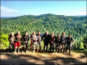
Photo Submitted 5/20/2013 (Thanks!)
Sopiago Springs Resort OHV Area Photo
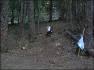
Photo Submitted 10/29/2012 (Thanks!)
Sopiago Springs Resort OHV Area Photo
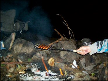
Photo Submitted 10/29/2012 (Thanks!)
Sopiago Springs Resort OHV Area Photo
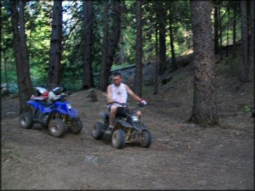
Photo Submitted 10/29/2012 (Thanks!)
RIDER COMMENTS & REVIEWS