 |
      |
| Home > Montana > Pipestone |
Pipestone OHV Area
Thursday, February 8, 2024
| Other Names | Pipestone Travel Management Area, Four Corners, Delmoe Lake Road, Whiskey Gulch, Whitetail |
| Last Known Status | Open |
Open year-round (weather permitting), this large area has about 75 miles of smooth and fast trails. The Pipestone Trailhead has plenty of turnaround room for large trailers and although camping is permitted, traffic noise from the interstate can be heard.
The Four Corners Trailhead is the preferred location for camping and it has loading ramps, a restroom and ample room for large trailers. Also check out the "Ringing Rocks", a large formation of boulders that emit a bell like tone when struck with a hammer or another rock.
REGULATIONS
| Permit Required | Yes | Montana OHV Permit |
| Dates Open | Daily Year-Round | |
| Other ATV Stickers Accepted | No | A non-resident temporary registration sticker is required. (As of March 2020, Montana no longer honors stickers from any other states.) |
| Spark Arrestor | Yes | A spark arresting exhaust silencer or end cap is required for all vehicles. |
| Noise Limit | Yes (96 dB) | |
| Whip Flags | Not Required | |
| Maximum Vehicle Width | Yes (50 inches) | has entrance gate or posts |
 Motorcycles & Dirt Bikes Motorcycles & Dirt Bikes | Permitted | |
 ATVs ATVs | Permitted | (maximum width 50 inches) |
 UTV & SXS UTV & SXS | Permitted | (maximum width 50 inches) |
 4x4 & Jeeps (registered) 4x4 & Jeeps (registered) | Prohibited | |
| Dune Buggy & Sand Rail 4x4 (unregistered) | Prohibited | |
| 2 Stroke Engines | No Restriction | |
| MX Helmet Required | Youth Only | required for persons under 18 by state law (RiderPlanet strongly recommends helmets for all riders.) |
 Camping Camping | No Restriction | (camp anywhere) |
 Campfires Campfires | ||
| Night Riding | Yes | |
| Trail Blazing | Prohibited | keep on the trail |
| Rule Enforcement |
TERRAIN
| Approx Size | 30,000 acres (47 sq mi) | |
| Miles Of Trail | 75 | |
| Climate Type | Forest | |
| Elevation | 4500 to 5500 ft. | |
| Trail Maintenance | Marked, Not Rated, Lightly Maintained | |
| Loose Dirt |  Mostly Mostly | |
| Hard Pack |  Little Little | |
| Sand | Little | |
| Mud | Little | |
| Dust | Little | |
| Rocks |  Some Some | |
| Trees |  Many Many | |
| Berms | Some | |
| Single Track | Some | |
| Hazards |  Few Few | (hazards assumed marked but use caution) |
 Novice Novice | Some | |
 Amateur Amateur | Mostly | |
 Expert Expert | Little |
TYPE OF AREA
| Area | Motorized Trails |
| Land | BLM |
GPS POINTS


KEY SERVICES
 Gasoline Gasoline | 5-20 Miles (SE) | Town Pump - Whitehall (406) 287-5630 |
| Diesel | 5-20 Miles (SE) | Town Pump - Whitehall (406) 287-5630 |
 Water Water | 5-20 Miles (NW) | Delmoe Lake Campground (406) 287-3223 |
 RV Hookup RV Hookup | 5-20 Miles (NE) | Cardwell Store & RV Park (406) 287-5092 |
 RV Disposal RV Disposal | 5-20 Miles (NE) | Cardwell Store & RV Park (406) 287-5092 |
| Campground | 5-20 Miles (NW) | Delmoe Lake Campground (406) 287-3223 |
 Conv Store Conv Store | 5-20 Miles (SE) | Town Pump - Whitehall (406) 287-5630 |
FEES & PASSES
| Parking | (None) |
| Entry | (None) |
| Riding | (None) |
| Camping | (None) |
RATINGS
| Our Rating |  Good Good |
| Recommended Stay | Full Day |
| Comments | (Scroll Down For Rider Reviews & Comments) |
DRIVING DIRECTIONS
| Nearest City | Whitehall, MT | ||
| From: Butte, MT
1) Take I-90 East to Exit 241 2) Turn left (north) off the exit ramp onto Pipestone Road, proceed underneath bridge 3) Immediately veer right after bridge, continue toward Pipestone Staging Area. For the Four Peaks Staging Area: 4) Follow N. Delmoe Lake Road 4.5 miles to staging area. |


OFFICIAL CONTACTS
| Contact Info | BLM - Butte Field Office 106 North Parkmont Butte, MT 59701 (406) 533-7600 mt_butte_fo@blm.gov www.blm.gov |
| Contact Info | Montana Fish, Wildlife And Parks 1420 East 6th Avenue Helena, MT 59620-0701 (406) 444-2950 fwpgen@mt.gov fwp.mt.gov |
| Comment | Montana OHV Permit Info |
Pipestone Trail Photo
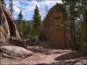
Photo Submitted 7/15/2011 (Thanks!)
Pipestone Trail Photo
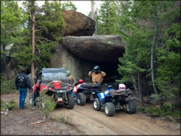
Photo Submitted 10/12/2012 (Thanks!)
Pipestone Trail Photo
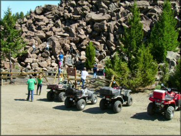
Ringing Rocks Photo Submitted 4/29/2013 (Another great shot. Thank You!)
Pipestone Trail Photo
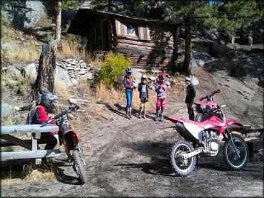
Photo Submitted 9/22/2013 (Thanks!)
Pipestone Trail Photo
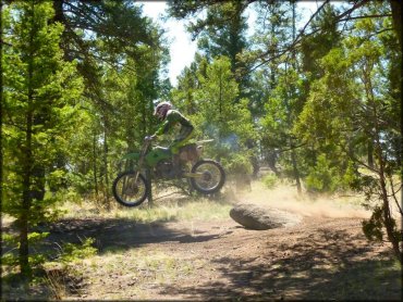
Photo Submitted 9/22/2013 (Thanks!)
Pipestone Trail Photo
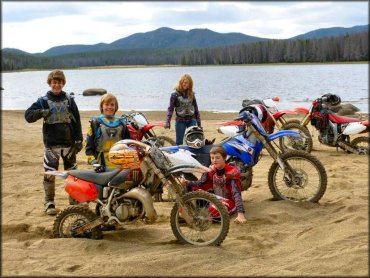
Photo Submitted 9/22/2013 (Thanks!)
Pipestone Trail Photo
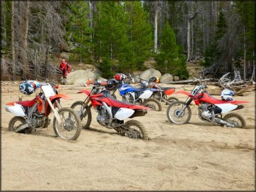
Photo Submitted 9/22/2013 (Thanks!)
Pipestone Trail Photo
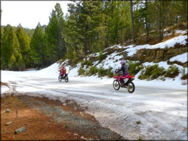
Photo Submitted 9/22/2013 (Thanks!)
Pipestone Trail Photo
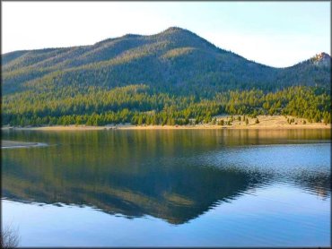
Photo Submitted 9/22/2013 (Thanks!)
Pipestone Trail Photo
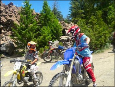
Photo Submitted 9/22/2013 (Thanks!)
Pipestone Trail Photo
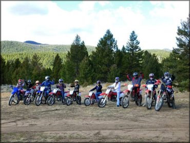
Photo Submitted 9/22/2013 (Thanks!)
Pipestone Trail Photo
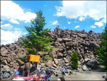
Photo Submitted 9/22/2013 (Thanks!)
RIDER COMMENTS & REVIEWS