 |
      |
| Home > Nevada > Eldorado Canyon |
Eldorado Canyon
Saturday, December 23, 2023
| Other Names | Pine Nut Mountains, Dayton, Carson City Foothills, Fort Churchill, Eureka Canyon, Santiago Canyon, Hedcett Canyon, Bismark Peak, Fort Churchill Road |
| Last Known Status | Open |
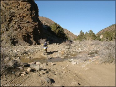
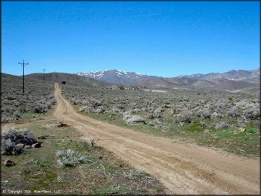
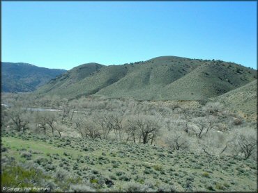
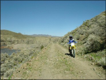
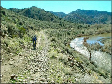
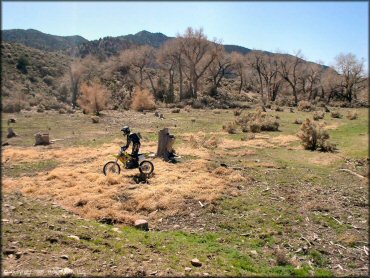
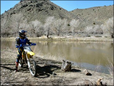
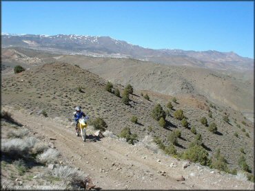
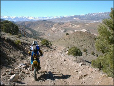
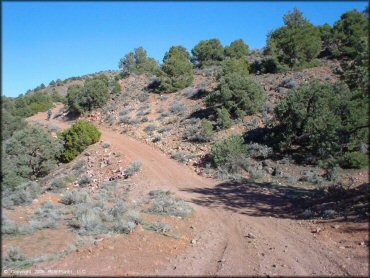
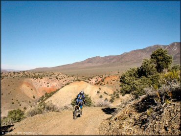
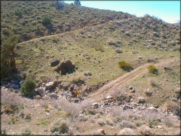
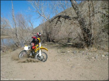
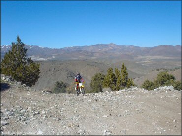
This area near Dayton offers some scenery that's a cut above the typical Nevada sand and sage. The trails get a little bit rocky, but if you like stream and creek crossings, you'll want to hit this place during spring thaw when the creek washes out over the parts of the trail.
Due to the elevation and the shade from the trees you may find some trails blocked by snow even in the late spring. You can can stage or camp at the trailhead or there are some primitive camping spots along the trail on your way up the canyon, but a 4x4 is recommended to access anything past the base of the canyon.
REGULATIONS
| Permit Required | Yes | NVOHV sticker required |
| Dates Open | Year-Round | |
| Other ATV Stickers Accepted | Yes | Nevada registration is not required if the vehicle is already registered in another state and will be located in Nevada for no more than 15 days. |
| Spark Arrestor | Yes | A spark arresting exhaust silencer or end cap is required for all vehicles. |
| Noise Limit | Yes (96 dB) | |
| Whip Flags | Not Required | |
| Maximum Vehicle Width | No Restriction | |
 Motorcycles & Dirt Bikes Motorcycles & Dirt Bikes | Permitted | |
 ATVs ATVs | Permitted | |
 UTV & SXS UTV & SXS | Permitted | |
 SUVs & Jeeps (registered) SUVs & Jeeps (registered) | Permitted | |
| Dune Buggy & Sand Rail 4x4 (unregistered) | Permitted | |
| 2 Stroke Engines | No Restriction | |
 Camping Camping | No Restriction | (camp anywhere) |
 Campfires Campfires | No Restriction | season permitting |
| Night Riding | Yes | Not Recommended very rocky in spots - would be a difficult night ride |
| Trail Blazing | Permitted | BLM - ride anywhere, but tread lightly |
| Alcohol | No Restriction | |
| Rule Enforcement | None |
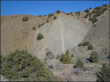
TERRAIN
| Approx Size | 233,600 acres (365 sq mi) | |
| Climate Type | High Desert & Forest | |
| Elevation | 4500 to 6200 ft. | |
| Trail Maintenance | Not Marked, Not Rated, Not Maintained | |
| Loose Dirt |  Some Some | |
| Hard Pack | Some | |
| Sand | Some | |
| Mud | Some | |
| Dust | Some | |
| Rocks |  Mostly Mostly | |
| Trees | Some | |
| Steep Hills | Some | steep hill climbs on sides of canyon, not on trail |
| Water Crossings | Some | 15-20 stream crossings (seasonal) |
| Small Jumps |  Few Few | |
| Large Jumps |  None None | |
| Berms | Few | |
| Sand/Gravel Pits | None | |
| Single Track | Few | 70% roads, 30% narrow trails |
| Roads | Some | |
| Intersections | Few | |
| Rider Traffic | Few | |
| Shade | Some | |
| Ranges/Gunfire | Few | |
| Hazards | Few | (hazards not marked) Beware of open mine shafts, cliffs. |
 Novice Novice |  Little Little | |
 Amateur Amateur | Mostly | |
 Expert Expert | Some | |
| Comment | Canyon trail is moderate difficulty with many stream crossings and rocks. | |
TYPE OF AREA
| Area | Motorized Trails |
| Land | BLM |
GPS POINTS


KEY SERVICES
 Gasoline Gasoline | 1-5 Miles (NW) | Dayton Chevron (775) 246-9990 |
| Diesel | 1-5 Miles (NW) | Dayton Chevron (775) 246-9990 |
 Water Water | 1-5 Miles (NW) | Dayton RV Park (775) 246-9300 |
 RV Hookup RV Hookup | 1-5 Miles (NW) | Dayton RV Park (775) 246-9300 |
 RV Disposal RV Disposal | 1-5 Miles (N) | Dayton State Park (775) 687-5678 ** available Memorial Day through Labor Day** |
| Campground | On Site | primitive camping along trail - 4x4 required |
 Conv Store Conv Store | 1-5 Miles (NW) | Dayton Chevron (775) 246-9990 |
FEES & PASSES
| Parking | (None) |
| Entry | (None) |
| Riding | (None) |
| Camping | (None) |
| Comment | BLM, but beware private land, near entrance & along Schaad Lane |
RATINGS
| Pros | many stream crossings, good variety, secluded, excellent scenery |
| Cons | a little rocky, no services |
| Our Rating |  Very Good Very Good |
| Recommended Stay | Full Day mid spring |
| Comments | (Scroll Down For Rider Reviews & Comments) |
DRIVING DIRECTIONS
| Nearest City | Dayton, NV | ||
| Address | Old Como Road, Dayton, NV 89403 | ||
| From: Carson City, NV
1) 50 East to Dayton 2) Downtown Dayton (stop light) 3) Take right on Dayton Valley Road, continue .3 miles 4) Turn right on Old Como Road, drive pass high school until road turns to gravel 5) Staging area is marked. |


OFFICIAL CONTACTS
| Contact Info | BLM - Carson City District Office 5665 Morgan Mill Road Carson City, NV 89701 (775) 885-6000 blm_nv_ccdowebmail@blm.gov www.blm.gov |
Eldorado Canyon Trail Photo
Eldorado Canyon Trail Photo
Eldorado Canyon Trail Photo
Eldorado Canyon Trail Photo
Eldorado Canyon Trail Photo
Eldorado Canyon Trail Photo
Eldorado Canyon Trail Photo
Eldorado Canyon Trail Photo
Eldorado Canyon Trail Photo
Eldorado Canyon Trail Photo
Eldorado Canyon Trail Photo
Eldorado Canyon Trail Photo
Eldorado Canyon Trail Photo

Eldorado Canyon Trail Photo
Eldorado Canyon Trail Photo
Eldorado Canyon Trail Photo
RIDER COMMENTS & REVIEWS