 |
      |
| Home > Nevada |

 95 Motorsports Complex
Status: Variable Schedule (call for practice schedule)
Type: Track (Privately Owned / Commercial)
Location: Fernley, NV
Difficulty:

Formerly known as 95A Speedway, this property is under new ownership and features a motocross track that caters to all skill levels. More...
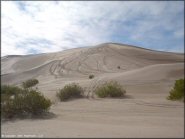 Amargosa Dunes
 Status: Open
Type: Dune (BLM)
Location: Amargosa, NV
Difficulty:

If you live near Las Vegas and want to catch some big air or just cruise through the bushes over some rolling dunes, you would probably enjoy this place. More...
 Battle Mountain MX
 Status: Open
Type: Track (Privately Owned / Commercial)
Location: Battle Mountain, NV
Difficulty:
This motocross track is open daily but you need to contact the owner to gain access. More...
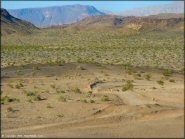
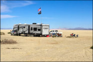 Black Rock Desert
 Status: Open
Type: Trail (BLM)
Location: Gerlach, NV
Difficulty:
Once an ancient lake, this massive silt playa consists of over 400 square miles of ultra-flat terrain. More...
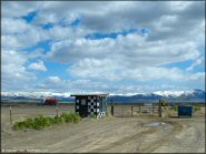
 Blue Mountain
Status: Open
Type: Trail (BLM)
Location: Winnemucca, NV
Difficulty:
This secluded area offers scattered primitive camping opportunities along with miles of easy 4x4 roads and a few hidden sections of single-track trails. More...
 Boulder Hills
 Status: Open
Type: Combo (BLM)
Location: Boulder City, NV
Difficulty:
This area has a large motocross track with good lips and some huge doubles with hard packed landings that carry a heavy penalty. More...
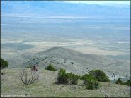
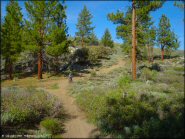 Bull Ranch Creek
Status: Open
Type: Trail (BLM, National Forest)
Location: Reno, NV
Difficulty:
If you are coming to Reno to ride, this place is not to be overlooked. More...
 Chief Mountain OHV Area
 Status: Open
Type: Trail (BLM)
Location: Caliente, NV
Difficulty:
This area offers a large staging area, clean restrooms, picnic tables, fire rings, and an informative trailhead kiosk, and two main trail loops. More...
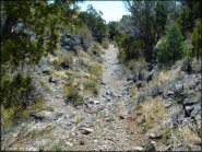
 China Springs
 Status: Open
Type: Trail (National Forest)
Location: Gardnerville, NV
Difficulty:
This part of the Toiyabe National Forest has about 17 miles of forest service roads and rocky 4x4 trails. More...
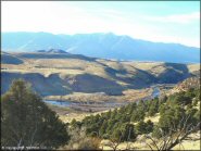
 Cold Creek
 Status: Open
Type: Trail (National Forest)
Location: Las Vegas, NV
Difficulty:
This remote area is open to all vehicle types and offers miles of 4x4 roads and trails that wind through the rugged Spring Mountains. More...
(Page 1 of 8)
(Page 1 of 8)